7 entries match your criteria.
Related Historical Markers
Oasis of Murals • 29 Palms
By Cosmos Mariner, June 18, 2014
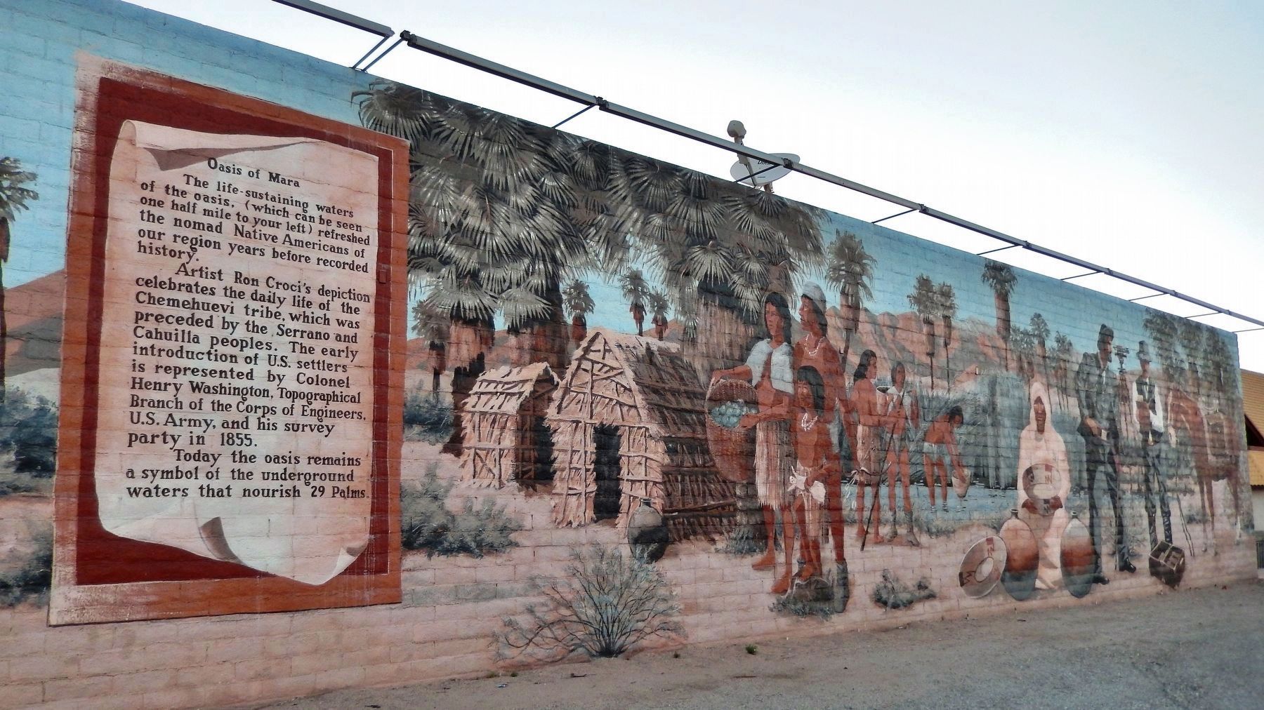
Oasis of Mara Mural
SHOWN IN SOURCE-SPECIFIED ORDER
| | The life-sustaining waters of the oasis, (which can be seen one half mile to your left) refreshed the nomad Native Americans of our region years before recorded history. Artist Ron Croci's depiction celebrates the daily life of the Chemehuevi . . . — — Map (db m165758) HM |
| | His real name was Orville Jackson Cones, but some folks around here just called him "Cactus Jack". They say he could make a tin can "dance in the sand" with his six shooter. In 1929 he and his wife Clara homesteaded in 29 Palms and in 1932 he . . . — — Map (db m165754) HM |
| | After barnstorming across the United States from his native Wisconsin in 1914 and serving his country in World War I, the urge to homestead brought Bill Underhill to 29 Palms in 1928. He helped build roads and the first swimming pool, and was active . . . — — Map (db m165757) HM |
| | Originating in 49 Palms Canyon in the mountains above 29 Palms during desert thunderstorms flash floods would race down the canyon, onto the highway and through the downtown area, flooding businesses and residences. The Flood Control Channel, . . . — — Map (db m165755) HM |
| | The monolithic buttes and towers that surround Hidden Valley in what is now Joshua Tree National Park were once reputed to be the stronghold of Rustlers and outlaws known locally as the McHaney gang. The valley was aptly named due to its remoteness . . . — — Map (db m165759) HM |
| | Bill Smith arrived in 29 Palms in 1923, driving his Model T Ford. To provide for early homesteading needs he began the development of Smith’s Ranch. Bill and his brother, Harry, drilled a well and provided water to fellow settlers. Bill’s shower, . . . — — Map (db m165756) HM |
| | Bill Keys arrived in 1910 as the caretaker of the once prosperous Desert Queen Mine in what is now Joshua Tree National Park. When the mine closed, Bill claimed it and the mill site (which became the ranch home) for his unpaid wages. Through . . . — — Map (db m165753) HM |
Apr. 25, 2024