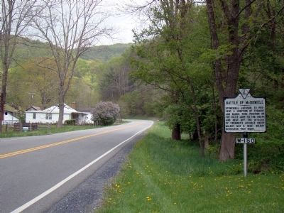
Stonewall Jackson, to prevent a junction of Fremont and Banks, took position on the hills just to the south and beat off the attacks of Fremont’s advance under Milroy, May 8, 1862. Milroy retreated that night. — — Map (db m4232) HM
May 8, 1862, one mile southeast, Jackson and Edward Johnson, C.S.A. defeated Milroy and Schenck, U.S.A. This church served both Blue and Gray as a hospital. — — Map (db m62929) HM
Federals in action 4000, killed and wounded 256.
Confederates in action 2500, killed and wounded 498.
Confederate Officers Killed
Captains Lieutentants
Samuel Dawson John K. Goldwire
William L. Furlow . . . — — Map (db m4283) HM
Monterey was headquarters for Confederates during much of the 1861 Mountain Campaign and headquarters for Federals prior to the fighting at McDowell. In the winter of 1861-1862, skirmishing occurred across the county as the frontier between the . . . — — Map (db m155465) HM
This stately brick house was built about 1855 for Felix Hull (ca. 1823-1861) in the Greek Revival style popular in the late antebellum period. During the Civil War, his widow, Eliza Mathews Hull, was living here on 7-8 May 1862 when the house was . . . — — Map (db m155460) HM
Union troops camped in the fields south of here between April 17, 1862, and the Battle of McDowell on May 8. They deployed artillery, including “two twelve pounders [that] were planted on the plateau in the read of [the church] so as to cover the . . . — — Map (db m155462) HM
Beyond the ridge you are facing is Sitlington’s Hill. On the afternoon of May 8, 1862, Gen. Edward “Allegheny” Johnson directed two brigades of Confederate infantry to take position on the hill facing the Federals across Bull Pasture Creek in . . . — — Map (db m155083) HM
In the spring of 1862 Confederate fortunes seemed to have gone from bad to worse. Union forces had won several key battles in the West, while the U.S. Navy was establishing its coastal blockade and Major General George B. McClellan’s Army of the . . . — — Map (db m165817) HM
“… [The 31st Virginia] came close to the 3rd and saluted them, and called them by name, and proceeded with the slaughter.” Andrew Price, 3rd Virginia Most of Stonewall Jackson’s Confederates climbed Sitlington’s Hill through a ravine off to . . . — — Map (db m194639) HM
Major General Edward Johnson commanded the Confederates on the crest overlooking the town of McDowell. Johnson spread his line along the hilltop, anchoring his right flank on the knoll to your right. Stonewall Jackson remained in the valley below, . . . — — Map (db m16685) HM
The Confederate 12th Georgia Infantry Regiment held this exposed crest overlooking McDowell. Milroy’s Union troops assaulted this hilltop from two directions – on the left and the right. The Confederates held their ground against repeated attacks . . . — — Map (db m16689) HM
You are standing in the middle of what was once Fort Edward Johnson. Confederate soldiers built this fort in 1862 under the command of Brigadier general Edward Johnson, a career officer from Virginia.
Look to your right, and then left across . . . — — Map (db m208803) HM
My name is Shepherd Green Pryor, but my friends and family call me “Shep.” I was elected First Lieutenant of the Muckalee Guards, Company A, 12th Regiment, Georgia Volunteer Infantry. We’ve just survived a cold Virginia winter on the top . . . — — Map (db m16773) HM
On April 19, 1862, General Johnson, with General Lee’s approval, moved our regiment from Allegheny Mountain to Shenandoah Mountain. To protect ourselves from Yankee bullets, we dug about a mile of trench in this rocky ground. We then opened our . . . — — Map (db m16775) HM
My Dear Penelope
Wee are now tolerable well fortified; got 12 pieces of cannon and places all fixed for the men to shoot from; that is, fortifications for cannon with openings to shoot through so the men can man the cannon and not . . . — — Map (db m86203) HM