5 entries match your criteria.
Related Historical Markers
By Duane and Tracy Marsteller, February 13, 2021
History at Its Source Marker
SHOWN IN SOURCE-SPECIFIED ORDER
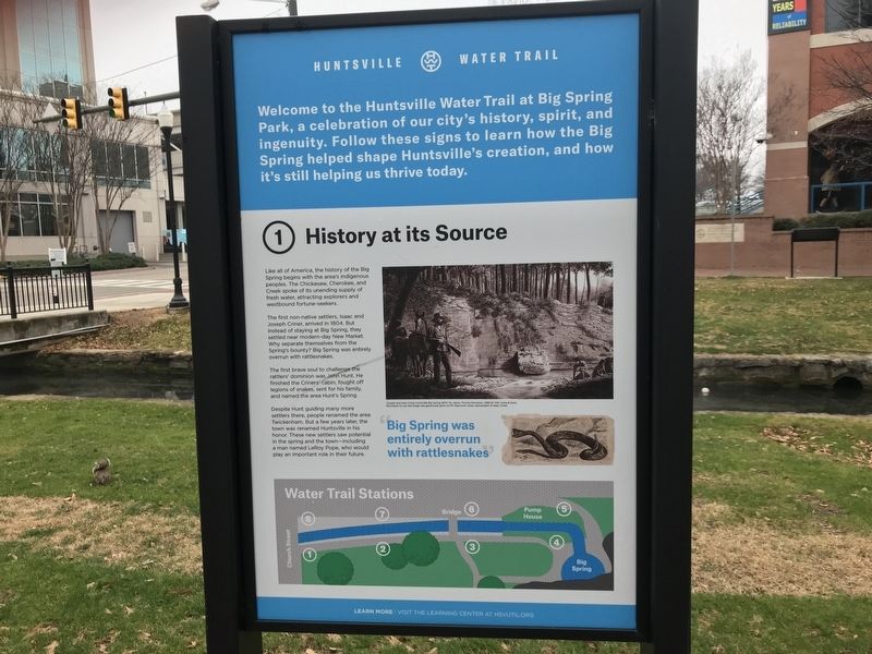
| | (Preface) Welcome to the Huntsville Water Trail at Big Spring Park, a celebration of our city's history, spirit, and ingenuity. Follow these signs to learn how the Big Spring helped shape Huntsville's creation, and how it's still helping us . . . — — Map (db m167110) HM |
| | Once John Hunt started bringing settlers in, the town began growing fast. Within five years, LeRoy Pope — who had big plans for the area — bought Big Spring and much of the land around it, including the site of John Hunt's cabin.
Then in 1823, . . . — — Map (db m167109) HM |
| | After the building of the dam and pump system in 1823, Huntsville enjoyed more than a century of continued growth.
In 1843, LeRoy Pope's son, William generously sold Big Spring to the city for the paltry sum of one dollar, and in 1858 the city . . . — — Map (db m167108) HM |
| | By 1957, the Big Spring that was once so essential to Huntsville's origin and growth, was no longer the city's primary water supply. However, Big Spring Park lives on as a source of pride for the city and a monument to its founding.
Even with all . . . — — Map (db m167104) HM |
| | Roughly 7-20 million gallons of water emerge from The Big Spring every day. Even in the 19th and 20th centuries, when people used the spring as their main water supply, most of the water generated by The Big Spring flowed down the Indian Creek Canal . . . — — Map (db m167111) HM |
Apr. 24, 2024