Lexington in Middlesex County, Massachusetts — The American Northeast (New England)
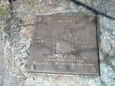
The Site of the Old Belfry
of
The Old Belfry
from which the alarm
was rung April 19, 1775
This Tablet was erected by the
Lexington Chapter
Daughters of the American Revolution
1910
Erected 1910 by Daughters of the American Revolution, Lexington Chapter.
Topics and series. This historical marker is listed in these topic lists: Notable Places • War, US Revolutionary. In addition, it is included in the Daughters of the American Revolution series list. A significant historical month for this entry is April 1862.
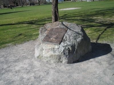
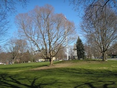
Location. Marker is missing. It was located near 42° 26.961′ N, 71° 13.858′ W. Marker was in Lexington, Massachusetts, in Middlesex County. Marker was on Massachusetts Avenue, on the right when traveling west. Marker was located on the Lexington Battle Green. Touch for map. Marker was in this post office area: Lexington MA 02420, United States of America. Touch for directions.
Other nearby markers. At least 8 other markers are within walking distance of this location. Marrett and Nathan Munroe House (within shouting distance of this marker); Lexington Green (within shouting distance of this marker); This Flag Pole (within shouting distance of this marker); Battle of Lexington Monument (within shouting distance of this marker); Lexington Meeting Houses (within shouting distance of this marker); Cambridge Farms (within shouting distance of this marker); Line of the Minutemen (within shouting distance of this marker); The Battle Green (within shouting distance of this marker). Touch for a list and map of all markers in Lexington.
More about this marker. A relief image of the Old Belfry appears on the marker.
WBZ-TV, Boston, reported on Monday Dec 14, 2009 that this brass tablet was pried off the stone and taken by vandals sometime in the previous week.
—Editor
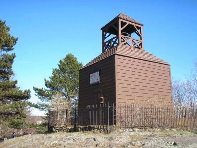
Related marker. Click here for another marker that is related to this marker. See the Old Belfry at its current location.
Also see . . .
1. Battle of Lexington. (Submitted on April 29, 2009, by Bill Coughlin of Woodland Park, New Jersey.)
2. The Battle of Lexington. The American Revolutionary War website. (Submitted on May 7, 2009, by Bill Coughlin of Woodland Park, New Jersey.)
3. Battle at Lexington Green, 1775. The Start of the American Revolution and the "shot heard round the world." from EyeWitness to History.com. (Submitted on April 29, 2009, by Bill Coughlin of Woodland Park, New Jersey.)

Photographed By Bill Coughlin, April 15, 2009
2. Marker on the Lexington Green
On the night of April 19, 1775, after Paul Revere and William Dawes brought word of the advancing British troops, a bell in a belfry at this location rang out the alarm. About 130 Lexington Minute Men, under Capt. John Parker, soon assembled nearby.
Credits. This page was last revised on June 16, 2016. It was originally submitted on April 29, 2009, by Bill Coughlin of Woodland Park, New Jersey. This page has been viewed 2,802 times since then and 51 times this year. Photos: 1, 2, 3, 4. submitted on April 29, 2009, by Bill Coughlin of Woodland Park, New Jersey.


