Sadsbury Township near Christiana in Lancaster County, Pennsylvania — The American Northeast (Mid-Atlantic)
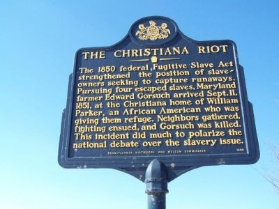
The Christiana Riot
Erected 1998 by Pennsylvania Historical and Museum Commission.
Topics and series. This historical marker is listed in these topic lists: Abolition & Underground RR • African Americans • Government & Politics • Notable Events. In addition, it is included in the Pennsylvania Historical and Museum Commission series list. A significant historical date for this entry is September 11, 1870.
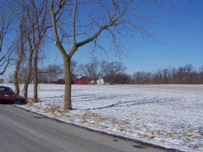
Location. 39° 56.177′ N, 76° 0.73′ W. Marker is near Christiana, Pennsylvania, in Lancaster County. It is in Sadsbury Township. Marker is on Lower Valley Road, half a mile west of Orchard Buck Road, on the left when traveling west. Touch for map. Marker is at or near this postal address: 79 Lower Valley Rd, Christiana PA 17509, United States of America. Touch for directions.
Other nearby markers. At least 8 other markers are within 3 miles of this marker, measured as the crow flies. East Octoraro #1 Bridge (1910-2020) (approx. 1˝ miles away); Philadelphia & Columbia Railroad Bridge at Pine Creek, Circa 1830 (approx. 1.6 miles away); Christiana Riot Monument (approx. 1.6 miles away); Mercer’s Mill Covered Bridge (1880) (approx. 1.7 miles away); Atglen Borough Hall (approx. 2.2 miles away); Atglen (approx. 2.2 miles away); World War II (approx. 2.2 miles away); A Stream for Steam (approx. 3 miles away). Touch for a list and map of all markers in Christiana.
Related marker. Click here for another marker that is related to this marker. Gorsuch Tavern in Sparks, Maryland where the slave-owner assembled his forces.
Also see . . . The Christiana Riot - Behind the Marker. ExplorePAHistory.com (Submitted on July 19, 2011, by Mike Wintermantel of Pittsburgh, Pennsylvania.)
Credits. This page was last revised on February 7, 2023. It was originally submitted on February 24, 2008, by Bill Pfingsten of Bel Air, Maryland. This page has been viewed 3,389 times since then and 76 times this year. Photos: 1, 2. submitted on February 24, 2008, by Bill Pfingsten of Bel Air, Maryland.

