Philippi in Barbour County, West Virginia — The American South (Appalachia)
First Battle of a Long War
The Fight at Philippi
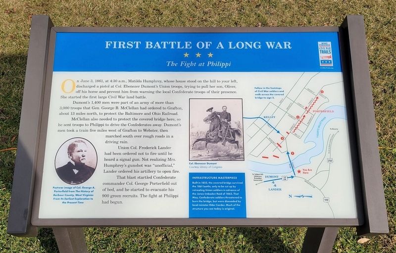
On June 3, 1861, at 4:30 a.m., Matilda Humphrey, whose house stood on the hill to your left, discharged a pistol at Col. Ebenezer Dumont's Union troops, trying to pull her son, Oliver, off his horse and prevent him from warning the local Confederate troops of their presence. She started the first large Civil War land battle.
Dumont's 1,400 men were part of an army of more than 3,000 troops that Gen. George B. McClellan had ordered to Grafton, about 13 miles north, to protect the Baltimore and Ohio Railroad.
McClellan also needed to protect the covered bridge here, so he sent troops to Philippi to drive the Confederates away. Dumont's men took a train five miles west of Grafton to Webster, then marched south over rough roads in a driving rain.
Union Col. Frederick Lander had been ordered not to fire until he heard a signal gun. Not realizing Mrs. Humphrey's gunshot was "unofficial," Lander ordered his artillery to open fire.
That blast startled Confederate commander Col. George Porterfield out of bed, and he started to evacuate his 900 green recruits. The fight at Philippi had begun.
(Captions)
Postwar image of Col. George A. Porterfield from The History of Barbour County, West Virginia: From Its Earliest Exploration to the Present Time
Col. Ebenezer Dumont Courtesy Library of Congress
Follow in the footsteps of Civil War soldiers and walk across the covered bridge to sign 2.
(Sidebar)
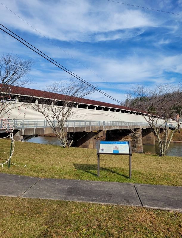
Infrastructure Masterpiece Built in 1852, the covered bridge survived the 1861 battle, only to be cut up by retreating Union soldiers in advance of the Jones-Imboden Raid of 1863. That May, Confederate soldiers threatened to burn the bridge, but were dissuaded by local minister Elder Corder. Much of the structure you see today is original.
Erected 2022 by West Virginia Civil War Trails.
Topics and series. This historical marker is listed in these topic lists: Bridges & Viaducts • War, US Civil. In addition, it is included in the West Virginia Civil War Trails series list. A significant historical date for this entry is June 3, 1861.
Location. 39° 9.161′ N, 80° 2.633′ W. Marker is in Philippi, West Virginia, in Barbour County. Marker is at the intersection of Mansfield Drive (Bypass U.S. 250) and North Main Street (U.S. 250), on the left when traveling south on Mansfield Drive. Marker is located in Blue and Gray Park. Touch for map. Marker is in this post office area: Philippi WV 26416, United States of America. Touch for directions.
Other nearby markers. At least 8 other markers are within walking distance of this marker. The Philippi Covered Bridge (here, next to this marker); Benjamin F. Kelley (a few steps from this
marker); In Memory of the Sago Miners (a few steps from this marker); Philippi (within shouting distance of this marker); Confederate Regimental Flag (within shouting distance of this marker); Churchville Cavalry Flag (within shouting distance of this marker); United States Flag (within shouting distance of this marker); Palmetto Flag (within shouting distance of this marker). Touch for a list and map of all markers in Philippi.
More about this marker. Marker is #1 of 5 on the Civil War Trails walking tour in Philippi.
Related marker. Click here for another marker that is related to this marker. Old CWT Marker At This Location titled “Battle of Philippi"
Credits. This page was last revised on December 4, 2022. It was originally submitted on December 3, 2022, by Bradley Owen of Morgantown, West Virginia. This page has been viewed 177 times since then and 38 times this year. Photos: 1, 2. submitted on December 4, 2022, by Bradley Owen of Morgantown, West Virginia. • Bernard Fisher was the editor who published this page.

