Near Herkimer in Herkimer County, New York — The American Northeast (Mid-Atlantic)
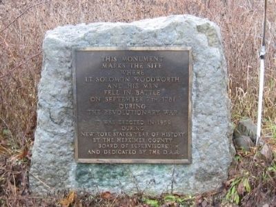
Where Lt. Solomon Woodworth and His Men Fell
Erected 1959 by the Herkimer County Board of Supervisors during New York State’s Year of History and dedicated to the D.A.R.
Topics and series. This historical marker is listed in this topic list: War, US Revolutionary. In addition, it is included in the Daughters of the American Revolution series list. A significant historical month for this entry is September 1848.
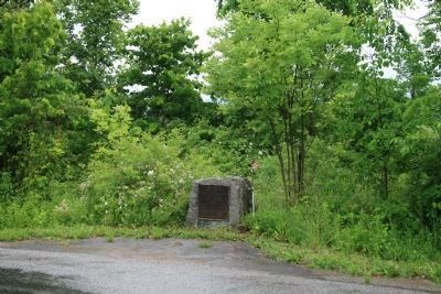
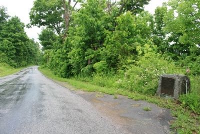
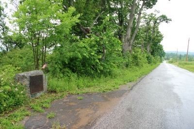
Location. 43° 4.147′ N, 74° 57.872′ W. Marker is near Herkimer, New York, in Herkimer County. Marker is on Smith Road north of Shells Bush Road (County Route 94), on the left when traveling north. Touch for map. Marker is in this post office area: Herkimer NY 13350, United States of America. Touch for directions.
Other nearby markers. At least 8 other markers are within 4 miles of this marker, measured as the crow flies. Fenner Farm (approx. 2 miles away); Fort Dayton (approx. 3 miles away); Revolution in the Mohawk Valley (approx. 3 miles away); The Thirty-Fourth Regiment (approx. 3 miles away); General Herkimer Takes Command (approx. 3 miles away); 1834 Jail (approx. 3.1 miles away); Fred'ck Staring (approx. 3.3 miles away); Early Village Burying Ground (approx. 3.3 miles away). Touch for a list and map of all markers in Herkimer.
More about this marker. Smith Road crosses West Canada Creek north of the marker.
Regarding Where Lt. Solomon Woodworth and His Men Fell. They fell in the Battle of West Canada Creek a little over three miles north of their fort, Fort Herkimer, and a short distance from this monument.
Related marker. Click here for another marker that is related to this marker. It is another monument to Solomon Woodworth and his men in Fulton County.
Also see . . .
1. The Death of Solomon Woodworth. Page on Ken Johnson’s Fort Plank website.“. . . We took rations for seven days and with a company of 42 privates besides officers and 5 Stockbridge indians & our Oneida. We start from Fort Herkimer on the 7th day of Sept crossed West Canada Creek and soon after came across the trail of the Indians and after following a few miles further we came up with enemy when a Skirmish ensued and the Indians apparently fled, when our Captain (Woodworth) exclaimed ‘Hurra! men, the rascals run!’ A few moments however we found ourselves surrounded, and all of our officers and 23 privates fell in the conflict—the remainder except myself and 5 others were either wounded and tomahawked by the Indians or made their escape back to the fort—I was taken with five other prisoners . . . ” (Submitted on December 21, 2011, by James Finnegan of Mohawk, New York.)
2. The Fate of A Scouting Party. By James F. Morrison. From “the British version”: “. . . The rebels soon after came to where they had their fire place where Lt. Clement and the Indians being at a little distance heard them say, ‘Damn them, they are gone off.’ The Indians then resolved to fight them & taking an Advantageous Situation formed in a half circle before they discharged a shot. Then poured in a volley and rushed on the Rebels with their Tomahawks, and Spears who after firing a few shots were totally defeated. The number of the Enemy was about Forty with three officers and their Loss was as follows: 3 officers and 19 privates killed, 8 privates taken. . . .” (Submitted on December 21, 2011, by James Finnegan of Mohawk, New York.)
Credits. This page was last revised on June 16, 2016. It was originally submitted on December 22, 2011, by James Finnegan of Mohawk, New York. This page has been viewed 1,255 times since then and 70 times this year. Photos: 1. submitted on December 22, 2011, by James Finnegan of Mohawk, New York. 2, 3, 4. submitted on June 14, 2013, by Dale K. Benington of Toledo, Ohio. • J. J. Prats was the editor who published this page.


