2 entries match your criteria.
Related Historical Markers
By Robert H. Moore, II, January 10, 2009
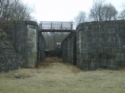
One of the locks at "Four Locks"
SHOWN IN SOURCE-SPECIFIED ORDER
| 1 ► Maryland, Washington County, Big Pool — Four Locks — Chesapeake and Ohio Canal National Historical Park — National Park Service, U.S. Department of the Interior — |
| Here the Potomac River makes a meandering four-mile loop around Prather’s Neck. To avoid the bend in the river, the canal engineers cut the canal one-half mile across the neck. Because of the rapid elevation change, these four locks were . . . — — Map (db m15285) HM | |||
| 2 ► Maryland, Washington County, Big Pool — Mule Power — Chesapeake and Ohio National Historical Park — National Park Service, U.S. Department of the Interior — |
| “Here at Four Locks mule barn, mules rested during the winter months. Boat captains left their mules here, paying a mule tended to care for them. Often the mules grew thin because the keeper did not feed the mules as well as their owners . . . — — Map (db m15278) HM | |||