Farrelly Pond District in San Leandro in Alameda County, California — The American West (Pacific Coastal)
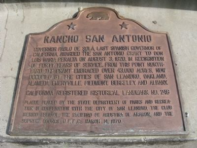
Rancho San Antonio
Erected 1970 by State Department of Parks and Recreation, City of San Leandro, Club Iberico Espaňol, Sociedad de Agustina de Aragon, and Portuguese Union-State of California. (Marker Number 246.)
Topics and series. This historical marker is listed in these topic lists: Notable Places • Settlements & Settlers. In addition, it is included in the California Historical Landmarks series list. A significant historical month for this entry is March 1900.
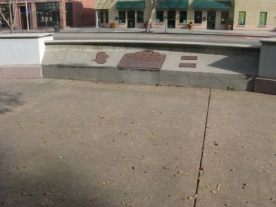
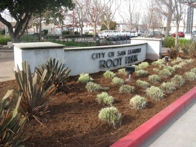
Location. 37° 43.63′ N, 122° 9.475′ W. Marker is in San Leandro, California, in Alameda County. It is in the Farrelly Pond District. Marker can be reached from East 14th Street (California Route 185) near Toler Avenue, on the right when traveling south. Marker is located at the City of San Leandro - Root Park. Touch for map. Marker is in this post office area: San Leandro CA 94577, United States of America. Touch for directions.
Other nearby markers. At least 8 other markers are within walking distance of this marker. De Anza Expedition 1775 - 1776 (here, next to this marker); The Little Brown Church (approx. 0.2 miles away); San Leandro Courthouse Site (approx. 0.2 miles away); County Courthouse (approx. 0.2 miles away); Historic Best Building (approx. 0.2 miles away); Casa Peralta (approx. 0.2 miles away); San Leandro – Cherry Festivals (approx. ¼ mile away); Historic Daniel & Meta Best Home (approx. ¼ mile away). Touch for a list and map of all markers in San Leandro.
Regarding Rancho San Antonio. This site was designated as California Registered Historical Landmark No. 246 on December 18, 1936.
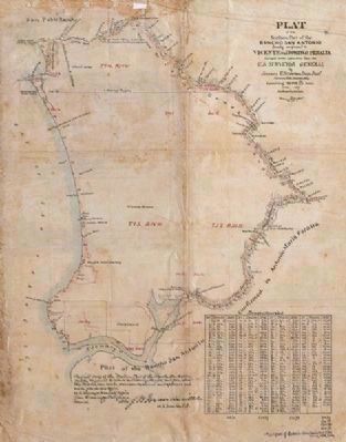
Also see . . . History of the Rancho San Antonio. The 44,800-acre Spanish land grant was made to Sergeant Luis Maria Peralta (1759-1851) by the last Spanish governor, Don Pablo Vicente de Sol in 1820 in recognition of his forty years of military service to the Spanish King. Although he never lived there himself, his four sons built homes and managed the large rancho. (Submitted on January 13, 2010, by Syd Whittle of Mesa, Arizona.)
Photographed By Mathew H. Kohnen
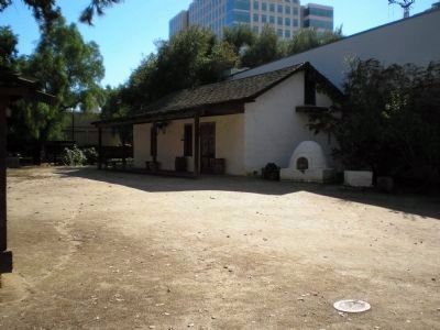
5. Luis Maria Peralta Adobe - San José.
Luís Peralta never lived on his Rancho but chose instead to reside at his adobe in the Pueblo of San José.
Click for more information.
Click for more information.
Credits. This page was last revised on February 7, 2023. It was originally submitted on January 13, 2010, by Syd Whittle of Mesa, Arizona. This page has been viewed 1,989 times since then and 56 times this year. Last updated on December 20, 2016, by Michael Kindig of Elk Grove, California. Photos: 1, 2, 3, 4. submitted on January 13, 2010, by Syd Whittle of Mesa, Arizona. 5. submitted on November 28, 2007, by Mathew H. Kohnen of San Jose, California.
