4 entries match your criteria.
Related Historical Markers
Other markers in the database about the Military Road from Fort Howard at Green Bay, to Fort Crawford at Prairie du Chien, that was built in 1835.
By Gordon Govier, January 20, 2005
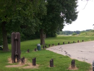
Military Road Highway View
SHOWN IN SOURCE-SPECIFIED ORDER
| | You are traveling the route of the Old Military Road, built in 1835-36, to connect Fort Crawford at Prairie du Chien and Fort Howard at Green Bay, via Fort Winnebago at "The Portage" between the Fox-Wisconsin rivers. The section from Prairie du . . . — — Map (db m36908) HM |
| | In July, 1833, Lt. Alexander Center blazed a nearby oak, marking the 100-mile point of a military road he and James Doty were surveying. The Old Military Road, built from 1835 to 1837, connected Ft. Crawford at Prairie du Chien, Ft. Winnebago at . . . — — Map (db m36907) HM |
| | Fort Howard, Green Bay
to Fort Crawford, Prairie du Chien
— — Map (db m36004) HM |
| | The Military Road, built in 1835, became the first highway to cross the state. Congress appropriated $5,000 to connect the St. Lawrence and Mississippi River basins.
The troops at Fort Crawford constructed the road from Prairie du Chien to . . . — — Map (db m46182) HM |
Apr. 16, 2024