El Paso in El Paso County, Texas — The American South (West South Central)
Chamizal National Memorial
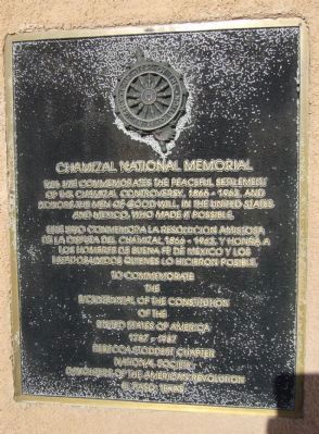
Este sitio conmemora la resolucion amistosa de la disputa del Chamizal, 1866-1963, y honra a los hombres de buena fe de Mexico y los Estados Unidos quienes lo hicieron posible.
The
Bicentennial of the Constitution
Of the
United States of America
1787 – 1987
Erected 1987 by Rebecca Stoddert Chapter, National Society Daughters of the American Revolution El Paso, Texas.
Topics and series. This historical marker and memorial is listed in this topic list: Notable Places. In addition, it is included in the Daughters of the American Revolution series list. A significant historical year for this entry is 1963.
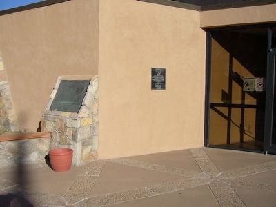
Location. 31° 46.066′ N, 106° 27.239′ W. Marker is in El Paso, Texas, in El Paso County. Marker can be reached from South San Marcial Street. Marker is just to the left of the entrance to the Chamizal National Memorial Visitor Center. Touch for map. Marker is at or near this postal address: 800 South San Marcial Street, El Paso TX 79905, United States of America. Touch for directions.
Other nearby markers. At least 8 other markers are within walking distance of this marker. Stephen Tyng Mather (here, next to this marker); Estela Portillo Trambley (a few steps from this marker); Defining A Border (about 700 feet away, measured in a direct line); Guardian Angel Church (approx. half a mile away); Site of Camp Concordia and Fort Bliss (approx. ¾ mile away); Henry C. Trost (approx. 0.8 miles away); Urbici Soler (approx. 0.8 miles away); Victoriano Huerta (approx. 0.8 miles away). Touch for a list and map of all markers in El Paso.
Additional keywords. International Boundaries
Credits. This page was last revised on June 10, 2018. It was originally submitted on November 16, 2010, by Bill Kirchner of Tucson, Arizona. This page has been viewed 856 times since then and 28 times this year. Last updated on June 5, 2018, by Brian Anderson of Humble, Texas. Photos: 1, 2, 3. submitted on November 16, 2010, by Bill Kirchner of Tucson, Arizona. • Andrew Ruppenstein was the editor who published this page.


