Through Shut In Gap passed the most direct route from the Arcadia Valley to Fredericktown. Advance elements of the rebel army rode through the gap undetected and were not spotted until they approached a Union picket post at the Russellville . . . — — Map (db m99142) HM
The three towns of Arcadia, Ironton, and Pilot Knob are located in the Arcadia Valley. The valley’s iron mining industry helped spur population growth and led the St. Louis & Iron Mt. Railroad to extend its tracks to Pilot Knob in 1858. The . . . — — Map (db m99143) HM
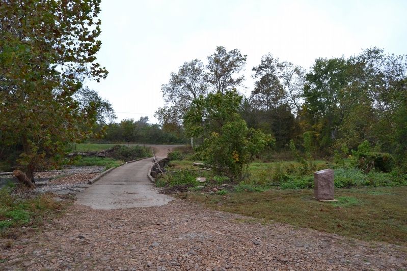
Slemons’ brigade, riding in advance of the rebel army, was first spotted at 1 p.m. by pickets here at the Russellville Junction. After the pickets had sounded the alarm, a cavalry patrol rode here to verify the pickets report. Despite much shooting . . . — — Map (db m99144) HM
On this hillside stood Ft. Curtis. It commanded the high ground overlooking the junction of the road that connected Ironton and Pilot Knob with Fredericktown. In 1863 it was abandoned for Ft. Davidson because it was too far from the rail terminus . . . — — Map (db m99145) HM
Settlers to what we now call Iron County arrived in the first few decades of the 19th century. Little did they know what would unfold just a few more decades later when the Civil War erupted in Missouri.
One of those first settlers was Ephraim . . . — — Map (db m99167) HM
A section of Montgomery's Battery, two 3-inch Ordnance Rifles, under Lt. Simonton, helped drive the rebels back into Shut-In Gap and held them there until fighting ceased at sunset on the 26th. Early the next morning, Simonton's guns, positioned in . . . — — Map (db m38441) HM
Ironton Gap, about a quarter mile wide, separates Shepherd and Pilot Knob mountains and divides Arcadia Valley into northern and southern halves. Through the gap passed the road which connected the villages of Pilot Knob and Ironton. Cabell’s . . . — — Map (db m99174) HM
Skirmishes between Clark’s rebel brigade and the Union’s 14th Iowa were fought on Shepherd Mt. on the second day. Prior to the assault on Ft. Davidson two Rebel cannons were placed on the mountain, but, because of the accurate fire from Union . . . — — Map (db m99175) HM
The two branches of Knob Creek, a tributary of Stouts Creek, enclosed Ft. Davidson on three sides. Cabell’s brigade charged the fort three times from its position behind the creek in the center of the rebel line. Most of Clark’s brigade on the left . . . — — Map (db m99176) HM
(Front): Surrounded by the rugged splendor of the highest peaks of the Missouri Ozarks, Arcadia Valley lies in the geologic center of the Ozarks, one of the world's oldest mountain regions. The valley towns are in an area settled in the iron . . . — — Map (db m38440) HM
Battle of Pilot Knob Pilot Knob Mountain September 27, 1864 1:00 P.M. - 2:30 P.M.Prior to the Confederate attack on Ft. Davidson a detachment of 3rd M.S.M. Cavalry was forced off Pilot Knob Mountain by Slemons' and McCray's Rebel Brigades. The 3rd . . . — — Map (db m38445) HM
1. Shortly after noon, Maj. Gen. Sterling Price’s advance attacks the Federal pickets encamped at the Ironton courthouse.
2. Federal reinforcements rush from Pilot Knob. They counterattack and drive the raiders three miles to Shut-In Gap. . . . — — Map (db m99197) HM
1. The Confederates attack at dawn. Outnumbered and outflanked, the Federals retire to the mountain slopes.
2. Federal infantry holds Shepherd Mountain but are gradually forced back to avoid encirclement. By 10 a.m. they retire into Fort . . . — — Map (db m99198) HM
1. While the Confederates deploy, they put two cannons on Shepherd Mountain and open fire. Accurate return fire puts both cannons out of action.
2. Maj. Gen. John S. Marmaduke’s Missouri division streams down Shepherd Mountain. Rifle and . . . — — Map (db m99200) HM
A dry moat surrounded Fort Davidson and all sides. During the third and final desperate Confederate assault, Arkansas troops of Gen. William Cabell’s brigade fought their way into the dry moat and prepared to climb the wall. Hand grenades were . . . — — Map (db m99202) HM
This crater marks the site of the powder magazine. The underground structure was 40 feet long, 12 feet high and 12 feet wide. It was covered with 15 feet of earth to protect it. The powder magazine held some 20 tons of gunpowder and ammunition . . . — — Map (db m38442) HM
In September of 1864 Major General Sterling Price and a 12,000 man army re-entered Missouri in a forlorn effort to regain the state for the Confederacy. On September 27th they laid siege to Fort Davidson. The defenders, though greatly outnumbered, . . . — — Map (db m38444) HM
You are standing near the junction of Maple and Lucas Streets where the Union Church once stood. Originally built around 1860, the non-denominational church was torn down in the 1920s. It served as a meeting place for Union troops during the Civil . . . — — Map (db m99203) HM
The iron furnace is the most visible remains of what was once a thriving iron mining industry in the Arcadia Valley. The first iron furnace was constructed in 1848, but was destroyed by the rebel army after the Battle of Pilot Knob. It was rebuilt a . . . — — Map (db m99208) HM
From 1858 to 1871, Pilot Knob was the terminus of the St. Louis & Iron Mt. Railroad. During the war the supply depot located here supplied Union outposts at Patterson, Centerville, Farmington and Fredericktown. The road to Middlebrook ran alongside . . . — — Map (db m99209) HM
The Immanuel Lutheran Church was built in 1861 on land deeded to the congregation by the Pilot Knob Mining Co. The church served as a Union hospital during the Battle of Pilot Knob and telegrams found in the building after the battle indicate that . . . — — Map (db m99211) HM
St. Mary’s Catholic Church was erected on this site in 1861. During the evacuation of the fort under the cover of darkness, some of the Union troops filed up the north rifle pit and formed in the shadow of the church created by a burning charcoal . . . — — Map (db m99210) HM
The Union army evacuated Ft. Davidson at about 2:00 a.m. on September 28. Despite having to pass between the campfires of Dobbin’s brigade, Gen. Ewing marched his men undetected through the Confederate lines and to the Caledonia-Potosi Rd. After . . . — — Map (db m99212) HM
The three towns of Arcadia, Ironton, and Pilot Knob are located in the Arcadia Valley. The valley’s iron mining industry helped spur population growth and led the St. Louis & Iron Mt. Railroad to extend its tracks to Pilot Knob in 1858. The . . . — — Map (db m99213) HM