5 entries match your criteria.
Related Historical Markers
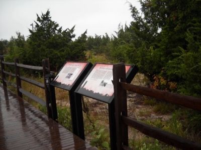
To better understand the relationship, study each marker in the order shown.
By Bill Coughlin, August 18, 2010
Cape May Markers
SHOWN IN SOURCE-SPECIFIED ORDER
| | During the late 18th century, the first coastal defenses built in the United States were earthen forts constructed on high points near important harbors. Soon thereafter, star-shaped stone forts were built in the years leading up to the War of 1812. . . . — — Map (db m34612) HM |
| |
This tower was built to house a sophisticated system for aiming the guns of Fort Miles. From Fire Control Towers along the coast, soldiers would determine the exact location of an enemy ship using the geometric principle of triangulation. Each of . . . — — Map (db m34616) HM |
| | White Construction of New York was the contractor for this fire control tower. They used a “sliding form” or “slip form,” allowing for a continuous pour of concrete. In June of 1942, about fourteen piles were driven into the ground. Two wooden . . . — — Map (db m34978) HM |
| |
At the top of the Fire Tower are the slits for the observation level and the rooftop platform. As it was being designed, there was debate about whether the Cape May tower should have one, two or three observation levels. In March 23, 1942, it was . . . — — Map (db m34979) HM |
| | The Army started dismantling Fort Miles before it was even finished – not in the face of enemy invasion but because advances in warfare made it instantly obsolete. In fact, as early as 1943, construction of the entire nationwide Harbor Defense . . . — — Map (db m34976) HM |
Apr. 16, 2024