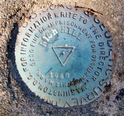
Rich Hill in Bates County, Missouri — The American Midwest (Upper Plains)
Harmony Mission
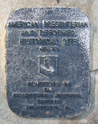
American Presbyterian and Reformed Historical Site No. 33
[Front]
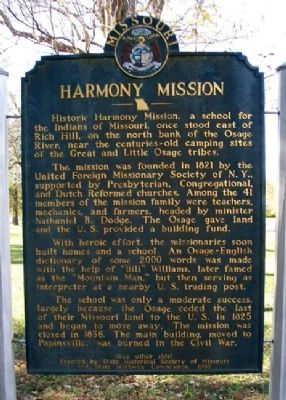
Historic Harmony Mission, a school for the Indians of Missouri, once stood east of Rich Hill, on the north bank of the Osage River, near the centuries-old camping sites of the Great and Little Osage tribes.
The mission was founded in 1821 by the United Foreign Missionary Society of N.Y., supported by Presbyterian, Congregational, and Dutch Reformed churches. Among the 41 members of the mission family were teachers, mechanics, and farmers, headed by minister Nathaniel B. Dodge. The Osage gave land and the U.S. provided a buildling fund.
With heroic effort, the missionaries soon built homes and a school. An Osage-English dictionary of some 2000 words was made with the help of "Bill" Williams, later famed as the "Mountain Man," but then serving as interpreter at a nearby U.S. trading post.
The school was only a moderate success, largely because the Osage ceded the last of their Missouri land to the U.S. in 1825 and began to move away. The mission was closed in 1836. The main building, moved to Papinsville, was burned in the Civil War.
(See other side)
[Back]
(Continued from other side)
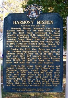
Harmony Mission, Missouri's first Indian mission school, was the first county seat and the first white settlement in Bates County, organized, 1841, named for Missouri Governor Frederick Bates. Later the once thriving Osage River town of Papinsville, named for a French trader, was county seat. In 1856 centrally located Butler, named for a Ky. congressman, became county seat.
During the Civil War, Bates was one of the counties depopulated by Union General Thomas Ewing's Order No. 11 of 1863. The next year only 390 persons were living in the county, but the post war years brought over 10,000 by 1868 to farm the fertile acres and mine the rich coal deposits.
Here in the Osage Valley of Bates and Vernon counties were the villages of the Wazhazhe Indians, called Osage by the French. In 1808, less than 100 years after they were first visited by a white man, Du Tisné, 1719, they ceded most of their Missouri land to the U.S. They ceded the rest, 1825. The first chief called Pahuska (White Hair) once lay buried in Blue Mound and for years they returned to honor him.
American Presbyterian and Reformed Historical Site No. 33
Registered by the Presbyterian Historical Society
Philadelphia, Pa.
Erected 1955 by State Historical Society of Missouri and State Highway Commission. (Marker Number 33.)
Topics and series. This historical marker is listed in these topic lists: Churches & Religion • Education • Native Americans • Settlements & Settlers. In addition, it is included in the American Presbyterian and Reformed Historic Sites, and the Missouri, The State Historical Society of series lists. A significant historical year for this entry is 1821.
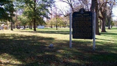
Location. 38° 5.823′ N, 94° 21.2′ W. Marker is in Rich Hill, Missouri, in Bates County. Marker is at the intersection of Walnut Street (State Highway A) and 13th Street, on the right when traveling east on Walnut Street. Marker is at the NE corner of Prospect Park. Touch for map. Marker is in this post office area: Rich Hill MO 64779, United States of America. Touch for directions.
Other nearby markers. At least 8 other markers are within 11 miles of this marker, measured as the crow flies. The Town That Coal Built (approx. 0.4 miles away); Bates County, Missouri in 1862 (approx. 10.6 miles away); Prairie Fire and the Battle of Island Mound (approx. 10.6 miles away); The Battle of Island Mound: A Demonstration to the Nation (approx. 10.7 miles away); First Kansas Colored Volunteer Infantry Regimental History (approx. 10.7 miles away); The Battle of Island Mound (approx.
10.7 miles away); Battle of Island Mound Memorial (approx. 10.7 miles away); The Toothman Farm (approx. 10.7 miles away).
Related marker. Click here for another marker that is related to this marker.
Also see . . .
1. Harmony Mission Cemetery. (Submitted on January 28, 2011, by William Fischer, Jr. of Scranton, Pennsylvania.)
2. Short History in the WPA Guide to Missouri. (Submitted on January 28, 2011, by William Fischer, Jr. of Scranton, Pennsylvania.)
Credits. This page was last revised on August 14, 2018. It was originally submitted on January 28, 2011, by William Fischer, Jr. of Scranton, Pennsylvania. This page has been viewed 2,842 times since then and 177 times this year. Last updated on August 8, 2018, by Douglass Halvorsen of Klamath Falls, Oregon. Photos: 1, 2, 3, 4, 5. submitted on January 28, 2011, by William Fischer, Jr. of Scranton, Pennsylvania. • Andrew Ruppenstein was the editor who published this page.
