Fort Dodge in Ford County, Kansas — The American Midwest (Upper Plains)
Fort Dodge
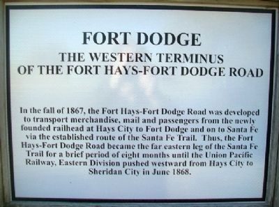
The Western Terminus of the Fort Hays-Fort Dodge Road
In the fall of 1867, the Fort Hays-Fort Dodge Road was developed to transport merchandise, mail and passengers from the newly founded railhead at Hays City to Fort Dodge and on to Santa Fe via the established route of the Santa Fe Trail. Thus, the Fort Hays-Fort Dodge Road became the far eastern leg of the Santa Fe Trail for a brief period of eight months until the Union Pacific Railway, Eastern Division pushed westward from Hays City to Sheridan City in June 1868.
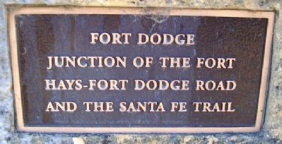
Fort Dodge
Junction of the
Fort Hays-Fort Dodge Road
and the Santa Fe Trail
Topics. This historical marker is listed in these topic lists: Forts and Castles • Industry & Commerce • Roads & Vehicles • Wars, US Indian. A significant historical month for this entry is June 1868.
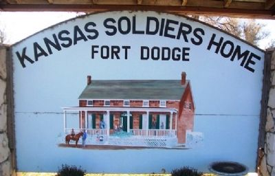
Location. 37° 43.972′ N, 99° 56.141′ W. Marker is in Fort Dodge, Kansas, in Ford County. Marker is at the intersection of U.S. 400 and Sheridan Street, on the left when traveling west on U.S. 400. Marker is on the grounds of the Kansas Soldiers' Home. Touch for map. Marker is in this post office area: Fort Dodge KS 67843, United States of America. Touch for directions.
Other nearby markers. At least 8 other markers are within walking distance of this marker. Sutler Store (within shouting distance of this marker); Commanding Officer's Quarters (about 300 feet away, measured in a direct line); Hospital (about 400 feet away); Enlisted Men's Barracks (about 600 feet away); Storehouse (about 800 feet away); Cemetery (approx. 0.2 miles away); Wagnor Memorial Fountain (approx. ¼ mile away); a different marker also named Fort Dodge (approx. ¼ mile away). Touch for a list and map of all markers in Fort Dodge.
Related marker. Click here for another marker that is related to this marker.
Also see . . .
1. Fort Dodge in Kansas Cyclopedia (1912). KSGenWeb entry (Submitted on May 19, 2013, by William Fischer, Jr. of Scranton, Pennsylvania.)
2. Fort Hays-Fort Dodge Trail, Kansas. Legends of America website entry (Submitted on May 11, 2023, by Larry Gertner of New York, New York.)
3. Kansas Soldiers' Home. Kansas Commission on Veterans' Affairs website entry (Submitted on May 19, 2013, by William Fischer, Jr. of Scranton, Pennsylvania.)
Credits. This page was last revised on May 11, 2023. It was originally submitted on May 19, 2013, by William Fischer, Jr. of Scranton, Pennsylvania. This page has been viewed 566 times since then and 17 times this year. Photos: 1, 2, 3, 4, 5. submitted on May 19, 2013, by William Fischer, Jr. of Scranton, Pennsylvania.
