Viewmont near Charlottesville in Albemarle County, Virginia — The American South (Mid-Atlantic)
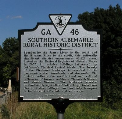
Southern Albemarle Rural Historic District
Erected 2009 by Department of Historic Resources. (Marker Number GA-46.)
Topics and series. This historical marker is listed in these topic lists: Agriculture • Architecture • Settlements & Settlers. In addition, it is included in the Former U.S. Presidents: #03 Thomas Jefferson, the Former U.S. Presidents: #05 James Monroe, and the Virginia Department of Historic Resources (DHR) series lists. A significant historical year for this entry is 2007.
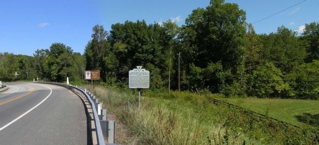
Location. 37° 54.444′ N, 78° 32.566′ W. Marker is near Charlottesville, Virginia, in Albemarle County. It is in Viewmont. Marker is on Scottsville Road (Virginia Route 20) just south of Carters Mountain Road (Route 627), on the left when traveling south. Touch for map. Marker is at or near this postal address: 4321 Scottsville Rd, Charlottesville VA 22902, United States of America. Touch for directions.
Other nearby markers. At least 8 other markers are within 8 miles of this marker, measured as the crow flies. Site of Viewmont (approx. 0.8 miles away); Viewmont (approx. 0.8 miles away); Ash Lawn - Highland (approx. 7 miles away); Ash Lawn – Highland (approx. 7.1 miles away); North Garden Church (approx. 7.2 miles away); Hatton Ferry (approx. 7.2 miles away); These Willow Oaks (approx. 7.7 miles away); Vanguard of Freedom (approx. 7.7 miles away). Touch for a list and map of all markers in Charlottesville.
Related markers. Click here for a list of markers that are related to this marker. Other markers associated with the Southern Albemarle Rural Historic District .
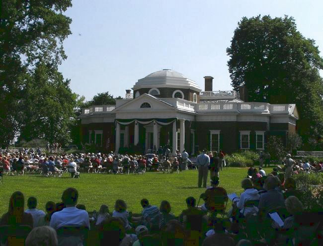
Photographed By Paul Crumlish, July 4, 2009
3. Monticello (1772)
Monticello (located near Charlottesville) is one of almost two dozen National Register of Historic Places located within the Southern Albemarle Rural Historic District. Built in 1772, it was the mountaintop estate of Thomas Jefferson, the author of the Declaration of Independence and third President of the United States.
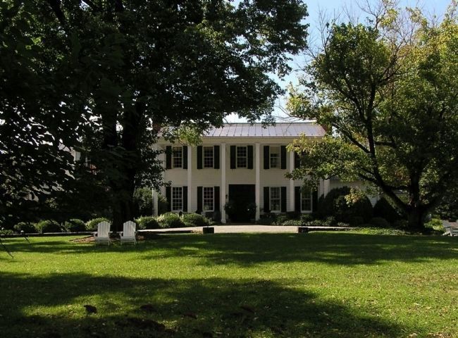
Photographed By PaulwC3, September 27, 2009
4. Clifton (prior to 1823)
Clifton (located in Shadwell) is one of almost two dozen National Register of Historic Places located within the Southern Albemarle Rural Historic District. Built prior to 1823, the Colonial Revival farmstead was built by Thomas Mann Randolph, Thomas Jefferson’s son-in-law.
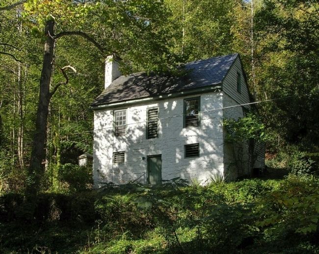
Photographed By PaulwC3, October 3, 2009
7. Cocke’s Mill Site (1792)
Cocke’s Mill Site (located near Powell Corner) is one of almost two dozen National Register of Historic Places located within the Southern Albemarle Rural Historic District. Built in 1792, it is an remaining example of the Colonial-era flour mills.
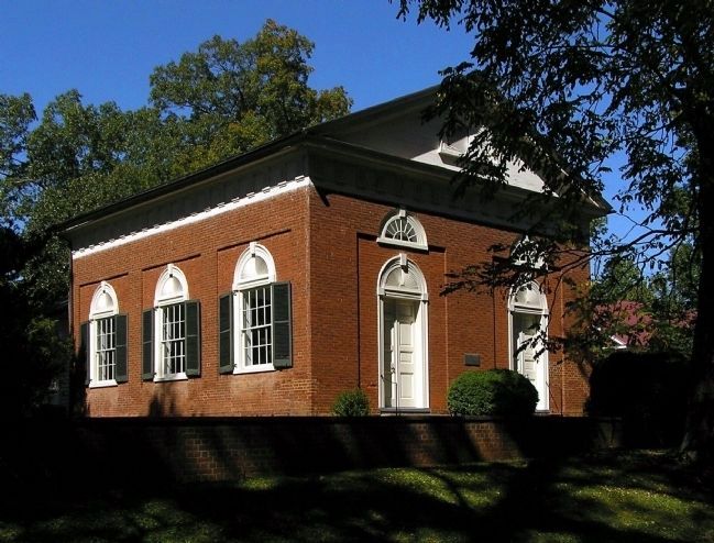
Photographed By PaulwC3, October 4, 2009
8. Christ Church Glendower (1832)
Christ Church Glendower (located near Keene) is one of almost two dozen National Register of Historic Places located within the Southern Albemarle Rural Historic District. Built in 1832, by William Phillips, a bricklayer who worked on other Roman Revival style buildings of the period in the area, it is an example of Jefferson influenced architecture.
Photographed By PaulwC3, October 11, 2009
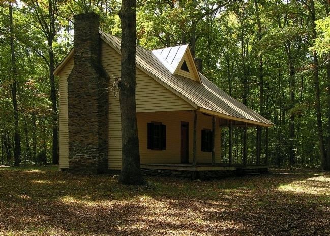
9. Pine Knot (1905)
Pine Knot (located near Glendower) is one of almost two dozen National Register of Historic Places located within the Southern Albemarle Rural Historic District. Built in 1905, the primitive cabin was the presidential country retreat of Theodore Roosevelt.
Photographed By PaulwC3, April 17, 2010
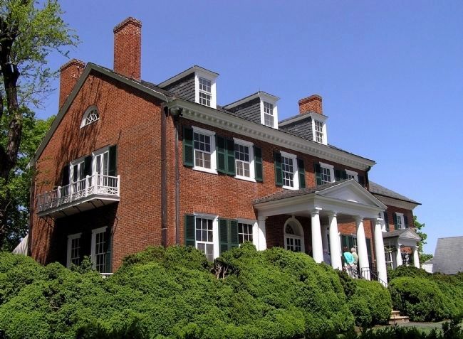
10. Morven (1820)
Morven (located near Simeon) one of almost two dozen National Register of Historic Places located within the Southern Albemarle Rural Historic District was built in 1820. The Georgian style main house anchors an almost 3,000 acre estate owned by the University of Virginia Foundation.
Photographed By PaulwC3, April 30, 2011
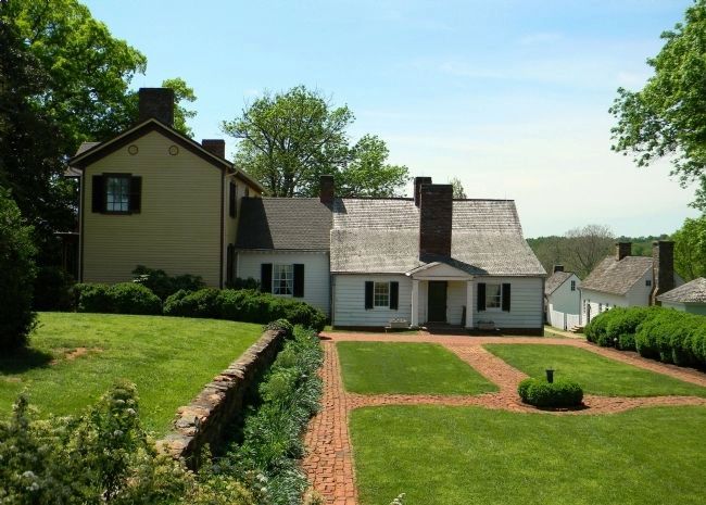
11. Ash Lawn – Highland (1799)
Ash Lawn - Highland (located near Simeon) is one of almost two dozen National Register of Historic Places located within the Southern Albemarle Rural Historic District. Built in 1799, it was the estate of James Monroe, the fifth President of the United States.
Photographed By PaulwC3, October 15, 2011
12. Esmont (1816)
Esmont (located near the village of Esmont) is one of almost two dozen National Register of Historic Places located within the Southern Albemarle Rural Historic District. Built in 1816, the estate is an example of Jeffersonian residential architecture
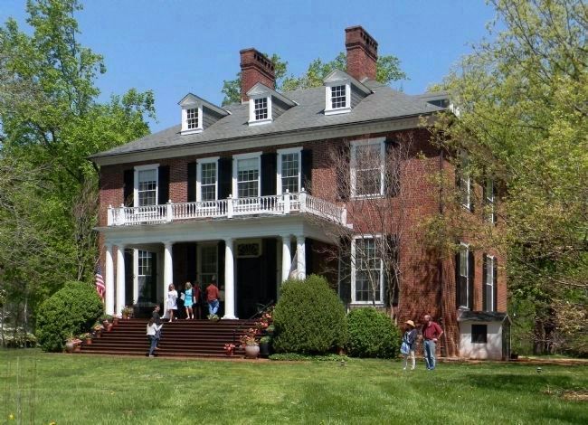
Photographed By PaulwC3, April 27, 2014
13. Redlands (1798)
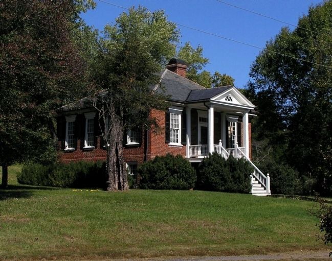
Redlands (located near Keene) is one of almost two dozen National Register of Historic Places located within the Southern Albemarle Rural Historic District. Built 1789-1798, the Georgian mansion was built on lands owned by Robert "King" Carter and has remained in the Carter family since.
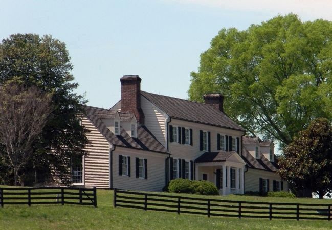
Photographed By PaulwC3, April 27, 2014
14. Bellair (1794)
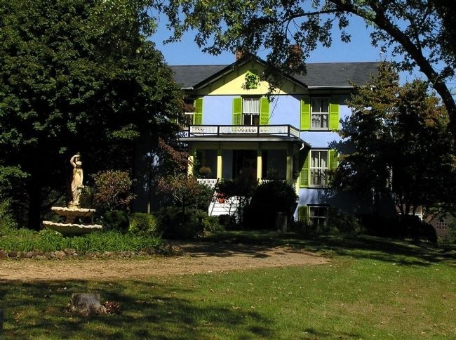
Bellair (located near Keene) is one of almost two dozen National Register of Historic Places located within the Southern Albemarle Rural Historic District. Built 1794, it has been updated over the years. Today is the hub of a Community Supported Agriculture farm.
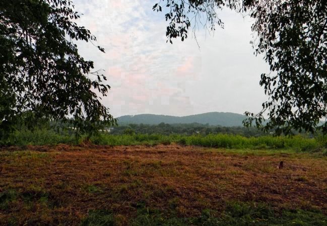
Photographed By PaulwC3, September 12, 2013
15. Site of Shadwell (1741-1770)
The birthplace of Thomas Jefferson (located near the village of Shadwell) burned in 1770. The site has been the subject of multiple archaeology studies, with the most recent in the early 1990s. Looking north, toward the Southwest Mountains, across one of the entrance ways of the one and a half story structure.
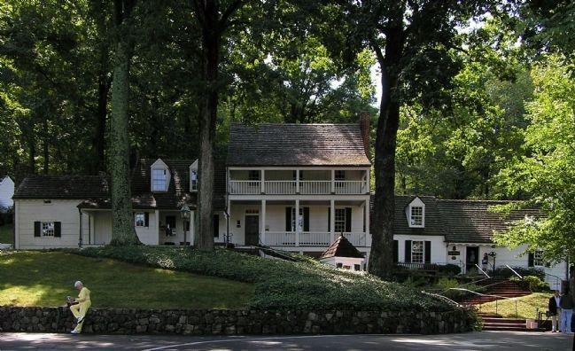
Photographed By PaulwC3, September 27, 2009
16. Michie Tavern (1772)
The Michie Tavern (located near Charlottesville) is one of the many historic properties located within the Southern Albemarle Rural Historic District. Built in 1772, it was one of the early taverns in Albemarle, originally located in the northern part of the county.
Photographed By PaulwC3, October 15, 2011
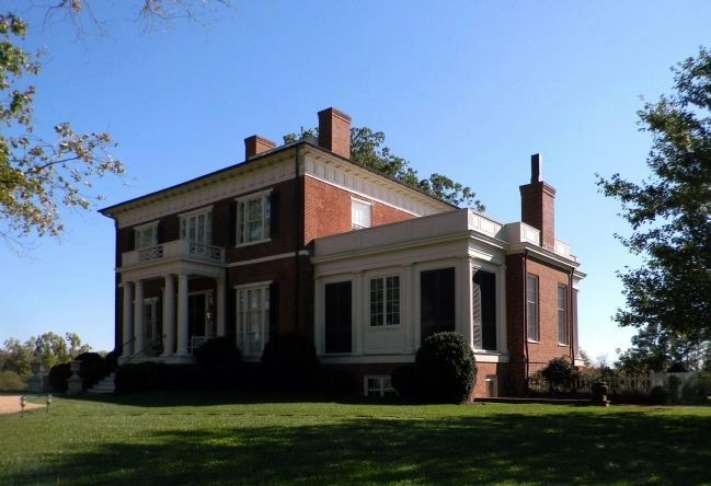
17. Estouteville (1830)
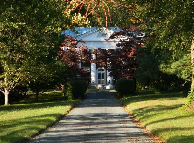
Estouteville (located near the village of Esmont) is one of almost two dozen National Register of Historic Places located within the Southern Albemarle Rural Historic District. Built 1827-1830, one of the most prominent Jeffersonian Early Classical Revival houses. At the time of construction it was the most expensive residence in the United States.
Credits. This page was last revised on February 2, 2023. It was originally submitted on October 3, 2009, by PaulwC3 of Northern, Virginia. This page has been viewed 2,561 times since then and 62 times this year. Last updated on October 12, 2009, by PaulwC3 of Northern, Virginia. It was the Marker of the Week November 1, 2009. Photos: 1, 2, 3. submitted on October 3, 2009, by PaulwC3 of Northern, Virginia. 4, 5, 6, 7, 8, 9, 10, 11, 12, 13, 14. submitted on April 28, 2014, by PaulwC3 of Northern, Virginia. 15. submitted on September 13, 2013, by PaulwC3 of Northern, Virginia. 16, 17. submitted on April 28, 2014, by PaulwC3 of Northern, Virginia. • Kevin W. was the editor who published this page.
