Fredericksburg, Virginia — The American South (Mid-Atlantic)
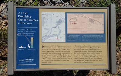
A Once Promising Canal Becomes a Raceway
Fredericksburg: Timeless.
Beginning in 1829, the Rappahannock Company constructed a series of dams and canals along the river, to transport bulk cargo. Gold had been found in Spotsylvania County in 1806 and a canal could bring heavy equipment and other materials to the area’s numerous mines. Gold production grew in the Rappahannock valley during the 1830s and 40s and the Town of Fredericksburg invested heavily in the canal enterprise that appeared to support a promising future.
Extracting gold by crushing quartz required heavy equipment and proved expensive. When the California gold strikes in 1849 drew mining companies to the West, Virginia mining declined. The canal system had been extended 50 miles upriver, but insufficient revenues forced it to close in 1853. The Fredericksburg Water Power Company constructed a dam across the river and turned this part of the system into a raceway. The new millrace supported several local industries.
(sidebar)
In 1849, the U.S. Mint received $129,382 in Virginia gold, while receiving $5.5 million in California gold.
(captions)
When the Fredericksburg Water Power Company constructed a dam across the Rappahannock River, it included a canal lock at the dam, to allow continued navigation to the upriver reaches.
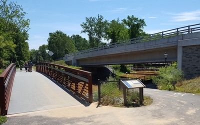
Early plans for a canal were developed by Laomi Baldwin, in 1817. The navigation company had to build a bridge where its canal cut Fall Hill Road. The original stone bridge abutment is visible under the modern bridge in front of you. The concrete on top of the stones is an adaptation for a 1950s bridge.
Erected by Fredericksburg Economic Development and Tourism Office.
Topics and series. This historical marker is listed in these topic lists: Bridges & Viaducts • Industry & Commerce • Waterways & Vessels. In addition, it is included in the Virginia, Fredericksburg: Timeless. series list.
Location. 38° 19.004′ N, 77° 29.178′ W. Marker is in Fredericksburg, Virginia. Marker can be reached from the intersection of Fall Hill Avenue (Virginia Route 639) and Tyler Street, on the right when traveling north. Located along the Rappahannock Canal Path. Touch for map. Marker is at or near this postal address: 3219 Fall Hill Ave, Fredericksburg VA 22401, United States of America. Touch for directions.
Other nearby markers. At least 8 other markers are within walking distance of this marker. Confederate Defenses in December 1862 (within shouting distance of this marker); Confederate and Federal Defenses in May 1863 (within shouting distance of this marker); Rappahannock River Heritage Trail (within shouting distance of this marker); Fall Hill Road (approx. 0.2 miles away); Tactical Terrain (approx. 0.2 miles away); Industrial Interlude (approx. 0.3 miles away); Embrey Dam (approx. 0.3 miles away); Falls of the Rappahannock River (approx. 0.3 miles away). Touch for a list and map of all markers in Fredericksburg.
Related marker. Click here for another marker that is related to this marker. Old Marker At This Location titled "A Navigation Canal Becomes a Raceway".
Credits. This page was last revised on February 2, 2023. It was originally submitted on June 20, 2016, by Bernard Fisher of Richmond, Virginia. This page has been viewed 436 times since then and 27 times this year. Photos: 1, 2. submitted on June 20, 2016, by Bernard Fisher of Richmond, Virginia.

