Monahans in Ward County, Texas — The American South (West South Central)
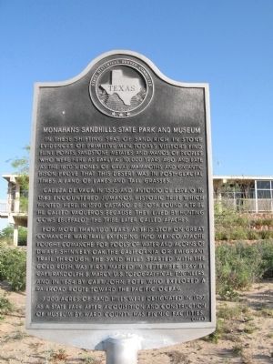
Monahans Sandhills State Park and Museum
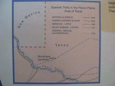
Cabeza de Vaca in 1535 and Antonio de Espejo in 1583 encountered Jumanos, historic tribe which hunted here. In 1590 Castaño de Sosa found a tribe he called Vaqueros because they lived by hunting cows (buffalo)--the tribe later called Apaches.
For more than 100 years at this stop on great Comanche War Trail extending into Mexico. Apache fought Comanche for pools of water and acorns of dwarf Shinnery oak. The California or Emigrant Trail through the Sand Hills started with the gold rush. Was first mapped in September 1849 by Capt. Randolph B. Marcy, U.S. topographical engineers, and in 1854 by Capt. John Pope, who explored a railroad route toward the Pacific Ocean.
3,000 acres of Sand Hills were designated in 1957 as a state park, after acquisition and construction of museum by Ward County. Has picnic facilities.
Erected 1964 by State Historical Survey Committee. (Marker Number 3434.)
Topics and series. This historical marker is listed in these topic lists: Exploration • Hispanic Americans • Native Americans • Paleontology. In addition, it is included in the Antonio de Espejo Entrada of 1582-1583, and the Comanche Trail into Mexico series lists. A significant historical month for this entry is September 1849.
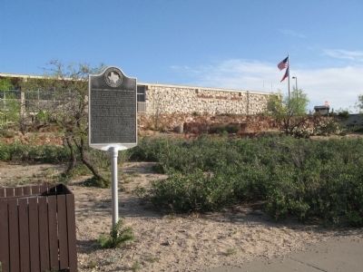
Location. 31° 37.109′ N, 102° 48.719′ W. Marker is in Monahans, Texas, in Ward County. Marker can be reached from State Highway Park Road 41, 0.2 miles north of Interstate 20, on the left when traveling north. Marker is located in front of the visitor center to Monahans Sandhill State Park. Touch for map. Marker is at or near this postal address: 2500 E Interstate 20, Monahans TX 79756, United States of America. Touch for directions.
Other nearby markers. At least 5 other markers are within 15 miles of this marker, measured as the crow flies. Monahan's Well (approx. 5 miles away); Old Holman Hotel (approx. 5.1 miles away); Christ The King Catholic Church (approx. 5.1 miles away); Ector County Discovery Well (approx. 13 miles away); Penwell (approx. 14.4 miles away).
Related marker. Click here for another marker that is related to this marker.
Also see . . . Monahans Sandhills State Park. Texas Parks and Wildlife Department (Submitted on April 30, 2014.)
Photographed By Richard Denney, April 17, 2014
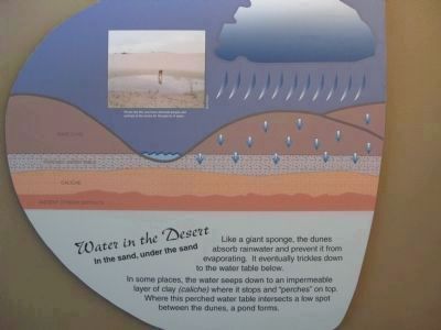
5. Springs in the Sand Dunes
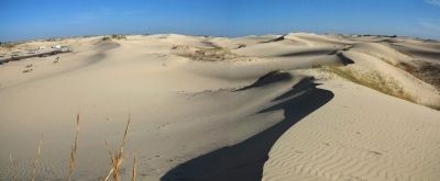
Photo shows how water forms springs in the sand dunes. Comanches, whose Comanche Trail passed through the dunes, were aware of the springs. Captain Marcy's Comanche guide, Manuel, in 1849, escorted Marcy through the dunes via Willow Springs, a campsite utilized by the Comanche. See more Gelo, Daniel J. "Comanche Land and Ever Has Been": A Native Geography of the Nineteenth-Century Comanchería." The Southwestern Historical Quarterly 103.3 (2000). High resolution photo; Click to read.
Credits. This page was last revised on October 20, 2016. It was originally submitted on April 28, 2014, by Richard Denney of Austin, Texas. This page has been viewed 1,172 times since then and 51 times this year. Photos: 1, 2, 3, 4, 5. submitted on April 28, 2014, by Richard Denney of Austin, Texas. • Bernard Fisher was the editor who published this page.
