5 entries match your criteria.
Related Historical Markers
By Bill Kirchner, July 24, 2011
Site of Squire Wilson's Home Marker
SHOWN IN SOURCE-SPECIFIED ORDER
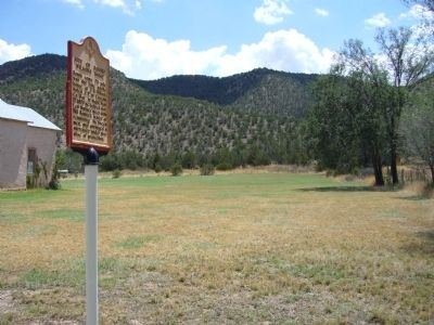
| | South some 75 yds. was the lone adobe house of J.B. Wilson, noted J.P. in Lincoln Co. War. At night, Mar 17, 1879 he helped Gov. Lew Wallace meet with Bill Bonney, leader of remaining McSween men, and arranged a surrender under promise of protection. — — Map (db m45969) HM |
| | Pat Garrett, the Lincoln County Sheriff who shot and killed William “Billy the Kid” Bonney at Fort Sumner in 1881, was himself murdered at a remote site nearby on February 29, 1908. Wayne Brazel, a local cowboy, confessed to shooting . . . — — Map (db m149330) HM |
| | Fort Sumner was established in 1862 to guard the Navajo and Apaches on the Bosque Redondo reservation. It was discontinued as a military post in 1868 and the buildings and site sold to Lucien B. Maxwell. William "Billy the Kid" Bonney was killed . . . — — Map (db m73713) HM |
| | In the frontier west, Pat Garrett has to be considered as one of the most famous and effective of legendary law officers. Six feet, five inches tall, he was an imposing and implacable foe of western criminals. An honest and honorable lawman, . . . — — Map (db m73452) HM |
| | The notorious New Mexico outlaw, also known as William Bonney, was captured and sucessfully imprisoned for the last time in the downstairs jail housed in this, the Cornell Building, at 208 W. San Francisco St., Santa Fe, from December 27, 1880 to . . . — — Map (db m73714) HM |
Apr. 24, 2024