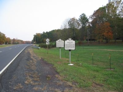
On Germanna Highway (Virginia Route 3) north of Spotswood Drive (County Route 760), on the right when traveling south. Reported permanently removed.
One of the principal crossings of the Rapidan River from colonial times. Here a part of the Army of the Potomac crossed the river, April 30, 1863, preceding the Battle of Chancellorsville. Here a part of Meade’s army crossed on the way to Mine Run, . . . — — Map (db m116528) HM
On Germanna Highway (Virginia Route 3) at the Germanna Community College Entrance (Virginia Route 375), on the right when traveling south on Germanna Highway. Reported permanently removed.
In March 1864, President Abraham Lincoln placed Gen. Ulysses S. Grant in charge of the Union’s overall military effort. Grant’s strategy was simple: attack the Confederates simultaneously on all fronts, overwhelming them by sheer force of numbers. . . . — — Map (db m3587) HM
On Germanna Highway (Virginia Route 3) north of the Germanna Community College Entrance (Virginia Route 375), on the right when traveling south. Reported permanently removed.
When the 1864 Overland Campaign started, Gen. Robert E. Lee’s Army of Northern Virginia held the upper fords of the Rapidan River, blocking the Union army's route to Richmond. Rather than attack Lee head on, Grant chose to cross here at Germanna . . . — — Map (db m3588) HM
On Constitution Highway (State Highway 20), on the right when traveling west.
This short trail leads to "Grant's Knoll." For three days Gen. Ulysses S. Grant made his headquarters here, issuing orders that would determine the fate of armies and men. President Abraham Lincoln had recently appointed Grant general-in-chief over . . . — — Map (db m7403) HM
Near Constitution Highway (Virginia Route 20), on the right when traveling west.
On May 5, 1864, this knoll was bordered by a second growth of scraggly pines and scrub oak. From here Grant and Meade could see little of the battle. Instead, they relied on subordinates to keep them apprised of the situation at the front. In the . . . — — Map (db m6024) HM
Near Constitution Highway (Virginia Route 20), on the right when traveling west.
At the battles of the Wilderness and Spotsylvania Court House, Grant would not only struggle against Lee’s army, but also against the conservative, sometimes timid, methods of the Union Army of the Potomac. George G. Meade, commander of that . . . — — Map (db m6026) HM
On Germanna Highway (State Highway 3), on the right when traveling east.
Known for many years as "Old Wilderness Tavern," the frame building at your left of this view, was a dependency of a by-gone complex. The site of the main structure is located by the brick ruins to the right of the picture, taken about 1865. In the . . . — — Map (db m7500) HM
On Germanna Highway (State Highway 3), on the right when traveling east.
The building complex known collectively as Wilderness Tavern appeared in the early 19th century to serve the needs of travellers. Located on either side of the Fredericksburg-Orange Turnpike, the original roadbed of which survives today as the . . . — — Map (db m7499) HM
Near Constitution Highway (Virginia Route 20), on the left when traveling west.
Ellwood stood in the midst of the Wilderness, a dark, forbidding forest characterized by stunted trees and densely tangled undergrowth. When the Confederates challenged General Ulysses S. Grant’s advance through the Wilderness on May 5, 1864, the . . . — — Map (db m155694) HM
Near Constitution Highway (Virginia Route 20), on the left when traveling west.
“The house stands on Wilderness Run, in a lonely place about half a mile south of the Culpeper plank road; it is a good-sized farmhouse, built of wood, square, with two porticos and painted a dove color. From the apex of the roof a . . . — — Map (db m6121) HM
Near Constitution Highway (State Highway 20), on the left when traveling west.
As one of the few large open areas in the Wilderness, the broad fields north and east of Ellwood assumed instant importance during the battle here. While fighting raged a miles to the west, the fields around Ellwood filled with artillery and . . . — — Map (db m12947) HM
On Constitution Highway (State Highway 20), on the right when traveling north.
The National Park Service acquired Ellwood in 1977. Since then, archeologists have conducted three studies of the site: test excavations around the base of the house (1978) and in the cellar (1979), and a geophysical survey of the grounds (1984). . . . — — Map (db m12948) HM