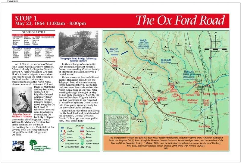
At 11:00 a.m. six cannon of Major John Lane’s Georgia artillery battalion, followed closely by Brigadier General Edward A. Perry’s weakened 270-man Florida infantry brigade, moved down this road to cover the vital crossing of Ox Ford. As the Union . . . — — Map (db m20946) HM
The five Virginia regiments led by Colonel David A. Weisiger began construction of the trenches before you on the morning of May 24 and continued to work on them during the next two days. The Virginians had been resting quietly near Anderson’s . . . — — Map (db m74893) HM
Grant misinterpreted Lee’s withdrawal on May 23 and 24 as Confederate weakness and ordered the Army of the Potomac to brush aside any scattered Rebel resistance and advance to Richmond. Major General Ambrose E. Burnside received orders to move his . . . — — Map (db m20953) HM
The first unit of the Union Ninth Corps to cross the North Anna was Brigadier General James H. Ledlie’s brigade. His 1,500 infantrymen were ready to advance by 3:00 p.m., despite having been soaked up to their armpits while crossing the river. . . . — — Map (db m20955) HM
The trenches before you were manned by the soldiers of Brigadier General Nathaniel Harris’ brigade of Mississippians, who had deployed just to the right of Sanders’ Alabamians by 1:00 p.m. on the 24th. The small pits behind the trench line served as . . . — — Map (db m20956) HM
Despite the disaster that had befallen the 35th Massachusetts, General Ledlie became even more determined to secure Ox Ford. Against the orders of his division commander, the drunken general ordered his unsupported brigade to assault the Confederate . . . — — Map (db m20957) HM
As the imperiled Union brigade huddled in the ravine before you, General Mahone recognized that their bold assault was unsupported and ordered General Harris to send a regiment from these trenches to attack them. At 6:45 p.m. the 12th Mississippi . . . — — Map (db m20959) HM
You are now standing in the tip of the famous “inverted V” position constructed by Lee’s army along the North Anna River. The trenches on your left continued to the Little River, while those on the right anchored on a bend in the North Anna below . . . — — Map (db m20961) HM
From the gun pits served by McIntosh’s artillery battalion, you can easily see the natural strength of the Confederate position. The repulse of Ledlie’s brigade served as a warning to Grant that Lee was still on the North Anna in great strength and . . . — — Map (db m20967) HM
You are standing before the trench line of the 10th Georgia Battalion, which held the right flank of Wright’s brigade. The Florida brigade and Lane’s artillery battalion held the position across the ravine to your right. On May 25 and 26 cannon and . . . — — Map (db m20971) HM