Near Laurel Mountain Road (County Route 15), on the right when traveling east.
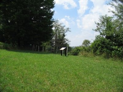
Union and Confederate forces clashed along the Beverly-Fairmont Turnpike (the narrow paved road in the foreground) on July 7-11, 1861. Union General Morris was ordered to "amuse" General Garnett at Laurel Hill - to make him believe the main . . . — — Map (db m34439) HM
On North Main Street (U.S. 250) west of Museum Street, on the right when traveling east.
As Union artillery fired on Philippi, Col. Dumont's infantry pounded across the covered bridge into the 500 people who lived here. In April, when the war was still a lark, local attorneys Thomas Bradford and Albert Gallatin Reger recruited men to . . . — — Map (db m212007) HM
On Circle Drive East, on the right when traveling north.
(Preface):In the spring of 1861, Union forces rushed into northwestern Virginia to secure the vital Baltimore and Ohio Railroad, protect important turnpikes, and support Unionists against Confederates. The two sides fought numerous . . . — — Map (db m58700) HM
On Mansfield Drive (U.S. 250) at North Main Street, on the right when traveling east on Mansfield Drive. Reported missing.
(preface)
In the spring of 1861, Union forces rushed into northwestern Virginia to secure the vital Baltimore and Ohio Railroad, protect important turnpikes, and support Unionists against Confederates. The two sides fought numerous . . . — — Map (db m211897) HM
On Pike Street at Bosworth Street, on the left when traveling north on Pike Street.
You are standing in the epicenter of the battlefield. Federal artillery shells rained down on this spot, and two Union infantry charges were converging here. Col. Dumont's 1,400 troops thundered across the bridge to your left just as another . . . — — Map (db m212006) HM
On Mansfield Drive (Bypass U.S. 250) at North Main Street (U.S. 250), on the left when traveling south on Mansfield Drive.
On June 3, 1861, at 4:30 a.m., Matilda Humphrey, whose house stood on the hill to your left, discharged a pistol at Col. Ebenezer Dumont's Union troops, trying to pull her son, Oliver, off his horse and prevent him from warning the local . . . — — Map (db m211890) HM
On North Main Street (U.S. 250) at Church Street, on the left when traveling south on North Main Street.
As Col. Porterfield's Virginians fled past here, surgeons quickly began to help the injured. The church that stood on the left side of the street served as a hospital. James E. Hanger of the 14th Virginia Cavalry was one of the Confederate . . . — — Map (db m212032) HM
On College Hill Drive, on the right when traveling south. Reported permanently removed.
On June 2, 1861, Federal troops advanced on Philippi from the Baltimore & Ohio rail hub at Grafton in two columns of about 1500 men each. The left column, under Col. Benjamin Kelley, took the train six miles east to Thornton, and then marched . . . — — Map (db m211560) HM
On Mansfield Drive (U.S. 250) at North Main Street (U.S. 250), on the right when traveling east on Mansfield Drive.
Col. Benjamin F. Kelley
Kelley, a railroad agent in Philadelphia and former resident of Wheeling, was called back to command the First Virginia (Union) Infantry--the first Union regiment raised in the South. He planned and led the attack on . . . — — Map (db m211896) HM
On Main Street (U.S. 250), on the right when traveling east. Reported missing.
Col. George A. Porterfield moved his newly recruited Confederates from Grafton on May 28, 1861, after receiving word of a Federal advance on the B&O Railroad. Porterfield's force a Philippi totaled no more than 775 volunteers. Few were fully trained . . . — — Map (db m211925) HM
On South Main Street (U.S. 250) at School Street, on the right when traveling south on South Main Street.
As Union soldiers entered the town, Virginia troops came pouring out of Philippi's streets, alleys, and buildings, some getting dressed as they ran.
The Confederates were soon streaming past this location as they fled to Beverly. Northern . . . — — Map (db m212148) HM
On the northbound Welcome Center and Rest Stop (Interstate 81) north of the state line, on the right when traveling north.
After stunning victories at Fredericksburg and Chancellorsville, Virginia, early in May 1863, Confederate Gen. Robert E. Lee carried the war through Maryland, across the Mason and Dixon Line and into Pennsylvania. His infantry marched north through . . . — — Map (db m1975) HM
On Williamsport Pike (U.S. 11), on the right when traveling north.
On the morning of July 2, 1861, Federal troops under Gen. Robert Patterson crossed the Potomac River from Maryland and marched south toward Martinsburg. Colonel Thomas J. Jackson sent his men north from their camp north of town to block them and to . . . — — Map (db m41631) HM
On Hammonds Mill Road (West Virginia Route 901) at St. Andrews Drive (County Route 3/1), on the right when traveling west on Hammonds Mill Road. Reported damaged.
Here at Stumpy’s Hollow on the morning of July 2, 1861, Confederate Lieutenant Colonel J.E.B. Stuart captured a Union infantry company almost single-handedly. The Federals – Company I, fifteenth Pennsylvania Volunteers – were acting as . . . — — Map (db m45596) HM
On Williamsport Pike (U.S. 11) at Hammonds Mill Road (County Route 901), on the right when traveling south on Williamsport Pike.
On the morning of July 2, 1861, Federal troops under General Robert Patterson crossed the Potomac River from Maryland and marched toward Martinsburg. Confederate Colonel Thomas J. Jackson’s command marched from Camp Stephens, four miles north of . . . — — Map (db m58078) HM
On Hammonds Mill Road (County Route 901) at Williamsport Pike (U.S. 11), on the left when traveling east on Hammonds Mill Road.
On the morning of July 2, 1861, Federal troops under General Robert Patterson crossed the Potomac River from Maryland and marched toward Martinsburg. Confederate Colonel Thomas J. Jackson’s command marched from Camp Stephens, four miles north of . . . — — Map (db m58080) HM
On Williamsport Pike (U.S. 11) 0.2 miles north of West Virginia Route 901, on the right when traveling north. Reported missing.
On the morning of July 2, 1861, Federal troops under General Robert Patterson crossed the Potomac River from Maryland and marched toward Martinsburg. Confederate Colonel Thomas J. Jackson’s command marched from Camp Stephens, four miles north of . . . — — Map (db m180733) HM
On Encampment Road east of Williamsport Pike (U.S. 11), on the left when traveling south.
During the Civil War, the strategically important Valley Turnpike crossed the stream just above the small waterfall here. Two battles were fought nearby. The first occurred on July 2, 1861, half a mile south on the Porterfield Farm. On the morning . . . — — Map (db m58083) HM
Fresh from victory at the Second Battle of Manassas, Gen. Robert E. Lee’s Army of Northern Virginia crossed the Potomac River on September 4-6, 1862, to bring the Civil War to Northern soil and to recruit sympathetic Marylanders. Union Gen. . . . — — Map (db m60605) HM
On East Race Street at North Spring Street when traveling east on East Race Street.
Isabelle “Belle” Boyd, the Confederate spy, lived here during part of her childhood. The ten-year-old and her family moved here in 1853 and left in 1858 for a dwelling (no longer standing) on South Queen Street. According to Boyd, . . . — — Map (db m63496) HM
This is one of the last surviving antebellum buildings in the area. It was constructed shortly after the Baltimore and Ohio Railroad reached Martinsburg in 1842. The adjacent railroad yards twice were Confederate Gen. Thomas J. “Stonewall” Jackson’s . . . — — Map (db m208792) HM
On East King Street (U.S. 11) at South Queen Street (State Highway 45) on East King Street.
Martinsburg, strategically located on the Valley Turnpike (present day U.S. Route 11) and the Baltimore and Ohio Railroad, was a major transportation center and the northern gateway to the Shenandoah Valley. Both sides contested for it frequently . . . — — Map (db m167591) HM
On East Commerce Street just north of East race Street, on the right when traveling north.
In April 1861, as the Civil War erupted, Confederate forces seized the Baltimore and Ohio Railroad from Harpers Ferry west. On May 24, Gen. Joseph
E. Johnston ordered Col. Thomas J. (later “Stonewall”) Jackson to destroy
the rolling . . . — — Map (db m149430) HM
In December 1862, Union Gen. Benjamin F. Kelley stationed detachments of the 54th Pennsylvania and 1st West Virginia Infantry regiments here to guard and repair the Baltimore and Ohio Railroad, a main supply route between the Ohio River and the . . . — — Map (db m58628) HM
On Hammonds Mill Road (West Virginia Route 901) east of Harlan Springs Road (County Route 1), on the right when traveling west.
Dr. Allen C. Hammond constructed this Greek Revival-style house about 1838. During the Civil War, both sides used it periodically for a headquarters or a hospital. The war ruined Hammond, a strong Southern sympathizer.
In October 1859, . . . — — Map (db m154839) HM
On the hill in front of you are two fortifications that Union Gen. George B. McClellan ordered constructed late in1861. They guarded the wooden covered bridge located here on the Weston and Gauley Bridge Turnpike. In October 1863, Capt. William H. . . . — — Map (db m58727) HM
On Main Street (County Highway 19/40), on the right when traveling east.
The scenic Elk River now flows peacefully before you, but in 1861, the conflict raged here. That year, Col. Erastus B. Tyler's 7th Ohio constructed earthworks near this location to protect an important suspension bridge. About 100 men of Capt. . . . — — Map (db m208238) HM
On Main Street at Camden Avenue (West Virginia Highway 4), on the right when traveling east on Main Street. Reported permanently removed.
In 1861, Col. Erastus B. Tyler’s 7th Ohio Infantry constructed earthworks near Suttonville to protect the suspension bridge across the Elk River. Later in the year, Capt. Weston Rowand’s Co. K, 1st Virginia Cavalry (US), about a hundred men, . . . — — Map (db m58728) HM
On Main Street at 3rd Street, on the right when traveling west on Main Street.
(Preface): On April 20, 1863, Confederate Gens. William E. “Grumble” Jones and John D. Imboden began a raid from Virginia through present-day West Virginia against the Baltimore and Ohio Railroad. Taking separate routes, . . . — — Map (db m58729) HM
On Main Street west of Central Avenue, on the right when traveling west.
Confederate Gen. Henry A. Wise’s army occupied the Lower Kanawha Valley in June 1861. Union Gen. George B. McClellan assigned the task of driving them out to Gen. Jacob D. Cox, who massed his troops in Gallipolis, Ohio. Cox planned to cross the Ohio . . . — — Map (db m73692) HM
Near Guyan Street north of 5th Avenue, on the left when traveling south.
When the Civil War began, few of Guyandotte’s residents were slaveholders, but many townspeople resented any infringement on their right as Virginians to own slaves. Guyandotte was reportedly the only town on the Ohio River that voted in favor of . . . — — Map (db m144784) HM
Near Guyan Street north of 5th Avenue, on the left when traveling south.
After capturing Guyandotte on November 10, 1861, and rounding up civilian Unionists and Federal recruits, Confederate forces under Col. John Clarkson and Col. Albert G. Jenkins began the next day to leave the town with their prisoners. At the . . . — — Map (db m238229) HM
On Guyan Street north of 5th Avenue, on the left when traveling south.
During the Civil War, this was the home of Mary Carroll, who narrowly managed to save it from destruction when much of Guyandotte was burned on November 11, 1861.
After capturing the town on November 10, 1861, and rounding up civilian Unionists . . . — — Map (db m73708) HM
On Arnoldsburg Road (U.S. 33/119) at County Route 33/119, on the right when traveling west on Arnoldsburg Road.
Early in 1862, the 11th West Virginia Infantry in Spencer established an outpost here in Arnoldsburg to suppress Confederate guerilla activity. Union Maj. George C. Trimble commanded four companies here at Camp McDonald, named for former county . . . — — Map (db m73440) HM
On West Main Street (U.S. 60) at 3rd Street, on the right when traveling south on West Main Street.
After the Civil War, George W. Imboden lived here with his wife, Mary Tyree, the daughter of William Tyree of Tyree Tavern. When the war began, Imboden enlisted in the Staunton Artillery in Augusta County, Virginia, where he then resided. He . . . — — Map (db m34371) HM
On James River and Kanawha Turnpike (County Route 60/33) at Tyree Street, on the right when traveling east on James River and Kanawha Turnpike.
During his and Gen. Henry Alexander Wise’s unsuccessful Kanawha Valley campaign, Confederate Gen. John B. Floyd made his headquarters here, August 17-18, 1861, while Wise camped on the top of Big Sewell Mountain. In 1862, according to an inscription . . . — — Map (db m59937) HM
On Cemetery Street at Clay Street on Cemetery Street.
This is one of the earliest identified cemeteries west of the Allegheny Mountains. William Tyree, owner of nearby Tyree Tavern, and Confederate Col. George W. Imboden, brother of Gen. John D. Imboden, are buried here. The cemetery is best known, . . . — — Map (db m173345) HM
On North Court Street (State Highway 16) at Wiseman Avenue, on the right when traveling north on North Court Street.
During the Civil War, Fort Scammon stood in front of you on the hill behind the courthouse. There, on September 10, 1862, Union Col. Edward Siber and the 1,500 men of his 37th Ohio Infantry defended Fayetteville against Confederate Gen. William . . . — — Map (db m59214) HM
On Rotan Street (Local Road 19/15) at Austin Street and King Avenue, on the right when traveling south on Rotan Street.
At the top of the hill here a community came together to help Jewish soldiers
keep their faith in the midst of war. In early April 1862, Pvt. Joseph A. Joel
and 20 other Jewish soldiers in the 23rd Ohio Infantry asked Col.
Rutherford B. Hayes, a . . . — — Map (db m223876) HM
On Midland Trail (U.S. 60) at Taylor Hill Road, on the right when traveling west on Midland Trail. Reported missing.
When the war began, most residents of this part of present-day West Virginia were Confederate in their sympathies. Both Confederate and Union forces considered the wooden covered bridge here strategically important because the James River and . . . — — Map (db m34373) HM
On Midland Trail (U.S. 60), on the right when traveling west.
Smoke filled the sky over Gauley Bridge on July 26, 1861, as Confederate Gen. Henry B. Wise's soldiers torched the Kanawha River bridge that stood on the piers directly in front of you. That destruction, however, did not prevent Union Gen. Jacob . . . — — Map (db m242422) HM
On Pioneer Way (County Route 5/3) 0.2 miles east of North Court Street, on the right when traveling east.
(sidebar)
Confederate Gen. Albert G. Jenkins led 550 cavalrymen on a 500-mile raid from Salt Sulphur Springs, Aug. 22-Sept. 12, 1862, attacking Federal forces and destroying military stores. He captured and paroled 300 Union soldiers, . . . — — Map (db m73427) HM
On Laurel Dale Road (West Virginia Route 93) at Presbyterian Church Road (County Route 1), on the right when traveling south on Laurel Dale Road. Reported permanently removed.
On April 20, 1863, Confederate Gens. William E. "Grumble" Jones and John D. Imboden began a raid on the Baltimore and Ohio Railroad from Virginia through present-day West Virginia. Taking separate routes, they later reported that they . . . — — Map (db m165723) HM
On Presbyterian Church Road (County Road 1) at Laurel Dale Road (State Route 93), on the right when traveling west on Presbyterian Church Road.
On April 20, 1863, Confederate Gens. William E. "Grumble" Jones and John D. Imboden began a raid on the Baltimore and Ohio Railroad from Virginia through present-day West Virginia. Taking separate routes, they later reported that they . . . — — Map (db m178393) HM
On Lennox Lane at Patterson Creek Road (County Road 5), on the right when traveling south on Lennox Lane.
Earthworks and other remnants of Union Capt. James A. Jarboe's blockhouse are located nearby, where Jarboe's Co. I, 10th West Virginia Infantry, guarded the Morgantown and Patterson Creek roads intersection. The company also escorted the supply . . . — — Map (db m178391) HM
On Virginia Avenue (West Virginia Route 55) at Bush Lane, on the right when traveling east on Virginia Avenue.
Union Col. James A. Mulligan, 23rd Illinois Infantry, supervised the construction of Fort Mulligan between August and December 1863. Known locally as Fort Hill, the work protected the South Branch Valley and its Unionist residents and also served . . . — — Map (db m173171) HM
On Virginia Avenue (U.S. 220) at Pine Street, on the right when traveling east on Virginia Avenue. Reported permanently removed.
Union Col. James A. Mulligan, 23rd Illinois Infantry, supervised the construction of Fort Mulligan between August and December 1863. Known locally as Fort Hill, the work protected the South Branch Valley and its Unionist residents and also served . . . — — Map (db m173250) HM
The brick church formerly on this site was named Mount Zion Presbyterian Church. The congregation stopped meeting here after Federal forces occupied Petersburg in May 1862, took over the church building, and began using it as a commissary. The . . . — — Map (db m58681) HM
On South Main Street (U.S. 220) at C Street on South Main Street.
During the Civil War, loyal Unionist Home Guard companies patrolled Hardy County (now Grant County) to defend it against Confederate incursions. Near here on Johnson Run on June 19, 1864, a mixed command that included men from several companies . . . — — Map (db m129309) HM
Although saltpeter (potassium nitrate or nitre), an essential element in the manufacture of gunpowder, had been mined at Organ Cave since the eighteenth century, the need for the mineral increased dramatically during the Civil War. Several saltpeter . . . — — Map (db m59342) HM
On Church Street (U.S. 60) at Washington Street on Church Street.
Early in May 1862, Union Col. George Crook, 36th Ohio Infantry, led his command from Charleston to raid the Virginia Central Railroad near Covington. After tearing up track and burning a bridge, he and his men arrived in Lewisburg on May 17, with . . . — — Map (db m59344) HM
On Bloomery Pike (West Virginia Route 127), on the right when traveling west.
Early in 1862, Confederate raids and attacks put Hampshire County and much of the surrounding area under nominal Southern control. The Baltimore and Ohio Railroad and nearby telegraph wires were severed, impeding Federal troop movements. A militia . . . — — Map (db m30455) HM
On Cumberland Road (West Virginia Route 28) at Long Road (County Route 28/4), on the left when traveling north on Cumberland Road. Reported missing.
In 1861, during the early part of the Civil War, Union Gen. Benjamin F. Kelley established Camp Washington here on the Washington Bottom Farm to secure the Baltimore and Ohio Railroad in this area. Located between Romney and Cumberland, Maryland, . . . — — Map (db m81398) HM
On Cumberland Road (West Virginia Route 28) at Long Road (County Route 28/4), on the left when traveling north on Cumberland Road.
On October 24, 1861, Union Gen. Winfield Scott ordered Gen. Benjamin F. Kelley to strengthen his position at New Creek Station (present-day Keyser) on the Baltimore and Ohio Railroad and then march to Romney and occupy the town. Situated on the . . . — — Map (db m81399) HM
On Old Jersey Mountain Road, on the right when traveling north.
The shop of Jacob Sheetz, a Hampshire County gunsmith, once stood ahead of you in the yard to the right of the house. In 1861, Sheetz found himself unusually busy converting ancient flintlock rifles to the modern percussion type.
The long . . . — — Map (db m58647) HM
On South Branch River Road (County Route 8) 1 mile south of U.S. 50.
This is Hickory Grove, the home of Adam and Mary Stump and their son Capt. George W. Stump, who led a company of the 18th Virginia Cavalry during the war. Capt. Stump was always heavily armed with a carbine and numerous revolvers; his men called . . . — — Map (db m174941) HM
On U.S. 50 near the South Branch of the Potomac River, on the left when traveling west.
On the night of June 12, 1861, Col. Lewis Wallace led his 11th Indiana (Zouaves) Regiment from Cumberland, Maryland, by train across the Potomac River and into present-day West Virginia. He had learned that “several hundred” Confederate troops . . . — — Map (db m33450) HM
On West Main Street (U.S. 50) at North High Street, on the right when traveling west on West Main Street.
On May 23, 1861, Virginians voted in a statewide referendum to approve or disapprove the Ordinance of Secession that the convention in Richmond had passed on April 17. Here at the Hampshire County Courthouse, 1,188 out of 2,635 eligible voters . . . — — Map (db m58656) HM
On Main Street (U.S. 50), on the right when traveling east.
On January 1, 1862, Confederate Gen. Thomas J. "Stonewall" Jackson led four brigades west from Winchester, Va., to secure Romney in the fertile South Branch Valley on the North Western Turnpike. He attacked and occupied Bath on January 4 . . . — — Map (db m159294) HM
On East Main Street (U.S. 50) 0.1 miles south of Campus Drive.
Romney experienced many troop movements and skirmishes during the course of the war because of its location on the vitally important North Western Turnpike. The road linked Winchester, near the northern end of Virginia’s Shenandoah Valley, with . . . — — Map (db m159293) HM
On Old State Highway 55 at New River Road (County Road 1), on the right when traveling west on Old State Highway 55.
For two nights beginning on May 28, 1862, Union Gen. John C. Frémont and his approximately 20,000-man army camped on the broad, rolling plateau before you. They had marched from Franklin (Pendleton Co.) three days earlier through the rain and . . . — — Map (db m33596) HM
On West Virginia Route 259 south of Dove Hollow Road (Local Route 14), on the left when traveling south.
The frame house across the road is Woodlawn, the home of James Ward Wood, who served as a private in Co. F (originally the Hampshire Riflemen), 7th Virginia Cavalry (CS), from January to August 1864. During this period, the unit fought in the . . . — — Map (db m48968) HM
On West Virginia Route 259 at Howard's Lick Road (County Route 12), on the right when traveling south on State Route 259.
When the Civil War began in 1861, John and Susanna Mathias lived in this house with their son John Thomas Mathias (age 21) and their daughter Susan Mathias (age 12).
John T. Mathias enlisted in Confederate service in the 1st Regiment Virginia . . . — — Map (db m164936) HM
On Harness Road just east of Hyde Street, on the left when traveling east.
If you had been standing here about mid-morning of August 7, 1864, you would have seen Confederate soldiers running for the hills on your right. Confederate Gen. John McCausland's cavalry brigade was camped in the fields in front of you on this . . . — — Map (db m238789) HM
On Olivet Drive at Paskell Hill Drive on Olivet Drive. Reported permanently removed.
During the Civil War, Moorefield could be seen in front of you from this then-treeless hill. Beyond the town is the confluence of two watercourses that form the South Branch River, which flows north through a fertile valley. The Harness family . . . — — Map (db m58673) HM
On Olivet Drive, 0.5 miles east of Winchester Avenue (Old West Virginia Route 55), on the left when traveling south.
During the Civil War, Moorefield could be seen in front of you from this then-treeless hill. Beyond the town is the confluence of two watercourses that form the South Branch River. The Harness family cemetery was located at the northern end of . . . — — Map (db m155452) HM
On North Main Street (U.S. 220) at Winchester Avenue (Old West Virginia Route 55) on North Main Street. Reported permanently removed.
This house was constructed about 1853 for Samuel A. McMechen, merchant, father of five daughters and deacon of Moorefield Presbyterian Church up the street on your right. The attached McMechen Store, on the right, predates the house. A . . . — — Map (db m47831) HM
On North Main Street (U.S. 220) just north of Winchester Avenue (Old West Virginia Route 55), on the right when traveling north.
This house was constructed about 1853 for Samuel A. McMechen, merchant, father of five daughters and deacon of Moorefield Presbyterian Church up the street on your right. The attached McMechen Store, on the right, predates the house. A . . . — — Map (db m153029) HM
Near Mill Island Drive, 1 mile south of South Fork Road (County Route 7). Reported missing.
The mansion in front of you is Mill Island, constructed about 1840 in the Greek Revival style for Felix Seymour and his wife, Sidney McNeill Seymour. During the Civil War, Mill Island served as a Confederate hospital, especially for Capt. John . . . — — Map (db m214991) HM
On South Main Street (U.S. 220) at Winchester Avenue, on the right when traveling north on South Main Street.
When the Civil War began, the Greek Revival-style Moorefield Presbyterian Church consisted of the main sanctuary that fronts on Main Street and the small chapel behind it. The chapel was constructed about 1847, and the sanctuary was completed in . . . — — Map (db m47863) HM
On U.S. 220 just north of Rolling Acres Drive, on the right when traveling north. Reported permanently removed.
The Confederate cavalry brigade of Gen. Bradley
T. Johnson bivouacked in the fields to your left
on August 7, 1864. Willow Wall (built ca. 1830), visible to your left down the road, was Johnson’s headquarters. Johnson’s brigade and that of Gen. . . . — — Map (db m48970) HM
On U.S. 220, 0.1 miles north of Fish Pond Road, on the right when traveling north.
The Confederate cavalry brigade of Gen. Bradley T. Johnson bivouacked in the fields around you on August 7, 1864. Willow Wall (built ca. 1830), visible to your left down the road, was Johnson's headquarters. Johnson's brigade and that of Gen. . . . — — Map (db m152772) HM
On Main Street (U.S. 48) north of High Street, on the left when traveling south. Reported permanently removed.
During the Civil War, most of Wardensville's two hundred residents supported the Confederacy. Southern guerrilla found friends here. On May 7, 1862, Union Col. Stephen W. Downey arrived here with a mixed force of infantry and cavalry, searching . . . — — Map (db m200869) HM
On East Main Street (West Virginia Route 55/259) just north of High Street.
During the Civil War, most of Wardensville's two hundred residents supported the Confederacy. Southern guerrilla found friends here. On May 7, 1862, Union Col. Stephen W. Downey arrived with a mixed force of infantry and cavalry, searching for . . . — — Map (db m238236) HM
Near Water Avenue at Virginia Avenue, on the right when traveling west.
(Preface): On April 20, 1863, Confederate Gens. William E. “Grumble” Jones and John D. Imboden began a raid from Virginia through present-day West Virginia against the Baltimore and Ohio Railroad. Taking separate routes, . . . — — Map (db m58719) HM
On April 20, 1863, Confederate Gens. William E. “Grumble” Jones and John D. Imboden began a raid from Virginia through present-day West Virginia against the Baltimore and Ohio Railroad. Taking separate routes, they later reported . . . — — Map (db m58717) HM
On South Second Street at West Pike Street (West Virginia Highway 20), on the right when traveling north on South Second Street. Reported damaged.
From 1861 through 1865, Clarksburg was temporary home to hundreds of Union soldiers. Although many tents and huts were erected to quarter he men, soldiers occupied every public building at one time or another. You are facing the site of one such . . . — — Map (db m58718) HM
On West Main Street at South 5th Street, on the right when traveling east on West Main Street.
The house in which Thomas J. Jackson was born on January 21, 1824, stood across the street and halfway down the block to your right (marked with a bronze plaque). His father struggled to make ends meet and poverty marred Jackson’s childhood. Both . . . — — Map (db m166847) HM
On West Main Street at South 3rd Street, on the right when traveling east on West Main Street.
Harrison County was among the first jurisdictions in western Virginia to support the Union. A pro-Union meeting was called for November 24, 1860, at the Clarksburg Courthouse, just after Abraham Lincoln had been elected president and many Southern . . . — — Map (db m73418) HM
On West Virginia Route 68, 0.2 miles north of U.S. 33, on the right when traveling south.
(Preface): Confederate Gen. Albert G. Jenkins led 550 cavalrymen on a 500-mile raid from Salt Sulphur Springs, Aug. 22-Sept. 12, 1862, attacking Federal forces and destroying military stores. He captured and paroled 300 Union . . . — — Map (db m39627) HM
On Court Street North at West Main Street (U.S. 33), on the left when traveling north on Court Street North.
During the Civil War, both Union and Confederate supporters formed guerrilla bands. Each government denounced the other side’s partisans as bushwhackers or common thieves but gave those on their own side an official military designation as cover. . . . — — Map (db m73647) HM
On Court Street north of Main Street (U.S. 33), on the right when traveling north. Reported permanently removed.
In 1824 Jacob Sturdier built the first grist mill in Ripley along Mill Creek. In 1853, Jacob Sayre sold the mill to John McGrew who came to Jackson County in 1844.
The McGrew mill building was a structure of about 40 ft. by 30 ft. and was . . . — — Map (db m11426) HM
On Court Street north of Main Street (U.S. 33), on the right when traveling north. Reported permanently removed.
Jackson County was created by an act of the Virginia Assembly on March 1, 1831, and named in honor of President Andrew Jackson.
The first courthouse on this site was a brick structure. The land for the courthouse square was donated by Jacob . . . — — Map (db m11439) HM
On FFA Drive east of Cedar Creek Drive (County Route 25), on the left when traveling east.
Although western Virginia eventually separated from the original state to form West Virginia and join the Union, many residents of the new state supported the Confederacy. Many others served the Union, while still others wished to avoid contact with . . . — — Map (db m73651) HM
On Allstadt Hill Road, 0.2 miles north of Millville Road (County Route 27), on the left when traveling north.
The Allstadt House and Ordinary was the home of John H. Allstadt. On the evening of October 16, 1859, John Brown and his "army" of would-be slave liberators launched their attack on Harpers Ferry from Kennedy Farm just across the Potomac River in . . . — — Map (db m145216) HM
On Washington Street, on the right when traveling west.
As you explore Jefferson County’s Civil War sites, you will learn about some of the notable exploits on the native soil of Thomas J. “Stonewall” Jackson, one of the war's most famous figures. Jackson was born in Clarksburg, Virginia (now West . . . — — Map (db m155096) HM
The Federal offensive in the Shenandoah Valley begun in May 1864 faltered in the summer with Confederate victories and Gen. Jubal A. Early's Washington Raid in July. Union Gen. Philip H. Sheridan took command in August, defeated Early at . . . — — Map (db m238785) HM
On S Seminary Street at E Congress Street, on the left when traveling south on S Seminary Street.
Edge Hill Cemetery contains the graves of Fontaine Beckham and John Avis, two participants in the saga of John Brown’s Raid in October 1859. Beckham was the mayor of Harpers Ferry then and one of four civilian casualties. Ironically, though John . . . — — Map (db m41672) HM
On North Samuel Street at East Washington Street (West Virginia Route 51), on the right when traveling north on North Samuel Street.
Jefferson County’s association with significant events in Civil War history began in October 1859, when abolitionist John Brown raided the U.S. Arsenal at Harpers Ferry. Quickly captured, Brown and his followers were brought here to Charles Town . . . — — Map (db m41671) HM
On South Samuel Street at East Hunter Street on South Samuel Street.
This is where seven men were hanged in December 1859 and March 1860 for their part in John Brown’s Raid on Harpers Ferry. The scaffold stood here in a large field. A month after the trial, on December 2, 1859, John Brown was the first to die. He . . . — — Map (db m41650) HM
On E Washington Street (U.S. 340 Bus) at S Seminary Street, on the right when traveling east on E Washington Street.
The Federal offensive in the Shenandoah Valley begun in May 1864 faltered in the summer with Confederate victories and Gen. Jubal A. Early's Washington Raid in July. Union General Philip H. Sheridan took command in August, defeated Early . . . — — Map (db m238786) HM
On George Street (West Virginia Route 115) at Washington Street (West Virginia Route 51), on the right when traveling north on George Street.
One of the most famous trials in American history was held in this building in 1859, when John Brown and his followers faced charges of treason against Virginia, inciting slaves to rebel, and murder. Judge Richard Parker presided.
The trial . . . — — Map (db m170247) HM
On E Congress Street at S Church Street, on the right when traveling east on E Congress Street.
The present church, the fourth on this site, was completed in 1851. Federal troops occupied it during the Civil War and severely damaged it. The churchyard contains the graves of many Washington family descents. They are buried near the eastern . . . — — Map (db m41675) HM
On Bakerton Road at Knott Road (Route 31/2), on the right when traveling west on Bakerton Road.
About two o’clock in the afternoon of September 17, 1862, Confederate Gen. A.P. Hill’s 3,000-man division began crossing the Potomac River at Boteler’s Ford about two miles northwest of here, en route to the battle raging at Antietam Creek near . . . — — Map (db m1955) HM
On Washington Street (Business U.S. 340) east of Boundary Street, on the left when traveling east.
The Reverend Doctor Josiah P. Smeltzer laid the cornerstone of St. John's Lutheran Church on April 30, 1850. The building was completed two years later and dedicated on August 1, 1852. Little more than seven years had passed when, at dawn on . . . — — Map (db m70794) HM
On Millville Road, on the right when traveling south.
This is the site of the last Civil War engagement in Jefferson County and one of the last fights involving Col. John S. Mosby’s Rangers. It also marked the end of the Independent Loudoun Rangers, a small cavalry unit recruited in 1862 from Loudoun . . . — — Map (db m59417) HM
The Federal offensive in the Shenandoah Valley begun in May 1864 faltered in the summer with Confederate victories and Gen. Jubal A. Early's Washington Raid in July. Union Gen. Philip H. Sheridan took command in August, defeated Early at . . . — — Map (db m206976) HM
On Charles Town Road at Luther Jones Road (County Route 8) on Charles Town Road.
The Federal offensive in the Shenandoah Valley begun in May 1864 faltered in the summer with Confederate victories and Gen. Jubal A. Early's Washington Raid in July. Union Gen. Philip H. Sheridan took command in August, defeated Early at . . . — — Map (db m238787) HM
On German Street (West Virginia Route 230) at King Street (West Virginia Route 480), on the right when traveling west on German Street.
Fresh from victory at the Second Battle of Manassas, Gen. Robert E. Lee’s Army of Northern Virginia crossed the Potomac River on September 4-6, 1862, to bring the Civil War to Northern soil and to recruit sympathetic Marylanders. Union Gen. . . . — — Map (db m1957) HM
190 entries matched your criteria. The first 100 are listed above. The final 90 ⊳