One hundred thirty-nine large format Historical Area Markers were erected statewide during the 1960s. Some are duplicates placed in different areas. Some carry variations of text found on other markers within the same region. The area markers usually do not commemorate specific individuals or events, since these are already memorialized by smaller State Historical Markers.
On Interstate 87, on the right when traveling south.
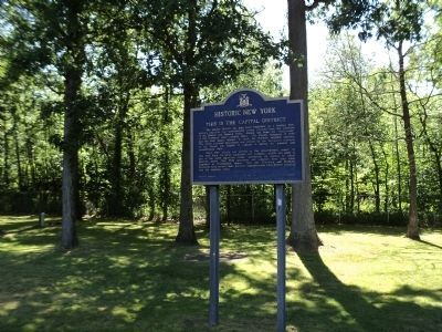
The Capital District has long been important as a trading post, military objective and governmental center. Located near the juncture of the Hudson and Mohawk rivers, Albany has been the “crossroads” of the northeast since . . . — — Map (db m56854) HM
On Main Street (New York State Route 417) at Liberty Street, on the right when traveling south on Main Street.
The presence of oil in this area of the Allegheny foothills has been known by white men since 1627, when a French missionary reported that the Indians used "a good kind of oil" for medicinal purposes from the nearby Seneca Oil Spring. Production . . . — — Map (db m88286) HM
The valleys of the Upper Susquehanna River were natural routes for Indians, traders and settlers. Oquaga, near Windsor, was an Indian fur-trading post, and became an objective of the Sullivan-Clinton Campaign of 1779. From a dam at the outlet of . . . — — Map (db m35164) HM
On New York State Route 16, 0.2 miles south of New York State Route 39, on the left when traveling south.
Erie Indians were the first inhabitants of this region. In 1654, they were driven out by the Senecas who occupied several sites along the banks of Cattaraugus Creek. The Cattaraugus, the principal stream of many that divide the Cattaraugus Hills, . . . — — Map (db m86681) HM
On New York State Route 31 at West Brutus Street, on the right when traveling east on State Route 31.
Construction of the Erie Canal was hailed as the greatest engineering accomplishment to that time. Under the leadership of Governor De Witt Clinton, construction began July 4, 1817. With little technical knowledge, thousands of workers surveyed, . . . — — Map (db m88628) HM
Near New York Thruway (Interstate 90) 25.4 miles east of Ridge Road (New York State Route 414), on the right when traveling east.
Construction of the Erie Canal was hailed as the greatest engineering
accomplishment to that time. Under the leadership of Governor De Witt Clinton,
construction began July 4, 1817. With little technical knowledge, thousands
of workers . . . — — Map (db m146448) HM
On East Chautauqua Street (New York State Route 430) at South Erie Street (New York State Route 394), on the right when traveling east on East Chautauqua Street.
Chautauqua Lake, eighteen miles long and one to three miles wide, has as its outlet a branch of Connewango Creek, a tributary of the Allegheny River. This gives Chautauqua an indirect connection with the Gulf of Mexico by way of the Ohio, and . . . — — Map (db m64687) HM
On Wyncoop Creek Road (County Road 3) just south of Main Street (County Road 60), on the right when traveling south.
Generals John Sullivan and James Clinton were appointed by George Washington to lead a punitive expedition against the hostile tribes of the Iroquois Confederacy and to capture the British forts at Oswego and Niagara. The objectives were to . . . — — Map (db m198208) HM
Indians living in the valleys of the Unadilla and Susquehanna Rivers played an important role in the region's early history. Fur traders from Albany and the Mohawk Valley reached out to Oquaga (now Windsor), and a mission to the Indians was . . . — — Map (db m93549) HM
On Taconic State Parkway, 0.5 miles north of New York State Route 217, on the right when traveling north.
Columbia County
Historic New York
Columbia County, which extends from the Hudson River to the New England border. was formed in the late 18th century from parts of two 17th century land patents. Early settlers came from Holland, followed by . . . — — Map (db m237040) HM
On New York State Thruway / AMVETS Memorial Highway (Interstate 90 at milepost 443).
Following La Salle's arrival at the Niagara River in 1678, that waterway between Lakes Erie and Ontario became a natural route to and from the river during the 18th century. Permanent settlement of the Western New York began in 1800 following the . . . — — Map (db m24593) HM
Extending one mile north from Delaware Park Lake, between Elmwood and Delaware Avenues, the Pan-American Exposition was a spectacular sight to over eight million visitors from May 1 to November 2, 1901. Ornate buildings, embellished with . . . — — Map (db m57079) HM
Near Governor Thomas E. Dewey Thruway (Interstate 90 at milepost 412), 10.6 miles west of Alleghany Road (New York State Route 77), on the right when traveling west.
The Niagara River between Lakes Ontario and Erie was the natural route to the interior of the continent. Following the arrival of French explorers in 1678, missionaries, traders, troops and settlers traveled by its waters. At the outlet of the . . . — — Map (db m57072) HM
On Sandy Redoubt, on the right when traveling east.
During the 18th century, when nations fought to control the strategic route between the St. Lawrence River in Canada and the Hudson River to the south, the fortification overlooking the outlet of Lake George into Lake Champlain was called “the . . . — — Map (db m9094) HM
On New York State Route 29, on the right when traveling east.
Sir William Johnson (1715-1774), Indian trader, statesman, diplomat and colonial empire builder. In 1763 he built Johnson Hall, the center of his estate and the scene of many Indian conferences.
Coming from Ireland in 1738, Johnson traded with . . . — — Map (db m57406) HM
On North William Street (New York State Route 29) near W. Main Street (New York State Route 67), on the right when traveling north.
Historic New York
Johnson Hall - 1763
Johnstown
Sir William Johnson (1715-1774), Indian trader, statesman,diplomat and Colonial Empire Builder, in 1763 built Johnson Hall, the center of his estate and the scene of many Indian . . . — — Map (db m5683) HM
Near Governor Thomas E. Dewey Thruway (Interstate 90 at milepost 397), 4.3 miles east of Alleghany Road (New York State Route 77), on the right when traveling east.
The Holland Land Company was organized by six banking firms in the Netherlands to purchase the unsettled land of western New York State. Their agent, Theophile Cazenove, in 1792-93 bought more than three million acres, known as the Holland Purchase. . . . — — Map (db m57082) HM
Near NY Thruway (Interstate 90), on the right when traveling west.
The Seneca Indians, “Keepers of the Western Door” occupied this area since the formation of the Iroquois confederacy about 1550. Most numerous and most warlike of the Six Nations, they for a time dominated the tribes . . . — — Map (db m140045) HM
Near New York Thruway (U.S. 87), on the right when traveling south.
The deep ravines, irregular ridges and rocky slopes of the Catskill Mountains long remained wild and desolate. Small settlements began in mountain valleys before the American Revolution. After the war, population grew steadily as New Englanders . . . — — Map (db m28598) HM
On New York State Route 30, on the right when traveling north.
Historic New York
The Adirondacks
The Adirondack Mountains, consisting of rocky peaks, sheer cliffs and narrow valleys, also have wooded slopes and sparkling lakes. Forty three mountains have elevations 4000 feet or higher. Mount . . . — — Map (db m44731) HM
On New York State Route 30, on the right when traveling north.
Historic New York
The Adirondacks
The Adirondack Mountains, consisting of rocky peaks, sheer cliffs and narrow valleys, also have wooded slopes and sparkling lakes. Forty three mountains have elevations 4000 feet or higher. Mount . . . — — Map (db m44686) HM
Near NY Thruway (U.S. I-90), on the right when traveling west.
(Three miles northwest of Remsen, Oneida County) Home and grave of Baron Frederick William von Steuben (1730-1794) Drillmaster of the American Revolution Arriving at Valley Forge in February, 1778, this German-born officer found . . . — — Map (db m75979) HM
On NY Thruway (U.S. I-90), on the right when traveling west.
Situated on the important Mohawk Valley route between the Hudson River and the Great Lakes, Utica has long been a travel crossroads. Indian trails converged there, and Fort Schuyler was built on the site in 1758. The community which grew . . . — — Map (db m75978) HM
On Interstate 90, 1 mile east of New York State Route 169, on the right when traveling east.
Where the Mohawk Valley narrows and pierces the ridge separating the Great Lakes from the Atlantic watershed were "The Little Falls," the first portage in travel up the river. Here lived the Canajoharie Indians, the Mohawk Upper Castle. The . . . — — Map (db m64986) HM
On NY Thruway (U.S. I-90), on the right when traveling west.
Oriskany Battlefield (Eight miles west of Utica) The Battle of Oriskany was one of the bloodies engagements of the American Revolution. British and Indians here ambushed the Tryon County militia as they were marching to the relief of . . . — — Map (db m75970) HM
On Interstate 81, on the right when traveling north.
Where the North Country touches Lake Ontario is the western gateway to the Adirondacks. Although reached by Samuel de Champlain in 1615, and viewed by other French explorers, La Salle and Frontenac, this area was an unsettled wilderness until some . . . — — Map (db m57115) HM
On New York State Route 3 west of Richardson Rd, on the right when traveling east.
Following the social upheavals of the French Revolution and the Napoleonic Era, some French aristocrats sought refuge in the wilderness of Northern New York. The vast Macomb Purchase provided lands for speculators who sold to French promoters. In . . . — — Map (db m57116) HM
Near Genesee Expressway (Interstate 390 at milepost 38), 4.7 miles north of Sonyea Road (New York State Route 36).
The 150 mile-long Genesee River rises in Pennsylvania and flows northward into Lake Ontario. Though relatively a small stream, except in flood stages, it has cut, in its middle portion, a deep gorge with walls rising 600 feet above foaming waters. . . . — — Map (db m56842) HM
On Moyer Road at Brill Drive, on the left when traveling south on Moyer Road.
On this site the eighteenth and last Shaker community in America was founded in 1836 by members of the Sodus Bay Shaker community. The Shakers, formerly known as the United States Society of Believers in Christ's Second Appearing, were a religious . . . — — Map (db m87748) HM
On NYS Thruway (U.S. 90) 4 miles west of N Peterboro Street (New York State Route 13).
Construction of the Erie Canal was hailed as the greatest engineering accomplishment to that time. Under the leadership of Governor De Witt Clinton, construction began July 4, 1817. With little technical knowledge, thousands of workers surveyed, . . . — — Map (db m65012) HM
On Empire Boulevard (New York State Route 404) at Wilbur Tract Road, on the right when traveling west on Empire Boulevard.
From Irondequoit Bay, Indian trails led southward to Seneca villages and on to the Ohio country. LaSalle abd French missionaries arrived in 1669. In 1687, Marquis de Denonville, governor of New France, landed with soldiers and Indian allies to . . . — — Map (db m93767) HM
Near Governor Thomas E. Dewey Thruway (Interstate 90 at milepost 366), 12.6 miles Interstate 490, on the right when traveling east.
The Genesee River rises in Pennsylvania and flows northward 150 miles before emptying into Lake Ontario. Starting as a placid stream, the Genesee, in Letchworth State Park, plunges over three impressive cataracts, dropping 300 feet in three miles. . . . — — Map (db m57085) HM
On Riverview Drive, on the right when traveling west.
The majestic Mohawk Valley has been the scene of many key events which have helped to shape the character and destiny of New York State and the nation. This was once the home of the proud Mohawks, one of the main tribes of the powerful six-nation . . . — — Map (db m130806) HM
On New York State Route 5, on the right when traveling east.
The Mohawk Valley was a principal pass to the interior between the Adirondack Mountains and the Allegheny Plateau. Here dwelt the Mohawks, one of the Nations of the Iroquois Confederacy who barred the white man's advance westward. In the . . . — — Map (db m59525) HM
On New York State Thruway (Interstate 90 at milepost 184), on the right.
General Nicholas Herkimer (1728–1777), one of the first American-born generation of the Palatine Germans who settled the Mohawk Valley, leading farmer-trader of
the Valley, and hero of the Battle of Oriskany, built
Herkimer Home in . . . — — Map (db m4269) HM
Sir William Johnson (1715-1774), Indian trader, statesman, diplomat and Colonial Empire Builder, in 1763 built Johnson Hall, the center of his estate and the scene of many Indian conferences.
Coming from Ireland in 1738, Johnson traded with the . . . — — Map (db m64987) HM
On Interstate 90, 7 miles east of New York State Route 30, on the right when traveling east.
The Mohawk Valley was a principal pass to the interior between the Adirondack Mountains and the Allegheny Plateau. Here dwelt the Mohawks, one of the Nations of the Iroquois Confederacy who barred the white man's advance westward. In the seventeenth . . . — — Map (db m64988) HM
On NY Thruway (U.S. I-90), on the right when traveling west.
The Mohawk Valley was a principal pass to the interior between the Adirondack Mountains and the Allegheny Plateau. Here dwelt the Mohawks, one of the Nations of the Iroquois Confederacy who barred the white man's advance westward. In the . . . — — Map (db m75968) HM
On New York State Thruway Westbound (Interstate 90 at milepost 184), on the right when traveling west.
Historic New York
Site of The Battle of Oriskany,
August 6, 1777
Oriskany Battlefield
(Eight miles west of Utica)
The Battle of Oriskany was one of the bloodies
engagements of the American Revolution. British and
Indians here ambushed . . . — — Map (db m4267) HM
The promontory at the outlet of the Niagara River into Lake Ontario was a strategic point for controlling the route to the interior Great Lakes region. The French early recognized its importance, and LaSalle, in 1678, and Denonville. In 1687, . . . — — Map (db m52519) HM
On Memorial Drive near State Route 69 (New York State Route 69), on the right when traveling north.
Historic New York
Site of The Battle of Oriskany
August 6, 1777
The Battle of Oriskany was one of the bloodiest engagements of the American Revolution. British and Indians here ambushed the Tryon County militia as they were marching to . . . — — Map (db m22747) HM
On New York State Route 12 north of Plank Road, on the right when traveling north.
(Three miles northwest of Remsen, Oneida County) Home and grave of Baron Frederick William von Steuben (1730-1794) Drillmaster of the American Revolution Arriving at Valley Forge in February, 1778, this German-born officer found . . . — — Map (db m75951) HM
On New York State Route 12 north of Plank Road, on the right when traveling south.
Situated on the important Mohawk Valley route between the Hudson River and the Great Lakes, Utica has long been a travel crossroads. Indian trails converged there, and Fort Schuyler was built on the site in 1758. The community which grew . . . — — Map (db m75953) HM
The ceremonies outside the village of Rome on Independence Day, 1817, climaxed years of discussion about building the Erie Canal. Dignitaries and local citizens assembled at sunrise to attend the start of construction. Judge Joshua Hathaway, a . . . — — Map (db m50330) HM
On Interstate 90, 3 miles east of New York State Route 365, on the right when traveling east.
Historic New York
Site Of The Battle Of Oriskany,
August 6, 1777
Oriskany Battlefield
(Eight miles west of Utica)
The Battle of Oriskany was one of the bloodiest engagements of the American Revolution. British and Indians here ambushed the . . . — — Map (db m109306) HM
On Interstate 90, 3 miles east of New York State Route 365, on the right.
Historic New York
The Oneida Country
The Oneida Indians joined the Mohawks. Onondagas, Cayugas and Senecas, about 1550, to form the Five Nations, or Iroquois Confederacy. This was the legendary "Great Peace" made by the Indian statesmen . . . — — Map (db m109304) HM
On New York State Thruway - East (Interstate 90) west of New York State Route 233, on the right when traveling east.
Historic New York
Steuben Memorial
(Three miles northwest of Remsen, Oneida County)
Home and grave of Baron Frederick William von Steuben
(1730-1794)
Drillmaster of the American . . . — — Map (db m54322) HM
On New York State Thruway - East (Interstate 90) west of New York State Route 233, on the right when traveling east.
Historic New York
Utica Area
Situated on the important Mohawk Valley route between the Hudson River and the Great Lakes, Utica has long been a travel crossroads. Indian trails converged there, and Fort Schuyler was built on the site . . . — — Map (db m54343) HM
On Minoa Road at Manlius Center Road (New York State Route 290), on the left when traveling south on Minoa Road.
When work on the Erie Canal began in 1817, little was known about canal engineering, and construction depended on the ingenuity of many persons. Canvass White (1796-1834), a surveyor, greatly facilitated canal construction by perfecting a "meagre . . . — — Map (db m142726) HM
Onondaga Indians, the keepers of the council fires for the Iroquois League, lived here. French soldiers and Jesuit missionaries came from Canada in 1654 to seek their friendship. In that year, Father Simon Le Moyne discovered salt springs in the . . . — — Map (db m57112) HM
On Interstate 90, 1 mile west of New York State Route 233, on the right when traveling east.
Onondaga Indians, the keepers of the council fires for the Iroquois League, lived here. French soldiers and Jesuit missionaries came from Canada in 1654 to seek their friendship. In that year, Father Simon LeMoyne discovered salt springs in the . . . — — Map (db m64982) HM
Near Governor Thomas E. Dewey Thruway (Interstate 90 at milepost 353), 9.2 miles east of Genesee Expressway (Interstate 390), on the right when traveling east.
The Seneca Indians, “Keepers of the Western Door,” occupied this area since the formation of the Iroquois confederacy about 1550. Most numerous and most warlike of the Six Nations, they for a time dominated the tribes northward into Canada and . . . — — Map (db m56880) HM
Near Ridge Road (New York State Route 104) 0.5 miles west of Oak Orchard Road (New York State Route 98), on the right when traveling east.
The Neutral Nation of Indians, an Iroquoian group affiliated with the Eries, were early inhabitants of this area. About 1650 they were conquered by the Senecas of the Five Nations Confederacy. French explorers and traders crossed this area and . . . — — Map (db m92499) HM
Rivers and streams flowing southward make this area a part of the great Susquehanna River Valley. Early fur traders from the Mohawk Valley dealt with Indians as far away as Oquaga(Now Windsor). Large colonial land grants were obtained by George . . . — — Map (db m98343) HM
On New York State Thruway (Interstate 87), on the right when traveling north.
The steep, barren Ramapo Mountains, with elevations of less than 1300 feet, isolated this region from the mainstream of developments in the Hudson Valley. The Ramapo River, flowing from Round Lake near Monroe into New Jersey, provided a . . . — — Map (db m56696) HM
On Interstate 87, on the right when traveling north.
Since pre-historic times, this route has served Indian hunting and war parties as they traveled between the north country and the southern region of New York State. This area was once considered the key to domination of Colonial North . . . — — Map (db m56853) HM
On New York Thruway (U.S. I-90), on the right when traveling west.
Sir William Johnson (1715-1774), Indian trader, statesman, diplomat and Colonial Empire Builder, in 1763 built Johnson Hall, the center of his estate and the scene of many Indian conferences. Coming from Ireland in 1738, . . . — — Map (db m75961) HM
On New York State Route 30, on the right when traveling south.
Timothy Murphy was Schoharie County's Revolutionary hero. Owner of one of the first double-barreled rifles, he was a sharpshooter known to the Indians as the magic man whose gun would shoot without reloading. As a member of Morgan's Rifles, Murphy . . . — — Map (db m130215) HM
On West Main Street (U.S. 20) at Park Place, on the right when traveling west on West Main Street.
Historic New York
Memorial Day
On May 5, 1866, the residents of Waterloo held the first complete,
community-wide observance of Memorial Day. They dedicated the entire day to honoring the Civil War dead in a solemn and patriotic manner. . . . — — Map (db m8194) HM
The Finger Lakes of central New York occupy deep north-south valleys bordered by beautiful sloping shore lines which are occasionally cut by picturesque glens and gorges. From west to east these sparkling lakes are Canandaigua, Keuka, Seneca, . . . — — Map (db m57113) HM
On U.S. 11, 0.2 miles west of East De Kalb Road, on the right when traveling north.
The gently rolling country between the St. Lawrence River and the Adirondack Mountains is cut by the St. Regis, Raquette, Grass and Oswegatchie Rivers. Tumbling from the slopes of the Adirondacks, these swift streams flow in westerly and northerly . . . — — Map (db m87882) HM
This area was settled early in the 1800's by immigrants from Scotland. They were encouraged to come here by agents of George Parish, a large landholder in the North Country. These conscientious farmers and tradesmen came up the St. Lawrence River . . . — — Map (db m179880) HM
On New York State Route 12, 1 mile north of Oak Point Road, on the left when traveling north.
As you enter the Thousand Island Region, you visit what the Iroquois called, "the Garden Place of the Great Spirit." This series of scenic isles actually number more than 1,800, ranging from small bird perches to some containing thousands of . . . — — Map (db m75703) HM
Near New York State Route 37, 0.5 miles west of Whalen Road.
The St. Lawrence River from earliest times has provided a direct route for travel and transportation between the Atlantic Ocean and the Great Lakes. After the Revolution much of the land in northern New York came into the hands of Alexander Macomb . . . — — Map (db m79339) HM
On New York State Route 37, 0.5 miles east of Haverstock Road, on the right when traveling west.
Following exploration by Champlain and Hudson in 1609, the first permanent settlement began in the Hudson Valley in 1624. Dutch rule was displaced in 1664 by the English who named New York after the King's brother, the Duke of York and Albany. . . . — — Map (db m79281) HM
Near South Main Street (New York State Route 415) 0.4 miles south of Mill Street, on the left when traveling south.
Seneca Indians inhabited this area until 1779 when their towns and cornfields were destroyed by the Sullivan-Clinton expedition, forcing a migration to Niagara.
After the Revolution these lands were included in the Pulteney Purchase of one million . . . — — Map (db m56845) HM
On Southern Tier Expressway (Interstate 86) 0.8 miles west of Victory Highway (New York State Route 417), on the right when traveling west.
This part of New York State was once the homeland of the Seneca Indians, one of the six nations of the Iroquois Confederacy. These people were great agriculturalists, known for their corn, beans, squash, fruit trees and livestock. During the . . . — — Map (db m222465) HM
On Long Island Expressway (Interstate 495), on the right when traveling west.
The first settlers came from New England and in 1653 established Huntington. Settlements spread along the north shore and early in the 18th century to the south shore. Many of the newcomers obtained rights to their land from Wyandanch, a . . . — — Map (db m65089) HM
On Long Island Expressway (Interstate 495), on the right when traveling east.
The first settlers came from New England and in 1653 established Huntington. Settlements spread along the north shore and early in the 18th century to the south shore. Many of the newcomers obtained rights to their land from Wyandanch, a . . . — — Map (db m65090) HM
On the Route 17 Quickway at the Roscoe Rest Area,, 2.8 miles east of Exit 94 (Old Route 17), on the right when traveling east.
The Catskill Mountains tower above the Hudson River as it winds its way past one of the most popular resort areas in the United States. These time-worn mountains were called Kaatskill (Cat Creek) by Dutchmen of the seventeenth century, probably . . . — — Map (db m22427) HM
On New York Thruway (Interstate 87), on the right when traveling south.
Dutch Settlers at Esopus were troubled by hostile Algonquin (Esopus) Indians, who were finally pacified by Governor Peter Stuyvesant in 1658. In 1661 Wiltwyck, later Kingston, was settled and remained strongly Dutch after the English . . . — — Map (db m56706) HM
On New York Thruway (U.S. I-87), on the right when traveling south.
The Senate House is so called because the first elected Senate of the State of New York met in this building on the morning of September 9, 1777. Colonel Wessel Ten Broeck built this house for his home in 1676 in the tiny . . . — — Map (db m75635) HM
On New York Thruway (Interstate 87) south of County Route 34, on the right when traveling south.
Following Henry Hudson’s voyage in 1609, the Dutch in 1614 established a trading post near the future site of Albany; permanent settlement was made at Fort Orange (Albany) in 1624. Esopus (Kingston) was settled in 1653 and other villages . . . — — Map (db m56703) HM
Near New York Thruway (Interstate 87 at milepost 66), on the right when traveling south.
Palatine German refugees from the religious wars of Europe settled on these river banks in 1709, and Dutch and French Huguenots followed. During the Revolution, control of the Hudson River was important for British strategy and for American defense. . . . — — Map (db m48669) HM
On New York State Thruway (Interstate 87), on the right when traveling north.
Palatine German refugees from the religious wars of Europe settled on these river banks in 1709, and Dutch and French Huguenots followed. During the Revolution, control of the Hudson River was important for British strategy and for . . . — — Map (db m56698) HM
On New York State Thruway (Interstate 87), on the right when traveling north.
General Washington came to the farm home of the Hasbrouck family in Newburgh on April 1, 1782. He occupied the house until August 19, 1783, while his troops were encamped at Temple Hill, a few miles away. These were trying . . . — — Map (db m56697) HM
On New York State Thruway (Interstate 87), on the right when traveling north.
The deep ravines, irregular ridges and rocky slopes of the Catskill Mountains long remained wild and desolate. Small settlements began in mountain valleys before the American Revolution. After the war, population grew steadily as New . . . — — Map (db m56699) HM
On New York State Route 28 at Mt. Pleasant Road, on the right when traveling west on State Route 28.
The deep ravines, irregular ridges and rocky slopes of the Catskill Mountains long remained wild and desolate. Small settlements began in the mountain valleys before the American Revolution. After the war, population grew steadily as New Englanders . . . — — Map (db m132152) HM
On New York State Thruway (Interstate 87 at milepost 66) near the Route 32 overpass, on the right when traveling south.
General Washington came to the farm home of the Hasbrouck family in Newburgh on April 1, 1782. He occupied the house until August 19, 1783, while his troops were encamped at Temple Hill, a few miles away.
These were trying months while a peace . . . — — Map (db m385) HM
On Interstate 87, on the right when traveling north.
Where the Hudson River runs eastward before turning south is a series of falls, an obstacle to navigation but also a source of power. These lay athwart the north-south trail between Albany and Montreal. The Queensbury Patent of 23,000 . . . — — Map (db m56852) HM
On Interstate 87, on the right when traveling south.
One of the most decisive battles in world history ended with the surrender near here of the British army invading from Canada under General “Gentleman Johnny” Burgoyne in 1777. The defeat ended a summer-long campaign by over 7,000 British, Hessian . . . — — Map (db m56850) HM
On Adirondack Northway (U.S. 87 at milepost 55) when traveling south.
The natural route by water and portage between the St. Lawrence River and the Hudson River traversed Lake George. Christened Lac du Saint Sacrement in 1646 by the Jesuit missionary, Isaac Jogues, it was renamed in 1755 by Sir William Johnson to . . . — — Map (db m18102) HM
On Lake Shore Drive (U.S. 9N), on the left when traveling south.
The natural route by water and portage between the St. Lawrence River and the Hudson River traversed Lake George. Christened Lac du Saint Sacrement in 1646 by the Jesuit missionary, Isaac Jogues, it was renamed in 1755 by Sir William Johnson . . . — — Map (db m126225) HM
Near Jay Street (New York State Route 22) 0.1 miles south of Beaver Dam Road.
John Jay (1745 – 1829), statesman, jurist, first Chief Justice of the United States, and Governor of New York State for six years, built Bedford House in 1800. It remained his home for the last twenty-nine years of his life.
Jay represented New . . . — — Map (db m24691) HM
Near Governor Thomas E. Dewey Thruway (Interstate 87 at milepost 6), on the right when traveling north.
The rugged shore of the Hudson River and the rocky hills north of Manhattan did not encourage early settlement. Patents were issued in 1639 to Jonas Bronck (Bronx) and in 1646 to Adriaen Van der Donck (Yonkers). After the overthrow of Dutch rule in . . . — — Map (db m31283) HM
On New York State Route 14, 0.2 miles north of Randall Road.
The Finger Lakes of central New York occupy deep north-south valleys amid gently rolling hills. From east to west these sparkling lakes are Skaneateles, Owasco, Cayuga, Seneca, Keuka and Canandaigua. This region was the home of the Cayuga and Seneca . . . — — Map (db m68627) HM
On New York State Route 54, on the right when traveling south.
The Finger Lakes are a portion of the most remarkable series of parallel valleys in the world.
They occupy six of the 21 north-south valleys set amid gently rolling hills. From
west to east these
sparkling lakes are Canandaigua, Keuka, Seneca, . . . — — Map (db m139707) HM