On the night of 0ctober 8, 1871, Peshtigo, a booming town of 1700 people, was wiped out of existence in the greatest forest fire disaster in American history.
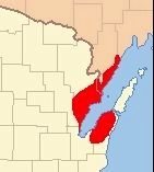
Loss of life and even property in the great fire occurring the same night in Chicago . . . — — Map (db m120657) HM
Ole Knutson Nattestad, first Norwegian settler in Wisconsin, came to Clinton Township, July 1, 1838.
In his native Numedal, Nattestad had been a farmer, peddler, and blacksmith. In 1836 he and his brother Ansten visited Stavanger and there . . . — — Map (db m22794) HM
In the 1830’s, tin miners from Cornwall, England started coming to S. W. Wisconsin to work the newly discovered lead ore deposits. In certain localities they built their stone cottages similar to the ones of their homeland.
Shake Rag, the . . . — — Map (db m2968) HM
A crude structure of boughs of trees “layed acrosse, one upon an other” was erected near here by Pierre Radisson and Medart Groseilliers in 1659. The two French traders came to Chequamegon Bay from Montreal and Radisson's account of . . . — — Map (db m48410) HM
Beginning in 1844, nearly 700 settlers were brought into this area by the British Temperance & Emigration Society, organized the previous year in Liverpool, England. By 1850 Dover boasted a hotel, post office, cooper, blacksmith, shoemaker, wagon . . . — — Map (db m6780) HM
The first 5-mile-long section of the Great River Road project, or the Mississippi River Parkway as it was originally named, was built near here in 1953 and extended east across the Black River. Eventually, the Great River Road would follow the . . . — — Map (db m33948) HM
The Wade House, one of the earliest stage coach inns in Wisconsin, is the major unit in this historic restoration carried out by The Kohler Foundation of Kohler, Wisconsin. Built by Sylvanus Wade between 1847 and 1851 at the total cost of $300, this . . . — — Map (db m31782) HM
On the site of old Fort Crawford, Col. Hercules Louis Dousman, important agent in John J. Astor's fur company, built his "house on the mound" in 1843. Later it was named Villa Louis. Today this luxurious mansion appears much as it did in the days . . . — — Map (db m23589) HM
Indian people lived at Aztalan between AD 900 and 1200. The village encompassed 20 acres and was well-planned. The inhabitants planted corn, beans and squash, hunted wild game, fished and collected native plants for food. An elite group of . . . — — Map (db m37429) HM
Near this site on September 30, 1882, the world's first hydroelectric central station began operation. The station, here reproduced, was known as the Vulcan Street Plant and had a direct current generator capable of lighting 250 sixteen-candle . . . — — Map (db m147251) HM
Louis Powell Harvey lived here 1851-1859. He was a leader in business, education, journalism, and politics. Soon after his inauguration, Gov. Harvey led a relief expedition to Wisconsin troops who had just fought their first major battle and . . . — — Map (db m231663) HM
This wayside is part of the old McCann farm, childhood home of Old Abe, the War Eagle. In the Spring of 1861 a band of hungry Chippewa came to the McCann farm and traded a young eagle for corn. The eagle became a family pet. When Company C, Eighth . . . — — Map (db m13984) HM
The Sioux uprising in Minnesota during the Summer of 1862, culminating in the New Ulm Massacre, caused great alarm in Superior. A Committee of Safety was chosen, a Home Guard organized, and a stockade built on the bay shore here. An inventory of all . . . — — Map (db m33950) HM
You are standing on what was once the bottom of a glacial lake in which Castle Rock, the formation rising before you, was an island. Thousands of years of erosion by water, ice and wind created the surface features you see in this area.
The . . . — — Map (db m4230) HM
This park, named for its most outstanding mound, contains thirty-one fine examples of effigy mounds. Effigy mounds are low earthworks usually built in the shapes of birds or animals. Though used for burial purposes, a mound seldom contains more than . . . — — Map (db m114906) HM
Ebenezer Brigham (1789-1861), first permanent white settler of Dane County, came here as a prospector in 1828. The inn he built for his miners became popular with travelers on the old Military Road, and Blue Mounds became a well-known landmark. . . . — — Map (db m224706) HM
As a boy Ole Evinrude (1877-1934) lived near Cambridge. His father hoped to keep him on the farm and when Ole built a sailboat like he had seen in a picture book his father destroyed it. In a secret place in the woods the boy built another. Here on . . . — — Map (db m35297) HM
Thirteen counties were represented here at the first state fair sponsored by the Wisconsin State Agricultural Society. Entries included horses, cattle, sheep, swine, farming implements, dairy products, flour and corn meal, domestic manufactures, . . . — — Map (db m37236) HM
About two miles east of here, the Wisconsin River has its source in Lac Vieux Desert. Several spellings and meanings were given to the name of the stream in early days. The Algonquian "Wees-konsan" means "the gathering of the waters." The Winnebago . . . — — Map (db m35791) HM
Nicholas Perrot was a daring adventurer, fur-trader and able diplomat. The handsome Frenchman built Fort St. Antoine on the shore of Lake Pepin near here in 1686. Alarmed by the aggressions of the English, the French government felt it was necessary . . . — — Map (db m10056) HM
Farmers in this area learned early that the land on both sides of the Kickapoo River offered excellent conditions for apple-growing. In 1905 John Hays and Ben Twining collected apples from eight or ten farmers around Gays Mills for exhibit at the . . . — — Map (db m31676) HM
Grant, Iowa and Lafayette counties were once the center of a lead-mining boom. Indians had sold lead to early traders, but there were few white miners here in 1820. Mining brought in a large part of the 37,000 population credited to the three . . . — — Map (db m55044) HM
This church was organized June 10, 1886. The first service was held here October 31 of the same year. Seven years earlier Mary Baker Eddy, the Discoverer and Founder of Christian Science, had founded the Church of Christ, Scientist, in Boston, . . . — — Map (db m13164) HM
Here on the Wisconsin River the village of Newport was begun in 1853, planned for a population of 10,000. Assuming that the Milwaukee & LaCrosse Railroad would cross the river here, over 2000 settlers quickly came to Newport, causing a lively land . . . — — Map (db m7984) HM
James Knaggs, who lived across the river from this point, operated a ferry here for nineteen years. In 1831 John and Juliette Kinzie, traveling on horseback from Green Bay to their Indian Agency assignment at Portage, were ferried across. In the . . . — — Map (db m3243) HM
Once upon a time, according to an old Indian legend, the sand beach on the east side of this bay was a favorite camping ground. One spring a few lodges of Chippewa from La Pointe encamped here. When their chief, Bi-aus-wah, returned from the hunt, . . . — — Map (db m194929) HM
John Muir (1838-1914), world famous naturalist and "father of the national park system," often stopped to rest and admire this view as he walked from his home in Marquette County to the University of Wisconsin. Muir loved the wilderness from which . . . — — Map (db m20148) HM
Wisconsin Central Railroad was formally organized in the National Hotel on this site by Judge George Reed and his associates, Feb. 4, 1871. Here the contracts were let for its construction and the first general office was located. The road secured . . . — — Map (db m22444) HM
This point is near the center of the 90,000 acre Coon Creek Watershed, the nation's first large-scale demonstration of soil and water conservation. The area was selected for this purpose by the U.S. Soil Conservation Service (then . . . — — Map (db m33321) HM
The Village of Langlade and Langlade County were named for Charles Michel de Langlade, who has been called the "Father of Wisconsin." Born at the trading post of Mackinac in 1729, de Langlade's character, military ability, and influence left a . . . — — Map (db m36825) HM
After holding off his pursuers at the Battle of Wisconsin Heights (about 1½ miles south of present Sauk City) Black Hawk led his people over unfamiliar country toward the Mississippi. In the meantime, the Army alerted Fort Crawford at Prairie . . . — — Map (db m23630) HM
First Forest Patrol Flight was made from Trout Lake by Jack Vilas June 29, 1915. Vilas was commissioned "Official Aviator" by the Wisconsin State Board of Forestry (now Wisconsin Conservation Department) and on his own request . . . — — Map (db m35999) HM
This beautiful lake is twenty-two miles long, varies in width from one to two and a half miles, and covers about thirty-eight square miles. It was caused by the delta of the Chippewa spreading across the gorge of the Mississippi at the southeastern . . . — — Map (db m10026) HM
Started in 1848 and completed in 1853, extended 58 miles west from Milwaukee on a course roughly paralleling State Street past the Frederick Miller Plank Road Brewery through Wauwatosa, Pewaukee, and Oconomowoc to Watertown. The $110,000 road of . . . — — Map (db m31123) HM
Dedicated to the conservation, advancement and dissemination of the American heritage, the Society was founded in 1846, chartered in 1853. Legislative support, the first bestowed in any state, began in 1854; the Society became a state agency in . . . — — Map (db m31582) HM
You are traveling the route of the Old Military Road, built in 1835-36, to connect Fort Crawford at Prairie du Chien and Fort Howard at Green Bay, via Fort Winnebago at "The Portage" between the Fox-Wisconsin rivers. The section from Prairie du . . . — — Map (db m36908) HM
The area around Lac Court Oreilles has long been a favorite habitat of Indians because of the abundant game, fish, berries and wild rice. Radisson and Groseilliers were the first white men to visit this area (1659) and they found Ottawa Indians. . . . — — Map (db m47318) HM
In 1730 the French Government decided to destroy the Fox village on the shore of this lake because of the depredations of the Foxes on the fur traders. Capt. Morand came up the river with a large force of French soldiers and Menominee warriors. The . . . — — Map (db m237968) HM
This tract of land was once a part of the estate on which General William (Billy) Mitchell (1879-1936) lived as a boy. His fearless and inquisitive personality as a youth carried over into his military career when he spoke out against overwhelming . . . — — Map (db m31135) HM
“The Greatest Show on Earth” was born and grew to maturity in Baraboo, just north of here. When the five Ringling brothers gave the first performance of their "Great Double Shows, Circus and Caravan," May 19, 1884, the main tent was 45 by 90 feet. . . . — — Map (db m185211) HM
At 318 State Street, approximately 300 feet northeast of here, C. Latham Sholes perfected the first practical typewriter in September, 1869. Here he worked during the summer with Carlos Glidden, Samuel W. Soule, & Matthias Schwalbach in the machine . . . — — Map (db m31124) HM
The names of many places and families in this vicinity reflect the origin of its early settlers. Most of the settlers of Cedar Grove and Oostburg were from the province of Zeeland, although some have lived for a time in New York before catching the . . . — — Map (db m41735) HM
In 1875 the Wisconsin Legislature offered a prize of $10,000 to the citizen of this state who could produce a machine "which shall be a cheap and practical substitute for the use of horses and other animals on the highway and farm." Such machine was . . . — — Map (db m55383) HM
In the old days when both automobiles and roads were few in number, it was easy for those who had cars to get far enough away from home to get lost. While there were some “trails” such as the Cannon Ball Trail and the Yellowstone Trail . . . — — Map (db m88574) HM
Shawano is both a Chippewa and a Menominee Indian term signifying "to the South." Shawano Lake first was given this name because it was the southern boundary of Chippewa tribal territory. The city and county later were named after the lake. Like . . . — — Map (db m8201) HM
In 1836 the Menominee Indians ceded all their lands between the Wolf and Fox Rivers to the United States Government. Payment was made every October, in twenty annual installments, on these grounds. All their remaining lands were ceded in 1848 and . . . — — Map (db m34708) HM
To the east is Madeline Island, known to the Ojibway as Moning-wunakauning, “The Home of the Golden Breasted Woodpecker.” The French soldier Pierre le Sueur built his post there in 1693. In 1718 a fort was erected which remained France’s principal . . . — — Map (db m208926) HM
Still visible here is the southeast terminus of the 2½ mile portage that linked the St. Croix and Chippewa River systems. Indians, explorers, missionaries and fur-traders all used this "carrying place" to move their birch bark canoes back and forth . . . — — Map (db m47351) HM
In the fall of 1836 Elisha Edgerton and his wife Belinda came here in their wagon drawn by oxen. They cleared the land and built their farm home, with buildings recognized as a Wisconsin Premium Farm by the State Agricultural Society. Episcopal . . . — — Map (db m36719) HM
At this site approximately 4,500 years ago, Wisconsin Indians gathered to bury their dead. Because of their use of copper tools, weapons and ornaments, this group became known as the Old Copper people. They fashioned spearpoints, knives and . . . — — Map (db m58143) HM
You are now on the great divide which separates the two principal drainage areas of Wisconsin. Water falling to the north of this point finds its way into Lake Superior, then down through the Great Lakes and the St. Lawrence River 2,000 miles into . . . — — Map (db m47222) HM
Sugarbush Hill which you see across the valley is one of the highest points in the northern highland geological province. This province, which includes some 15,000 square miles in northern Wisconsin, is underlain by the crystalline rock on an . . . — — Map (db m33686) HM
On August 16, 1886 the Appleton Electric Street Railway Company began operation of the world’s first commercially successful electric street railway. The cars were driven by Van Depoele direct current motors which received power from a . . . — — Map (db m10457) HM
In this station pulverized coal was first successfully burned continuously and at high efficiencies in furnaces of stationary steam boilers November 11-15, 1919. This radical departure from conventional firing methods of the period was vigorously . . . — — Map (db m80527) HM
Lac du Flambeau (Lake of Torches) has been a permanent settlement of the Chippewa Indian Nation since about 1745, when Chief Sharpened Stone led his band to this lake. Nearby lakes furnished a fine setting for Indian life, with wild rice in . . . — — Map (db m36009) HM
This 8 sided five story house of solid brick construction was built in the early 1850s by pioneer John Richards. It is the best example in Wisconsin of an unusual architectural design which was in vogue briefly before the Civil War. It was claimed . . . — — Map (db m35454) HM
This barn was built by an early settler in 1853 was used by regional farmers driving cattle to the Milwaukee market over the Milwaukee-Watertown Plank Road. It was moved from the Plank road area east of the Rock River to this site in 1963 and . . . — — Map (db m223762) HM
In the autumn of 1828 a permanent fort was built on this site by the First Regiment of the United States Infantry under the command of Maj. David E. Twiggs, later a general in the Confederate Army. The fort was constructed primarily to control the . . . — — Map (db m2364) HM
Many of the explorers who followed Columbus were more interested in finding an easy route to Asia than they were in exploring and settling this continent. In 1634 Jean Nicolet, emissary of Gov. Samuel de Champlain of New France, landed at Red Banks . . . — — Map (db m22457) HM
On June 14, 1673 Jacques Marquette and Louis Jolliet started the portage (1.28 miles) from here to the Wisconsin River, which led to their discovery of the Upper Mississippi June 17, 1673 at Prairie du Chien. The expedition, in two birch bark . . . — — Map (db m2341) HM
It was here that Major Richard I. Bong was born, received his education, and grew to manhood. After attending Superior State College where he received his first pilot training, he joined the U.S. Army Air Corps on May 29, 1941. Assigned to the New . . . — — Map (db m72259) HM
On July 27, 1894 forest fires racing through dry timber slashings descended on Phillips from three directions. Within a matter of hours the city of 2500 persons lay in smoldering ruins. More than 400 homes, the business district, a new tannery and . . . — — Map (db m47236) HM
Corporal Mitchell Red Cloud was posthumously awarded the Congressional Medal of Honor for his courageous action in battle between U.S. troops and Chinese Communists near Chonghyon, Korea, Nov. 5, 1950. Red Cloud’s Company was entrenched beside Hill . . . — — Map (db m1865) HM
On these banks of the Upper Fox River June 7, 1673, explorers Marquette and Jolliet visited the Mascoutin Indian Tribe that lived here. For many years traders and missionaries camped here while visiting the Indians. In 1846 Nathan Strong, a . . . — — Map (db m20165) HM
This park, on the site of a Winnebago village, commemorates an heroic descendant of those people, Corporal Mitchell Red Cloud, Jr. Fighting in Korea in 1950 as a member of the 24th Army Division, Corporal Red Cloud bravely held off an enemy attack . . . — — Map (db m8534) HM
When Nicolet in 1634 stepped ashore not far from the present site of Green Bay, the Menominees were living in peace with their neighbors on both sides of the Menominee River, on the present sites of Menominee, Michigan, and Marinette, Wisconsin. . . . — — Map (db m13622) HM
The 32nd Division was organized in 1917. Originally it was made up of National Guardsmen from Wisconsin and Michigan.
World War I: Fought in Alsace, Aisne-Marne, Olse-Aisne and Meuse-Argonne Offensives. Vanquished 23 German Divisions. Served in . . . — — Map (db m36339) HM
In 1873 the Rev. Dr. J.W. Carhart of Racine designed and operated the first light self-propelled highway vehicle in the United States, and probably the first in the world. He named it the Spark. It was driven by a two cylinder steam engine, steered . . . — — Map (db m34220) HM
Chief Waupaca, better known as Sam Wapuka, was a friendly Potawatomi Indian who lived in this vicinity about the time the first white men arrived. Although he was friendly to the settlers, his tribesmen were bitterly opposed to the invasion of the . . . — — Map (db m20634) HM
The first kindergarten in the United States was founded by Margarethe Meyer Schurz in this building in 1856. Moved to the present site and restored in 1956 by the Watertown Historical Society. — — Map (db m35450) HM
When Governor Henry Dodge addressed the joint session of the legislature here on October 25, 1836, the Territory of Wisconsin included all of present day Wisconsin, Iowa, Minnesota, and parts of the two Dakotas. The population was about equally . . . — — Map (db m33129) HM
Lock and Dam No. 8 at Genoa, 679.2 miles above the mouth of the Ohio River, is set on a foundation of sand, gravel and broken rock. It has a 110 foot wide chamber and an 11 foot lift from the lower to the upper pool. Construction of the dam cost . . . — — Map (db m23406) HM
The Treaty of the Cedars was concluded on the Fox River near here September 3, 1836. Under the treaty the Menominee Indian nation ceded to the United States about 4,000,000 acres of land for $700,000 (about 17 cents per acre). The area now contains . . . — — Map (db m2490) HM
On December 2, 1669, the Eve of St. Francis, Father Claude Allouez arrived at Oconto, then a village of about 600 Indians. Here Allouez founded the Mission of St. Francois Xavier, the first mission in north eastern Wisconsin. Six French fur traders . . . — — Map (db m13440) HM
Admiral Marc A. Mitscher, U. S. Navy, pioneer in naval aviation and Commander of Naval Air Task Force 58, famed for its destruction of Japanese sea power in World War II, was born in Hillsboro, January 26, 1887. A 1910 graduate of the U. S. Naval . . . — — Map (db m18729) HM
"And they stood every man in his place round about the camp." Judges 7:21
One night in September 1898 two salesmen, John H. Nicholson and Samuel E. Hill, shared room 19 in the Central Hotel, Boscobel. They wondered if some organization could . . . — — Map (db m43533) HM
The rock-crested hill to the east was named after One-Eyed Decorah, a Winnebago chief who, according to tradition, took refuge in a cave near the peak after being wounded in a Chippewa attack on his village. He remained in hiding throughout the . . . — — Map (db m23186) HM
The 32nd Division was organized in 1917. Originally it was made up of National Guardsmen from Wisconsin and Michigan.
World War I: Fought in Alsace, Aisne-Marne, Oise-Aisne, and Meuse-Argonne Offensives. Vanquished 23 German Divisions. Served . . . — — Map (db m35888) HM
Jeremiah McLain Rusk, who owned and lived on this farm, was born June 17, 1830 in Deerfield, Ohio. In 1853 he moved to Viroqua. He served with distinction in the Civil War and in the United States Congress. As Governor (1882-1889) Rusk gained . . . — — Map (db m31729) HM
On this campus pioneer research and experimentation in "wireless" led to successful transmissions of voice and music in 1917, and the beginning of broadcasting on a scheduled basis in 1919.
Experimental station 9XM transmitted telegraphic . . . — — Map (db m33629) HM
In early October 1839, approximately 20 families settled near this site to found the colony of Freistadt. Prompted by religious persecution in the homeland, the group sought and found religious haven in Wisconsin. The first log cabin was located . . . — — Map (db m31267) HM
For countless ages the wild cranberry flourished in many marshy areas of Central Wisconsin. In 1829 Daniel Whitney mentioned the purchase of three canoe loads of cranberries brought down the Yellow River by Indians from the area now known as . . . — — Map (db m1215) HM
“Keep hopping, hoeing and hoping” said an editorial in 1867 when hops were selling for 50¢ a pound, pickers by the thousands worked in the fields, merchants were selling silks, laces, paisley shawls and grand pianos, and farmers were . . . — — Map (db m52853) HM
When this site was selected for a settlement in 1855, one of its founders read in an old history of the state that the Menominee Chief Tomah had at one time gathered his tribe in this vicinity for a conference.
He suggested the name "Tomah" for . . . — — Map (db m3960) HM
The rugged range of hills which can be seen to the north of here is among the oldest visible physical features on the earth. The hard quartzite rock that forms them was deposited as sand in a shallow sea which once covered this region. Although . . . — — Map (db m19488) HM
During the middle 1870's, when the great logging era of Northern Wisconsin was in its infancy, the Mississippi River Logging Company attempted to float pine logs down the Soft Maple and Potato Creeks to the Chippewa River but the streams were too . . . — — Map (db m45141) HM
The Second Fort Crawford Military Hospital was built here in 1831. In 1934 this portion of it was restored with original stone as a memorial to William Beaumont, M.D. (1785-1853), pioneer military surgeon.
Among prominent military personnel . . . — — Map (db m43641) HM
Horicon Marsh, an area of 31,653 acres, was scoured out by the Wisconsin glacier, at least 10,000 years ago. Gradually the upper Rock River made deposits which slowed its current and spread its waters over the marshland. The Marsh became a haunt of . . . — — Map (db m23090) HM
Twice in his lifetime Abraham Lincoln is known to have traveled within sight of the Rock River east of this marker.
Lincoln passed this way July 2, 1832, as a private in a mounted company of Illinois militia accompanying forces under General . . . — — Map (db m22738) HM
Here rises the Wisconsin River. Many feet have trod this spot in many kinds of shoes from moccasins of French traders and Indians, boots of loggers, early settlers and the Army to sport shoes of today's tourists. This procession began . . . — — Map (db m223275) HM
Albion Academy and Normal Institute, chartered in 1853 and opened in 1854, on land donated by Jesse Saunders, was founded and operated by Northwestern Seventh Day Baptist Association until 1894; by Peter Hendrickson, former Beloit College professor, . . . — — Map (db m40436) HM
These brothers-in-law during the winter of 1659-60 camped with the Ottawa Indians two miles upstream from this point on Lac Court Oreilles (meaning "Lake of the Short Ears" in French). Early French explorers called the Ottawa Indians "Court . . . — — Map (db m47333) HM
In 1858 Joseph Zettel, a native of Switzerland, acquired the farm directly south of this Station and established the first commercial orchard on the Door Peninsula. The high yields and quality of his fruit aroused the interest of Emmett S. Goff of . . . — — Map (db m5190) HM
Discovered in 1850 by Increase A. Lapham, this is the only known intaglio Effigy mound in the world. It was excavated for ceremonial purposes by American Indians of the Effigy Mound Culture about 1000 A.D. A part of the tail has been covered. Of ten . . . — — Map (db m82646) HM
Gifted author of this region, Hamlin Garland was born at West Salem September 14, 1860, and died March 4, 1940. His ashes rest in the Garland family plot in Neshonoc cemetery, heart of the Coulee Country immortalized in his books, “Trailmakers . . . — — Map (db m8918) HM
In this machine shop, in 1908, Otto Zachow and William Besserdich developed and built the first successful four-wheel drive automobile. Their first car, the “Battleship”, soon proved that it "could go anywhere a team of horses could . . . — — Map (db m8108) HM
When Nelson Dewey left his parents' home at Hamilton, New York, at the age of 23, he traveled by stage coach, steamer, sailing vessel, horse-back, and on foot to reach Wisconsin. The trip took five weeks, and Dewey arrived in Cassville in June of . . . — — Map (db m21489) HM
The Indians believed that many years ago the Great Spirit, in the form of a snake, created the Dells when it forced its huge body through a narrow opening in the rocks. Geological studies, however, show that the Dells were formed some fifteen . . . — — Map (db m1882) HM
This site is part of a 4800-acre tract patented to Eleazer Williams by the United States. In 1882 Williams led a delegation of New York Indians to the Fox River Valley, hoping to set up an Indian Empire in the West. A year later he married the . . . — — Map (db m57219) HM
600 entries matched your criteria. The first 100 are listed above. Next 100 ⊳