106 entries match your criteria. Entries 101 through 106 are listed.⊲ Previous 100
Missouri, The State Historical Society of Historical Markers
Markers of the State Historical Society of Missouri installed in every county by the State Historical Society and State Highway Commission from 1951 to 1961. Also includes markers installed in 1958 along the route of the Butterfield Overland Mail in Missouri.
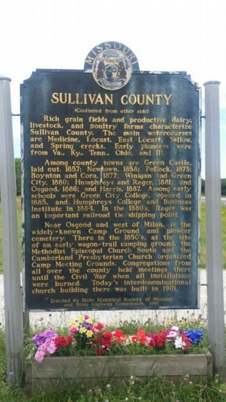
Side 1 First called Highland, Sullivan County was formed, 1843. Fully organized in 1845, it was named for Revolutionary War Gen. John Sullivan. Comprising 654 sq. miles of high glacial prairie land, the county lies in territory ceded 1824, . . . — — Map (db m95702) HM
Side A
Financial center and shipping point, this prairie town was founded in 1855 as the seat of Vernon County, fertile farming and coal producing area. Col. D. C. Hunter, who laid out the town, named it for Nevada City, Calif. The county, . . . — — Map (db m44016) HM
Daniel Boone, universal symbol of the American frontier, was 65 when he came to Upper Louisiana, now Missouri, 1799. His wife Rebecca was 60. The Spanish lieutenant governor granted Boone 845 acres nearby here on Femme Osage Creek.
Boone did . . . — — Map (db m42564) HM
Webster County, organized March 3, 1855, encompasses 590 sq. miles of the highest extensive upland area of Missouri’s Ozarks. The judicial seat, Marshfield, lies 1490 feet above sea level, highest county seat in Mo. Pioneer legislator John F. . . . — — Map (db m99606) HM
[side 1] The last of Missouri's 114 counties to be formed, Worth was organized in Feb., 1861, 6 months and 39 years after Missouri was admitted into the Union, Aug., 1821, with 25 counties. Encompassing 267 sq. miles of . . . — — Map (db m179674) HM
Wright County, in the Ozark Highland of Missouri, lies in a region ceded the U.S. by the Osage Indians in 1808. The first white settlers, mainly from Tennessee, came in the 1830’s. The county, named for Senator Silas Wright of N.Y., was organized in . . . — — Map (db m99290) HM
106 entries matched your criteria. Entries 101 through 106 are listed above. ⊲ Previous 100