129 entries match your criteria. The first 100 are listed. The final 29 ⊳
Arkansas Civil War Sesquicentennial Commission Historical Markers
Scores of markers placed by the Arkansas Civil War Sesquicentennial Commission to commemorate the state's rich Civil War history for the statewide observance of the 150th anniversary of the Civil War.
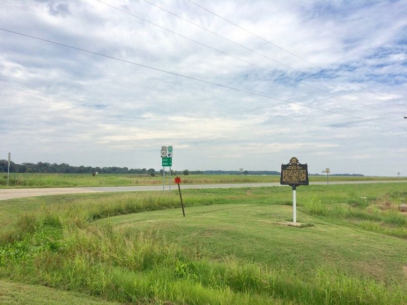
On U.S. 165 at State Route 169, on the right when traveling north on U.S. 165.
On January 9, 1863, Gen. John McClernand and Adm. David D. Porter led a 30,000 man army and a flotilla of Union gunboats up the Arkansas River to confront Gen. T.J. Churchill's 5,000 Confederates at Arkansas Post. The gunboats bombarded Fort Hindman . . . — — Map (db m107701) HM
On East Jefferson Street east of North Oak Street, on the left when traveling east.
Ashley County in the Civil War
Thirteen companies were raised and organized in Ashley County for Confederate service during the Civil War: Co. F, 2nd Arkansas Cavalry; Cos. A, B, K and L, 3rd Arkansas Infantry; Co. F, 8th Arkansas Infantry . . . — — Map (db m107691) HM
On South Main Street (Business U.S. 62) at East 7th Street, on the right when traveling north on South Main Street.
On Oct. 12, 1862, Maj. John Wilber led a force of 125 men of the 14th Missouri State Militia (U.S.) and 100 from the Enrolled Militia from Ozark, Mo., to hit Confederate troops camped at Yellville. High water on the White River forced the Union . . . — — Map (db m170457) HM
On Georgia Flat Road (County Road 503) at Kane Road (County Road 422), on the left when traveling west on Georgia Flat Road.
Camp Jackson Confederate Gen. Ben McCulloch established
Camp Jackson in July 1861 before marching into
Missouri. After the Aug. 11 Battle of Oak Hills
he returned to Camp Jackson. The 4th Arkansas
Infantry Regiment, which formed Aug. 17, . . . — — Map (db m224988) HM
On Jackson Place north of McClure Avenue (County Road 923), on the left when traveling north.
The Old Wire Road at Mudtown was used by the
Butterfield Overland Mail Co. and both Union and
Confederate soldiers during the Civil War. In
February 1862, Union troops ate food left behind
at a Confederate camp and were sickened. Some
died, . . . — — Map (db m224817) HM
On West New Hope Road at South Osage Springs Drive, on the right when traveling west on West New Hope Road.
Shortly after the Union Army of the Southwest entered Arkansas in February 1862, three divisions moved to Osage Springs in a bid to trap Confederate troops in their winter quarters. The trap failed, but the soldiers established Camp Halleck, . . . — — Map (db m224877) HM
On State Highway 12, 0.1 miles west of Van Winkle Place Road, on the left when traveling west.
Peter Van Winkle’s saw mill cut lumber for Confederate soldiers’ winter quarters at Cross Hollow and Oxford Bend in early 1862. Gen. Earl Van Dorn’s Confederates used the mill to grind corn after their March 1862 defeat at Pea Ridge, and wounded men . . . — — Map (db m90738) HM
On Rally Hill Road, 0.1 miles east of Meeks Creek Road South, on the right when traveling east.
On Jan. 21, 1864, Sgt. Isaac T. Jones led 24 men of the 11th Missouri Cavalry Volunteers into north Arkansas to bring dispatches to other Missouri troops operating against bushwhackers in the region. Jones and his men were near Rolling Prairie on . . . — — Map (db m141611) HM
On North Main Street south of West Rush Avenue, on the right when traveling south.
Boone County Men Served Both Armies
During the Civil War (1861-1865), most of Boone Co. was part of Carroll with a small part in Marion Co. Local men served in both armies. There was a lot of military activity. The "Joe Wright Guards", CSA, . . . — — Map (db m141558) HM
On West Main Street (U.S. 278) at Hunt Street, on the right when traveling north on West Main Street.
Though sparsely populated, Calhoun County raised five companies of soldiers for service in the Confederate army: Company B, Sixth Arkansas Infantry, Companies E and G, Second Arkansas Cavalry, and Companies A and K, Fourth Arkansas Infantry . . . — — Map (db m200670) HM
On South Main Street (U.S. 62) south of West Church Avenue, on the left when traveling north.
Both U.S. and C.S. troops rendezvoused in Berryville during the Civil War. By 1865, most of the town was in ruins. U.S. units were stationed here in 1863-64, including the 1st and 2nd Arkansas Cavalry, 6th and 8th Missouri State Militia, and Gaddy's . . . — — Map (db m168287) HM
On State Highway 187 at Mockingbird Lane, on the right when traveling south on State Highway 187. Reported missing.
The 1st Arkansas Cavalry (U.S.), comprised mainly of Unionist refugees, mustered into service in July 1862. The regiment fought at Prairie Grove in 1862 and Fayetteville in 1863, but its main duty was fighting the bushwhackers and irregular . . . — — Map (db m225158) HM
On Main Street (State Highway 23) south of Spring Street, on the right when traveling south.
The Eureka Springs area's reputation as a health resort has its origins in the Civil War. Late 19th-century accounts claim Dr. Alvah Jackson treated sick and wounded soldiers during the war. In early 1865, Maj. J. W. Cooper, who led Confederate . . . — — Map (db m59967) HM
On Tommy Ratzlaff Avenue south of East Main Street (U.S. 62), on the right when traveling south.
Elements of three companies of the First Arkansas Cavalry (U.S.) were dispatched to Yocum Creek at Duncan Springs on November 15, 1862, to evacuate Unionist families to safety at Elkhorn Tavern, including some related to soldiers in the First. While . . . — — Map (db m198709) HM
Near State Highway 142, 0.9 miles east of Robert Mazzanti Road (Parish Road 505).
When Arkansas went to war in 1861, Lycurgus and Lydia Johnson and their family stayed with their home at Lakeport. By 1862, U.S. gunboats were common on the Mississippi River, and on Sept. 6, 1862, Confederate troops burned 158 bales of cotton at . . . — — Map (db m89797) HM
On Valley Street (U.S. 67) 0.1 miles south of Malvern Road, on the left when traveling south.
Confederate Manufacturing
Arkadelphia was a manufacturing center for Confederate Arkansas early in the Civil War. Gen. Thomas Hindman established a powder works and an arsenal in 1862, producing guns, cannon, bullets, shells, wagons and . . . — — Map (db m96557) HM
On South Main Street (Arkansas Route 51) south of East 4th Street, on the left when traveling south.
Skirmishes at Okolona
Gen. Frederick Steele’s Union army left Little Rock on March 23, 1864, for a planned invasion of Texas, but it was April 2 before they faced organized Confederate attacks. Gen. Joseph Shelby attacked the Union wagon train . . . — — Map (db m200735) HM
On West Main Street at South 4th Street, on the left when traveling west on West Main Street.
The Civil War in Cleburne County
Cleburne County was infested with bands of bushwhackers who would prey on both military and civilian targets. Union troops operating in the area also seized food from civilians. Guerrillas ambushed 35 men . . . — — Map (db m141586) HM
On Old Camden Road, 0.8 miles south of Marks Cemetery Road, on the left.
Battle of Marks' Mills
On April 23, 1864, a Union force with 240 wagons left Camden to get supplies from Pine Bluff for Gen. Frederick Steele's army. Gen. James Fagan's Confederate cavalrymen ambushed them at Marks' Mills on April 25. . . . — — Map (db m121150) HM
Near South Washington Street at East Ross Street, on the right when traveling south.
John P. McCown was born Aug. 19, 1815, in Sevierville, Tenn. An 1840 graduate of West Point, he served in the Mexican and Seminole wars before resigning from the U.S. Army on May 17, 1861. McCown joined the Confederate army, rising to the rank of . . . — — Map (db m121139) HM
On East Burrow Road west of South Bridge Street (State Route 9), on the left when traveling west.
While a Confederate unit, the Conway Mounted Rifles, formed at Lewisburg in May 1861, the town was a Union base for much of the war. A garrison was established Sept. 28, 1863, and Col. Abraham H. Ryan recruited the 3rd Arkansas Cavalry (U.S.) there. . . . — — Map (db m170456) HM
On Sardis Road (County Road 61) at Puddin Drive, on the right when traveling west on Sardis Road.
Side 1
Conway County in the Civil War
Conway County men served in both the Union and Confederate armies in the Civil War. Co. I, 1st Arkansas Mounted Rifles, Co. B, Carroll’s Cavalry, Co. I, 36th Arkansas Infantry, . . . — — Map (db m96451) HM
Near Kellers Chapel Road, 0.1 miles west of Chapel Hill Drive, on the left when traveling west.
The last Confederate veteran living in Arkansas, William Murphy Loudermilk, is buried here in Keller’s Chapel Cemetery. Private Loudermilk, who was born Oct. 17, 1847, joined a North Carolina regiment in the Army of Tennessee at age 16 and fought at . . . — — Map (db m116195) HM
On Southwest Drive south of East Highland Drive, on the right when traveling north.
Several companies were raised in Craighead County for the Confederate army. Co. I of the 13th Arkansas Infantry – the “Confederate Grays” – formed in 1861. A company of the 23rd Arkansas Infantry and Co. I of the 30th . . . — — Map (db m116186) HM
Near North 3rd Street, 0.1 miles south of Knox Street, on the left when traveling south.
After the Dec. 7, 1862, Battle of Prairie Grove, the Union Frontier Division set out to strike Confederate forces on the Arkansas River. On Dec. 27, 8,000 Union troops headed south through the Boston Mountains. They hit Van Buren on Dec. 28 and . . . — — Map (db m119954) HM
Near Arkansas Route 77 north of East Military Road, on the right when traveling south.
On April 27, 1865, the steamboat Sultana exploded on the Mississippi River. She was heading north, dangerously overloaded with some 2,200 passengers, most of them freed Union prisoners of war from the Andersonville and Cahaba camps. A . . . — — Map (db m116352) HM
On State Highway 163, 2.2 miles south of Highway 64, on the left when traveling south.
After Arkansas seceded from the Union in May 1861, Confederate officers began to recruit in the Wittsburg area. Companies B, D, F and K of the 5th Arkansas Infantry Regiment were organized at Wittsburg June 12-14, 1861. David Cross, for whom Cross . . . — — Map (db m116179) HM
On North Main Street north of East 2nd Street, on the right when traveling north.
Road to Marks' Mills
Gen. Frederick Steele’s Union army set out from Little Rock on March 23, 1864, to join a second army in Louisiana and invade Texas. He made it as far as modern-day Prescott before turning toward Camden in hopes of . . . — — Map (db m121222) HM
On County Road 409, 1.6 miles south of Cunningham Street, on the left when traveling south.
Front
Gen. Frederick Steele’s Union army left Camden on April 26, 1864, starting a retreat to Little Rock. Confederate pursuers caught up with them on April 29 on the Jenkins’ Ferry Road and began skirmishing. Union gunners of the 2nd . . . — — Map (db m121168) HM
On Arkansas Route 9, 0.2 miles north of County Road 409.
Arkansas Military Institute
The state legislature chartered the Arkansas Military Institute in 1850, and the school was built on Chapel Ridge in Tulip. Cadets had to be over 14 and at least 4 feet 9 inches tall. Classes included Latin, . . . — — Map (db m121218) HM
On Kelso Road, 0.3 miles east of State Route 1, on the right when traveling east.
In mid-February 1863, Confederate troops at Cypress Bend fired on Union transports on the Mississippi River. On Feb. 19, a force of Union cavalry and mule-mounted infantry set out in pursuit. The Union troops drove off enemy pickets before . . . — — Map (db m107693) HM
On South Main Street (State Highway 83) south of East Shelton Street, on the right when traveling south.
(side 1)
Sixteen Confederate companies were raised in Drew County during the Civil War. Two, the "Confederate Stars" and "Selma Rifles," joined the 3rd Arkansas Infantry and fought with the Army of Northern Virginia. Three, the "Cut-off . . . — — Map (db m85087) HM
Near State Highway 319 at Cadron Settlement Lane, on the right.
Confederate forces used Cadron as a base in the war’s early years, and Union troops were here after taking Little Rock in September 1863. The site was valuable for the saw and grist mills nearby, the telegraph line that ran to Little Rock, and the . . . — — Map (db m96452) HM
Faulkner County had divided loyalties during the Civil War. Soon after the war started, Col. A.R. Witt helped organize several companies for the 10th Arkansas Infantry (C.S.). After fighting at Shiloh, the 10th was captured at Port Hudson, La. . . . — — Map (db m119987) HM
On East River Street east of South 1st Street, on the right when traveling east.
On March 29, 1864, troops of the 30th Texas Cavalry and local partisans attacked the Union post at Roseville south of here, burning 133 bales of cotton and two cotton gins. They returned in force on May 4 and drove the defending troops of the 2nd . . . — — Map (db m119956) HM
On U.S. 63, 0.1 miles north of Main Street (State Route 9), on the right when traveling north.
Civil War in Fulton CountyFulton County men fought on both sides in the Civil War, and some were arrested in 1861 as members of the Unionist Peace Society. U.S. troops marched through in April 1862 during the Pea Ridge Campaign. Fulton County . . . — — Map (db m179988) HM
On Central Avenue (Arkansas Route 7) north of Spring Street, on the right when traveling north.
On July 5, 1864, a battalion of the 4th Arkansas Cavalry (U.S.) left Little Rock on a scouting mission toward Caddo Gap. They fought small bands of Confederate soldiers each day before arriving at Farr’s Mill, where Gulpha Creek hits the Ouachita . . . — — Map (db m170440) HM
Near Arkansas Route 229, 0.4 miles north of Lee Street, on the right when traveling north. Reported missing.
Confederate Headquarters
Confederate Gen. Edmund Kirby Smith led troops from Louisiana on a forced march to attack Gen. Frederick Steele’s Union army as it crossed the Saline River to retreat to Little Rock. He arrived here on April 29, . . . — — Map (db m121215) HM
Near Arkansas Route 46, 2 miles south of Arkansas Route 291, on the right when traveling south.
General Samuel Rice
Samuel A. Rice, then Iowa’s attorney general, organized the 33rd Iowa Infantry Regiment in the summer of 1862 and was named its colonel. Stationed in Helena, Rice played a prominent role in the July 4, 1863 battle there . . . — — Map (db m121203) HM
On Highway 46, 2 miles south of Highway 291, on the right when traveling south.
Jenkins Ferry
In 1846, Thomas Jenkins paid the Saline County clerk $1 to register to “keep a ferry” and charge travelers to cross the Saline near the mouth of Cox’s Creek when the river was at flood stage. Gen. Frederick . . . — — Map (db m121204) HM
On Arkansas Route 46 at County Road 6, on the right when traveling south on State Route 46.
Officers Killed
Gen. J.G. Walker’s Texas Division made the final Confederate attack in the April 30, 1864, battle of Jenkins’ Ferry. Its three brigades, led by Gen. William Read Scurry, Gen. Thomas N. Waul and Col. Horace Randal, charged . . . — — Map (db m121207) HM
On Arkansas Route 46 at Arkansas Route 291, on the right when traveling south on State Route 46.
Refugee Children
Many African Americans fleeing slavery were with Gen. Frederick Steele’s Union army as it retreated to Little Rock. As army wagons became stuck in the thick mud, so too did wagons with refugee children. Some were . . . — — Map (db m121183) HM
Near U.S. 270 west of Salburnit Road (State Route 291), on the right when traveling west.
Front
Both Union and Confederate cavalry moved north of Jenkins’ Ferry on April 29, 1864. Lt. Col. Benjamin Elliott’s 1st Missouri Cavalry Battalion had been sent to Princeton on the 28th to seek Gen. Frederick Steele’s army as it . . . — — Map (db m121182) HM
On County Road 628 south of White Road, on the right when traveling south.
The 5th Arkansas Infantry Regiment was organized on June 28, 1861, at Gainesville about 7 miles northwest of modern-day Paragould. Men from Greene County served in Companies C, D, E and H. The soldiers trained and camped near the springs at Camp . . . — — Map (db m170413) HM
On Pavilion Road east of Martin Luther King Boulevard (Business U.S. 270), on the left when traveling east.
Gen. Frederick Steele led a Union army from Little Rock on March 23, 1864, to join an invasion of Texas. Confederate skirmishers harassed the army as it reached Rockport March 27. An inflatable pontoon bridge, in 34 wagons and served by men of the . . . — — Map (db m121148) HM
On U.S. 278 at 1st Street, on the left when traveling north on U.S. 278.
At least four Confederate companies were recruited in what is now Howard County, including three serving in the 19th Arkansas Infantry, which trained near Center Point. The 19th Arkansas was part of the garrison at Arkansas Post when it was . . . — — Map (db m121146) HM
On South 9th Street north of Vine Street, on the left when traveling north.
Union soldiers occupied Batesville twice during the Civil War. Gen. Samuel Curtis's Army of the Southwest camped near this site in May 1862 while threatening Little Rock. Union troops were impressed with the town's culture and appearance, saying . . . — — Map (db m70557) HM
On Arkansas Route 56 south of Pirates Place, on the right when traveling south.
Military Activity at Calico Rock
While no battles were fought at Calico Rock, the area saw considerable military activity. The 4th Missouri Cavalry (C.S.) and 1st Illinois Cavalry skirmished at Calico Rock Landing on May 26, 1861. Following . . . — — Map (db m170196) HM
On Lacrosse Road at County Road 57, on the left when traveling north on Lacrosse Road.
Union troops passed through the Wild Haws area many times during the Civil War. Gen. Samuel Curtis was here with cavalry, artillery and Illinois infantry on May 1, 1862. Fifth Kansas Cavalry troops rode through on July 6, 1862, as did a company of . . . — — Map (db m170462) HM
On Avenue Street, 0.1 miles west of Adams Street, on the right when traveling west.
In spring 1862, Confederate Gen. Thomas Hindman sent the C.S.S. Maurepas under Capt. Joseph Fry up the White River to destroy Union supplies at Jacksonport and Grand Glaize. Fry arrived on June 2, 1862, and began shelling Jacksonport. Union . . . — — Map (db m116187) HM
On West 4th Avenue east of South Oak Street, on the right when traveling east.
Boone-Murphy House
Following the Union capture of Little Rock on Sept. 10, 1863, citizens of Pine Bluff asked that a Union garrison be stationed there for their protection. Gen. Frederick Steele sent the veteran 5th Kansas Cavalry and 1st . . . — — Map (db m170444) HM
On West Main Street (U.S. 64) at South Fulton Street, on the right when traveling east on West Main Street.
Clarksville in the Civil War
Clarksville was a key point in the defense of the Arkansas River Valley during the Civil War. Confederate troops occupied the town several times before Union forces took Little Rock and Ft. Smith, gaining . . . — — Map (db m96447) HM
Near McKamie Road (Arkansas Route 53) 0.3 miles south of Magnolia Street, on the right when traveling south. Reported missing.
Three African American men represented Lafayette County in the state legislature after the Civil War. Monroe Hawkins, born a slave in North Carolina around 1832, was a minister and laborer. He was a delegate in the 1868 Constitutional Convention and . . . — — Map (db m121211) HM
On Smithville Cemetery Road south of State Route 115, on the right when traveling south.
Skirmish near Smithville
After the March 1862 Battle of Pea Ridge, Union troops moved into northern Arkansas. The 5th Illinois Cavalry under Maj. A.H. Seley occupied Smithville. On June 17, a local woman warned a patrol of the 5th that . . . — — Map (db m170473) HM
On Arkansas Route 115 at Elm Street, on the right when traveling west on State Route 115.
The Civil War in Lawrence County
Smithville was the Lawrence County seat in 1861, and while most residents supported secession, others stayed loyal to the Union. At least 17 Confederate companies were raised in the county. Other troops . . . — — Map (db m170478) HM
On Front Street at South Main Street, on the right when traveling east on Front Street.
Moro in the Civil War
The town of Moro was established in 1850 and about 700 people lived here and nearby when the Civil War began in 1861. Union troops from the 1st Indiana, 1st Missouri, 9th Illinois, 5th Kansas, 2nd Wisconsin, and 3rd . . . — — Map (db m116247) HM
Near Madison Road, 0.2 miles south of State Route 54.
In 1861, John G. Gibson recruited a company at Tyro, Ark., that would become Co. H, 3rd Arkansas Infantry, nicknamed the Orphan Company, in the Army of Northern Virginia. Thirty-three Arkansas men joined in 1861, 22 in ’62, and one in ’63. . . . — — Map (db m107698) HM
Near Old Richmond Road (County Road 17) 1.6 miles south of County Road 714, on the right when traveling south.
Confederate Camp at Richmond
On Aug. 28, 1864, Confederate Gen. Sterling Price led an army from Camden on a raid that took them through Missouri, Kansas and the Indian Territory before they returned to Arkansas at Laynesport in Little . . . — — Map (db m121143) HM
On East Walnut Street (State Highway 22/109) near Airport Industrial Road.
In late September 1863, Confederate Col. J.O. Shelby's cavalry headed north to raid into Missouri. On Sept. 27, 1863, Shelby's scouts found Co. H, 1st Arkansas Infantry (U.S.) camped at Haguewood Prairie near present-day Paris. The Union troops . . . — — Map (db m129518) HM
On Arkansas Route 38 at Ray Sowell Road, on the right when traveling east on State Route 38.
As the Civil War began, the Caroline Home Guard formed at Austin on June 29, 1861. The “Austin Rifles” became Co. I, 5th Arkansas Infantry, C.S.A. Both Union and Confederate troops camped at Austin during the war and Federal troops tore . . . — — Map (db m116330) HM
On South Court Street at West Durkee Street, on the right when traveling south on South Court Street.
On Aug. 24, 1864, Confederate Gen. J.O. Shelby and his men, wearing captured Union uniforms, attacked a series of forts protecting hay-cutting operations between modern-day Carlisle and Hazen. Confederate artillery blasted the forts held by the 54th . . . — — Map (db m96453) HM
On SE Front Street (U.S. 70) 1 mile east of Honeysuckle Lane, on the left when traveling east.
Hicks' Station, located on the Memphis & Little Rock Railroad between DeValls Bluff and Huntersville (N Little Rock), guarded the eastern approaches to the capital city. During the Little Rock Campaign, Confederate cavalry used it as a staging area . . . — — Map (db m72142) HM WM
On West War Eagle Avenue at West Main Street (Business U.S. 412), on the right when traveling west on West War Eagle Avenue.
Front
On January 10, 1863, nine men, including two Confederate officers and prominent local citizens and Masonic lodge members, were taken from a guardhouse near here, led to Samuel Vaughn's farm one mile northeast of Huntsville, and shot. . . . — — Map (db m141514) HM
On West War Eagle Avenue at West Main Street (U.S. 412), on the right when traveling west on West War Eagle Avenue.
Front
Isaac Murphy was born Oct. 16, 1799, in Pennsylvania. A teacher and lawyer, he moved to Fayetteville in 1834 and became involved in politics. Murphy took part in the 1849 Gold Rush, but lost his farm to creditors. He, his wife and . . . — — Map (db m141518) HM
Near Potter Lane at State Route 14, on the left when traveling east.
Yellville In The Civil War
While there were no major battles fought in Marion County, the area saw many scouts, expeditions and skirmishes during the Civil War, and civilians endured both soldiers and guerrillas. In November 1862. Union . . . — — Map (db m160309) HM
Near McClure Road at Cobb Lane, on the left when traveling east.
When Gen. Frederick Steele's Union army invaded southwest Arkansas in April 1864, threatening the Confederate state capital at Washington, Gov. Harris Flanagin moved the state archives to Rondo, where they were deposited in James Abraham's store. . . . — — Map (db m96022) HM
An expedition of about 100 soldiers of the Second Missouri Artillery (U.S.) set out from Osceola on April 5, 1864, in pursuit of guerrillas who had just robbed the town. Marching through dense swamps with water from 1 to 3 feet deep, the Missouri . . . — — Map (db m170408) HM
On Arkansas Route 198 east of County Road 661, on the left when traveling east.
In late July 1864, Missouri Union cavalry headed south into Mississippi County to hunt for bands of guerillas. On August 2, they encountered Confederate pickets near Osceola and pursued them to the main force led by Captains Charles Bowen and H.M. . . . — — Map (db m170412) HM
On Madison Street at North 2nd Street, on the right when traveling west on Madison Street.
Clarendon was a major White River port and crossroads when the Civil War began. Six Confederate companies were raised here and in Monroe County in 1861-2. A Union fleet tried to supply the Army of the Southwest here in June 1862, but turned back . . . — — Map (db m152977) HM
On George Street west of East Street, on the right when traveling west.
Montgomery County men served in several Confederate units during the Civil War. The “Montgomery Hunters” (Co. F) and “Caddo Rifles” (Co. C) joined the 4th Arkansas Infantry in 1861. Co. I, 33rd Arkansas Infantry was raised at Caddo Gap in 1862, and . . . — — Map (db m200630) HM
On Nevada 23 Road (Arkansas Route 23) north of County Road 423, on the left when traveling north.
Action at Moscow
After skirmishing for several days at Prairie D’Ane, Gen. Frederick Steele turned his starving Union army away from Louisiana and headed toward Camden to seek supplies. Confederate cavalry under T.P. Dockery and S.B. Maxey . . . — — Map (db m200730) HM
On Blevins Road (U.S. 371) west of Interstate 30, on the right when traveling west.
Gen. Sterling Price’s Confederate army held strong earthworks on the western edge of Prairie D’Ane when Gen. Frederick Steele’s Union troops approached on April 10, 1864, and dug their own trenches. After heavy fighting on the 10th, the combatants . . . — — Map (db m96559) HM
On Court Street (State Highway 7) at Stone Street (State Highway 7), on the right when traveling east on Court Street.
Civil War in Newton County Several military actions took place in Newton
County during the Civil War. On Jan. 10, 1863, Union
troops attacked and destroyed a large saltpeter
works on the Buffalo River. Skirmishes were fought
June 14 and Nov. . . . — — Map (db m225345) HM
On Arkansas Route 24, 0.8 miles south of Ouachita Road 62, on the right when traveling south.
The 1st Kansas Colored Infantry, a regiment that included many former Arkansas slaves, was formed in August 1862, the first black unit recruited during the war. 1st Kansas troops were the first black men to see combat, losing 10 killed and 12 . . . — — Map (db m56624) HM
On West Main Street at North Plum Street, on the left when traveling east on West Main Street.
Perry County men served on both sides in the Civil War. Many enlisted in Company B, 1st Arkansas Mounted Volunteers, the Perry County Rangers, in 1861. Later designated the 3rd Arkansas Cavalry, the troops fought for the Confederacy east of the . . . — — Map (db m156837) HM
On Arkansas Route 85, 1.2 miles south of Old Little Rock Road, on the right when traveling north.
After the Jan. 11, 1863, battle at Arkansas Post, Gen. Willis Gorman led troops from Helena on a raid up the White River. Col. Powell Clayton and 1,200 cavalrymen went to Big Creek west of Helena when a patrol of 25 men of the 2nd Wisconsin Cavalry . . . — — Map (db m107709) HM
On Walnut Street at Porter Street, on the right when traveling north on Walnut Street.
Front
Seven Phillips Co. men served as generals in the Confederate army. Patrick Cleburne, perhaps the most acclaimed Arkansas general, led an Army of Tennessee division and proposed freeing slaves if they would fight for the . . . — — Map (db m107716) HM
On York Street east of Beech Street, on the right when traveling east.
On April 6, 1863, Adjutant General Lorenzo Thomas made a speech at Ft. Curtis seeking to enlist former slaves into the U.S. army. The next day, hundreds of black men joined the 1st Arkansas Infantry (African Descent). Later designated U.S. Colored . . . — — Map (db m107825) HM
On Courthouse Square at South Washington Avenue (State Route 301), on the left when traveling east on Courthouse Square.
Henry Merrell
Henry Merrell, known as the "Industrial Missionary to the South," was born in Utica, N.Y., in 1816. He moved to Arkansas in 1856 and built an industrial complex in Pike Co. He helped draft an anti-secession resolution in . . . — — Map (db m121147) HM
On Market Street at North Main Street, on the left when traveling west on Market Street.
As word of the collapse of the Confederate
armies east of the Mississippi River came to
Arkansas, Confederate Gen. M. Jeff Thompson
established headquarters of the Northern Sub-
District of Arkansas at Harrisburg in mid-April
1865. Thompson and . . . — — Map (db m221249) HM
On Sherwood Avenue west of Mena Street, on the left when traveling west.
Polk County men served on both sides during the Civil War. Two companies of the 4th Arkansas Infantry – Co. I and Co. H, the Polk Invincibles—and Hart’s Battery served the Confederacy and at least 73 local men joined the Union army. One man in the . . . — — Map (db m200629) HM
On East Ash Street at 2nd Street, on the right when traveling east on East Ash Street.
Kirkbride Potts built Potts Inn in the 1850s and it served as a Butterfield Stage Route stop. When war began in 1861, Potts joined the Pope County Home Guard. Four sons were in the Confederate army. Thomas, Joseph and Richard Potts enlisted in the . . . — — Map (db m119958) HM
Near Lake Front Drive, 0.2 miles west of River Lane.
Pope County in the Civil War
Pope County soldiers served in at least 10 companies that were raised for Confederate service during the Civil War, fighting in battles east of the Mississippi River and in Arkansas. Two companies were . . . — — Map (db m119957) HM
On Main Street (State Highway 33) at Prairie Avenue, on the right when traveling south on Main Street.
DeValls Bluff was strategically important to both the Union and Confederate armies as a major White River port and as head of the Memphis and Little Rock Railroad. It became a key Union supply depot after its fall 1863 occupation, as well as a . . . — — Map (db m96455) HM
On Main Street (State Highway 33) at Snyder Road, on the right when traveling south on Main Street.
The Memphis and Little Rock Railroad was the first railroad to run in Arkansas. It was chartered in 1853, but when the Civil War began, only two sections were complete. One, running from DeValls Bluff to north of Little Rock, was finished in . . . — — Map (db m96454) HM
On North First Street (State Highway 161) at Gregory Place, on the right when traveling north on North First Street.
The 4th Arkansas Infantry Battalion (C.S.) enlisted at Little Rock on Nov. 10, 1861. It included Capt. T.F. Murff’s Co. A, the ‘Bayou Metre Hornets,’ which had received a flag at an Oct. 18 barbecue at modern-day Jacksonville. The regiment fought at . . . — — Map (db m116350) HM
On Division Street at South Second Street, on the right when traveling east on Division Street. Reported missing.
Following their defeat at the July 4, 1863, Battle of Helena, Confederate Gen. Sterling Price’s infantry division fell back to Des Arc and Searcy. Price assumed command of the Confederate army in Arkansas on July 23 and Gen. James Fagan took over . . . — — Map (db m116472) HM
On South First Street (Arkansas Route 161) at Lakeshore Drive, on the right when traveling south on South First Street.
Following the Aug. 27, 1863, battle at Bayou Meto, Confederate Gen. John Marmaduke asked to be removed from under Gen. Lucius M. Walker’s command. The two generals were at odds over actions at Helena and Brownsville earlier in 1863. Marmaduke’s . . . — — Map (db m116265) HM
Near South First Street (State Road 161) north of Lakeshore Drive, on the right when traveling north.
After the Confederate defeat at Helena, Arkansas, and the surrender of Vicksburg, Mississippi, on July 4, 1863 U.S. leaders dedcided to capture Little Rock, placing another Confederate state capital under Union control.
Bridg. Gen. John Wayne . . . — — Map (db m204641) HM
On 13th Street at South Arch Street, on the right when traveling west on 13th Street.
In May 1864, Confederate troops in the Shenandoah Valley were under strength.
The Union army threatened to cut off supplies to Lee's Army of No. Virginia. Cadets were sought from the Virginia Military Institute (VMI) to bolster the Confederate . . . — — Map (db m170448) HM
On West 16th Street just east of South Gaines Street, on the right when traveling west.
After occupying Little Rock Sept. 10, 1863, Union officials made plans to fortify the capital city. Construction began Nov. 9 on "a square redoubt which will command the city and all principal approaches". The resulting earthwork was named Fort . . . — — Map (db m228006) HM
The Civil War could have begun at this U.S. Arsenal. As other states seceded, rumors that reinforcements were heading for the Arsenal led around 1,000 militia from south and east Arkansas to demand the surrender of the garrison. On Feb. 12, 1861, . . . — — Map (db m116214) HM
On March 23, 1864, Gen. Frederick Steele led a Union army south from Little Rock to join another army in Louisiana and invade Texas. After fighting at Elkins' Ferry and Prairie D'Ane, Steele's hungry army occupied Camden. Disastrous defeats at . . . — — Map (db m116237) HM
Near Riverfront Drive east of Riverfront Place when traveling south.
The elegant steamboat Lizzie Simmons was built in 1859 and ran between Memphis and New Orleans until the Confederate Navy bought her in 1861 and converted her into a gunboat, the C.S.S. Pontchartrain. The vessel fought on the . . . — — Map (db m116257) HM
On North Magnolia Street south of West F Avenue, on the right when traveling south.
Fearing a Union attack on Little Rock, Confederate Gen. Sterling Price ordered his men to fortify the high ground on the north side of the Arkansas River in the summer of 1863. A strong network of earthen works soon developed, including some in what . . . — — Map (db m116251) HM
Near Riverfront Drive east of Riverfront Place when traveling south.
Arkansas's sole Civil War rail line, the Memphis and Little Rock Railroad, ran from DeValls Bluff to what is now North Little Rock. After U.S. troops occupied the capital in 1863, the Union army built warehouses, shops, and other railroad facilities . . . — — Map (db m116260) HM
On U.S. 62 at Ring Drive, on the left when traveling east on U.S. 62.
Col. Robert G. Shaver established a camp near Pocahontas to train troops for the 7th Arkansas Infantry, C.S.A., including two Randolph County companies. With 1,250 men and officers, the 7th was one of the largest regiments raised in Arkansas. They . . . — — Map (db m159749) HM
On North Bettis Street at East Everett Street on North Bettis Street.
Pocahontas was a "no-man's land" after the Confederate troops organized here in 1861 moved east of the Mississippi. Soldiers and irregulars from both sides patrolled the region. One group of 300 Union militia and cavalry from Arkansas and Missouri . . . — — Map (db m232529) HM
On Dogwood, 0.1 miles east of Arkansas Highway 5, on the right when traveling east.
The 11th Arkansas Infantry organized at Benton in July 1861 and Saline County men served in 6 of its 10 companies. The 11th was captured in the Island No. 10 campaign in April 1862 and spent 5 months in Union prisons, later serving in Louisiana and . . . — — Map (db m96586) HM
On Military Road at Old Congo Road, on the right when traveling north on Military Road.
George M. Holt
George M. Holt was born in Tennessee July 4, 1831, and moved to Arkansas before 1859. A doctor, he rose to brigadier general in the pre-war militia and led the 2nd Brigade, 1st Division. The Arkansas Military Board ordered . . . — — Map (db m170454) HM
129 entries matched your criteria. The first 100 are listed above. The final 29 ⊳