Links to "trail heads" for battlefield tours. Each uses the related markers section to provide a virtual tour of a battlefield or portion of a battlefield. Please use the Click to map all markers shown on this page option on each related markers page to see a map of each "trail."
On Military Park Road (County Road 65), on the right when traveling south.
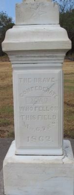
(Front):THE BRAVE CONFEDERATE DEAD, WHO FELL ON THIS FIELD, Mar. 6, 7, & 8, 1862.The graves of our dead with the grass overgrown, May yet form the footstool of Liberty's throne; And each single wreck in the war-path of Might, Shall yet be . . . — — Map (db m242713) WM
On East Douglas Street (U.S. 62), on the right when traveling west on East Douglas Street.
The battle on this field was fought between the Confederate army of General T.C. Hindman (Arkansas) and Federal forces commanded by Generals James G. Blunt (Kansas) and F.J. Herron (Iowa). Battlefield Park occupies the approximate center of the . . . — — Map (db m35248) HM
On 13th Street Northwest at Quakenbos Street Northwest, on the right when traveling north on 13th Street Northwest.
Civil War Defenses of Washington 1861-1865 The partial reconstruction of Fort Stevens that you see today was done by the Civilian Conservation Corps in 1937. No visible evidence of the original fort remains. Battle of Fort Stevens July . . . — — Map (db m3028) HM
On Ford Avenue (State Highway 144) at Coastal Highway (U.S. 17), on the right when traveling east on Ford Avenue.
Situated at Genesis Point, 10 miles east on the right bank of the Great Ogeechee River below the "lost town" of Hardwick, this fort was the right of the exterior line designed for the defense of Savannah. It denied the use of the river to Union . . . — — Map (db m8387) HM
On Nashville Street (U.S. 41) 0.3 miles south of Peters Lane, on the left when traveling north.
After the battle of Missionary Ridge, Bragg's Confederate Army retreated in disorder towards Dalton. Brig. Gen. Patrick R. Cleburne was ordered to take position in the gap, hold back the Federals, and save the trains and artillery from capture. . . . — — Map (db m12181) HM
On Johnson Street at North McDonough Street, on the left when traveling east on Johnson Street.
In this vicinity were fought the engagements that ended the Atlanta Campaign of 1864. Confederate forces under Gen. Hardee, endeavoring to defend the remaining R.R. to Atlanta, against outnumbering Federal troops, Aug. 31 & Sept. 1 were forced to . . . — — Map (db m12330) HM
On Burnt Hickory Road NW at Old Mountain Road NW, on the left when traveling east on Burnt Hickory Road NW.
One of the two abortive attempts to break Johnson’s line, [CS] June 27, 1864, was made in this area by 3 Federal brigades. Deployed on the ridge W. of the stream & astride Burnt Hickory Rd., they moved E. toward the Spur of the mountain, which was . . . — — Map (db m867) HM
On Palisades Road, 0 miles east of Peachtree Road NE (U.S. 19), in the median.
Lt. Gen. John B. Hood, on taking command of the Army of Tennessee [CS], July 18, 1864, began aggressive action against the Federal approach to Atlanta from
upper Chattahoochee crossings. July 20. Hood’s 1st move was to attack Thomas’ Army of the . . . — — Map (db m14415) HM
On Hall Memorial Road NW at Hall Road, on the left when traveling south on Hall Memorial Road NW.
May 13, 1864, McPherson's 15th and 16th A.C. (US) moving from Snake Creek Gap reached this cross-roads where his forces were deployed for advance toward Camp Cr. Gen. Judson Kilpatrick's Cav. Div. (US) led advance; during a sharp engagement he . . . — — Map (db m11552) HM
Near Battlefield Memorial Highway (U.S. 421), on the right when traveling south.
In the summer of 1862 the Confederacy took the offensive Robert E. Lee's army advanced into Maryland. Sterling Price and Earl Van Dorn's armies marched toward Corinth, Mississippi. Braxton Bragg and Kirby Smith moved out of Tennessee and into . . . — — Map (db m31622) HM
Near Chapel Point Road, on the right when traveling east.
Divided loyalties and ironies tore at Marylander’s hearts throughout the Civil War: enslaved African-Americans and free United States Colored Troops; spies and smugglers; civilians imprisoned without trial to protect freedom; neighbors and families . . . — — Map (db m1104) HM
Near Main Street, on the right when traveling north.
In September of 1864 Major General Sterling Price and a 12,000 man army re-entered Missouri in a forlorn effort to regain the state for the Confederacy. On September 27th they laid siege to Fort Davidson. The defenders, though greatly outnumbered, . . . — — Map (db m38444) HM
Built by U.S. Corps of Engineers, 1826-34. Good example of brick fort. Seized by Confederates, April 14, 1861. Scene of battle, April 25, 1862. — — Map (db m31278) HM
On Burnett Road (State Highway 82) at Ross West Road, on the right when traveling south on Burnett Road.
You are standing near the center of the first phase of fighting in the Battle of Averasboro, March 15-16, 1865. On March 15th the left wing of General Sherman’s Union army, commanded by General H.W. Slocum, was advancing along this road (A) from . . . — — Map (db m41993) HM
On Bass Road (County Route 1008) at Bass Road (County Route 1194), on the left when traveling east on Bass Road.
This memorial marks the battlefield of Bentonville where, on March 19-21, 1865, General Joseph E. Johnston, with about 15,000 Confederate troops, principally from North Carolina, South Carolina, Georgia Tennessee, Alabama, and Mississippi, checked . . . — — Map (db m222917) HM
On New Bern Road (U.S. 70) at Woodmen Way on New Bern Road.
The yellow sidebar in the upper left of the marker provides a brief synopsis of the Carolinas Campaign. It states:
The Carolinas Campaign began on February 1, 1865, when Union Gen. William T. Sherman led his army north from Savannah, . . . — — Map (db m23802) HM
On 1340 Old Waynesboro Road, on the right when traveling south.
On the morning of July 4, Union General Judson Kilpatrick's Cavalry Division consisting of General George Custer and Colonel Nathaniel Richmond's Brigades were ordered from Gettysburg to attack the wagon trains that were moving on the road between . . . — — Map (db m30968) HM
On Broadway (Pennsylvania Route 194) at Carlisle Street (Pennsylvania Route 94), on the right on Broadway.
June 30, 1863
between Brig. Gen. Judson Kilpatrick's
3rd Cavalry Division Army of the Potomac
and
Major Gen. J.E.B. Stuart's Cavalry Division
Army of Northern Virginia — — Map (db m4997) HM
Invasion! In January 1865, Gen. William Tecumseh Sherman's army of 60,000 Union soldiers invaded South Carolina. Its goals: to link up with Ulysses S. Grant's forces opposing Robert E. Lee's Confederates in Virginia and destroy the South's . . . — — Map (db m7437) HM
On April 12, 1861, Confederate forces bombarded Fort Sumter and the Civil War began. The Federal garrison surrendered the next day and evacuated on the 14th, leaving the fort in Confederate hands. Throughout the Civil War Fort Sumter was the center . . . — — Map (db m30573) HM
On Holtzclaw Avenue, on the right when traveling south.
Front of the Monument
Ohio's Tribute
To The Andrews Raiders
1862
Erected 1890.
Right side of the Monument
Escaped
21st Ohio Vol. Inf.
J. Alfred Wilson, Co. C
Mark Wood, " "
Wm. J. Knight, " E
Wilson W. . . . — — Map (db m56807) HM
Near Fort Dickerson Road west of Chapman Highway, on the left when traveling north.
–1863–
• One of sixteen Union Army earthen forts and battery positions protecting Knoxville, Nov. 1863–May 1865.
• Named for Capt. Jonathan C. Dickerson, 112th Illinois Mounted Infantry who was killed near Cleveland, TN . . . — — Map (db m4319) HM
On Jefferson Davis Highway (U.S. 51) at Graves Street (State Highway 87), on the right when traveling north on Jefferson Davis Highway.
Federal forces captured this important Confederate work, 18 miles west, in 1862. To end depredations committed by the Federal garrison, Forrest, with a force from his Confederate Cavalry Corps, attacked and captured the fort. Of the garrison of 551 . . . — — Map (db m43263) HM
On Fort Donelson Park Road, 0.1 miles north of Donelson Parkway (U.S. 79), on the right when traveling north. Reported missing.
Here the Union won its first major victory of the Civil War. The surrender of Fort Donelson, along with the capture of Forts Henry and Heiman, forced the Confederacy to abandon Nashville and give up southern Kentucky and much of middle and west . . . — — Map (db m173008) HM
On Appomattox Court House NHP entrance road, on the right when traveling north.
Here on Sunday April 9, 1865, after four years of heroic struggle in defense of principles believed fundamental to the existence of our government Lee surrendered 9000 men the remnant of an army still unconquered in spirit. — — Map (db m169653) HM
On Beverly Ford Road (County Route 676), on the right when traveling north.
On June 9, 1863, the Civil War visited the river fords, farmer's fields and rolling hills near Brandy Station. During the intense daylong fighting that swirled all around the little town, Confederate and Union horsemen clashed in the largest cavalry . . . — — Map (db m156293) HM
On General Winder Road (County Route 657) at James Madison Highway (U.S. 15), on the right when traveling west on General Winder Road. Reported permanently removed.
In the summer of 1862 General John Pope formed the Federal Army of Virginia. While the elements of this new 63,000-man army were converging upon Culpeper, Confederate General Thomas J. "Stonewall" Jackson saw that part of the Union army - 12,000 men . . . — — Map (db m183950) HM
On Dabney Mill Road (Virginia Route 613), on the right when traveling east.
Hoping to cut Lee’s supply route into Petersburg, in February 1865 Grant ordered two army corps led by Major Generals Gouverneur K. Warren and Andrew A. Humphreys to seize the Boydton Plank Road. The Confederate corps commanded by Maj. Gen. John B. . . . — — Map (db m6486) HM
On White Oak Road (Virginia Route 613) at Courthouse Road (Virginia Route 627), on the left when traveling west on White Oak Road.
Here at Five Forks on April 1, 1865 10,000 Confederates, commanded by General Pickett, were overwhelmed by about 50,000 Federal troops, led by General Sheridan, thereby opening the way to the Southside Railroad making further defense of Petersburg . . . — — Map (db m180073) HM
On Boydon Plank Road (U.S. 1) at Duncan Road (Virginia Route 670), on the left on Boydon Plank Road.
Here, the Union’s Sixth Army Corps broke through the Confederate line defending Petersburg, causing a series of actions which eventually led to the evacuation of the city by Lee’s army that evening. Nearby, Confederate General A.P. Hill was killed . . . — — Map (db m6080) HM
On Reams Drive (County Route 606) 0.1 miles west of Halifax Road (County Route 604), on the right when traveling west. Reported permanently removed.
The first field fortifications were built at Reams Station on July 1, 1864 by soldiers of the Union Sixth Corps while tearing up the railroad following the return of the ill-fated Wilson-Kautz cavalry raid. Hastily thrown up, the works were "L" . . . — — Map (db m164221) HM
Near White Oak Road at Clairborne Road, on the right when traveling west. Reported permanently removed.
Welcome to the Civil War Preservation Trust’s White Oak Road Battlefield! The battlefield walking trail is a two-thirds-of-a-mile path that takes you past six wayside signs interpreting the 1865 battle, the remains of the Confederate earthworks, and . . . — — Map (db m184282) HM
This small park is the last remnant of Fairfax County’s only major Civil War battlefield. The Battle of Ox Hill, also known as the “Battle of Chantilly,” lasted but a few hours on the afternoon of September 1, 1862. Here, some 6,000 Union troops . . . — — Map (db m182229) HM
On Valley Pike (U.S. 11) at Belle Grove Road, on the right when traveling south on Valley Pike.
General Philip Sheridan defeated General Jubal Early here for the third time in 30 days. Sheridan’s pursuit of Confederates from Fisher’s Hill halted at Mount Crawford. On his return he encamped his three corps in this immediate area. Early . . . — — Map (db m581) HM
On Opequon Church Lane, on the right when traveling west.
Around this site and a mile to the west occurred two major battles of the Civil War. First Kernstown March 23, 1862 Stonewall Jackson attacked what appeared to be a withdrawing federal force led by federal Br. Gen. Shields. Desperate . . . — — Map (db m2632) HM
On Redbud Road (Route 661), on the right when traveling east. Reported permanently removed.
(Left Side): The Third Battle of Winchester - September 19, 1864 Bloodiest Battle of the Shenandoah Valley Gen. Jubal Early assuming that Gen. Phil Sheridan was yet another cautious Union commander, divided his roughly 14,000 troops on . . . — — Map (db m158714) HM
On Washington Highway (U.S. 1), on the right when traveling south.
Approaching Richmond from the north after the Wilderness Campaign, Lt. General U.S. Grant sought to cross the North Anna River and capture the critical rail center at Hanover Junction (Doswell). General R. E. Lee ordered the construction of a . . . — — Map (db m14867) HM
Near Cold Harbor Road (Virginia Route 156), on the right when traveling east. Reported missing.
General Robert E. Lee’s plan on June 26, 1862 did not anticipate a direct assault on the Union position here at Beaver Dam Creek. He hoped to maneuver instead of force to drive Fitz John Porter’s troops away from their powerful entrenchments. But . . . — — Map (db m14983) HM
On Anderson Wright Drive, on the right when traveling north. Reported permanently removed.
Here Grant and Lee, with combined armies numbering some 180,000 men, fought for two weeks in May and June of 1864. They came here directly after the battles of the Wilderness, Spotsylvania, and North Anna River. Grant stretched his line to seven . . . — — Map (db m15047) HM
On Cold Harbor Road (Virginia Route 156), on the right when traveling east.
For thirteen days Union and Confederate armies faced each other around Cold Harbor, their lines separated by only 150 yards of ravaged ground. Twice, on June 1 and June 3 1864, savage fighting erupted when the Federals launched massive assaults . . . — — Map (db m16214) HM
On Watt House Road (Virginia Route 718), on the right when traveling south. Reported permanently removed.
The action here on June 27, 1862, was the second-largest battle in American history up to that time. One day earlier General Robert E. Lee had pried the Union Fifth Corps from its position at Beaver Dam Creek. Here he brought 65,000 Confederate . . . — — Map (db m15022) HM
On Brook Road (U.S. 1) at Interstate 295, on the left when traveling south on Brook Road.
On 11 May, 1864, Confederate cavalry commanded by Maj. Gen. J.E.B. Stuart chose ground just east of here to engage Union cavalry under Maj. Gen. Philip H. Sheridan, who was advancing on Richmond by way of Mountain Road. Outnumbered three to one, . . . — — Map (db m3717) HM
On New Market Road (Virginia Route 5) at Malvern Hill Lane, on the right when traveling west on New Market Road. Reported permanently removed.
Nearby stood the Malvern Hill manor house built for Thomas Cocke in the 17th century. The Marquis de Lafayette camped here in July-August 1781, and elements of the Virginia militia encamped nearby during the War of 1812. During the Civil War, 1 July . . . — — Map (db m9603) HM
On Charles City Road at Willis Church Road (Virginia Route 156), on the right when traveling west on Charles City Road.
In this vicinity, the Union Army of the Potomac made a stand on 30 June 1862, during its retreat from the Chickahominy River toward the James River. Maj. Gen. George B. McClellan posted several Union divisions facing east and north to protect this . . . — — Map (db m15058) HM
On Darbytown Road at Fussells Ridge Drive, on the right when traveling east on Darbytown Road.
About noon on 16 Aug. 1864, Union Brig. Gen. Alfred H. Terry, with almost 5,000 men in four brigades, attacked the Confederate line over this ground. In a brief yet vicious struggle, Terry's men broke through 400 yards west of here. During the . . . — — Map (db m16179) HM
On East Williamsburg Road (U.S. 60), on the left when traveling west. Reported permanently removed.
Confederate attacks on May 31, 1862, designed to push the Union army away from Richmond, struck an isolated wing of the Federal Fourth Corps in this vicinity. The heaviest action took place along the Williamsburg Road. Marching from the west, . . . — — Map (db m10595) HM
On Highland Turnpike (U.S. 250) at Bullpasture River Road (Virginia Route 678), on the left when traveling west on Highland Turnpike.
May 8, 1862, one mile southeast, Jackson and Edward Johnson, C.S.A. defeated Milroy and Schenck, U.S.A. This church served both Blue and Gray as a hospital. — — Map (db m62929) HM
On April 19, 1862, General Johnson, with General Lee’s approval, moved our regiment from Allegheny Mountain to Shenandoah Mountain. To protect ourselves from Yankee bullets, we dug about a mile of trench in this rocky ground. We then opened our . . . — — Map (db m16775) HM
Near Ball’s Bluff Road, on the left when traveling east.
On the night of October 20, 1861, a small Federal scouting party crossed the Potomac River from Maryland to determine whether recent troop movements indicated a Confederate withdrawal from Leesburg. Advancing inland from Ball’s Bluff, the . . . — — Map (db m157212) HM
On Louisa Road (U.S. 33) at Trevilians Square, on the right when traveling east on Louisa Road.
— Fought here June 11, 12, 1864 — Confederate Gens. Wade Hampton, Fitzhugh Lee and Thomas L. Rosser, victors over Federal Gens. P.H. Sheridan and G.A. Custer 5000 Confederates, 8000 Federal Casualties Confederate 612, Federal 1,007 . . . — — Map (db m156005) HM
On Sandusky Drive, on the left when traveling west.
In early May 1864, while Confederate Gen. Robert E. Lee confronted the Union Army of the Potomac west of Fredericksburg, Union Gen. U.S. Grant sent Gen. Franz Sigel’s army to destroy Lee’s supplies in the Shenandoah Valley. After the Union defeat . . . — — Map (db m3942) HM
Near Battery Heights Boulevard at Quarry Road, on the left when traveling south. Reported permanently removed.
This 11-acre historic park, part of the Manassas Museum System, contains one of only two surviving Civil War fortifications in the City of Manassas. The earthwork was built by Confederate troops in the Spring of 1861 as part of the Manassas . . . — — Map (db m2366) HM
On Massey Hughes Drive, 0.4 miles Maryland Avenue, on the left when traveling east.
Across Hampton Roads from this point the C.S.S. Virginia (Merrimac) and the U.S.S. Monitor fought, March 9, 1862. This was the first combat between iron-clad vessels in the history of the world. After a severe engagement in which each . . . — — Map (db m16420) HM
On Constitution Highway (State Highway 20), on the right when traveling west.
The Armies The Army of the Potomac Throughout the winter of 1863-1864, the armies rested and refitted on opposite sides of the Rapidan River. The ranks of the Union army swelled with thousands of new draftees and recruits - soldiers whose . . . — — Map (db m155689) HM
On Constitution Highway (State Highway 20) at Gold Dale Road (County Route 611), on the right when traveling east on Constitution Highway. Reported unreadable.
Amidst numbing cold and stinging rain, in late 1863 Union General George G. Meade and his Army of the Potomac attempted a year-end stroke against Robert E. Lee. This effort climaxed along Mine Run, two miles in front of you. Since . . . — — Map (db m173937) HM
On Virginia Route 619, on the left when traveling south.
Here Lee fought his last battle, April 6, 1865. Ewell almost won a great vic- tory but was overwhelmed by Sheridan. Nottoway Chapter U.D.C. 1928 — — Map (db m11806) HM
On Port Republic Road (County Route 659) south of Cross Keys Road (Virginia Route 276), on the right when traveling south.
Here, June 8, 1862, Gen. J. C. Fremont—pursuing Gen. T. J. “Stonewall” Jackson—was checked by Gen. R. S. Ewell with part of Jackson’s army, which lay towards Port Republic. Federals engaged: 12,750, killed and wounded: 684. Confederates engaged: . . . — — Map (db m4056) HM
On South East Side Highway (U.S. 340) at Ore Bank Road / Lynnwood Road (Virginia Route 708), on the right when traveling east on South East Side Highway.
The cross road here roughgly divides the Confederate and Union lines in the battle of June 9, 1862. Jackson attacked Shields, coming southward to join Fremont, but was repulsed. Reinforced by Ewell, Jackson attacked again and drove Shields from the . . . — — Map (db m230190) HM
On Old Valley Pike (U.S. 11), on the right when traveling south.
September 22, 1864 General Philip Sheridan with 30,000 Federals defeated General Jubal Early with 11,000 Confederates. Driven in route from Winchester September 19, by Sheridan's overpowering numbers, Early formed his line of battle across the . . . — — Map (db m4139) HM
On George Collin Parkway aka Miller Lane (Virginia Route 305) near Interstate 81, exit 264 west (U.S. 211), in the median.
The Battle of New Market was fought here Sunday morning, May 15, 1864. The Confederates under Gen. J. C. Breckinridge were victorious over the Federals under Gen. Franz Sigel. The decisive incident of the battle was the heroic capture of the Federal . . . — — Map (db m182592) HM
Near Old Salem Church Road near Plank Road (Virginia Route 3).
Spotsylvania Baptists built this church in 1844 and named it Salem, a Biblical word meaning peace. Two decades later, Salem Church was engulfed by war. Initially the church had just 29 members, but by 1859 the number had risen to 77, 20 of whom . . . — — Map (db m3503) HM
Near Plank Road / Germania Highway (State Highway 3), on the right when traveling west.
April 27-May 6, 1863. Leaving a large detachment under Sedgwick in front of Fredericksburg, Hooker marched a flanking column around and behind the Confederates. Lee then left a small unit to face Sedgwick and advanced westward to meet Hooker. . . . — — Map (db m3517) HM
On Grant Drive, 0.1 miles north of Brock Road (County Route 613), on the left when traveling south.
"Nothing in history equals this contest. Desperate, long and deadly, it still goes on. From morn till night, nor ends the carnage there -- all night it goes on too. I cannot tell you any of the particulars. You could not understand it. I do not . . . — — Map (db m10708) HM
During the Civil War, Front Royal, a “cross-roads town” of fewer than 600 residents, was the economic center of Warren County. One soldier described the town as “...quite rural. The principal objects of interest are two small . . . — — Map (db m2436) HM
Near Laurel Mountain Road (County Route 15), on the right when traveling east.
Union and Confederate forces clashed along the Beverly-Fairmont Turnpike (the narrow paved road in the foreground) on July 7-11, 1861. Union General Morris was ordered to "amuse" General Garnett at Laurel Hill - to make him believe the main . . . — — Map (db m34439) HM
On Mansfield Drive (U.S. 250) at North Main Street (U.S. 250), on the right when traveling east on Mansfield Drive.
Col. Benjamin F. Kelley
Kelley, a railroad agent in Philadelphia and former resident of Wheeling, was called back to command the First Virginia (Union) Infantry--the first Union regiment raised in the South. He planned and led the attack on . . . — — Map (db m211896) HM
On Fort Mill Ridge Park Road, on the right when traveling east.
Fort Mill Ridge is a Union fortification constructed between March and June, 1863, to defend the Mechanicsburg Gap and South Branch Potomac Valley. The remains of the fortification have been undisturbed over the past 135 years and are among the most . . . — — Map (db m167998) HM
On Seneca Trail (U.S. 219) 0.2 miles north of Delta Road 18, on the right when traveling north. Reported damaged.
Here, November 6, 1863, Union troops, commanded by Gen. W.W. Averell, defeated Confederate forces under Gen. John Echols. This has been considered the most extensive engagement in this State and the site was made a State park in 1929. — — Map (db m34364) HM
On Rich Mountain Road / Files Creek Road (County Route 37/8), on the right when traveling east.
On July 11, 1861, a Federal flank attack surprised Confederates guarding this pass The battle of Rich Mountain took place here where the Staunton-Parkersburg turnpike crossed the crest of the mountain. About 2:30 pm, the Union forces began . . . — — Map (db m156078) HM
On Poplar Street, on the right when traveling south.
"They have not given me an adequate force. I can do nothing. They have sent me to my death."
Gen. Robert S. Garnet CSA
"I have made a very clean sweep of it."
Maj. Gen. George B. McClellan USA