On Trinity Church Road near Point Lookout Road (Maryland Route 5).
Pro Deo. Pro Patria. This tablet erected in honor of Hon. Albert C. Ritchie, Governor of Maryland, members of the General Assembly 1924 and other public spirited citizens in recognition of their co-operation in restoring this historic . . . — — Map (db m973) HM
On Trinity Church Road near Point Lookout Road (Maryland Route 5).
In memory of Nicholas Young of St. Mary’s Co. Maryland, elected to the House of Burgesses Nov 30, 1665.
Boxwood dedicated June 13, 1932, and tablet placed through Maj. William Thomas Chapter, D.A.R. by Delia Harris Maddox, Ann Delia Power . . . — — Map (db m1006) HM
Near Trinity Church Road near Point Lookout Road (Maryland Route 5).
Here lyeth the body of Lionel Copley of Wadworth, County York, England, born 1648, died Sept. 27, 1693. And of Anne Boteler, his wife, of Watton, Woodhull, County Herts, England, died March 5, 1692.
He was sometime Lieutenant Governour of . . . — — Map (db m1005) HM
Near Old State House Road at Point Lookout Road (Maryland Route 5).
Margaret Brent (ca. 1601–1671), a Catholic gentlewoman, lived in Maryland from 1638 to 1650. In June 1647 the dying governor, Leonard Calvert, made her executrix of his estate with power to pay the soldiers he had hired to put down a Protestant . . . — — Map (db m950) HM
Near Trinity Church Road near Point Lookout Road (Maryland Route 5).
First register of the Colonial Land Office, Clerk of the Assembly 1682, Chief Clerk to the Secretary of the Province 1692, member of the committee signing protest against the removal of the Capital from St. Mary’s City to Annapolis 1694. His home . . . — — Map (db m962) HM
Near Trinity Church Road west of Point Lookout Road (Maryland Route 5).
The National Society, Daughters of Founders and Patriots of America placed this tablet in honor of our National President 1952–1955 Laura Maryland Carpenter Blinn, born in St. Mary’s County and whose ancestors landed here with the Lord . . . — — Map (db m951) HM
Near Trinity Church Road near Point Lookout Road (Maryland Route 5).
(west face) To the memory of Leonard Calvert, First Governor of Maryland this monument is erected by the State of Maryland.
(north face) Leonard Calvert, second son of George Calvert, first Baron of Baltimore and Anne, his wife, . . . — — Map (db m968) HM
On Trinity Church Road, 0.1 miles west of Point Lookout Road (Maryland Route 5), on the left when traveling west.
In the early 1880s, Marylanders began to commemorate the “lost city” of St. Mary’s as a place of special significance. The 300th anniversary of Maryland’s founding in 1934 brought renewed attention and enthusiasm. The State House replica . . . — — Map (db m959) HM
Near Old State House Road at Point Lookout Road (Maryland Route 5).
Mathias de Sousa was the first black Marylander. Of African and Portuguese descent, he was one of nine indentured servants brought to Maryland by Jesuit missionaries and was on The Ark when Lord Baltimore’s expedition arrived in the St. . . . — — Map (db m5626) HM
On Trinity Church Road west of Point Lookout Road (Maryland Route 5), on the right when traveling west.
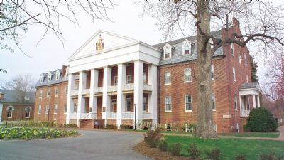
Established by act of Assembly, 1839. A monument to the birth of the State, 1634. “Where the mothers of future generations may receive their education at a place so well calculated to inspire affection and attachment for their native state.” . . . — — Map (db m972) HM
Near Trinity Church Road near Point Lookout Road (Maryland Route 5).
On this site was erected in 1676 the first State House of Maryland. Previous to this date the Assembly met in various places subsequent to the Planting of the Province at St. Mary’s City, March 27, 1634. The twelve stone markers forming a cross . . . — — Map (db m967) HM
Near Trinity Church Road near Point Lookout Road (Maryland Route 5).
In memory of Thomas Allen Senior, a passenger of the Ark and Dove expedition, member of Assembly of Maryland 1648, Justice of the Peace of Isle of Kent, found shot on the sands of Point Lookout, St. Mary’s County Maryland August 11, 1648. Placed . . . — — Map (db m949) HM
Near Trinity Church Road near Point Lookout Road (Maryland Route 5).
Built 1642 on Smith’s Creek, Saint Mary’s County. Removed to lot near present rectory, Saint Mary’s City.
In 1695 the Capital was removed from Saint Mary’s City to Annapolis and the State House came to be a place of Church of England worship.
. . . — — Map (db m910) HM