The Nobles Trail began in 1852 by William Noble as an alternate wagon route that initially branched off the Applegate Trail at Black Rock and headed southwesterly through forested and volcanic country, finally arriving at Shasta City, CA. Sixty-one official T-markers by Trails West Inc. document its route.
On State Highway 395, on the left when traveling south.
This route was first used in 1852 by emigrants to Northern California seeking to avoid the hardships of the Lassen Trail. It crossed the desert from the Humbolt River in Nevada, passed this point, and proceeded over the mountains to the town of . . . — — Map (db m10269) HM
On Forest Road 32N21, 0.5 miles south of California Route 44, on the left when traveling south.
"Day pleasant. Road has been excellent ... Has led us through beautiful glades and plains ... Tonight we camped at 'Butte Creek' a fine little stream with abundance." Benjamin Franklin Ruggles, Aug 15, 1859 — — Map (db m148737) HM
Near California Route 44, 8.4 miles north of Mooney Road, on the left when traveling north.
"Thence northwest winding westward through some timber into a dry valley, some grass near the west end of the valley ... here we camped some grass wood plenty but no water, having water in our keg." J. D. Randall, Aug 24, 1852 — — Map (db m148185) HM
Near North Street, on the right when traveling north.
This meadow, now a city park, was a welcome stopping place on the Noble Emigrant Trail, pioneered by William H. Nobles in 1851 and first used in 1852. Here, emigrants en route to the Northern California mines were able to rest, refresh their stocks, . . . — — Map (db m10268) HM
Near California Route 44, 4.9 miles north of California Route 36 when traveling north.
"10 ms. from the...head (of) Susan Valley you will find an excellent spring 150 yds. south of the road; but little grass here; grass is scarce on this ridge." J. D. Randall, Aug 23, 1852 — — Map (db m148177) HM
Near Bridge Creek Springs Road, 1 mile north of Merrill Flat Road.
"This is a fine valley and has the purest and coldest water a man ever drank ... I think this is the most pleasant camping place we have had, fine pine timbers ... Found the grave of Nancy Allen today." Gorham Gates Kimball, Jun 23, 1865 — — Map (db m148179) HM
On Bridge Creek Springs Road, 2 miles north of California Route 44, on the right when traveling north.
"We have risen to a considerable heighth [sic] today, though our road has been up and down. We are now crossing the Sierra Nevada Mountains by 'Nobles Pass' said to be the easiest pass of three" Benjamin Franklin Ruggles, Aug 13, 1859 — — Map (db m148178) HM
On Eagle Lake Road, 0.2 miles north of California Route 36, on the right when traveling north.
"We commenced the ascent directly on leaving the city...The greater portion of the company took the road to Marysville while the remaining portion & ourselves included have taken the Red Bluff Road." Mary C. Fish, Sep 12, 1860 — — Map (db m148037) HM
On North Weatherlow Street near Nevada Street, on the right when traveling north.
"This is a village of about 20 houses nearly all of which were built this summer. (It) is situated at the head of the valley... there is a hotel, store, blacksmith shop and... a saw-mill not far away." - Allen J. Tyrrell, Sep 8, 1860 . . . — — Map (db m87785) HM
On Dersch Road, 0.3 miles west of Hyrax Road, on the right when traveling west.
"Rolled on to Bear Creek a distance of about 14 miles and encamped on a small island near the creek... many grapes nearly ripe along the banks and grizzly bears are said to be plenty." - Joseph R. Bradway, Sep 12, 1853 — — Map (db m149411) HM
On Forest Road 32N21, 4.7 miles south of California Route 44, on the right when traveling south.
"We finally reached Black Butte Creek and followed it to Black Butte Lake. The lake was three miles long and on its left shore was a volcano which had been active a few years before." Tosten Kittelsen Stabek, 1852 — — Map (db m148275) HM
Near Volcanic Legacy Scenic Byway (California Route 44), on the left when traveling west.
"Then some miles of very rocky road amongst which is the piece called the 'Devils Half Acre', then tolerable road for rest of the day" - Benjamin Franklin Ruggles, Aug 16, 1859 — — Map (db m149314) HM
Near Volcanic Legacy Scenic Byway (California Route 44) 1.3 miles north of Forest Route 32N32, on the right when traveling west.
"Day pleasant. First part of afternoon had down hill road and good, then had a long and very rocky hill to go down road very winding." - Benjamin Franklin Ruggles, Aug 16, 1859 — — Map (db m149214) HM
Near California Route 44/89, on the left when traveling north.
“Drove 5 miles to Hat Creek Station (Old Station). Wild looking place. Signs of Indians. They have been here of late fishing.”
Gorman Gates Kimball, Jun 19, 1865 — — Map (db m58127) HM
On California Route 44, 0.1 miles east of McElroy Road, on the left when traveling east.
"Drove to Little Hat Creek (Hill) 6 miles, a beautiful little mountain valley with Hat Creek running through it. - Very good road today." Gorman Gates Kimball, Jun 19, 1865 — — Map (db m148336) HM
Near Volcanic Legacy Scenic Byway (California Route 44), on the right when traveling east.
"Tonight we are camped at 'Lost Camp Station' which is 8 miles below Hat Creek Station. Good water here but grass is enclosed...Have seen some very high mountains today" - Benjamin Franklin Ruggles, Aug 16, 1859 — — Map (db m149158) HM
"Drove up Hat Creek Crost [sic] it (Went) over a rockey [sic] ridge up a level flat & over some small bluffs to a creek (Lost Creek) Drove up it to a ranch and camped" A. L. Covel, Sep 5, 1859 — — Map (db m148738) HM
On California Route 44 at Pittville Road, on the left when traveling west on State Route 44.
"Very cold froze hard in camp last night ... We rolled on over a rough stony road ... and put up near a small pond fine feed and good water ... ducks & geese plenty ... This evening our camp presents a cheerful scene." J. R. Bradway, Sep 7, 1853 — — Map (db m148273) HM
Near Volcanic Legacy Scenic Byway (California Route 44) 1.2 miles north of Forest Route 32N56, on the right when traveling north.
"There has been snow capped mountains in sight for the last week: this evening Shasta Peak, Lawsons Butte are in plain view & they resemble large banks of snow." - Mary C. Fish, Sep 14, 1860" — — Map (db m149213) HM
On California Route 44/89, on the left when traveling north.
“We had at starting 5 miles up-hill travel mostly of a gradual ascent. This brought us to the summit of the hill from which Sacramento Valley may be seen.”
Allen J. Tyrell, Sep 14, 1860 — — Map (db m58129) HM
"Started and travailed [sic] some sixteen milles [sic] and camped within forty rodds [sic] (220 yards) of the Canon House for the night" - Ransom Josiah Arnold, Sep 11, 1860 — — Map (db m149413) HM
On Highway 299 at Mackley Alley, on the left when traveling west on Highway 299.
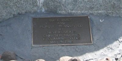
On this site, in May 1852, a group of Shasta merchants met with William H. Noble to employ him as a guide over a direct route he had marked as an immigrant trail. This meeting resulted in the establishment of the Noble's Trail.
Rededicated . . . — — Map (db m148329) HM
On 15432 Eureka Way (California Route 299) at 2nd Street, on the right when traveling west on 15432 Eureka Way.
"We was [sic] informed that the citizens of Shasta had prepared a dinner at the St. Charles Hotel for the emegrants [sic]...We was [sic] the first train of waggons [sic] that ever come [sic] into Shasta on the . . . — — Map (db m148328) HM
On Lassen Peak Highway (California Route 89), on the right when traveling south.
Mt. Lassen
10,451 feet
This tablet marks the route of those early pioneers who, in 1852, first went over
The Noble Pass
Linking the Humboldt – Nevada Road with Shasta and Northern California, and their road is . . . — — Map (db m58115) HM
On Alpine Meadows Road just east of Emigrant Trail Road, on the right when traveling south.
In 1852, William H. Nobles located an easier and more direct route to California for gold-seekers and pioneers heading west. Nobles Trail contributed importantly to the development of Northern California and led to additional transportation routes. . . . — — Map (db m58138) HM
On Lassen Peak Highway (California Route 89), on the right when traveling south.
Pioneered by William Nobles, this trail linked the Applegate Trail in Nevada to the Northern Sacramento Valley. During the 1850s and 60s, several thousand emigrants used this trail in their migration from the eastern United States. — — Map (db m58473) HM
Near California Highway 44 south of Ogburn Road, on the left when traveling west.
“Traveled 15 miles to Charley’s Ranch and camped there. Good water, drove the stock 2 miles to grass, here we heard the first chicken crow, and saw the first hog.”
- John S.L. Taylor, Sep. 2, 1854 — — Map (db m70349) HM
Near Dersch Road, 2.6 miles south of California Route 44, on the right when traveling south.
This site was an early stopping place for emigrants using the Nobles Trail and became a stage and freighting station established by William W. L. Smith in 1858. Site of Foot of the Mountain Station is one mile north of Dersch Road. — — Map (db m149410) HM
Near California Route 44 west of Emigrant Trail/Wilson Hill Road, on the right when traveling west.
The two branches of the Nobles Trail rejoined near Shingletown and continued westward to Shasta City. Shingletown was named after the numerous shingle mills in the area. — — Map (db m149326) HM
On Forest Route 17, 0.1 miles south of California Route 44, on the left when traveling south.
"Traveld 7 miles. Road very hard to brake on account of stone & chaperal brush. Encamped on Rassberry (Manzanita) Creek. Grass rather (poor) but abundenc(e) of Mt Rassberrys." -
Solomon Kingery, Aug 17, 1852 — — Map (db m149161) HM
On Forest Service Road 32N13F, on the right when traveling south.
"Drove up a hill (at the trail junction we took) the left hand road past peek [sic] (Table Mountain) on our left)" - A. L. Covel, Sep 6, 1859 — — Map (db m149160) HM
Near Deer Flat Road, 0.1 miles west of Manzanita Creek Drive, on the right when traveling west.
"Our road still runs a westerly direction pretty level road but very thick large timber to Battle Creek... Steep banks; ford good. Swift current 25 ft. wide 2 ft. deep; very clear good water." - J. D. Randall, Aug. 28, 1852 — — Map (db m149324) HM
On Deer Flat Road, 0.9 miles north of California Route 44, on the right when traveling north.
"Deer Flat is quite a little valley. Here were two ranches or farms. Emigrants stop here to rest and recruit their stock...We lay over eights day [sic]" - John Murray Mickey, Aug 12, 1854 — — Map (db m149319) HM
Near California Route 44, 3.3 miles west of Mineral Road (County Route 17), on the left when traveling west.
"Six miles farther (from Lost Creek) over a very rough road and some very large hills to another creek (Manzanita Creek). Previous to reaching this stream passed over an extensive plain of Manzanita" - J. R. Bradway, Sep 10, 1853 — — Map (db m149316) HM
On Main Street (Nevada Route 447) 0 miles north of Beechnut Court, on the left when traveling north.
Situated between Black Rock Desert on the east and Smoke Creek Desert on the west, the townsite of Gerlach lies in country occupied for thousands of years.
John C. Frémont traveled through these Northern Paiute Indian lands when he camped here in . . . — — Map (db m150274) HM