37 entries match your criteria.
Nobles Trail Historical Markers
The Nobles Trail began in 1852 by William Noble as an alternate wagon route that initially branched off the Applegate Trail at Black Rock and headed southwesterly through forested and volcanic country, finally arriving at Shasta City, CA. Sixty-one official T-markers by Trails West Inc. document its route.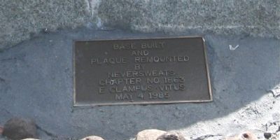
By Syd Whittle, May 11, 2008
Plaque on Base of Marker
| 1 ► California, Lassen County, Litchfield — 677 — Noble Emigrant Trail — |
| 2 ► California, Lassen County, Litchfield — N-26 — Nobles Trail - Soldiers Bridge — |
| 3 ► California, Lassen County, Old Station — N-36 — Nobles Trail - Butte Creek Meadow — |
| 4 ► California, Lassen County, Old Station — N-34 — Nobles Trail - Dry Valley — |
| 5 ► California, Lassen County, Susanville — 675 — Noble Emigrant Trail — |
| 6 ► California, Lassen County, Susanville — N-28 — Nobles Trail - Big Spring — |
| 7 ► California, Lassen County, Susanville — N-30 — Nobles Trail - Bridge Creek — |
| 8 ► California, Lassen County, Susanville — N-29 — Nobles Trail - First Nobles Pass — |
| 9 ► California, Lassen County, Susanville — N-27 — Nobles Trail - Fork in the Road — |
| 10 ► California, Lassen County, Susanville — N-26 — Nobles Trail - Rooptown — |
| 11 ► California, Shasta County, Anderson — N-58 — Nobles Trail - Bear Creek — |
| 12 ► California, Shasta County, Old Station — N-27 — Nobles Trail - Butte Creek — |
| 13 ► California, Shasta County, Old Station — N-40 — Nobles Trail - Devil's Half Acre — |
| 14 ► California, Shasta County, Old Station — N-39 — Nobles Trail - Hat Creek Rim — |
| 15 ► California, Shasta County, Old Station — N-41 — Nobles Trail – Hat Creek Station — |
| 16 ► California, Shasta County, Old Station — N-42 — Nobles Trail - Little Hat Creek Hill — |
| 17 ► California, Shasta County, Old Station — N-44 — Nobles Trail - Lost Camp Station — |
| 18 ► California, Shasta County, Old Station — N-43 — Nobles Trail - Lost Creek Route 1855 & Later — |
| 19 ► California, Shasta County, Old Station — N-35 — Nobles Trail - Poison Lake — |
| 20 ► California, Shasta County, Old Station — N-38 — Nobles Trail - Snow Capped Mountains — |
| 21 ► California, Shasta County, Old Station — N-48 — Nobles Trail – Third Nobles Pass — |
| 22 ► California, Shasta County, Redding — N-60 — Nobles Trail - Canon House — |
| 23 ► California, Shasta County, Shasta — N-61 — Noble’s Trail — |
| 24 ► California, Shasta County, Shasta — N-61 — Nobles Trail - Shasta City — |
| 25 ► California, Shasta County, Shingletown — 11 — Mt. Lassen/The Noble Pass/The Park Highway — |
| 26 ► California, Shasta County, Shingletown — Nobles Emigrant Trail — |
| 27 ► California, Shasta County, Shingletown — Nobles' Emigrant Trail — |
| 28 ► California, Shasta County, Shingletown — N - 56 — Nobles Trail – Charley’s Ranch — |
| 29 ► California, Shasta County, Shingletown — N-57 — Nobles Trail - Foot of the Mountain Station — |
| 30 ► California, Shasta County, Shingletown — N - 53 — Nobles Trail – Junction — |
| 31 ► California, Shasta County, Shingletown — N-55 — Nobles Trail - Shingletown — |
| 32 ► California, Shasta County, Summertown — N-49 — Nobles Trail - Manzanita Creek — |
| 33 ► California, Shasta County, Summertown — N-47 — Nobles Trail - Table Mountain — |
| 34 ► California, Shasta County, Viola — N-52 — Nobles Trail - Battle Creek Ford — |
| 35 ► California, Shasta County, Viola — N-51 — Nobles Trail - Deer Flat — |
| 36 ► California, Shasta County, Viola — N-50 — Nobles Trail - Manzanita Chute — |
| 37 ► Nevada, Washoe County, Gerlach — 152 — Gerlach — |