Opened by Jim Beckwourth, the Beckwourth Trail was a significant trail that crossed the Sierra Mountains. Its main claim to fame was that it had the lowest elevation crossing of the mountains and was a much needed alternative to the difficult mountain crossings on the Carson and Truckee Trail routes. It departed from the Truckee Trail in present day Sparks, Nevada and headed west to Marysville, California.
On Foothill Boulevard, 0.2 miles Dunstone Drive, on the right when traveling south.
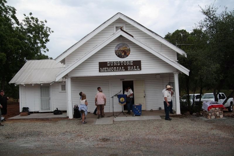
Built in 1899 by the Methodist Episcopal Church, it sits on the Beckwourth Trail. It was donated to the Wyandotte Community Association and named after the pioneer of the Wyandotte area, William Dunstone. In 2016, it became the home of Argonaut . . . — — Map (db m159622) HM
On Scott Road, 2.3 miles south of California Route 70, on the left when traveling south.
"We descended in to the head of a beautiful valley here we found things requisite for camping ... our road led immediately down the valley from camp ... with a good level road all the way." - John C. Thorniley, Aug 16-17, 1852 — — Map (db m148331) HM
"The road now continues down the valley ... thirteen miles. Here is a spring of water near the road, on the left. Also a small stream, the head waters of Feather River. ...Passed several [mountains] called buttes." - Henry T. Baldy, Sep 8, 1852 — — Map (db m148732) HM
Near Feather River Highway (Route 70), on the left when traveling west.
“Beckwiths House (is) the first house that I have seen since I left (Ft.) Laramie... at Beckwiths House the roads fork, the left hand goes to 76 & Maryesville, the right hand is called Beckwiths rout to Maryesville.” – John F. . . . — — Map (db m66177) HM
On Feather River Highway (Route 70), on the left when traveling west.
Beckwourth, a mountaineer, trader, and Crow Chief, discovered and promoted this emigrant trail. In 1852, near this site, he established the first waystop for emigrants between here and Salt Lake City. — — Map (db m66176) HM
Near Feather River Highway, on the left when traveling east.
This marker is made up of four panels. They are presented left to right.
Agriculture in Sierra Valley
A few years after James Beckwourth settled on what he called the War Horse Ranch just west of here in 1852, more ranches and farms . . . — — Map (db m66179) HM
Lowest pass in the Sierra Nevada Mountains
Discovered in 1851 by
James P. Beckwourth
Dedicated to the discoverer and to the pioneers who passed along this trail by the Las Plumas Parlor No. 254 N.D.G.W.
May 1937
No desert’s waste nor . . . — — Map (db m143424) HM
On Chilcoot Avenue, 0.3 miles south of California Route 70, on the left when traveling west.
"Trow informed us we were in California, when father gave three loud cheers, which echoed from the rocks and hills about us. Willie said that he would not like to spend his life in California if this was it." - Harriet S. Ward, Oct 1, 1853 — — Map (db m148728) HM
“Crossed a brook with high banks, where Squire Stephens upset the wagon he was driving in which was Philip Linthicum and he was hurt very badly” – John Dalton, Sep. 2, 1852 — — Map (db m56549) HM
“... camped in order to cut some grass to feed along the road ahead, and also on account of P. Linthicum who was still very sick; not expected to live.” – John Dalton, Sep. 3, 1852 — — Map (db m56548) HM
On Bucks Lake Road, on the right when traveling west.
Now under water, Rich Valley and Bucks Ranch (1850) made a superb stopping place for emigrants of 1851 and later. “Good grass, wood and water” – John Dalton, Sep. 1, 1852 — — Map (db m56536) HM
On Jackson Street at Coburn Street on Jackson Street.
This marker stands on part of the American Ranch of 1850. A way stop for emigrants of 1851 and later. “Here were obtained some fine vegetables...” Joshua Variel. Sept. 17, 1852 — — Map (db m56403) HM
On Quincy Junction Road at Chandler Road, on the right when traveling north on Quincy Junction Road.
“Had a hard road, crooked & rocky. Had to cross (Greenhorn) creek 8 times in going 5 miles. Got down to the New England Ranch at noon, camped here for today.” - Chester Smith, Sep. 27, 1852. — — Map (db m66159) HM
Near Bucks Lake Road (County Route 119) at Snake Lake Road, on the left when traveling east.
Millions in gold were taken from the Spanish Creek Mines between 1851 and 1905. To supply the miners the small town of New Boston sprang up at the mouth of Wahponsey Creek. Complete with a toll gate, apple orchard and gardens, in the 1870’s it was . . . — — Map (db m56530) HM
On California Route 70 at Cow Camp Road, on the right when traveling west on State Route 70.
"We beheld a large valley spread out before us, surrounded by majestic mountains covered with pine and snow. Six miles down the valley brought us into camp on the banks of a branch of Feather River." - Jacob S Hayden, Aug 19, 1853 — — Map (db m148730) HM
On D Street at 3rd Street, on the right when traveling south on D Street.
“Started for Marysville with good road at noon... hitched up and plodded on our dusty road to Marysville, where we arrived at 4 o’clock. This is a busy little place, but they had just had quite an extensive fire” – William . . . — — Map (db m113874) HM
On N Virginia St at N Red Rock Rd, on the right when traveling west on N Virginia St.
The historic road corridors from the Truckee Meadows northwestward into the Honey Lake area contains a tangle of intertwined routes following the course of valleys, portions of an emigrant trail cutoff, toll roads, county roads and casual parallel . . . — — Map (db m115855) HM
On C Street west of Victorian Plaza Circle, on the right when traveling west.
"Leaving the [Truckee] river bore off to the right over a sage plain near a mile with rather sandy road to the base of a low ridge." - D. B. Andrews, Aug 9, 1852 — — Map (db m149888) HM
On Tahoe Pyramid Bikeway, on the left when traveling east.
[Just before fording to the north side of Truckee River]" the road forks the left hand one is the old Truckee Route to Sacramento...The right hand one and the one we traveled is Beckwiths Cutoff [Beckwourth Trail]" - East S. Owen, Aug 22, 1852 — — Map (db m149925) HM