Henness Pass Road was the primary emigrant trail from Virginia City, Nevada as early as 1849 and the only mountain pass that existed at the time. During the Gold Rush, this often forgotten highway served as a supply road for the Comstock silver mines in Nevada. In 1852, Henness Pass Road was a wagon toll road from Nevada to the gold field of California. Between 1860 and 1868, traffic was so heavy at times during its heyday that freight wagons traveled by day and stagecoaches drove at night. The road continued to be used until the the completion of the transcontinental railway in 1868.
In 1849 a Mr. Anthony staked out 160 acres on the north side of Deer Creek on the road which would become part of the Marysville-Henness Pass-Virginia City trade route, and built a house and out-buildings. While further details about Mr. Anthony are . . . — — Map (db m65966) HM
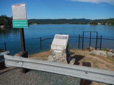
On Mooney Flat Road, on the right when traveling north.
Site of the first 3 story team & stage stop on the Henness Pass route to the Northern Mines & Comstock Lode. Built & operated by George & Veronica Schmidt served miners, travelers & teamsters. — — Map (db m45153) HM
On Henness Pass Road (County Route S301), on the right when traveling west.
Built by N.O. Cornish to
serve traffic on the Henness
Pass Road “a large and
commodious house for the
accomodation (sic) of the
public provided smithing and
hay for teamsters(.“) In 1868
the transcontinental R.R.
ended . . . — — Map (db m65875) HM
On Ridge Road, 0.5 miles east of Tippe Canoe Mine Road, on the right when traveling east.
Beginning in 1854, John Bope's Ranch and Inn was a major stopping place on the Ridge Road. "3-1/2 miles to Tavern in Plum Valley, here we campt,...gold diggings all around here." - Loring S. Comstock, Aug 28, 1855 — — Map (db m99648) HM
On Ridge Road at Mountain House Road, on the left when traveling east on Ridge Road.
"On again (along ridge), 2 miles to Gallaway's Rancho, then 4 miles to Forest City, to right of road and Orleans Flat (and Alleghany) to left of road. - Loring Samuel Comstock, Aug 28, 1855. — — Map (db m99646) HM
The Plum Valley House, built in 1854 by John Bope, was constructed of hewn logs and whip sawn lumber. It was a toll station on the Henness Pass Road between Marysville and Virginia City. It is named for the wild plums which grow in the area. — — Map (db m65932) HM
On Main Street at Nevada Street, on the right when traveling east on Main Street.
"Went to Downieville, called one of the smartest mining towns in the country, containing some 4, or 5,000 inhabitants, buildings in the business part of town are very well built a great deal of business is done" - Winslow Blake, Aug 25, 1852 — — Map (db m99645) HM
On Mountain House Road at Henness Pass Road, on the right when traveling north on Mountain House Road.
Near this point stood the locally famous inn built by Dan T. Cole in 1860. By 1890 the three-story roadhouse contained 16 lodging rooms, a dining and dance hall, bar, post office and telegraph station. A division point for the towns of Downieville, . . . — — Map (db m65960) HM
Near Henness Pass Road (County Route S450) 1 mile east of California Highway 89 when traveling north.
There are three interpretive sites here at Kyburz Flat. Take a moment to understand the people who lived here, how each used the environment in different ways, and the unique marks each left on the landscape.
Visiting all three sites should take . . . — — Map (db m66039) HM
On Alleghany Ridge Road at Highway 49, on the right when traveling north on Alleghany Ridge Road.
In 1859 the rich Comstock Silver Lode was discovered in Washoe Territory, Nevada, causing many miners to quickly pack up and head east. Immediately a company was formed to construct a road connecting this area of California to the Comstock finds. . . . — — Map (db m65968) HM
On South Virginia Street at East Peckham Lane, on the right when traveling north on South Virginia Street.
Here was located one of the busiest crossroads of pioneer Nevada, converging point for many major toll roads of the area. The earliest emigrants from the east crossed through Truckee Meadows at this point and by 1853 the intersection was known as . . . — — Map (db m93674) HM
On Henness Pass Road, on the left when traveling west.
The Henness Pass Road was a major immigrant trail from the Truckee Meadows to the California gold fields. In the 1850's it was improved and became a toll road. In 1860 Felix O'Neil built a bridge over the Truckee River, east of this place and near . . . — — Map (db m94297) HM
On Bridge Street, on the left when traveling north.
This site was the last natural crossing of the Truckee River before the Henness Pass Road began its climb over the Sierras. In 1860, Felix O’Neill had the first station on the river, while D.M. Bull operated a stage stop at the foot of Dog Valley . . . — — Map (db m231065) HM
On 3rd Street at Crystal Peak Park Road, on the left when traveling west on 3rd Street.
Modern Verdi came into being with the construction of the Central Pacific Railroad through Nevada in 1867-’69. It became a major mill town and terminal for shipment of ties and construction timbers with a network of logging railways reaching into . . . — — Map (db m66021) HM