El Camino Real, “The King's Highway” (California) Historical Markers
The El Camino Real in California was a 600-mile trail connecting the 21 Spanish missions in California (formerly Alta California), along with a number of sub-missions, four presidios, and three pueblos. The trail began at its southern end from the San Diego area (Mission San Diego de Alcalá), heading north to the trail's northern terminus at Mission San Francisco Solano in Sonoma, just north of San Francisco Bay. Numerous historical markers highlight its history along the route in addition to almost 600 bells mounted on posts (some going back to 1904) which have been placed every one to two miles along the trail route.
On Rainbow Crest Drive at Reyes Adobe Road, on the left when traveling west on Rainbow Crest Drive.
Daughters of the American Revolution commemorate the significant role the
Reyes Adobe historical site played in the development of California and its
history. The property was a stop along the state's famous El Camino Real. — — Map (db m154344) HM
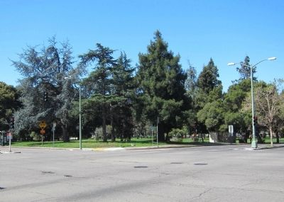
On North Main Street at Paseo Luis Olivares, on the left when traveling north on North Main Street.
The Franciscans arrived from México in 1769 led by Fr. Junipero Serra who founded California Missions from San Diego to Sonoma. This trail was known as “El Camino Real” (the King’s Highway). The “El Camino Real Bells” were originally placed . . . — — Map (db m162931) HM
Near Moorpark Street at La Maida Street, on the right when traveling east.
This dwelling, built in 1849 by Don Vincente de la Osa, was a favored stopping place for the numerous travelers on El Camino Real. It stands on land that is part of the one-square-league Rancho El Encino granted in 1845 by Governor Pio Pico to three . . . — — Map (db m131161) HM
Near Sepulveda Boulevard at Brand Boulevard, on the right when traveling north.
El Camino Real is Spanish for "The Royal Road” or "The Kings Highway". Originally the
El Camino Real was the 700 mile road that connected the 21 California Missions. They stretch
from San Diego to Sonoma. Each mission was one day's journey by . . . — — Map (db m200792) HM
Near San Fernando Mission Boulevard east of Sepulveda Boulevard.
1. Historical Museum
The museum exhibits a pictorial history of the mission, pottery, santos, trade and commerce items, together with an extensive collection of early mission baskets given by Marie and Mark Harrington.
2. . . . — — Map (db m114714)
Near Vineland Avenue, 0.1 miles south of U.S. 101, on the left when traveling south.
On July 16, 1769, padre Junipero Serra
dedicated the first of 21 missions to be
established in Alta California. These
missions along what is today known as
El Camino Real are located one day's ride
apart. Mission bells symbolizing the
founding . . . — — Map (db m155801) HM
Near Barrington Boulevard, 0.3 miles south of Wilshire Boulevard, on the right when traveling south.
Marked this day March 20 1976, as a California Historical Spanish Colonial Landmark “In 1776 Portola encamped at the springs, part of the Rancho San Vicente - Santa Monica, known as the: 1. Junipero Serra Springs; 2. El Berrendo; 3. San Gregorio; . . . — — Map (db m122157) HM
On South Mission Drive, on the right when traveling north.
Founded September 8, 1771, by Franciscan Friars on Rio Temblores - due to flooding, the expedition moved to this 2nd site in 1774, where the Old Mission of stone and red brick was built with the help of Gabrieleno Indians.
The exterior has . . . — — Map (db m66721) HM
Near South Mission Drive, on the right when traveling north.
San Gabriel Mission was founded by Fr. Pedro Benito Cambon (statue above right) and Fr. Angel Fernandez de la Somera (statue above left) on Sept. 8, 1771 in nearby Montebello by the Rio Hondo River, and moved to this location in 1775. This . . . — — Map (db m139099) HM
Near Fort Romie Road near Mission Road, on the right when traveling east.
In 1906 guidepost bells were placed along the El Camino Real to guide early travelers and to preserve this historic route which linked California missions beginning in 1769.
www.californiabell.com — — Map (db m64311) HM
Near Civic Center just west of Marguerite Parkway, on the right when traveling west.
In 1769 Gasper de Portolá led a group of Spanish soldiers on a thousand-mile march from Baja California to San Francisco. His purpose was to locate the ports of San Diego and Monterey and to establish a series of churches and military posts. The . . . — — Map (db m188706) HM
On North Orange Olive Road at East Lincoln Avenue, on the right when traveling south on North Orange Olive Road.
Portola camped on bank of Santa Ana River in 1769. Jose Antonio Yorba, member of expedition, later returned to Rancho Santiago de Santa Ana. El Camino Real crossed river in this vicinity. Place was designated Santa Ana by travelers, and known by . . . — — Map (db m50302) HM
On Ortega Highway (California Route 74) at El Camino Real, on the right when traveling west on Ortega Highway.
This El Camino Real bell was gifted by Marianne and Ray Miller. The bell signifies the importance of Mission San Juan Capistrano's place on the El Camino Real. These bells are found throughout the state as a result of an early 20th Century . . . — — Map (db m188642) HM
On JWA Roadway, 0.1 miles south of Airport Way, on the right when traveling south.
The California Mission Bell commemorates the route of El Camino Real. This bell sits near the crossroads of the summer and winter route from Mission San Juan Capistrano to Mission San Gabriel Archangel. — — Map (db m188551) HM
This commemorative bell celebrates a combined century of service by the California Federation of Women’s Clubs and California State Automobile Association including the establishment of bell markers along the historical El Camino Real. — — Map (db m14819) HM
The above marker shows the direction of the road that connected the 21 Missions. Expeditions left here to go north to Mission Santa Clara or go south to the head-quarters at Mission San Carlos Borromeo de Carmelo.
This road was used from 1797 to . . . — — Map (db m15344) HM
On Second Street at Mariposa Street, on the right when traveling south on Second Street. Reported missing.
upper marker:
Placed here June 24, 1910 by San Juan Bautista Parlor No. 179 Native Daughters of the Golden West. Rededicated 1974.
lower marker:
El Camino Real Bell, placed here June 24, 1910, by San Juan Bautista . . . — — Map (db m82204) HM
On Foothill Boulevard (Route 66) 0.2 miles east of Hellman Avenue, on the right when traveling west.
The "El Camino Real Bells" have long been in place since the early part of the last century to mark the original route of "El Camino Real" from San Diego to Sonoma in California. The El Camino Real, (Royal Highway or King's Highway), closely follows . . . — — Map (db m150315) HM
Near Stuart Mesa Road near Las Pulgas Canyon Road.
From 1823 to the 1840's, the tile-roofed adobe chapel and hostel at Las Flores, built by Father Antonio Peyrí, served as the asistencia to Mission San Luís Rey and provided comfort to travelers on El Camino Real. The adobe structure and adjacent . . . — — Map (db m81322) HM
On Vandegrift Boulevard north of Stewart Mesa/Ash Road.
Panel 1:
This bell marks a place along the original route of El Camino Real, “The Kings Highway”, which connects the 21 missions from San Diego to Sonoma. Suspended from a pipe resembling a shepherd’s staff, the first bell was erected in . . . — — Map (db m50664) HM
This plaque is placed on the 250th anniversary of the birth of California’s Apostle Padre Junipero Serra O.F.M., to mark the Southern terminus of El Camino Real as Padre Serra knew it and helped to blaze it.
1713 – November 24 – 1963 . . . — — Map (db m11958) HM
On Dolores Street north of Chula Lane, on the right when traveling south.
This plaque is placed on the 250th anniversary of the birth of California’s apostle, Padre Junípero Serra, O.F.M. to mark the northern terminus of El Camino Real as Padre Serra knew it and helped to blaze it.
1713 - November 24 - 1963 . . . — — Map (db m32169) HM
Rancho Nipomo, almost 38,000 acres in size, was granted to Boston sea captain William Goodwin Dana, in 1837. The rancho for many years was the first stopping place on El Camino Real south of Mission San Luis Obispo. From 1839 until Dana's death in . . . — — Map (db m102642) HM
On El Camino Real (California Route 82) at Howard Street, on the right when traveling north on El Camino Real.
The Anza Expedition of 1776, on its way up the Peninsula to locate sites for the Presidio and the Mission of San Francisco, camped here on March 26 at a dry watercourse a short league beyond Arroyo de San Mateo. Location: El Camino Real and Ralston, . . . — — Map (db m154364) HM
On El Camino Real (Highway 82) south of Baywood Avenue, on the right when traveling south.
Here stood the MISSION HOSPICE built around 1800 by the Spanish Padres on El Camino Real to break the journey from Santa Clara and serve the Indians of Mission Dolores. — — Map (db m18417) HM
The ruins at this site are part of the original Mission La Purisima, founded by Padre Fermin de Lasuen on December 8, 1787, as the 11th in the chain of Spanish missions in California. The mission was destroyed by earthquake on December 21, 1812; the . . . — — Map (db m50517) HM
Near Casa de Fruta Parkway near Pacheco Pass Highway (California Route 152).
California had an ancient system of Paths made by migrating herd as they searched for food and salt. Native Americans later used these trails to hunt, gather, and trade for survival. European colonists improved these roads as they settled here. The . . . — — Map (db m209016) HM
[The Morgan Hill Centennial Project is a very unusual ‘marker’. It was created to celebrate the 100th anniversary of the incorporation of the City of Morgan Hill. One starts at the center of the marker and then proceeds along an expanding spiral . . . — — Map (db m46097) HM
On Mission Street at Sylvar Street, on the right when traveling west on Mission Street.
At this location, an “El Camino Real” mission bell marker previously stood. Its removal was requested by the Amah Mutsun Tribal Band, descendants of the indigenous peoples taken to the Santa Cruz and San Juan Bautista missions.
In November of . . . — — Map (db m203217) HM
Near Camarillo Ranch Road north of Mission Oaks Boulevard, on the right when traveling north.
In 1769 the "El Camino Real - The King's Highway” was begun by the
Franciscans and lead by Fr. Junipero Serra. Missions were situated in
areas where large populations of Indians lived and where soil was
fertile enough to sustain a settlement. As . . . — — Map (db m154365) HM
On Thompson Boulevard at Palm Street, on the right when traveling east on Thompson Boulevard.
The Chumash Indians used this site to celebrate their Hutash Fiesta, held after the harvest each year towards the end of September. The Hutash Fiesta coincided with the Spanish Missionary's San Miguel Day giving the historic Chapel built on the site . . . — — Map (db m124617) HM
On North Ventura Avenue, 0.5 miles north of Cañada Larga Road, on the right when traveling north.
Santa Gertrudis Asistencia (chapel) was originally located about 500 feet north. Its location is now covered by the freeway. This chapel served the Indians in the early days.
Marked 1970. Replaced 1986. — — Map (db m143330) HM
On Westlake Boulevard at Triunfo Canyon Road, on the left when traveling south on Westlake Boulevard.
For thousands of years, the Chumash Indians and their forebears lived in this valley. They have been described as a stone age people, hunters and gatherers, resourceful, friendly, fun-loving, astute traders, fine craftsmen, and expert rock artists. . . . — — Map (db m128414) HM