1281 entries match your criteria. Entries 101 through 200 are listed.⊲ Previous 100 — Next 100 ⊳
National Historic Landmarks Historical Markers
Nationally significant historic places designated by the Secretary of the Interior because they possess exceptional value or quality in illustrating or interpreting the heritage of the United States. Today, fewer than 2,500 historic places bear this national distinction.
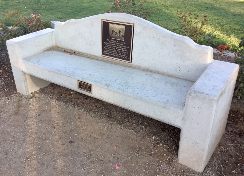
The 1942 Rose Bowl was the 28th Rose Bowl Game. Originally scheduled to be played in the
Rose Bowl Stadium in Pasadena,
California, it was moved to Durham, North Carolina, due to the fears of an attack on the West Coast of the United States . . . — — Map (db m128107) HM
Space Flight Operations Facility
has been designated a
National Historic Landmark.
This building possesses national significance
in commemorating the history of the
United States of America. — — Map (db m231405) HM
Built in 1908, the David B. Gamble House is a tribute to the genius of architects Charles Sumner Greene and Henry Mather Greene. Its design represents a unique California lifestyle and is a masterpiece of American craftsmanship. In 1966 it was made . . . — — Map (db m59811) HM
On this site stands CSO-4 (Pico #4), California's first commerically productive well. It was spudded in early 1876, under the direction of Demetrius G. Scofield, later to become first president of Standard Oil Company of California, and was . . . — — Map (db m157684) HM
The Hippodrome (also known as the "Carousel Building") was built in 1916 by famous carousel carver Charles I.D. Looff. Its unique combination of Byzantine, Moorish, and California design made it easily identifiable among the festive, eclectic . . . — — Map (db m119676) HM
Drakes Bay Historic
and Archaeological District
has been designated a
National Historic Landmark.
This landmark is associated with the 1579 landing of
Francis Drake, the 1595 landing of Sebastián Rodríguez
Cermeño and the wreck of the San . . . — — Map (db m184869) HM
The Civic Center Complex was designed by Frank Lloyd Wright (1869-1959) near the end of his long career. The Administration Building was completed in 1962 and the Hall of Justice in 1970. They are the only government buildings designed by the . . . — — Map (db m32748) HM
After several pioneer lodging structures were destroyed by fire, Henry Washburn and John Bruce had this building, opened in April, 1879, erected. Bruce died in it in 1882, but Henry, John, Edward, and later Clarence Washburn owned and operated it . . . — — Map (db m70572) HM
Stephen T. Mather, the first director of the National Park Service, employed park rangers to guide tourists and protect parks from poachers. In 1920, Mather hired architect Charles Summer to construct a home for members of his newly organized ranger . . . — — Map (db m65629) HM
LeConte Memorial Lodge was built by the Sierra Club in 1803/04 in honor of the world-renowned scientist and charter Sierra Club member Joseph LeConte who died near here in 1901. The memorial served as Yosemite Valley's first public information . . . — — Map (db m65529) HM
The first director of the National Park Service, Stephen T. Mather, was as at home in the High Sierra as he was in high society. To ensure Yosemite’s protection for future generations, he knew that influential people would have to care about the . . . — — Map (db m65504) HM
Tule Lake was one of ten American concentration camps established during World War II to incarcerate 110,000 persons of Japanese ancestry, of whom the majority were American citizens. Behind barbed wire and guard towers without charge, trial or . . . — — Map (db m10370) HM
Gold was discovered here in 1859 by W.S. Bodey after whom the town was named. Once the most thriving metropolis of the Mono Country, Bodie’s mines produced gold valued at more than 100 million dollars. Tough as nails, the “Bad Man from . . . — — Map (db m8437) HM
Constructed in 1827 by the Mexican government to collect custom duties from foreign shipping, a principal revenue source when Monterey was the capital of Alta California, Mexico's northernmost province. Thomas O. Larkin, US consul to Alta . . . — — Map (db m82186) HM
Larkin House, American Consulate 1844-1846. Built in 1835 by Thomas Oliver Larkin, only U.S. Consul to California.
Monterey History & Art Assn.
Courtesy Thomson J. Hudson Memorial Fund — — Map (db m33495) HM
The Royal Chapel of San Carlos de Borromeo, founded June 3, 1770, is the only remaining Presidio chapel in California.
Madariaga Adobe * Follow Church St. to Abrego
Cell Phone Tour (831) 718-9123 enter 710 — — Map (db m143524) HM
Decades of logging, grazing, recreation, and foot traffic brought Asilomar's dune ecosystem to the brink of extinction. When the Young Women's Christian Association (YWCA) established the Asilomar summer camp grounds in 1913, the dunes became a . . . — — Map (db m63773) HM
Near this spot stood the Breen cabin of the party of emigrants who started for California from Springfield, Illinois, in April 1846, under the leadership of Captain George Donner. Delays occurred and when the party reached this locality, on October . . . — — Map (db m94058) HM
Famous as the home of Madame Modjeska, one of the world's great actresses, it was designed by Stanford White in 1888 on property called the Forest of Arden. Sold soon after her retirement, it remains a monument to the woman who contributed . . . — — Map (db m143499) HM
This house was purchased in 1915 by local restaurant proprietor Jukichi Harada in the names of his three American-born minor children. It was remodeled and expanded to two stories in 1916. The question of legal ownership of this house resulted in . . . — — Map (db m154720) HM
Frank A. Miller (1857-1935) made adobe bricks for a small 12 room guest house which he opened in 1876. Over the years by successive building additions he fulfilled his dream by recreating this early California Mission style setting of a hotel. — — Map (db m50994) HM
In the 1850's, Horatio Gates Livermore and later his sons, Horatio P. and Charles E. pioneered the development of ditches and dams on the American River for industry and agriculture. One historic result was Folsom Power House, which began . . . — — Map (db m706) HM
Locke
has been designated a
National Historic
Landmark
This site possesses national significance
in commemorating the history of the
United States of America
Locke Historic District is the largest and
most complete example of . . . — — Map (db m162018) HM
In memory of the industrious Chinese pioneers of California whose strength and sacrifice helped build the transcontinental railroad, construct the levees of the Sacramento San Joaquin Delta, and develop agriculture in the Central Valley. With . . . — — Map (db m18234) HM
The house originally designed in 1857 by Seth Babson and was purchased by Leland Stanford in 1861. It served as the State Executive Office from 1861 to 1867, before the completion of the State Capital. It was later extensively remodeled and . . . — — Map (db m11842) HM
The Native Sons and Native Daughters of the Golden West planted it on July 19, 1939, and dedicated it September 9, 1948, on the occasion of the celebration of Admission Day and the Centenary of the founding of the modern City of Sacramento. — — Map (db m11886) HM
This structure, erected in 1852-53, was occupied during the 1850’s by the B.F. Hastings Bank, Wells Fargo and Co., various state officials, Sacramento Valley Railroad, and the Alta Telegraph Co. during April 1860 - May 1861. The Alta Telegraph Co. . . . — — Map (db m11388) HM
Founded in December 1848 by John A. Sutter, Jr., Sacramento was an outgrowth of Sutter’s Fort established by his father, Captain John A. Sutter, in 1839. State Capital since 1854, it was a major distribution point during the Gold Rush. A . . . — — Map (db m11486) HM
In the early 1920’s the California Transportation Company, the leading passenger carrier on the Sacramento and San Joaquin rivers, announced plans to build two modern passenger vessels for its Sacramento to San Francisco run. In 1927, the Delta . . . — — Map (db m16507) HM
Walnut Grove, Est 1850
Walnut Grove was established in 1850 by John W. Sharp and is one of the earliest settlements along the Sacramento River. Chosen because of the abundant walnut and oak forests in the area, the town quickly prospered as an . . . — — Map (db m37406) HM
has been designated a
Registered National
Historic Landmark
under the provisions of the
Historic Sites Ace of August 21, 1935
This site possesses exceptional value
in commemorating or illustrating
the history of the United . . . — — Map (db m41010) HM
San Juan Bautista Plaza Historic District
has been designated a
Registered National
Historic Landmark
Under the provisions of the
Historic Sites Act of August 21, 1935
This site possesses exceptional value
in commemorating or . . . — — Map (db m154360) HM
This 6,000-square-foot ranch complex is C-shaped, with a carriage house at one end and a two-story building at the other. It is one of only a few authentic nineteenth-century adobe ranch houses of its kind—combining both Hacienda and Monterey . . . — — Map (db m81323) HM
This Victorian hotel, built in 1887, is one of America’s largest wooden buildings. Few seaside resort hotels of this significant architectural style remain in America. The hotel has hosted several presidents and other national figures. — — Map (db m11108) HM
Founded June 12, 1798 by Father Lasuen, then president of the California missions, and administered by Father Peyri. Notable for its impressive architecture — a composite of Spanish, Moorish, and Mexican. — — Map (db m401) HM
Estudillo House
has been designated a
Registered National
Historic Landmark
under the provisions of the
Historic Sites Act of August 21, 1935
This site possesses exceptional value
in commemorating or illustrating
the . . . — — Map (db m11781) HM
The steam ferryboat "Berkeley" was the first successful west coast-built and operated ferry to be driven by a screw propeller as opposed to side-wheels. Built by the famous Union Iron Works of San Francisco in 1898, the ferry operated until 1958 as . . . — — Map (db m51330) HM
1829 Large adobe-block townhouse built by José Antonio Estudillo. Included servants' quarter, work and storage rooms, living and dining rooms, and Roman Catholic chapel.
1884 Helen Hunt Jackson's Ramona published, linking the . . . — — Map (db m145304) HM
After many attempts dated back to 1774 to provide a reliable source of water for crops and livestock for Mission San Diego de Alcala, a dam and flume system was finished between 1813 and 1816 by Indian laborers and Franciscan Missionaries to divert . . . — — Map (db m51074) HM
On Sunday, July 16, 1769 Fathers Junipero Serra, Juan Viscaino and Fernando Parron raised and blessed a cross to establish Alta, California’s 1st Mission. Relocated from Presidio Hill to this site in August 1774 the Mission was the mother of those . . . — — Map (db m15262) HM
Soldiers, sailors, Indians, and Franciscan missionaries from New Spain occupied the land at Presidio Hill on May 17, 1769 as a military outpost. Two months later, Fr. Junípero Serra established the first San Diego Mission on Presidio Hill. . . . — — Map (db m11134) HM
Adobe built about 1850 by A.S. Ensworth. Home of Capt. Rufus K. Porter and family. Curved timbers brought from the "Clarissa Andrews," famed coaling hulk formerly of the Pacific Mail Steamship Co. Historian Hubert Howe Bancroft later owned this . . . — — Map (db m51096) HM
Formerly attached to Mission San Luís Rey, the 2,219-acre ranch passed through brief ownership by two Mission Indians, then Don Abel Stearns, and into possession of Ysidora Bandini upon marriage to Col. Cave Johnson Couts. The adobe ranch house, . . . — — Map (db m148680) HM
In 1844, Gov. Manuel Micheltorena granted 44,322 acres to Juan Jose Warner who built this house. Gen. Kearny passed here in 1846; Mormon Battalion in 1847. First Butterfield Stage stopped at this ranch on Oct. 6, 1858 enroute from Tipton, Mo. to San . . . — — Map (db m51084) HM
Headquarters from 1908 to 1921
From here A.P. Giannini launched
the branch system that transformed
the nature of banking in California
National
Historic Landmark
This site is of national significance
in commemorating the . . . — — Map (db m71998) HM
Visit America’s answer to Hitler’s U-Boats – one of the last 2,710 identical armed Merchant Ships built to carry “beans, bullets and black oil" to our fighting men around the world. The goal was to build them faster than the enemy could . . . — — Map (db m76503) HM WM
First fortified by the Spanish in 1797, this bluff above the bay was re-armed by the U.S. Army in 1864. The post remained active through the Civil War, western Indian Wars, and conflicts abroad, beginning with the Spanish-American War in 1898. . . . — — Map (db m70025) HM
First fortified by the Spanish in 1797, this bluff above the bay was re-armed by the U.S. Army in 1864. The post remained active through the Civil War, western Indian Wars, and conflicts abroad, beginning with the Spanish-American War in 1898. . . . — — Map (db m132330) HM
The land known today as Crissy Field has undergone many changes. Once a rich salt marsh and homeland of Ohlone people, it was later a landing site for Spanish and Russian explorers, a venue for the Panama-Pacific International Exposition and a . . . — — Map (db m63413) HM
Formally established on September 17, 1776, the San Francisco Presidio has been used as a military headquarters by Spain, Mexico, and the United States. It was a major command post during the Mexican War, Civil War, Spanish-American War, World Wars . . . — — Map (db m10743) HM
Selecting this site because of the great number of Salinan Indians living hereabout. Fray Fermin Francisco de Lasuen, O.F.M., second president of the California Missions. Founded San Miguel Archangel on July 25,1797. The sixteenth in a chain of . . . — — Map (db m64948) HM
Here, on the historic Piedra Blanca Rancho, William Randolph Hearst created La Cuesta Encantada (The Enchanted Hill), including La Casa Grande and adjacent buildings. With their rare art treasures and beautiful gardens. 1919-1947
Presented to . . . — — Map (db m68492) HM
Across this bridge lies California's eleventh mission and a glimpse of life during the 1820's. The Civilian Conservation Corps restored the buildings and grounds between 1934 - 1941. We hope you enjoy your visit to the past. — — Map (db m11116) HM
Has been designated a
National Historic Landmark
This courthouse complex possesses national
significance in commemorating the history of the
United States Of America
The Santa Barbara County Courthouse is a superlative
example of . . . — — Map (db m135167) HM
Santa Barbara Mission,
founded December 4, 1786.
Present church completed 1820.
Destroyed by earthquake 1925.
Restored 1927 & 1953.
Santa Barbara Mission
has been designated a
registered National
Historic Landmark
under the . . . — — Map (db m236093) HM
Mission Santa Inéz has been designated a National Historic Landmark. This religious complex possesses national significance in commemorating the history of the United States of America.
Mission Santa Ines, founded in 1804, is one of the . . . — — Map (db m143491) HM
Space Launch Complex 10, Vandenberg Air Force Base, has been designated a National Historic Landmark. This site possesses national significance in commemorating the history of the United States of America. 1986 - National Park Service - United . . . — — Map (db m81076) HM
The first workable quicksilver mine in North America – First mine of any kind in California – First worked 1824 – Denounced November 1845. Has produced more metallic wealth than any individual gold mine in California. Its . . . — — Map (db m146473) HM
American Coaster Enthusiasts (ACE) recognizes Santa Cruz Beach Boardwalk's Giant Dipper as an ACE Roller Coaster Landmark, a designation reserved for rides of historic significance.
The 75-foot high wood coaster officially opened on May . . . — — Map (db m62826) HM
The Giant Dipper roller coaster, with its trademark red and white structure, spectacular view of the Monterey Bay, and speedy dips and curves, keeps generations of riders coming back for more.
The Giant Dipper has thrilled over 50 million . . . — — Map (db m62827) HM
Whether you call it a merry-go-round, carousel, or whirlgig, visitors have always been enchanted with the Boardwalk’s oldest ride. At the grand opening of the “hippodrome,” as the carousel and its building were called, one hundred rocking chairs . . . — — Map (db m62814) HM
Has Been Designated a
Registered National
Historic Landmark
Under the Provisions of the Historic Sites Act of August 21, 1935
This Site Possesses Exceptional Value
in Commemorating and Illustrating
the History of the Unites . . . — — Map (db m100345) HM
This is the "House of Happy Walls", built by Charmian K. London in 1919 in memory of her husband, Jack London, renowned author. Here are housed many of his works and the collection gathered in their travels throughout the world. Charmian's house, . . . — — Map (db m24996) HM
Petaluma Adobe served as the center for General Mariano Guadalupe Vallejo’s 66,000-acre working rancho from 1836-1846. It was once the largest privately owned adobe building in northern California; Vallejo sold the building and surrounding acres in . . . — — Map (db m71981) HM
Luther Burbank was born in Massachusetts on March 7, 1849 and arrived in Santa Rosa in October 1875. In 1884 he purchased four acres surrounding this site as a place for horticultural experiments. Here he lived and worked until his death on April . . . — — Map (db m12590) HM
Erected in 1836 by General H. G. Vallejo. Headquarters of Bear Flag Party which on June 14, 1846 proclaimed a “California Republic” and raised the Bear Flag on Sonoma’s Plaza. Twenty three days later, July 7, 1846, Commodore John Drake Sloat, . . . — — Map (db m15283) HM
Has been designated a
Registered National Historic Landmark
Under the provisions of the Historic Sites Act of August 21, 1935 this site possesses exceptional value in commemorating and illustrating the history of the United States
U.S. . . . — — Map (db m231573) HM
Knight's Ferry Bridge
has been designated a
National Historic Landmark
This property possesses national significance
in commemorating the history of the
United States of America Knight’s Ferry Bridge is an exceptionally fine . . . — — Map (db m146387) HM
Columbia, the “gem of the southern mines,” became a town of 4000 to 5000 in the 1850s, following the discovery of gold here by the Hildreth party March 27, 1850. Gold shipments, estimated at $87,000,000, declined rapidly after 1858 but . . . — — Map (db m81870) HM
One of the best preserved of early mining towns and known as “Gem of Southern Mines”. Gold discovered through cloudburst 1850. Population grew to 6000 in six weeks.
Governor Earl Warren signed bill at Columbia July 15, 1945, creating . . . — — Map (db m154378) HM
Rancho Camulos has been designated a National Historic Landmark.
This residential complex possesses national
significance in commemorating the history of the
United States of America.
Ygnacio del Valle established Rancho Camulos in 1853, on . . . — — Map (db m154495) HM
In the fall of 1872, William Cushman was busily erecting two fine brick buildings, one on either side of his bank building. This one, on the west, had its roof completed as workers laid the foundation for the other one. Undoubtedly Cushman leased . . . — — Map (db m173241) HM
William H. Cushman built this imposing brick Italianate commercial building in two phases. He completed the western part as a two-story structure in 1872. Three years later, Cushman built an adjoining three-story edifice on the corner lot; he . . . — — Map (db m173242) HM
Charles R. Fish, a local banker, built this fine structure for his Bank of Clear Creek County. Today the Fish Block is one of the more prominent and substantial brick commercial buildings in town. It is similar in design, though less elaborate in . . . — — Map (db m173243) HM
Frenchman Louis Dupuy came to Georgetown in 1870 to seek his fortune in silver mining. A mine accident ended those dreams, and he soon opened the first phase of his extraordinary Hotel de Paris. The hotel, completed in 1890, featured steam heat, hot . . . — — Map (db m173301) HM
John Tomay came to Georgetown in 1873 to oversee the properties of the Baltimore Tunnel Company. He became an insurance, real estate, and loan agent and remained in Georgetown until his death in 1922. This “large, jovial man” was also . . . — — Map (db m173302) HM
This firehouse, which features Italianate detailing, originally stored the equipment of the Star Hook and Ladder Company, which had formed in 1874. The “Star Hooks” had acquired a new long fire truck with ladders, hook stakes, and . . . — — Map (db m173299) HM
Brothers James F. and Alfred C. Tucker conducted their grocery and provisions business out of this building during the 1870s. They advertised “Wines, Liquors, Tobacco, Queens-ware, Clothing, Boots and Shoes.” Here a customer in 1879 . . . — — Map (db m173240) HM
Near here, on the banks of the Conejos River, Zebulon M. Pike built a log stockade in early February, 1807, and for the first time raised an American flag over what is now Colorado. Pike's trek of 1806-07 was the second official United States . . . — — Map (db m22701) HM
Has been designated a Registered National Historic Landmark under the provisions of the Historic Sites Act of August 21, 1935 this site possesses exceptional value in commemorating and illustrating the history of the United States. US Department of . . . — — Map (db m45816) HM
The beauty of Garden of the Gods Park, with its dramatic red rock formations framing Pikes Peak, serves as a magnificent eastern gateway to Colorado’s Rocky Mountains. The park’s towering red sandstone rocks have long been recognized as a landmark. . . . — — Map (db m45983) HM
[Three panels on this marker describe the history of Central City, Colorado]
[Panel 1]
Heritage Tourism
Central City is a hidden gem set high in the mountains above the thriving front range hustle and bustle. A trip to Central . . . — — Map (db m51828) HM
has been designated a
Registered National
Historic Landmark
under the provisions of the
Historic Sites Act of August 21, 1935
This site possesses exceptional value
in commemorating or illustrating
the history of the United . . . — — Map (db m160243) HM
The Beaver Meadows Visitor Center reflects the legacy of one the world's most creative architects, Frank Lloyd Wright. After Wright's death the firm he founded, Taliesin Architects, designed the building you see before you. Architect Thomas . . . — — Map (db m167993) HM
Marker No. 1:
Amache
During the first months of World II, the United States Government ordered over 110,000 men, women, and children of Japanese descent to leave their homes, and incarcerated them in remote, military-style camps. . . . — — Map (db m62111) HM
A Historic Home
The Mather Homestead was built in 1778 by Deacon Joseph Mather, son of Reverend Moses Mather, a fiery patriot and the Minister of Middlesex Parish (now the First Congregational Church in Darien), for 62 years. He lived in . . . — — Map (db m226764) HM
Noah Webster Birthplace
has been designated a
Registered National
Historic Landmark
Under the provisions of the
Historic sites Act of August 21, 1935
This site possesses exceptional value
in commemorating and illustrating . . . — — Map (db m60003) HM
Site of the First
Foreign Mission School
Which from 1817 to 1826 trained
young men of many races to act
as Christian Missionaries among
their peoples. — — Map (db m41831) HM
Litchfield Historic District
Has Been Designated A
Registered National
Historic Landmark
Under the Provisions of the
Historic Sites Act of August 21, 1935
This Site Possesses Exceptional Value
In Commemorating or Illustrating
The . . . — — Map (db m229364) HM
New Haven Green
Has Been Designated A
National
Historic Landmark
This Site Possesses National Significance
Commemorating the History of the
United States of America
1971
National Park Service
United States Department of the . . . — — Map (db m35172) HM
This 16.5-acre outdoor space is the central square of the nine squares originally designed in 1638 by the settlers of the New Haven Colony as a common space for cultural, civic, religious and educational purposes and gatherings. It is one of the . . . — — Map (db m227293) HM
This 16.5-acre outdoor space is the central square of the nine squares originally designed in 1638 by the settlers of the New Haven Colony as a common space for cultural, civic, religious and educational purposes and gatherings. It is one of the . . . — — Map (db m227295) HM
This 16.5-acre outdoor space is the central square of the nine squares originally designed in 1638 by the settlers of the New Haven Colony as a common space for cultural, civic, religious and educational purposes and gatherings. It is one of the . . . — — Map (db m227296) HM
This 16.5-acre outdoor space is the central square of the nine squares originally designed in 1638 by the settlers of the New Haven Colony as a common space for cultural, civic, religious and educational purposes and gatherings. It is one of the . . . — — Map (db m227301) HM
This 16.5-acre outdoor space is the central square of the nine squares originally designed in 1638 by the settlers of the New Haven Colony as a common space for cultural, civic, religious and educational purposes and gatherings. It is one of the . . . — — Map (db m227302) HM
1281 entries matched your criteria. Entries 101 through 200 are listed above. ⊲ Previous 100 — Next 100 ⊳