106 entries match your criteria. The first 100 are listed. The final 6 ⊳
African Methodist Episcopal Zion (AME Zion) Church Historical Markers
This series features markers relating to the African Methodist Episcopal Zion (AME Zion or AMEZ) Church, a historically African American denomination of the Methodist tradition.
Note: This denomination is distinct from the similarly named African Methodist Episcopal (AME) Church.
By Mark Hilton, September 20, 2019
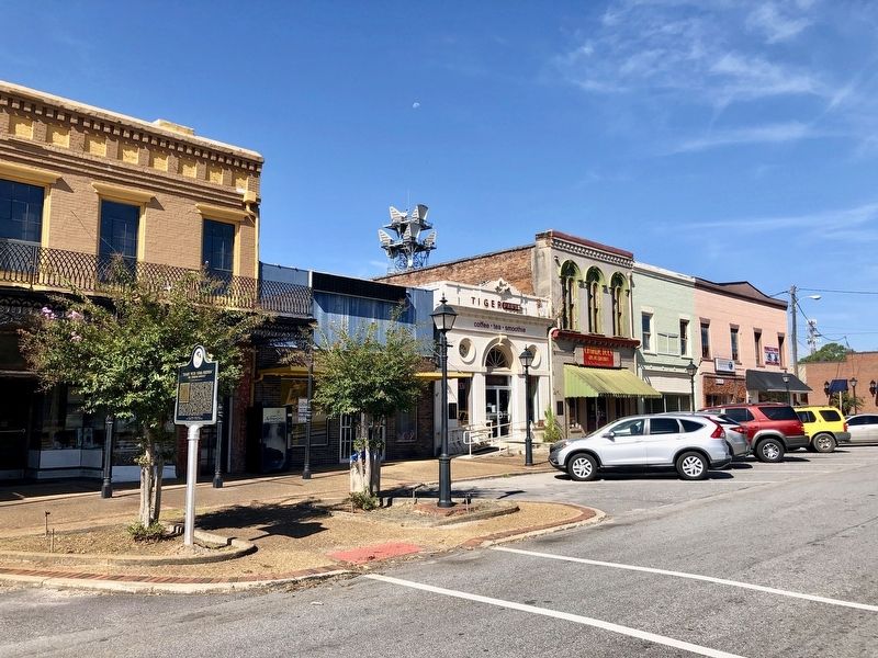
View of marker and some of the current businesses nearby.
On Westside Street south of West Northside Street, on the left when traveling south.
In 1957, local government officials in Tuskegee, Alabama sought to gerrymander the city's limits in an attempt to diminish the number of black votes in upcoming elections. Alabama state senator Sam Engelhardt sponsored Act 140, which transformed . . . — — Map (db m139876) HM
On West Montgomery Road east of Peyton Road, on the right when traveling west. Reported missing.
Churches within the African American community played an important role during the civil rights movement. They were places beyond control of white power structure, as well as locations where people could express themselves without reprisal. They . . . — — Map (db m139884) HM
On North Church Street north of West Martin Luther King Highway (U.S. 80), on the left when traveling north.
Before the mid-1960s, Tuskegee’s black population faced many challenges when attempting to register to vote. Furthermore, the State of Alabama redrew the town’s political boundaries in an effort to prevent registered blacks from voting in local . . . — — Map (db m69048) HM
On South Bayou Street at Church Street, on the left when traveling south on South Bayou Street.
This congregation originated in 1842 with a group of slaves who worshipped in their masters' church, a Methodist congregation. They were required to move to a small house provided for them. Their perseverance and faith held them together through . . . — — Map (db m86573) HM
On South Holt Street at Stone Street, on the right when traveling south on South Holt Street.
As the social and cultural epicenters of Montgomery's black
communities in the 1950s and 1960s, black churches also played a
political role, providing sanctuary and strength against discrimination
On December 5, 1955 following the first day of . . . — — Map (db m91464) HM
On North Perry Street at Madison Avenue, on the right when traveling north on North Perry Street.
Elijah Cook
Educator, Businessman, Lawmaker
Born a slave in Wetumpka in 1833, Elijah Cook became a leader in Montgomery’s African American community. Credited with helping to establish the city’s first school for blacks in the basement . . . — — Map (db m69222) HM
Role of MIA
The Montgomery Improvement Association (MIA) was founded on December 5, 1955, to implement the 382-day Montgomery Bus Boycott that jumpstarted the 20th-century Civil Rights Movement. The MIA, as its name suggests, remains dedicated . . . — — Map (db m129484) HM
Side 1
Located in the heart of one of Montgomery's historic African-American neighborhoods. Mount Zion A.M.E. Zion Church was constructed in 1899 and heavily remodeled in 1921. It served as a significant center for religious, political, and . . . — — Map (db m86411) HM
On Holcombe Street at Mildred Street, on the right when traveling north on Holcombe Street.
This congregation was organized by the Court Street Methodist Church in the early 1850s. The latter group offered their 1835 wood frame building to the black members if they would relocate it. In 1852 the church was moved to this site under the . . . — — Map (db m168917) HM
On South Jackson Street at High Street, on the right when traveling south on South Jackson Street.
Side 1
South Jackson Street
Long a home to African-American professionals, politicians, and businessmen, South Jackson Street is in the heart of Centennial Hill, a neighborhood which developed in the 1870s. One block north at . . . — — Map (db m71354) HM
On Oak Street, 0.1 miles south of Lincoln Terrace, on the right when traveling south.
The civil rights movement in Montgomery was born from the support
of both organized groups and individual residents. The day-in-day-out support came from local citizens, who were guided by groups on both the local and the national level.
The . . . — — Map (db m91467) HM
On Old Wetumpka Highway (County Road 74) 0.2 miles south of Brooks Road, on the left when traveling south.
In 1881, former slaves Gadson Draw, Frank Felder, Eli Madison, Kate Marshall, and Killis Marshall founded this church. Rev. Solomon S. Seay, Sr., pastor from 1928-1929, was a stalwart in the Civil Rights Movement and served as the third president of . . . — — Map (db m158657) HM
On Paul W Bryant Drive east of 2nd Avenue, on the left when traveling east.
In 1883 the Castle Hill Real Estate and Manufacturing Company began the first eastern expansion of the original 1821 Tuscaloosa city limits. Hoping to stimulate development in the area, the company created a popular amusement park centered around . . . — — Map (db m35467) HM
On 22nd Avenue at 11th Street, on the right when traveling north on 22nd Avenue.
Organized 1866, the first Black Methodist Church in Tuscaloosa. First house of worship, a rented building, was located where Denny Stadium now stands. First structure built by the church completed 1878. Present structure erected 1881, exterior brick . . . — — Map (db m203547) HM
On Broad Street at William Street, on the left when traveling south on Broad Street.
On this site, on a spring evening in 1834, a violent mob descended on a small group of Middletown residents who had come together to work towards abolishing slavery. The abolitionists, both black and white citizens, were members of the newly . . . — — Map (db m71118) HM
On Cross Street at Warren Street, on the right when traveling east on Cross Street.
About 1828, a handful of Middletown's black residents gathered to worship in the home of Asa Jeffrey, a sea man who lived on Cross Street almost opposite here. The group formed the African Methodist Episcopal Zion Church, Middletown's first black . . . — — Map (db m98689) HM
On Hempstead Street just north of Garvin Street, on the left when traveling north.
The history of 66 Hempstead Street as a site of Black self-help, fellowship and celebration is more than a century long. In the late 19th century, it housed a Black church and social hall before reverting to its original use as a factory. In . . . — — Map (db m227211) HM
On East 7th Street at Spruce Street, on the left when traveling east on East 7th Street.
Zion Church in New York City, organized in 1796, was the catalyst by which the African Methodist Episcopal Zion denomination was established in 1821. By the 1870’s a number of Wilmington residents had affiliated themselves with this growing . . . — — Map (db m11011) HM
On Hunt Place Northeast just west of 46th Street Northeast, on the right when traveling west.
Lewis Giles, Sr. (1894-1974) was an influential Washington architect who designed this Colonial Revival/craftsman style house in 1929. He lived here the rest of his life, and worked in his home office.
Giles graduated from Armstrong . . . — — Map (db m187369) HM
On T Street Northwest at North Capitol Street Northwest on T Street Northwest.
St. Martin of Tours Catholic Church celebrated its first Mass in 1901 in a nearby mansion. Father Eugene Hannan, a graduate of Gonzaga High School just south of here, founded St. Martin's to serve the growing Catholic population that dated to . . . — — Map (db m130841) HM
On North Capitol Street Northwest at R Street Northwest on North Capitol Street Northwest.
Organized 1832.
2nd Church Built 1833.
Admitted to Philadelphia-Baltimore Conference, 1837.
3rd Church Built 1888.
Relocated present site, 1956.
Bishop Raymond Luthe Jones, Presiding Bishop, 4th Episcopal District.
Dr. William B. . . . — — Map (db m11042) HM
On 14th Street Northwest at Church Street Northwest, on the left when traveling north on 14th Street Northwest.
Etched into the corner of the building next to this sign are the names of cars and trucks sold here back when showrooms lined this stretch of 14th Street. Hurley Motor Company, which opened here in 1920, sold Milwaukee-made Nash cars and . . . — — Map (db m110913) HM
On 14th Street Northwest at Corcoran Street Northwest, on the right when traveling north on 14th Street Northwest.
United States
Department of the Interior
National Park Service
National Register
of Historic Places
John Wesley A.M.E. Zion Church
"The National Church of Zion Methodism"
14th and Corcoran Streets, NW
Washington, . . . — — Map (db m110914) HM
On M Street Northwest west of 6th Street Northwest, on the right when traveling west.
Along this block is the world headquarters of the United House of Prayer for All People. Founded in 1919 in Massachusetts by Charles M. “Sweet Daddy” Grace, the church moved its headquarters to Washington in 1926. Soon after, it purchased a . . . — — Map (db m130896) HM
On Whitehead Street (U.S. 1) at Angela Street, on the right when traveling east on Whitehead Street.
Founded in 1864, Cornish Chapel members began building their church in 1885. Designed to resemble European cathedrals, it served as a place of worship, school, and refuge during inclement weather. The foundation was quarried from the site and its . . . — — Map (db m101245) HM
On Julia Street at Whitehead Street, on the right when traveling north on Julia Street.
This place of worship was named for Saint Stephen who is recognized as the first Christian martyr. He was stoned to death for his views on poverty and the role of the early church. The structure is built from locally quarried limestone and coral . . . — — Map (db m222629) HM
On East Wabash Street west of Oaklawn Drive, on the right when traveling east.
Side 1
Union Academy was the fulfillment of the dream of local African American pioneers seeking to advance the moral and cultural welfare of young people through education. By the 1870s, west Bartow's First Providence Missionary Baptist . . . — — Map (db m146231) HM
On North Blackford Street at West Michigan Street, on the right when traveling south on North Blackford Street.
Jones Tabernacle African Methodist Episcopal Zion Church, the fourth oldest African American church in Indianapolis, ministered to this neighborhood for almost a century. Organized in 1872, the church was named in honor of the Right Reverend . . . — — Map (db m132757) HM
On North Church Street at Oates Street, on the left when traveling north on North Church Street.
Founded in 1868 by Rev. Anthony Bunche, Zion Temple A.M.E. Zion Church is the oldest African-American church in Hopkins Co. It was established in an old log schoolhouse given by abolitionist Hubbard Lunsford. The current site was purchased in 1878. . . . — — Map (db m171905) HM
On East 7th Street at South Main Street, on the right when traveling west on East 7th Street.
Church became known as a temple after a news story praised its windows during 1917 renovation. Its first pipe organ was provided by matching funds from Andrew Carnegie. Here, on Christians Heritage Day 1965, Logan Countians honored the memory of . . . — — Map (db m123353) HM
On East Brashear Avenue just west of North 1st Street, on the right when traveling east.
This 24th bishop of A. M. E. Zion Church was born in Bardstown and educated under church auspices. Local A.M.E. Zion Church sponsored him for ministry. Licensed to preach, 1877; elected bishop, 1892. Served as president of National Afro-American . . . — — Map (db m171594) HM
On North Washington Street at Beall Avenue when traveling north on North Washington Street.
In 1867, several of Rockville's African American families left Jerusalem Methodist Episcopal Church to start the African Methodist Episcopal (A.M.E.) Zion Church under the leadership of Reverend Charles Pipkins.
In 1890, Pipkins and his . . . — — Map (db m101921) HM
On North Washington Street at Beall Avenue, on the right when traveling north on North Washington Street.
[The marker features a set of panels that are sections of a mural:]
European map of this geographic area, attributed to John Smith, 1608. People lived here for ten thousand years or more before the European . . . — — Map (db m174783) HM
1866 - First Baptist. The year after the Civil War ended, 19 African American residents of Webster Groves organized First Baptist Church of Webster Groves. In May of 1866 the land for First Baptist was purchased from William Porter. In November . . . — — Map (db m191871) HM
On Atlantic Street, on the right when traveling west.
First African American Church in Hackensack. Organized in 1864 as “Olive Branch Colored Mission Number Three of Hackensack.” First church was an old lime shed moved here in 1867. In 1917 current name was adopted in honor of the first Bishop of the . . . — — Map (db m7223) HM
On Broadway at Crittenton Street, on the right when traveling north on Broadway.
This building was constructed in 1874 and enlarged in 1884 by the Belleville Avenue Congregational Church. It was designed in high Victorian Gothic style by William Appleton Potter. Clinton Memorial African Methodist Episcopal Zion Church purchased . . . — — Map (db m50853) HM
On Cliff Street, on the right when traveling east.
On this site stood the St. Thomas A.M.E. Zion Parsonage. From 1910 to 1925, it was the home of Paul Robeson, noted actor, singer, scholar, athlete and humanitarian. — — Map (db m49969) HM
On Broad Street at Orchard Street on Broad Street.
Florence Spearing Randolph, born in Charleston, South Carolina on August 9, 1866 was an African-American A.M.E. Zion (Methodist) minister and social activist. She served as Pastor of Wallace Chapel A.M.E. Zion Church, Summit City, from 1925 to 1946. . . . — — Map (db m94510) HM
(Top plaque) Wallace Chapel A.M.E. Zion Church Summit, New Jersey has been listed on the New Jersey and National Registers of Historic Places by the United States Department of the Interior.
(Bottom plaque) Wallace Chapel A.M.E. Zion Church . . . — — Map (db m94511) HM
On Hawley Street east of State Street (Route 434), on the left when traveling west.
Fugitive slaves were aided
on the Underground Railroad
at this site.
Dr. S. Hand house & nearby
A.M.E. Zion and A.M.E. Bethel Church — — Map (db m101993) HM
Founded in 1840
stood 300 feet west of here
played a role in the
underground railroad &
was a center of Elmira's
African-American Community — — Map (db m66950) HM
On Main St. E. at St. Paul, on the right when traveling west on Main St. E..
Austin Steward, a freed slave, settled in Rochesterville in 1817, where he opened a butcher shop. In 1818, he constructed a two-story building on this site for his expanding grocery and dry goods store. Steward was a strong advocate of temperance . . . — — Map (db m55772) HM
On South Avenue, 0.2 miles north of Rockingham Street, on the left when traveling north.
Underground Railroad Sites
Rochester's proximity to Lake Ontario afforded runaway slaves a direct route to freedom in Canada. Hundreds of runaway slaves were "conducted" from one "station" to another along this secret network of escape routes . . . — — Map (db m65156) HM
On Union Avenue at Grand Boulevard, on the right when traveling east on Union Avenue.
Founded in 1834 by freed men and women
as the New Light Baptist Church, this is the second
religious institution in Westbury.
It was renamed Westbury A.M.E. Zion Church in 1892
The first edifice at this location was built in 1867
Rebuilt . . . — — Map (db m133860) HM
John Street Church is the oldest Methodist Society in continental America and is the mother church of American Methodism. The Society was organized in New York in 1766 by Philip Embury, and ardent Irish Methodist and former Wesleyan preacher who . . . — — Map (db m19721) HM
On South Townsend Street north of East Genesee Street (New York State Route 92), on the left when traveling north.
”… numbers of persons, who have never felt any interest in the cause of the slave, before, now seem to have all their sympathies awakened, in his behalf.” —from Diary of Ellen Birdseye Wheaton (Boston, 1923) . . . — — Map (db m138793) HM
On East Jefferson Street at East Onondaga Street, on the left when traveling east on East Jefferson Street.
The Underground Railroad: What Was It? Traveling by foot, wagon, boat, or railroad, between 100,000 and 150,000 African Americans sought freedom in Mexico, Canada, the Caribbean or the northern U.S. before the end of U.S. slavery in 1865. . . . — — Map (db m138801) HM
On East Genesee Street (New York State Route 92) at Pine Street, on the right when traveling west on East Genesee Street.
"What is life to me if I am to be slave in Tennessee? My neighbors! I have lived with you many years… My home is here, my children were born here… I don't respect this law — I don't fear it — I don't obey it! It outlaws me, and I . . . — — Map (db m138792) HM
On North Salina Street (U.S. 11) south of Butternut Street, on the right when traveling south.
”A strictly honest man…”
Born about 1807 in Oneida County, Prince Jackson was one of the earliest African American settlers in Syracuse and the earliest to have a documented deed for property. He came to Syracuse about 1827, married . . . — — Map (db m138798) HM
On Lodi Street east of Douglas Street, on the left when traveling east.
By the 1820s and 1830s, families such as the Allens, Jacksons, Reeds, Robinsons, Thompsons, Wales, and Wandells formed a coherent black community.
Rose Hill Cemetery
Established in 1841, Rose Hill was the burial place of many . . . — — Map (db m138800) HM
This church built in 1897
is successor to the Skunk
Hollow Mountain Church of
1856 (Methodist Episcopal
Church of Coloured People)
and the 1865 Swamp Church
of Palisades (an A.M.E. Zion
Church), both organized
by the Reverend . . . — — Map (db m84065) HM
St. David AME Zion Cemetery
ca 1857. Final Resting place
of early settlers. African
Americans, Native Americans
and European Ancestry. — — Map (db m133065) HM
On Front Street near King Street, on the right when traveling south.
This site marks the former location of the Bath African Methodist Episcopal Zion Church. The AME Zion denomination, chartered in New York City in 1801, began in the 1790s when discrimination against African American Christians forced them to . . . — — Map (db m65673) HM
On Broad Street (U.S. 17) at George Street, on the right when traveling west on Broad Street.
Asst. Superintendent Public Instruction, 1868-70; a founder Livingstone College, 1885; Bishop A.M.E. Zion Church; founded St. Peters, 1864. One blk. N. — — Map (db m24053) HM
During the Civil War, thousands of enslaved blacks freed themselves by escaping to Union lines. Craven County native William Henry Singleton (1843-1938) was one of them. According to his biography, Recollections of My Slavery Days (1922), as . . . — — Map (db m24054) HM
1. Cool Spring
Cool Spring is located on the south bank of Cross Creek, which winds its way through downtown Fayetteville. The spring was the primary soucre of water first for Native Americans and subsequently for the European pioneers. It . . . — — Map (db m31149) HM
On North Virginia Dare Avenue (U.S. 64/264) at Russel Twiford Road, on the right when traveling west on North Virginia Dare Avenue.
Agent of the American Colonization Society in Liberia, founded the A. M. E. Zion Churches in Albemarle area. His first church, 1865, near here. — — Map (db m9462) HM
On West St. James Street near Main Street (Business U.S. 64).
Editor of A.M.E. Zion Church papers; orator; a delegate to Methodist world conference; customs collector of Wilmington. Home stood 3 blks. E. — — Map (db m45347) HM
On East Granville Street near St. David Street, on the right when traveling east.
St. Paul A.M.E. Zion Church was organized
on the fourth Sunday in March 1866 under
the leadership of George C. Caine.
The house of worship was erected on the
corner of St. David and Granville Streets
in 1869.
We are grateful to . . . — — Map (db m46638) HM
The Moravian Church is a Protestant denomination tracing its roots to the followers of Jan Hus. A Czech priest and reformer, Hus was martyred for his faith in 1415. The Moravians founded a church body dedicated to a simple and devout life. For . . . — — Map (db m140201) HM
On Bethania Rural Hall Rd. at Turfwood Drive, on the left when traveling north on Bethania Rural Hall Rd..
The community established along this road in the Bethania Town Lot was built by African-American men and women who began acquiring land here following the Civil War. Many of these people had been enslaved on the Oak Grove plantation, from which they . . . — — Map (db m52538) HM
On Shallowford Road at Tuscany Drive, on the left when traveling north on Shallowford Road.
New Hope Church is the oldest continuing African Methodist Episcopal Zion Church within the Township of Lewisville. This church is among the oldest AME Zion congregations in Forsyth County. — — Map (db m54288) HM
On Martin Luther King Junior Drive at E Bragg Street, on the right when traveling north on Martin Luther King Junior Drive.
[ Upper Marker ]
Dr. Martin Luther King, Jr.
by Wilbur Lee Mapp
1994
[ Main Marker ]
Dr. Martin Luther King, Jr., planned to speak at Trinity AME Zion Church in Greensboro (a few blocks from here) on April 4, 1968. He canceled his . . . — — Map (db m219603) HM
On Underhill Street just north of East Washington Drive, on the right when traveling north.
John Coltrane (b.1926 - d.1967), world renowned jazz saxophonist and composer of the suite "A Love Supreme", lived with his extended family at 118 Underhill St. from 1928-1943. His family was headed by his maternal grandfather, Rev. W.W. Blair, who . . . — — Map (db m172052) HM
On South Hamilton Street at East Commerce Avenue, on the right when traveling north on South Hamilton Street.
Growing Up in High Point
John Coltrane was born in Hamlet, North Carolina, on September 23, 1926. He was an infant when his family moved to High Point. For most of his youth Coltrane lived with extended family in his grandparents' house on . . . — — Map (db m175493) HM
Near Metropolitan Avenue, 0.1 miles south of Charlottetowne Avenue, on the right when traveling south.
Noted African-American businessman and civic leader Thaddeus (Thad) Lincoln Tate contributed significantly to the betterment of the Charlotte community in the early to mid-20th century.
From the 1890s to the 1940s, Mr. Tate owned the Uptown . . . — — Map (db m126031) HM
Near Beatties Ford Road north of Sample Road, on the right when traveling north.
The door to your left was called the “servant entrance”. Actually it was the entrance and exit for slaves who were members of the church. Presbyterians rarely used the term “slave” preferring “servant”. The door . . . — — Map (db m63273) HM
On East Innes Street just east of South Main Street (U.S. 29/70), on the right when traveling east.
William Valentine, a free man of color, was born in North Carolina and lived in Salisbury for a number of years. His home on East Bank Street, purchased before the Civil War, was located just outside the gates of the Confederate States Military . . . — — Map (db m175794) HM
On Martin Luther King Jr Blvd / Perkins Street (Ohio Route 59) at Prospect Street, on the right when traveling west on Martin Luther King Jr Blvd / Perkins Street.
This church, founded in 1866, is the oldest Black congregation in Akron. After worshipping in several locations, the congregation held a fund-raiser to help finance the construction of a permanent home. The person collecting the most money had the . . . — — Map (db m43501) HM
On W High Street at S Franklin Street, on the right when traveling west on W High Street.
On this corner stood the only building built for the sole purpose of educating the Colored children of the Borough of Gettysburg. In 1834 Pennsylvania mandated public education. On September 19, 1934, citizens of Gettysburg met and chose six . . . — — Map (db m75467) HM
On South Washington Street at Breckenridge Street, on the right when traveling south on South Washington Street.
St. Paul's A.M.E. Zion Church, erected in 1917, is the third church to be used by Gettysburg's oldest African American congregation—founded ca. 1838 in a small frame building on nearby Franklin Street. Members of this congregation have long . . . — — Map (db m130259) HM
On Long Lane at Kuhn Alley, on the right when traveling north on Long Lane.
The first half-acre of this cemetery was purchased in 1867 by a society of Black men calling themselves the “Sons of Goodwill,” and for many years this place was called the “Goodwill Cemetery.” The minutes of the Sons of . . . — — Map (db m18029) HM
On East End Avenue just south of 3rd Street (Pennsylvania Route 68), on the right when traveling north.
Among the earliest settlers in the county were the slaves Fortune and Lunn, who were brought here by Levi Dungan around 1772. Many of the later African Americans who either eventually settled or passed through Beaver County came as they followed . . . — — Map (db m177037) HM
On Walnut Street at Commonwealth Ave., on the left when traveling east on Walnut Street.
In the 1850's this area, known as Tanner's Alley, was important on the Underground Railroad. Fugitive slaves hid at Joseph Bustill's & William Jones's houses, a block apart. Frederick Douglass & William Lloyd Garrison spoke at Wesley Union AME Zion . . . — — Map (db m6693) HM
On Walnut Street at Fourth Street, on the right when traveling east on Walnut Street.
Harrisburg's prominent role in the advance of the Union cause leading to the Civil War was particularly evident by its sympathy in harboring former slaves who had escaped servitude from the South. As early as 1836, the Harrisburg Anti-Slavery . . . — — Map (db m168922) HM
On Lincoln Street at Carlisle St., on the left when traveling north on Lincoln Street.
Abolitionist, minister, orator, editor, educator. Born in New York City; traveled in the U.S., Canada, and Britain on behalf of antislavery and free Blacks. General Secretary, A.M.E. Zion Church. Lived after 1870 in Harrisburg, where he edited the . . . — — Map (db m7161) HM
A landmark of central Pennsylvania's African American history. Established in 1827 by Wesley Union A.M.E. Zion Church. Among those buried here are T. Morris Chester, William Howard Day, Catherine McClintock, and at least 20 veterans of the Civil War. — — Map (db m7111) HM
This African-American evangelist opened a mission about 1900 at 738 North Penn Street, where she preached until her death. In 1914 her mission became the first home of St. James A.M.E. Zion Church, which was built at this location in 1936. — — Map (db m85358) HM
On Lombard Street west of South 15th Street, on the left when traveling west.
Founded in 1820 and vital in the formation of the A.M.E. Zion denomination, "Big Wesley" hosted anti-slavery meetings at its first location. At this site since 1885, the church has been a leader in civil rights, equal employment, and social justice . . . — — Map (db m191621) HM
On Camp Welfare Road, 2.5 miles south of Wateree Road, on the right when traveling north.
[Front]
This camp ground, described by one journalist as "picturesque, rugged, simple, with an overhanging air of festivity," has hosted an annual camp meeting since 1876; slaves had worshipped here before the Civil War. The site was . . . — — Map (db m14613) HM
On Mt Carmel Road, 0.2 miles south of Bayspring Road, on the right when traveling south.
(side 1)
According to local tradition, this African Methodist Episcopal Zion Campground was established c.1870. Instrumental in organizing the campground was former slave Isom Caleb Clinton, who was ordained Bishop of the church in 1892. . . . — — Map (db m235432) HM
On Clinton School Road at East Barr Street, on the right when traveling north on Clinton School Road.
[Marker Front]:
More than 300 members of Lancaster's black community are buried here, with the first grave dating to 1864. Originally the Clinton family cemetery, it was donated to Mt. Zion A.M.E. Church in 1960 by Dr. John J. Clinton . . . — — Map (db m23835) HM
On East Barr Street at Clinton Avenue, on the left when traveling east on East Barr Street.
[Marker Front]:
Located on this site, Lancaster Normal and Industrial Institute for black students was incorporated in 1905; M. D. Lee was president and J. G. McIlwain chairman of the board. By 1912, the school was offering both elementary . . . — — Map (db m23834) HM
On Crawford Road at Heckle Boulevard (South Carolina Highway 901), on the left when traveling south on Crawford Road.
Clinton Junior College, affiliated with the A.M.E. Zion Church, was founded in 1894 by Revs. Nero Crockett and W.M. Robinson as Clinton Institute. Named for Bishop Isom C. Clinton, it featured primary and secondary courses as well as a two-year . . . — — Map (db m24870) HM
On Allison Creek Road (County Road 1081) 0.1 miles east of Hands Mill Highway (State Highway 274), on the left when traveling east.
Allison Creek Presbyterian Church. This church was founded in 1854 by residents of the Clay Hill community on Allison Creek, who were members of Bethel (1769) and Ebenezer (ca. 1785) Presbyterian churches. They built this church soon . . . — — Map (db m175696) HM
On Upper East Valley Road (Tennessee Route 209), on the right when traveling south.
The Pikeville AME Zion Church is the oldest African-American church still operating in Bledsoe County. The core of the church building dates from about 1870 when it served as the Freedmen's Bureau school. The AME Zion congregation's use of the . . . — — Map (db m184534) HM
On West Summer Street (Business U.S. 11E) at Floral Street, on the left when traveling west on West Summer Street.
In 1887, with assistance from the African Methodist Episcopal Zion Church, the George Clem School was organized as Greeneville College. In 1932, the Greeneville Board of Education leased the property to provide public education for Negroes. Three . . . — — Map (db m90597) HM
On North Jackson Street (Business U.S. 11) at Knoxville Avenue, on the right when traveling north on North Jackson Street.
Freedom had been a long time coming for three to four million African American men, women, and children. During a period of turmoil and strife in antebellum America, when racism and discrimination were widely prevalent, enslaved African Americans . . . — — Map (db m177917) HM
On Holland Lane at Jamieson Avenue, on the right when traveling north on Holland Lane.
[Plaque on the left side of the entrance:]
From the establishment of Alexandria in 1749 to the present time, African Americans have been a vibrant part of this city's history. The City of Alexandria would not exist in its present form were . . . — — Map (db m131547) HM
Near South Kenmore Street north of 24th Street South, on the right when traveling south.
African American residents struggled through segregation and also faced challenges during the integration of Arlington Public Schools. Therefore, leaders sought solutions to accommodate the increasing population as schools and housing were . . . — — Map (db m214459) HM
On 24th Road South west of South Glebe Road (Virginia Route 120), on the right when traveling east.
The Little Zion Congregation was organized in 1866 by residents of Freedman's Village. The congregation purchased this site in 1874. In 1867, T.H. Lomax was elected Bishop of the AME Zion Church and assigned to the Washington, D.C. area. The Little . . . — — Map (db m130988) HM
On South Four Mile Run Drive at South Shirlington Road, in the median on South Four Mile Run Drive.
The Nauck community has a long and diverse history. The area that now comprises the Nauck neighborhood was originally granted to John Todd and Evan Thomas in 1719. The land was later acquired by Robert Alexander and sold to John Parke Custis in . . . — — Map (db m2504) HM
Near South Kenmore Street just north of 24th Street South, on the right when traveling south.
Churches fulfilled a critical role in the growth and development of Green Valley. They served as social and spiritual anchors while providing sanctuary for generations of residents.
[Captions:]
The Methodists were the first . . . — — Map (db m214455) HM
106 entries matched your criteria. The first 100 are listed above. The final 6 ⊳