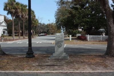
Following the death of
President George Washington
on December 14, 1799, local
citizens and members of
Camden Lodge #16 planted
six oak trees in a
memorial service honoring
this famous Statesman,
Soldier and Free Mason. This . . . — — Map (db m63927) HM
Near here stood Mulberry Grove, plantation home of General Nathanael Greene and Catherine Littlefield Greene. President George Washington twice visited the widowed Mrs. Greene at Mulberry Grove during the Southern tour of 1791. Traveling downriver . . . — — Map (db m18640) HM
(Panel one)
British Military Force Threatens the United States In the early years of the 19th century, the United States was a fledgling nation with
a population of 7,700,000, a standing army
of 6,700, and a navy of only 12 ships. . . . — — Map (db m25014) HM
These bronze cannon were presented to the Chatham Artillery by President Washington after his visit to Savannah in 1791. Of English and French make, respectively, they are excellent examples of the art of ordnance manufacture in the 18th century. . . . — — Map (db m5519) HM
During his visit to Savannah May 12-15 1791 was a guest at the Inn which stood on the northwest corner of Barnard and State Streets. This tablet is placed in commemoration of the bi-centenary of his birth by the Daughters of the American Revolution . . . — — Map (db m241960) HM
First Constitutional Session
of the Georgia Legislature
held in the "Long Room"
Jany 1783
Headquarters
Genl George Washington
May 1791 — — Map (db m6470) HM
In 1775 John Berrien of New Jersey came to the province of Georgia, where one of his mother's kin had previously settled. His father, John Berrien (1711-1772), was a judge of the supreme court of New Jersey and a trustee of Princeton College. From . . . — — Map (db m5341) HM
Where colony's production of silk was reeled until 1771. Building then used for public purposes. President Washington attended a ball here in 1791.
Building destroyed by fire in 1859. — — Map (db m9391) HM
During his Southern tour of 1791, President George Washington attended services at the original Christ Church on Sunday, May 15. While in Savannah from May 12-15, Washington lodged at a house on the corner of Barnard and State streets on St. James . . . — — Map (db m5696) HM
Five miles South on this road, George Washington spent Sunday night, May 15, 1791, at the house of "one Spencer." The occasion was Washington's Southern tour, and he was traveling in his carriage over this road from Savannah to Augusta.
Four . . . — — Map (db m7688) HM
This was the summer home of Joseph Habersham of Savannah (1751-1815), Georgia patriot, Revolutionary War hero, and political leader. He was a Colonel in the Continental Army, a member of Continental Congress, and of the Georgia Convention that . . . — — Map (db m43697) HM
Commander In-Chief of the American Army 1775–1783
First President of the United States - 1789–1797
First in war, first in peace, first in the hearts of his countrymen
Lyman Hall Chapter – Sons of The American Revolution . . . — — Map (db m87464) HM
“The Beloved Man of the Four Nations” to the Creeks, Benjamin Hawkins (1754 - 1816) was appointed Indian agent by President Washington. Soldier, Congressman, Senator, he determined with firmness and kindness to guide the Indians toward . . . — — Map (db m33030) HM
This is the site of the old Planter's Hotel, which was burned in 1839. There the Marquis de LaFayette was entertained during his visit to Augusta in March 1825. LaFayette landed at Savannah on March 19th and traveled to Augusta with Governor Troup . . . — — Map (db m35526) HM
400 feet west of here is Meadow Garden, home of George Walton, Revolutionary Patriot and soldier, Governor, Congressman, Senator, Jurist. With Button Gwinnett and Lyman Hall, he signed the Declaration of Independence, July 4, 1776, for the State of . . . — — Map (db m33358) HM
Robert Forsyth was the first law enforcement officer killed in the line of duty. Captain of Light Dragoons in Henry "Light-Horse Harry" Lee's cavalry during the Revolutionary War, Forsyth had been appointed the first marshal for the District of . . . — — Map (db m10164) HM
During his Southern tour of 1791, President George Washington visited Augusta--at that time Georgia's capital--from May 18-21. Washington met with Governor Edward Telfair and other "principal gentlemen of the place," including George Walton and . . . — — Map (db m9708) HM
"Monday, May 16th, 1791" wrote President George Washington in his diary as he recorded the date of his lodging in the Inn of Stephen Calfrey Pearce, 200 yards [from] this marker. Being forewarned, the Pearces had made lavish preparation for the . . . — — Map (db m16434) HM
President Washington passed here early on the morning of Tuesday, May 17th, 1791, enroute to the home of William Skinner with whom he had breakfast. The Skinner home, still standing (1953), is about 5 miles northwest. President Washington spent the . . . — — Map (db m7795) HM
Early settlers of Johnson County included patriots of the Revolutionary War. With this Historical Marker we commemorate the following veterans.
Daniel Chapman - Born July 25, 1756 in Westchester County, New York. Daniel Chapman served the . . . — — Map (db m146585) HM WM
Theodore Roosevelt Letter On Cuba
On January 22, 1907, President Theodore Roosevelt wrote to Secretary of War William Howard Taft rejecting the idea of a protectorate over Cuba and expressing his determination that the United States should . . . — — Map (db m169581) HM
The Battle of Kekionga in October 1790 was the first battle fought by the United States Army after the War for Independence. The campaign had been ordered by President Washington against the Miami settlement of Kekionga, the center of Indian . . . — — Map (db m21497) HM
Chief Little Turtle was one of the most feared and respected leaders during the frontier wars of the 1780s and 1790s when Fort Wayne was born. Known to his people as Meshekinnoquah, Little Turtle is thought to have been born in 1752 in a village . . . — — Map (db m21503) HM
Established by George Washington and first designated as The Badge of Military Merit, the Purple Heart is awarded in the name of the President of the United States to any member of the Armed Forces who, while serving under competent authority in . . . — — Map (db m161518) HM WM
In grateful appreciation for the heritage of our forefathers, this monument and its contents are dedicated to those generations yet to come. Time capsule to be opened July 4, 2076 — — Map (db m238399) HM
Beneath this stone is buried a capsule containing papers and items used in celebrating the American Revolution Bicentennial in Johnson County, Kansas. Placed on this Thanksgiving Eve November 24, 1976 A.D. by the Johnson County Bicentennial . . . — — Map (db m69376) HM
During the 1700’s, the political and economic interests of the colonists began to enlarge and disputes began to develop with Great Britain. After the defeat of the French and their expulsion in 1763, the colonists could focus even more of their . . . — — Map (db m56943) HM
With the signing of the Declaration of Indepenence, the Grand Union was automatically promoted to the status of a national banner and at the same time rendered obsolete. The British ties were snapped and the crosses of St. Andrew and St. George in . . . — — Map (db m56946) HM
The first President of the United States was an avid horseman and outdoorsman, as befit his era, and he at times was a participant in horse racing. The cherished tale of his Magnolia running against a horse owned by Thomas Jefferson was refuted by . . . — — Map (db m58334) HM
For Robert R. Livingston, 1746-1813 N.Y. provincial convention 1775; Continental Congress 1775-77, 1779-81; one of the committee to draft the Declaration of Independence. Sec. of Foreign Affairs, 1781-83. Administered oath to Washington, first . . . — — Map (db m159390) HM
On May 21, 1825, during a third, triumphal, visit to America, the Marquis de la Fayette, 67, visited Maysville. In appreciation for his services on General Washington's staff, and a commander of American troops, the town rolled out the red carpet . . . — — Map (db m83971) HM
Oldham was the 75th county created by the Kentucky Legislature. It was formed on January 15, 1824, from portions of Jefferson, Henry and Shelby Counties. The county is named for William Oldham, Revolutionary War patriot and early pioneer.
. . . — — Map (db m136163) HM
Unanimously elected
Commander in Chief of the Continental Army (1775-1783)
President of the Constitutional Convention (1787)
President of the United States of America (1789-1797)
A gift to the people of Louisiana by
The Louisiana . . . — — Map (db m113864) HM
Fort Cumberland was garrisoned from 1754 to 1765. During this period, there was bickering between Maryland and Virginia as to how the fort should be maintained and whose control it was under.
In early 1756, Colonel Washington favored a small . . . — — Map (db m17708) HM
Downtown
The Downtown Cumberland Mall is the main shopping and dining district for the city. The brick street is lined with large multi-story commercial buildings, which were built in the late 19th and early 20th centuries. These buildings . . . — — Map (db m139110) HM
Our founding father spent much time in this vicinity when a young man as surveyor, ambassador, aide-de-camp to General Braddock, and commander of Virginia military forces. This cabin served as his headquarters during part of this time.
Young . . . — — Map (db m167057) HM
As colonel under General Braddock at Fort Cumberland during the French and Indian War 1755 - 1758 and as Commander-in-Chief of the American Army in 1794Presented to the City of Cumberland by James Walter Thomas, L.L.D.; Litt.D. dedicated April . . . — — Map (db m17724) HM
On this site originally stood the Headquarters of George Washington, since removed to Riverside Park. He was entertained at David Lynn's house (which later occupied this site) when he came here in 1794 to review the troops during the Whisky . . . — — Map (db m155434) HM
Center Plaque
On October 16, 1794, President George Washington arrived in Cumberland to review about 5,000 troops of the Maryland and Virginia militia gathered here during th Whiskey Rebellion. A few days later, this militia army assembled upon . . . — — Map (db m17456) HM
The fort proper was the bastioned work at the west end of the fort. It was to your left (primarily on the site of the Church of Christ Scientist). Besides the four bastions (b) and the joining walls, there were four buildings for provisions (6), two . . . — — Map (db m167356) HM
By order of Colonel Bouquet, George Washington’s troops opened this road from Fort Cumberland to Reas-town (Bedford, Pa.) during July 1758. Bouquet and Washington conferred half-way between these places July 30, 1758. — — Map (db m166865) HM
Fording place for “Great Warriors Path” from New York to the South. Thomas Cresap built stockade fort here in 1741 used as a refuge during French and Indian War after Braddock’s defeat.
George Washington
was here on his first . . . — — Map (db m447) HM
February 22, 1797: At the Presidential Mansion in Philadelphia, President George Washington formally presented Irish-born John Barry with Commission Number One in the newly formed United States Navy. With the commission, backdated to the . . . — — Map (db m114812) HM
Annapolis' Sister City of Wexford, Ireland, was the boyhood home of John Barry, naval hero of the American Revolution. Barry went to sea as a young boy and advanced to be master of his own vessel. he settled in America and in 1776 joined the . . . — — Map (db m114944) HM
Standing on this spot, General Washington resigned his commission as Commander-in-Chief of the Continental Army on December 23rd, 1783. — — Map (db m17688) HM
“Having now finished the work assigned me, I retire from the great theatre of action.”
After the 1781 victory at Yorktown, some Americans thought the triumphant General George Washington should be crowned the new . . . — — Map (db m114542) HM
Just north of this building, facing Main Street, stood Mann’s Tavern where twelve delegates from five states met in 1786 to discuss commercial problems of the new nation. Their call for another convention in Philadelphia to render the government . . . — — Map (db m130220) HM
On February 20, 1781, George Washington ordered the Marquis de Lafayette with 1,200 men of the newly-established Light Infantry Corps to Virginia to counter Benedict Arnold's raids around Richmond. Lafayette arrived at the Head of Elk on March 3 . . . — — Map (db m170197) HM
Upper Plaque: This oak tree planted in 1967 perpetuates the memory of the original Three Mile Oak which stood nearby as explained in the marker below.
Lower Plaque: Trunk of the Three Mile Oak Under this tree passed General George . . . — — Map (db m2877) HM
Count de Rochambeau’s troops marched over this road from Spurrier’s Tavern to “Scott’s Plantation” (Belvoir) on Sept. 16, 1781 on the way to Yorktown. Washington and Rochambeau had gone ahead Sept. 10–11 on the way to Mt. Vernon. — — Map (db m2890) HM
Cedar Park
Patented to Richard Ewen in 1666 as “Ewen upon Ewenton.” Brick house built c.1697 by Richard Galloway II around earlier frame structure possibly dating back to 1656. Known as “West River Farm” in 18th Century. . . . — — Map (db m65889) HM
Jonathan Rawlings given a license to keep an “ordinary” (tavern) in 1771.
George Washington
dined here September 26, 1773, on his way to the Annapolis races. — — Map (db m3141) HM
1754–1914.
This oldest colonial structure of Baltimore was built in 1754 upon the estate known as “Georgia Plantation”
by
Charles Carroll, Barrister
1723–1783
One of the foremost patriots of . . . — — Map (db m41351) HM
This elm has watched the growth of "Baltimore Towne" for over 100 years, on former estate of John Eager Howard, Revolutionary and 1812 Officer and fifth governor of Maryland. Here, in "Howard's Woods", Count De Rochambeau's troops camped, 1782, . . . — — Map (db m209470) HM
This is a section of
“The General’s Highway”
Route of General Washington’s triumphant journey, December 3-23 1783, New York to Annapolis, to resign as Commander-In-Chief of the first “American Army”. . . . — — Map (db m103114) HM
"This tree dedicated to Colonel James McHenry Secretary of War under Presidents Washington and John Adams and for whom Fort McHenry was named in 1798 when it was offered to the Federal Government." — — Map (db m145548) HM
The Washington Monument is the first major public monument to George Washington. Originally, the Washington Monument was built so George Washington himself could stand on top of the column and look over one of America's great cities, and also keep . . . — — Map (db m7720) HM
To George Washington by the State of Maryland.
Born 22 February 1732. Died 14 December 1799.
To George Washington by the State of Maryland.
Commander in Chief of the American Army, 15 June 1775. Commission resigned at Annapolis, 23 . . . — — Map (db m2391) HM
Our nation never had more at risk than it did in September 1781. The American Revolutionary War—the War for Independence—had raged for nearly six years.
More than 4,000 American and French troops, allied in their fight against the . . . — — Map (db m166496) HM
Newcomers like James McHenry helped shape the future of the new republic. A native of Ireland's County Antrim, McHenry (1753-1816) emigrated to Philadelphia in 1771 where he studied medicine with Benjamin Rush, one of Colonial America's most . . . — — Map (db m6647) HM
Among the illustrious men interred within this enclosure who assisted in the achievement of National Independence in the Revolution and War of 1812 are the following Samuel Chase, 1741 – 1811, Signer of the Declaration of Independence . . . — — Map (db m21364) HM
Laid out and erected as a town by Act of Assembly in 1742 “there being as yet no such place settled at, or near the head of Chesapeake Bay".
George Washington
records many visits to Charlestown in his diary. He lodged here Aug. 10, . . . — — Map (db m144413) HM
Lafayette
embarked his troops March 8, 1781 to capture Benedict Arnold. Returned April 9, began overland march to Virginia April 12, 1781.
Washington and Rochambeau
with their combined forces stopped Sept. 6-7, 1781 on way to . . . — — Map (db m154172) HM
During the Revolutionary War (1775-1783), both
American and British troops passed through Elk Landing.
The American troops were led by
General George Washington, and the British Troops
were led by General William Howe.
You may be on the . . . — — Map (db m152162) HM
Part of Friendship Tract and home of Robert Alexander, delegate to the Provincial Convention of 1774 and to the Continental Convention of 1776. On August 25, 1777, he was host to Washington here and three days later offered allegiance to British . . . — — Map (db m154176) HM
Old Post Road
Established 1666
Lower Susquehanna Ferry
established 1695
Rodgers’ Tavern
where
George Washington
frequently stopped
between
1781–1798 — — Map (db m145429) HM
Patented 5th June, 1685, to Major Peter Sayer, a prominent Catholic. Later acquired by the Heath Family. On 14th May, 1773, George Washington “din’d and lodg’d at Mr. DL. Heath’s” taking his stepson Jackie Custis to King’s College, N.Y. . . . — — Map (db m65392) HM
Visited Warwick Feby. 1756, March 1756. “Din’d and lodg’d at Mr. D’L Heath’s May 1773. Passed through Sept. 9 and Oct. 28, 1774. Breakfasted March 23, 1791 and again in September 1793. — — Map (db m152183) HM
[unreadable] Emphasis is on promoting and keeping the area as it looked in George Washington's day. [unreadable]
[Aside:]
Piscataway Park lies on the Maryland side of the Potomac River about 20 miles south of Washington, DC, . . . — — Map (db m154695) HM
Two miles southwest Washington owned 600 acres of land bought in 1775 and retained until his death. In 1786 he visited this property accompanied by Gen. Smallwood. — — Map (db m6231) HM
Near present bridge was Laidler's Landing, which George Lee deeded to John Laidler in 1760. On main route to Fredericksburg and Williamsburg, it was also called Ledler's and Laidlaw's in George Washington's diary. To the south is Cedar Point, where . . . — — Map (db m176425) HM
Upon arrival of French forces in Newport, Rhode Island in July 1780, Baron Ludwig von Closen, a captain in the Royal Deux-Ponts Regiment, was selected by General Rochambeau as one of his aides-de-camp. Closen accompanied Rochambeau on most of his . . . — — Map (db m62756) HM
The Indian village of Potobac, visited in 1608 by Capt. John Smith, occupied this site. County Seat of Charles County, 1658 - 1895. Washington visited here frequently. Site of St. Columba Lodge No. 11 A. F.& A. M., chartered April 18, 1793. — — Map (db m128824) HM
Daniel St. Thomas Jenifer’s home.
First President of the Maryland
Senate 1777-81. Close friend of
George Washington
who visited here June 3rd, 1763. — — Map (db m1235) HM
One mile from here lived Gen. Wm. Smallwood, commander of the Maryland troops which saved Washington’s Army at Long Island. Governor of Maryland from 1785 to 1788. Washington visited here in 1786. — — Map (db m6081) HM
On August 5 and 6, 1785, and again June 30 and July 1, 1791, was the guest of Thomas Johnson at the latter's manorial residence which stood on the site of the present farm house, about 150 yards east of this point. Thomas Johnson, a member of the . . . — — Map (db m1538) HM
Washington
first took command of the
American Army under the
grandparent of this elm
Cambridge, Mass. July 3, 1775.
———————
Raised by Maryland D.A.R., given
and marked by the American Legion . . . — — Map (db m103414) HM WM
Originally erected 1932 by the Federation of Rural Women's Clubs of Frederick County, MD., as part of a national movement to commemorate the bicentennial of Washington's birth through recognizing places noted in his diary.
Replaced 2016 . . . — — Map (db m102966) HM
The "Point of Rocks" has long served as a distinguishing landmark along the Potomac River. Native Americans, and later colonial settlers and traders, used the vicinity as a home and transportation corridor. River transportation and improvements . . . — — Map (db m168024) HM
This boulder, taken from the bed of the improved Rt. 355 (formerly US Rte. 240) previously stood approximately 50 ft to the south at a point where the old Urbana Road/Georgetown Pike (now Araby Church Road) intersects the relocated improved highway. . . . — — Map (db m78432) HM
George Washington stopped here Sept. 26, 1784 on his trip to determine a feasible passage between the Potomac and the Ohio for a canal or easy portage between these rivers as a passage to the Western Territory. — — Map (db m479) HM
General Braddock's 6th camp on the march to Fort Duquesne Saturday and Sunday June 20th and 21st, 1755. Washington was forced to remain behind with a guard on account of "violent fevers" until cured by "Dr. James's Powders (one of the most excellent . . . — — Map (db m135626) HM
General Braddock's 4th camp on the march to Fort Duquesne June 17, 1755. Washington arrived here after Braddock's defeat July 15th, 1755. Washington also stopped here May 9th, 1754, July 7th or 8th, 1754, October 1st, 1770, November 26th, 1770 and . . . — — Map (db m361) HM
The flat land beside the little Youghiogheny River on the western edge of Oakland has two items of historic interest. First, it contains a spring, and according to tradition, George Washington stopped at the spring on the morning of September 26, . . . — — Map (db m68806) HM
General Washington resigned his commission at Annapolis, December 23, 1783. American Revolution officially ended by Congress meeting in Annapolis, January 14, 1783. District of Columbia given to Nation, 1791. Francis Scott Key wrote "The . . . — — Map (db m25) HM
Route of General Washington’s triumphant journey, December 3-23, 1783, New York to Annapolis, to resign as Commander-In-Chief of the first
American Army
Originally erected 1932 by Dorsey Chapter N.S.D.A.R. to commemorate . . . — — Map (db m145385) HM
Council of Safety met here 5 April 1775. Considered as site for county seat 1781
George Washington
passed 6 May 1775 on way to be made Commander-in-Chief of Army
Lafayette
and his troops marched past 15 April 1781 on the way to . . . — — Map (db m1243) HM
Susquehannock Indians
The Susquehannock Indians controlled the upper tributaries of the Chesapeake Bay. John Smith was the first European to encounter them when he explored the Upper Bay in 1608. He described them as "a most noble and . . . — — Map (db m188475) HM
Old Post Road Established 1666. Public Ferry ordered established by the Council of Maryland 1695 for travel between north and south. General Washington and many notable men used this ferry, also, the Continental Army and soldiers of War Between . . . — — Map (db m1275) HM
George Washington stayed here the night of June 5, 1773 on his way back to Mt. Vernon from Columbia College, New York, where he had left his step-son Jackie Custis. — — Map (db m1408) HM
1028 entries matched your criteria. Entries 101 through 200 are listed above. ⊲ Previous 100 — Next 100 ⊳