Near Monroe Street Northwest at Jefferson Street North, on the left when traveling east.
(side 1)
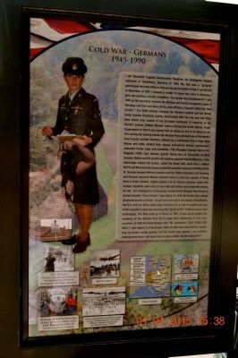
Cold War-Global
1945-
I am Petty Officer Richard Williamson, Jr. I am proud that my dad served on the first nuclear powered fast attack submarine, the USS Nautilus (SSN 571) which set all kinds of records in the 1950s . . . — — Map (db m85491) HM WM
[Written on the initial marker, provided for context]
Our Constitution names the President of the United States the Commander in Chief of all the Armed Forces. Presidents who have served in our military are displayed on the following . . . — — Map (db m92424) HM WM
On West Dewitt Henry Drive (State Highway 367) just west of West Mississippi Street, on the right when traveling west.
This monument pays tribute to the sacrifices made by families who lost a loved one in military services to the United States of America.
The heritage and patriotism of the Beebe community is depicted in the first scene.
The second scene . . . — — Map (db m183679) WM
On Cherokee Road, 1.5 miles east of North General Sherman Way, on the left when traveling north.
Led from Indian Territory by their New England schoolmaster, a band of young Cherokee Argonauts discovered gold here 1850. Town established 1853 when first stores erected by Welsh miners. During heyday of 1875, Cherokee boasted its own theatre, race . . . — — Map (db m234) HM
On Winton Road near California Route 26, on the right when traveling east.
All Americans have a partnership in the "ROCK" at West Point, California.
...It's purpose is to demonstrate the solidarity of the American people in their heartfelt concern and compassion for the 53 fellow Americans taken from the U.S. Embassy . . . — — Map (db m91729) HM WM
Near Redmesa Road, 0.2 miles north of Santa Susana Pass Road, on the left when traveling north.
Garden of the Gods was part of the Iverson Movie Ranch which flourished from 1912 until the late 1960s, the golden era of the "B" Western movies. This site was known as the "most shot up location in movie history."
Hollywood cowboys Rex . . . — — Map (db m127037) HM
On Hollywood Boulevard at Sycamore Avenue, on the left when traveling west on Hollywood Boulevard.
This building comprised five stories when it was
built by prominent Hollywood developer C.E. Toberman
(referred to in his day as "Mr. Hollywood") in 1925.
In 1928, he added the final stories to the Gothic-style
structure. The Academy of Motion . . . — — Map (db m231670) HM
On Hollywood Blvd at North Orange Drive, on the right when traveling east on Hollywood Blvd.
Built in 1927 by a group of celebrities that included Mary Pickford, Douglas Fairbanks and Louis B. Mayer. Site of the first Academy Awards in 1929. A hideaway for Clark Gable and Carol Lombard. Marilyn Monroe did her first commercial shoot by the . . . — — Map (db m167870) HM
On Pier 94 east of the Catalina Air-Sea Terminal Heliport.
Panel 1:
1945:
March: Lane Victory is named for the former slave, Isaac Lane, founder of Lane College, in Jackson, Tennessee. The Victory Ship was one of a class of cargo ships designed and built during World War II by the . . . — — Map (db m131429) HM
On Arnold Avenue, on the right when traveling north.
[Panel 1a:]
The 1930s
With war clouds gathering over the Pacific, in 1936 Congress authorized the construction of the Sacramento Air Depot. The Army Air Corp envisioned that the new depot would support operations on the West Coast, . . . — — Map (db m57199) WM
In commemoration of the historic meeting in Santa Barbara of the reigning monarch of the United Kingdom, Her Majesty Queen Elizabeth II, and His Royal Highness the Prince, Philip, Duke of Edinburgh with the President of the United States, Ronald W. . . . — — Map (db m135686) HM
Dedicated to Ronald W. Reagan, 40th President of the United States of America, for his steadfast commitment to develop and deploy missile defenses to protect our nation, our forces, our allies and friends.
"Wouldn't it be better to save lives . . . — — Map (db m98728) WM
On Notre Dame Avenue near West St. John Street, on the right when traveling south.
[ Main Marker: ]
International Business Machines : RAMAC
In 1952, IBM sent Reynold Johnson to San José to open its first West Coast development laboratory to research new data storage methods. At this site in 1955, IBM unveiled . . . — — Map (db m30095) HM
Near Presidental Drive, 1 mile north of Madera Road.
I know in my heart that man is good,
that what is right will always eventually triumph,
and there is purpose and worth to each and every life. — — Map (db m82161)
Near Heritage Road, 0.7 miles west of Bayside Drive (Delaware Route 9), on the left when traveling west.
This VC-9C, serial number 73-1682, transported America's top leadership from 1975 until 2011. Much of that time it served as Air Force Two for Vice Presidents Walter Mondale, George H.W. Bush, Dan Quayle, Al Gore, and Dick Cheney.
It also . . . — — Map (db m142564) HM
On T Street Northwest east of Columbia Road Northwest, on the right when traveling west.
On March 30, 1981, President Ronald Reagan marked the 100th visit to Washington Hilton by a sitting U.S. President. Reagan had been invited to speak in the International Ballroom at a meeting of the North America's Building Trades Unions. Upon . . . — — Map (db m93218) HM
On T Street Northwest west of Florida Avenue Northwest, on the right when traveling west.
This hill, with its sweeping views of Washington and the Potomac, has tantalized visionaries since the 1800s. But few of their plans have been built. In 1873 businessman and city commissioner Thomas P. Morgan (whose name survives as part of . . . — — Map (db m93415) HM
On 16th Street Northwest just south of Fuller Street Northwest, on the right when traveling south. Reported permanently removed.
Solidarność (or Solidarity) emerged in Poland in 1980) as the first free, independent labor union in the so-called Eastern Bloc, i.e. the Soviet sphere of influence, which included the USSR and much of Central . . . — — Map (db m163276) HM
On Louisiana Avenue Northwest just east of New Jersey Avenue Northwest, on the left when traveling north.
[Panel 1 of the historical narrative at memorial entrance]:
On February 19, 1942, 73 days after the United States entered World War II, President Franklin Roosevelt issued Executive Order 9066 which resulted in the removal of 120,000 . . . — — Map (db m40541) HM
On 15th Street Northwest at Belmont Street Northwest on 15th Street Northwest.
The Pitts Motor Hotel, formerly located at 1451 Belmont Street, lingers in memory for two reasons. In the 1960s it was a gathering place of Civil Rights movement leaders. Later it became a "welfare hotel."
In March 1968 the Reverend Dr. . . . — — Map (db m63706) HM
Near 15th Street Northwest south of G Street Northwest, on the right when traveling south.
This montage showing four presidential inaugural parades along 15th St., NW is based on artist Earl Minderman's 1980 visioning of President thomas Jefferson's inaugural parade as well as historic photos of the inauguration of Presidents Garfield, . . . — — Map (db m91808) HM
On 14th Street Northwest north of Constitution Avenue Northwest (U.S. 1/50), on the right when traveling north.
The Ronald Reagan Building and International Trade Center honoring the 40th president, filled the last open space in the Federal Triangle. When former First Lady Nancy Reagan dedicated it in 1998, the redevelopment of this area of . . . — — Map (db m57205) HM
On 21st Street Northwest south of H Street Northwest, on the left when traveling south.
This plaque commemorates the seminal research of the renowned Dr. Edward Teller during his tenure at The George Washington University.
By agreement with GW Professor George Gamow, President Cloyd Heck Marvin invited the Hungarian-born Teller to . . . — — Map (db m47326) HM
On F Street Northwest west of 4th Street Northwest, on the right when traveling east.
This Memorial was established by the National Law Enforcement Memorial Fund, as directed by an Act of the United States Congress.
The authorizing law was sponsored by U.S. Representative Mario Biaggi and U.S. Senator Claiborne Pell, and was . . . — — Map (db m65404) HM
On R Street Northwest at 14th Street Northwest, on the right when traveling east on R Street Northwest.
By the 1970s, nearby Dupont Circle's counterculture and gay businesses extended into Logan Circle, making Logan an attractive place to live for members of DC's gay and lesbian communities. Political collectives and individuals acquired . . . — — Map (db m184989) HM
On F Street Northwest at 15th Street Northwest, on the right when traveling west on F Street Northwest.
Built in 1799, in the hope that the new capital would become a great city.
Opened as a tavern and inn by William Rhodes, 1801.
Washington's first 'town hall,' where White House architect James Hoban and other citizens met to petition . . . — — Map (db m39618) HM
On Constitution Avenue Northwest east of 17th Street Northwest, on the right when traveling east. Reported permanently removed.
“One magnificent symbol of the bonds that tie our two great peoples together is the German-American Friendship Garden. This symbol of eternally renewing growth and strength will be dedicated this autumn here in the Capital. In its . . . — — Map (db m130364) HM
On Constitution Avenue Northwest (U.S. 50) at 17th Street Northwest, on the right when traveling east on Constitution Avenue Northwest.
"One magnificent symbol of the bonds that tie our two great peoples together is the German-American Friendship Garden...In its growth, our own commitments to the well-being of America and Germany shall be cultivated and nurtured." . . . — — Map (db m130365) HM
On Martin Luther King Jr. Avenue Southeast at V Street Southeast, on the right when traveling north on Martin Luther King Jr. Avenue Southeast.
This Anacostia icon once marked the entrance to Curtis Brothers Furniture Co. The business dated to 1926, when young Fred and George Curtis acquired a Model T Ford truck to deliver ice, then progressed to moving furniture. They soon rented a . . . — — Map (db m100690) HM
Near Maryland Avenue Southwest east of 3rd Street Southwest, on the right when traveling east.
In 1986 President Ronald Reagan signed legislation creating the rose as the national floral emblem for the United States. Plans then got underway to find a site to showcase roses in the nation's capital.
The U.S. Botanic Garden (USBG) was . . . — — Map (db m110456) HM
Near Raoul Wallenberg Place Southwest south of Independence Avenue Southwest, on the left when traveling north.
Panel 1:
Dedicated in gratitude to the Supreme Commander of Allied Forces in Europe, General Dwight David Eisenhower and the valiant soldiers of all Allied Armies he led into battle.
Victorious in battle, they brought the Third Reich . . . — — Map (db m48459) HM
Near U.S. 301, 0.2 miles south of East Dr. Martin Luther King Jr. Boulevard, on the right when traveling south.
In 1973 Libya claimed the Gulf of Sidra as a closed bay and part of its territorial waters. This prompted the United States to conduct Freedom of Navigation (FON) operations in the area once the claim did not meet the criteria established by . . . — — Map (db m194776) HM WM
Near U.S. 301, 0.2 miles south of East Dr. Martin Luther King Jr. Boulevard, on the right when traveling south.
In early March 1988, the Nicaraguan Sandinista government launched Operation Danto to overrun Contra rebel supply caches in the San Andrés de Bocay region, crossing into
Honduran territory in their drive.
The United States, under . . . — — Map (db m237445) WM
This cemetery is dedicated
to the memory of all the
patriotic men and women
who answered their
country’s call to service.
Their inspiring contribution
will help preserve in the
hearts and lives of all
Americans the spirit of . . . — — Map (db m145992) WM
Near Cedar Street, 0.1 miles north of Richard Davis Drive, on the right when traveling north.
The Richmond Hill Veterans Monument is dedicated to the men and women of the U.S. Armed Forces who have served our great nation throughout the 20th and 21st centuries, but the history of sacrifice and duty to our nation weaves a patriotic tapestry . . . — — Map (db m128029) WM
In honor and memory of the U.S. Army Air Force and U.S. Navy airmen who lost their lives while prisoners of war at Hiroshima, Japan, the day of the bomb-August 6, 1945.
-S/Sgt. Charles O. Baumgartner-USAAF -2nd/Lt. Durden Looper-USAAF -2nd . . . — — Map (db m93023) WM
On East Tugalo Street (State Highway 17A) at Big A Road North (State Highway 17A) on East Tugalo Street.
Gold Medalist
Weightlifting
1956 Olympic Games
Melbourne, Australia
———————
"The Greatest Weight Ever Raised by a Human Being
6,270 pounds in a backlift."
Listed in
The Guinness Book of . . . — — Map (db m63434) HM
On U.S. 24 at State Route 96, on the right when traveling west on U.S. 24.
In 1673 the areas of the Mississippi and Illinois Rivers were explored by Frenchmen Louis Joliet and Father Jacques Marquette. Their voyages resulted in French claims on the area until 1763 when, by the Treaty of Paris, France ceded the land to . . . — — Map (db m150015) HM
On West Main Street at 2nd Street, on the right when traveling west on West Main Street.
Dedicated to the memory of Ronald Reagan, who spoke at this intersection on October 18, 1980, while campaigning for the United States Presidency. — — Map (db m34158) HM
Even after thirty years of marriage to Bob Moomaw, I was always surprised by his ideas--and this event is another surprise. Bob said there have been sculptures built on more ridiculous concepts than my life--this is not ridiculous--this is my life: . . . — — Map (db m135930) HM
On East 2nd Street at South Galena Avenue, on the right when traveling west on East 2nd Street.
General Secretary Gorbachev,
if you seek peace--
if you seek prosperity
for the Soviet Union
and Eastern Europe--
if you seek liberalization.
come here, to this gate.
Mr. Gorbachev. Open this gate.
Mr. Gorbachev. Tear down this . . . — — Map (db m78278) HM
On South Hennepin Avenue at 5th Street, on the right when traveling south on South Hennepin Avenue.
The Dixon Historic Center, in Dixon's old South Central School building, celebrates Ronald Reagan's years in Dixon and his attendance at South Central School. Ronald attended sixth and seventh grades in this building. This building has been . . . — — Map (db m78279) HM
Near Custer Avenue north of West 3rd Street, on the left when traveling north.
This Pool given by the citizens of Dixon, Illinois in Memory of the Men & Women who served in World War II. Erected & Dedicated 1950
Dixon Park District
Edward Vaile, Pres.
Commissioners
Louis Pitcher
John R. McDaniel
Esther M. . . . — — Map (db m70717) HM
On South Hennepin Avenue, on the right when traveling south.
Books which young Ronald Reagan borrowed from the Dixon Public Library helped him shape lifelong values. At nine years of age in 1920 he received card number 3695, becoming a frequent Library visitor and an avid reader throughout his Dixon years. . . . — — Map (db m78275) HM
On South Hennepin Avenue at West 2nd Street, on the right when traveling south on South Hennepin Avenue.
On June 21, 1922, Ronald Reagan, with his brother Neil, was baptized at this church. Ronald and Mother Nelle were active members of the church from 1921 - 1937. Ronald Reagan taught a Sunday school class here. Mother Nelle taught Sunday school, snag . . . — — Map (db m78273) HM
On Reagan Way / South Hennepin Avenue south of West 9th Street, on the right when traveling south.
The Reagan family—Jack, Nelle, and their two sons, Neil (age 12) and Ronald (age 9), moved to Dixon and into this house on December 6, 1920. The boys attended school at South Side School, later known as South Central School, just four blocks . . . — — Map (db m78281) HM
Near East 2nd Street (Illinois Route 2) at South Galena Avenue (U.S. 52), on the right when traveling west.
[Plaque 1]
• The flag of the USSR is shown behind Vladimir Lenin, Russian leader of the Bolsheviks in the 1917 Revolution.
• Soviet soldiers stand in Moscow's Red Square near the Kremlin, seat of the Communist government of the USSR.
• . . . — — Map (db m230799) HM
On South Hennepin Avenue / Reagan Way at West 9th Street, on the right when traveling south on South Hennepin Avenue / Reagan Way.
Hennepin Avenue was often walked by a young Ronald Reagan from home to downtown and back. The street has four landmark institutions that played a vital role in the development of his character. They include the boyhood home, the grade school, now . . . — — Map (db m78280) HM
On East 2nd Street at South Galena Avenue, on the right when traveling west on East 2nd Street.
In 1991 Nick Tanev, an immigrant to the United States from Bulgaria, presented to then Mayor James Dixon and the City of Dixon, the sculpture called “The Wings of Peace and Freedom.” The presentation was made during a sister cities . . . — — Map (db m78277) HM
On East State Street just west of North Vine Street, on the right when traveling west.
O'Fallon's first theater built exclusively for motion pictures, the 500 seat State Theatre was built in 1937. It was here that O'Fallonites watched countless movies including those of O'Fallon native William Holden and the nephew of O'Fallon . . . — — Map (db m148588) HM
On East State Street just west of North Vine Street, on the right when traveling west.
Except during Prohibition, this building has been a saloon or tavern since it was built in the late 19th century. In 1920, it was purchased by Stephen and Emily "Ma" Rush as a soft drink parlor, later a confectionery and ice cream parlor. It was . . . — — Map (db m148579) HM
Buried in this cemetery are President Ronald Reagan's
paternal Irish ancestors. His great-grandparents,
Michael and Catherine Mulcahey Reagan, emigrated in
1856 and after Michael's 1884 burial in Calvary Hill
Cemetery (now part of Fulton . . . — — Map (db m230416) HM
On South Main Street (Illinois Route 172) north of Glassburn Street, on the right when traveling south.
On February 6, 1911, Ronald Wilson Reagan, the 40th president of the United States, was born in Tampico in an upstairs apartment at 111 South Main Street.
His father, John “Jack” Reagan, of Irish-Catholic ancestry, was a clerk in the H. C. . . . — — Map (db m230436) HM
On West Broadway Street (State Road 64) west of North Main Street, on the right when traveling west.
( Center Panel )
“They have earned the undying esteem and respect of all thoughtful and freedom-loving Americans for their overriding devotion and sense of duty to our Nation.”
— President Ronald Reagan — . . . — — Map (db m48224) WM
1906 - - - - - 1992
President, Brotherhood of Railroad Trainmen
1963 - 1969
President, United Transportation Union
1969 - 1972
Contributing six decades to the Rail Labor Movement, Charles Luna began working as a Yard . . . — — Map (db m58537) HM
On Old Fort Boulevard at Main Street, in the median on Old Fort Boulevard.
Gordon Parks was born on November 20, 1912 in Fort Scott, Kansas to Sarah and Andrew Jackson Parks. Gordon wrote, "Poppa was a dirt farmer who farmed mostly dirt, but he kept us alive and taught us about love and devotion." The youngest of 15 . . . — — Map (db m128781) HM
On Grant Avenue near Smith Lake, on the right when traveling north.
Born 05 Apr 1937
Harlem, New York
Graduated ROTC, City College
of New York, 1958
Married
Alma Vivian Johnson, 25 Aug 1962
Parents
Luther and Maud Powell
- First Black -
Secretary of State
National Security Advisor
Chairman, . . . — — Map (db m83307) HM WM
Near East Main Street (U.S. 60) at Midland Avenue (U.S. 60), on the right when traveling west.
After Meadow Court wom the Irish Sweeps Derby of 1965, fans were treated to Bing Crosby's impromptu crooning of "When Irish Eyes Are Smiling." The famous singer and actor was part owner of the winning colt. Years before, Crosby had greeted the . . . — — Map (db m57709) HM
Near Seton Avenue (Business U.S. 15) 0.6 miles south of Main Street (U.S. 140), on the left when traveling south.
Dedicated October 4, 1981. National Emergency Training Center. Emmitsburg, Maryland.
"Dedicated to the thousands of Firefighters who have lost their lives in the very act of saving others."
Ronald Reagan, President.
United States of . . . — — Map (db m19021) HM
On 24th Street just east of Philadelphia Avenue (Maryland Route 528), on the right when traveling east.
World War II was the last fought in which the President asked Congress for a declaration of war. Since then, United States armed forces have been in combat, including these smaller conflicts:
Cuba 1961
The U.S. orchestrates the . . . — — Map (db m150158) HM
On Linwood Avenue at Church Street, on the right when traveling east on Linwood Avenue.
Dedicated to the men and women
from the town of Northbridge who
served during the Vietnam War
"Ours was an honorable cause"
In memory of
Joseph E. Fitzgerald
SSgt. United States Army
November 25, 1948 - May 31, 1967
LLRP, 3rd . . . — — Map (db m117481) WM
On Grandview Parkway (U.S. 31) at Division Street (U.S. 31), on the right when traveling west on Grandview Parkway.
In 1942, the local Chamber of Commerce persuaded the Parsons Corporation to move its Pureaire Unit Kitchen Division into the vacant 60-year-old Greilick plant. About the same time the Sheffer Collet Company also started operations in a . . . — — Map (db m98231) HM
On Kendale Boulevard, 0.2 miles north of East Saginaw Street (Business Interstate 69) when traveling north.
In 1920 the Michigan Automotive Trade Association was founded in Detroit. On May 19, 1921, the group was incorporated, with the following officers: G.S. Garber, President: H.H. Shuart Secretary; and Clark Graves, Treasurer. The association's purpose . . . — — Map (db m102983) HM
The Coliseum, originally called the Livestock Pavilion, has traditionally been used for showing and judging livestock and for horse shows. In addition, four presidents who have visited the Fairgrounds have spoken here –
William Howard . . . — — Map (db m85011) HM
On Saint Francois Street east of Rue St. Jean, on the right when traveling east.
Florissant patriot graduated Air Force Academy, fighter pilot 8th Special Ops Squadron Vietnam. Silver Star, Distinguished Flying Cross Air Me[d]al. May 11, 1972 his A-37 Dragonfly was shot down during his 138th combat mission. His remains, . . . — — Map (db m149383) HM WM
On East Aztec Drive near Rimby Drive, on the left when traveling east.
During World War II, many aircrews came to Lewistown for the final phase of their training. Here they logged an average eight hours of ground school for every hour of flying time. In this building the men studied aircraft identification, learned . . . — — Map (db m143592) HM
On 4th Street, on the right when traveling west on 4th Street.
Grover Cleveland Alexander, the third winningest pitcher in major league baseball history, was born near Elba, Nebraska, on February 26, 1887. After pitching for local and minor league teams, Alexander signed with the Philadelphia Phillies. In 1911, . . . — — Map (db m104682) HM
On February 6, 1911, Ronald Wilson Reagan was born to Nelle and John Reagan in Tampico, Illinois. He attended high school in nearby Dixon and then worked his way through Eureka College. There, he studied economics and sociology, played on the . . . — — Map (db m179362) HM
Near Morris Pesin Drive, on the right when traveling east. Reported missing.
On the foggy, drizzly morning of June 13, 1958, Morris Pesin (1911-1992) made his historic 8 minute canoe trip to the Statue of Liberty with a Jersey Journal reporter to dramatize the close proximity of the Jersey City shoreline to Ms. . . . — — Map (db m126346) HM
On West 131st Street just east of Adam Clayton Powell Jr. Boulevard, on the left when traveling west.
Born in Charlotte, N.C., Romare Howard Bearden moved to Harlem with his family ca. 1914. After he completed his B.S. in Education from NYU in 1935, he studied with George Grosz at the Art Students' League, and worked as a political cartoonist. From . . . — — Map (db m210013) HM
Chairman Gorbachev made his final preparations here before participating in the historic luncheon at Quarters 1 with President Reagan and Vice President Bush on 7 December 1988. During that time, he also composed his first communique to the . . . — — Map (db m148741) HM
Near Pine Street, 0.2 miles north of E Tioga Street, on the left when traveling north.
1921 Year the Bridge was Completed
92.3’ Each Arch Span Length
752’ Total Bridge Length
41’ Each Arch length
This bridge was built in 1921, when Warren G. Harding was president of the United States. It closed to motor vehicles in 1981, . . . — — Map (db m144164) HM
On East Walnut Street near North William Street, on the right when traveling west.
We must honor those sons of ours who fought so bravely.
A Grateful Citizen (1925)
(Walkway plaque)
Most of them were boys when they died and they gave up two lives--the one they were living and the one they would have lived when . . . — — Map (db m66520) WM
Near 45th Street South just south of 15th Avenue South, on the right when traveling south.
On February 6, 1911, Ronald Wilson Reagan was born to Nelle and John Reagan in Tampico, Illinois. He attended high school in nearby Dixon and then worked his way through Eureka College. There, he studied economics and sociology, played on the . . . — — Map (db m238200) HM
On Lincoln Highway (Ohio Route 66) at North Main Street (Ohio Route 66), on the right when traveling east on Lincoln Highway.
…remember those who served, those who fought…
those still missing, and those who gave their last full
measure of devotion for our country.
-President Ronald Reagan — — Map (db m166769) WM
On East Mansfield Street (Ohio Route 19) at North Walnut Street, on the left when traveling east on East Mansfield Street.
Freedom is never more than one generation away from extinction. We didn't pass it to our children in the bloodstream it must be fought for protected and handed on for them to do the same.
Ronald Reagan
The cost of freedom is . . . — — Map (db m195381) WM
On Springfield Street at Bong Street, on the right when traveling east on Springfield Street.
P-47 Thunderbolt
Alexander Kartveli, Designer
The Thunderbolt was the largest, heaviest, single-seat fighter built during World War II: a rugged, dependable,and heavily armed fighting machine, whose accomplishments advanced the ultimate . . . — — Map (db m114927) WM
On Fairfax Road at Rampart Avenue, on the right when traveling east on Fairfax Road.
"The future doesn't belong to the fainthearted; it belongs to the brave. The Challenger crew was pulling us into the future and we'll continue to follow..."
President Ronald Reagan
As the second American woman . . . — — Map (db m43539) HM
On Main Street at U.S. 6, on the left when traveling south on Main Street.
1775 - 1917
New Providence, Bahamas Tripoli
War of 1812
Battle of Chapultepec, Mexico - Spain
China Relief Expedition (Boxer Rebellion)
Battle of Peking - Nicaragua
Vera Cruz - Haiti . . . — — Map (db m117235) HM WM
Originally part of the farm property of Sarah Briggs in 1848. The site was laid out by Joseph Fox and purchased by the Delaware County Commissioners in 1849 for the erection of a courthouse. The structure, whose construction plans cost $50, was . . . — — Map (db m83369) HM
On this site, Ronald Reagan, the fortieth President of the United States, delivered an address to the citizens of Media and Delaware County during his presidential re-election campaign on October 29, 1984. — — Map (db m157065) HM
Near North Broad Street (Route 501) south of West Kleine Lane, on the right when traveling south.
[Left panel:]
Count Nicholas Ludwig von Zinzedorf
In 1742, Count Nicholas Ludwig von Zinzendorf of Saxony, the leader and organizer of the modern day Moravian Church, preached at the tavern of Jacob Huber, north of Lititz, while . . . — — Map (db m136380) HM
Near Market Street (County Road 2004) just west of South 6th Street (County Road 2005), on the left.
Shimon Peres at the Liberty Medal Ceremony, 1996
Photo by Phil Mantas
Kofi Annan at the Liberty Medal Ceremony, 2001
Independence National Historical Park
Sadako Ogata at the Liberty Medal Ceremony, 1995 . . . — — Map (db m146648) HM
On Stockade Drive, 0.1 miles south of E. National Cemetery Road.
The Florence National Cemetery
established in 1865
is this day re-dedicated
to the memory of all the
patriotic men and women
who answered their
country's call to service
their inspiring contribution
will help preserve in the
. . . — — Map (db m45967) HM
[East Inscription]:
A Century of Service
Born December 5, 1902 in Edgefield, South Carolina, Strom Thurmond provided nearly a century of service to the Palmetto State and to this nation. Highlights of his extraordinary life include: . . . — — Map (db m46598) HM
[Left Marker]
"Mr. Gorbachev, tear down this wall!"
President Ronald W. Reagan
Berlin, June 12, 1987
[Right Marker]
"Ich bin ein Berliner!"
President John F. Kennedy
Berlin, June 26, 1963 — — Map (db m14171) WM
On February 6, 1911, Ronald Wilson Reagan was born to Nelle and John Reagan in Tampico, Illinois. He attended high school in nearby Dixon and then worked his way through Eureka College. There, he studied economics and sociology, played on the . . . — — Map (db m112633) HM
Panel A.
On November 9, 1989, to stem the flow of refugees, desperate Communist leaders announced amid chaos that they would issue passports to all East Germans, allowing them to come and go as they pleased. That evening hundreds of . . . — — Map (db m136631) HM
The United States never wavered in its commitment to freedom and democracy in Berlin, a city isolated 100 miles inside Easts Germany. In 1948, to assert its influence over Germany, the Soviet Union blockaded land access to Berlin. The Western . . . — — Map (db m136414) WM
Named for Admiral David Glasgow Farragut who was born in this area, Farragut High School began in 1904 as a six-room frame academic building on 12 acres of land at the junction of Concord Road and Kingston Pike. In addition to practical agriculture, . . . — — Map (db m101749) HM
President of the United States of America, served two terms from 1981-1989
During his inaugural speech, he called for an era of national renewal and hoped that America would again be 'A beacon of hope for those who do not have freedom.'
He . . . — — Map (db m106040) HM
On Jim McGehee Pkwy just south of Winchester Road, on the right.
Vernon Omlie, a flight instructor during World War I, and Phoebe Fairgrave began barnstorming in the Midwest in 1921. They landed in Memphis a year later, married and opened the first commercial aviation company in Memphis. Mid-South Airways, Inc. . . . — — Map (db m89711) HM
On Preston Street east of Bagby Street, on the right when traveling east.
Baker Common The Baker Family history and Houston’s history are one and the same Few have contributed more to our city’s progress than the members of the James Addison Baker family. They pioneered Texas law, built the law firm Baker Botts, . . . — — Map (db m140419) HM
On East North Street at North Getty Street (U.S. 83), on the right when traveling west on East North Street.
This four-story hotel building was constructed in 1927 by the family of William Davis "Billy" Kincaid (b. 1854) in memory of his life as a prominent Uvalde cattleman, businessman, and civic leader. The Kincaid Hotel became a popular place for . . . — — Map (db m64463) HM
On East Center Street (U.S. 89) west of North 100 East, on the right when traveling west.
Fortieth President of The United States
Destination: Kanab, Utah "Utah's Little Hollywood"
Television Series "Death Valley Days" Host 1960's — — Map (db m130626) HM
Near Memorial Drive north of Porter Drive, on the right when traveling north.
Under authority of Public Resolution 67, of the 66th Congress, approved March 4, 1921, an unknown American soldier was exhumed from each of the four American cemeteries in France. They were placed in identical caskets and assembled at Chalons Sur . . . — — Map (db m61934) HM WM
111 entries matched your criteria. The first 100 are listed above. The final 11 ⊳