[Written on the initial marker, provided for context]
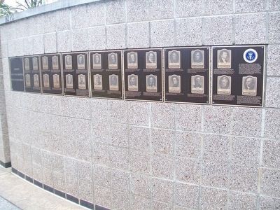
Our Constitution names the President of the United States the Commander in Chief of all the Armed Forces. Presidents who have served in our military are displayed on the following . . . — — Map (db m92400) HM WM
Near Angeles Crest Highway (California Route 2) 8.3 miles north of the Foothill Freeway (Interstate 210), on the left when traveling north.
This was the first National Forest in the State of California, second in the United States. Created by proclamation, December 20, 1892, by President Benjamin Harrison. The first name given to the forest was "San Gabriel Timberland Reserve." It was . . . — — Map (db m143501) HM
California’s oldest hotel in continuous operation. Among its century-old archives are names of such notables as Presidents Grant, Harrison, Cleveland; Authors Mark Twain, Bret Harte; Boxers Corbett, Fitzsimmons, actor Gilbert Barry and highwayman . . . — — Map (db m48213) HM
On Flat Tops Trail Scenic Byway (County Road 8) 44 miles east of State Highway 13, on the right when traveling north.
Welcome to the second oldest national forest in the United States. President Benjamin Harrison set aside the White River Timber Land Reserve in 1891, in a bold step towards protecting forests on the American frontier. Wide open and wild, . . . — — Map (db m163892) HM
On 1st Street Northwest at New Jersey Avenue Northwest, on the right when traveling north on 1st Street Northwest.
"No nation perhaps had ever before the opportunity offer'd them of deliberately deciding on the spot where their Capital city should be fixed..." - Peter C. L'Enfant to George Washington, September 11, 1789
A new nation . . . — — Map (db m60127) HM
On Collier Road NW north of Redland Road NW, on the left when traveling north.
At 4:30 p.m. on July 20, 1864, 2,700 Confederate soldiers in two brigades of Major General William W Loring's division attacked the Federal '20th Corps, aligned north of Collier Road. "The enemy was in plain view about 700 yards distant occupying . . . — — Map (db m142521) HM
On Collier Road at Redland Road NW, on the right when traveling west on Collier Road.
The 5 regts. of Col. Benjamin Harrison’s brigade of Ward’s div. (20th A.C.) [US] were N. of this ridge when the Confederate attack in this sector was made. The brigade was moved forward in support of Geary’s line & deployed astride Tanyard Branch . . . — — Map (db m16498) HM
Crawfish Spring was the first name given to the modern community Chickamauga, Georgia. Cherokees lived in this area before their forced removal in 1838, with their Chickamauga District courthouse located near the spring. In the 1840s an early white . . . — — Map (db m12314) HM
On Grove Street near South 6th Street, on the left when traveling east.
Imagine leafy Lombary poplars, dazzling rose bushes, lush gardens, circular walks, stately homes, and huge churning waterwheels along a wide avenue, and you'll get a picture of early days on Grove Street. The profusion of leaves and petals was . . . — — Map (db m119189) HM
During his presidency, Abraham Lincoln had promised to care for the men in the armed services-and for their widows and orphans. Lincoln was unable, however, to keep that promise. In response, the Grand Army of the Republic or G.A.R. . . . — — Map (db m56908) HM
Crown Hill Cemetery, founded in 1863, is the fourth largest cemetery in America. The history of Indiana and the United States is reflected in its monuments. President Benjamin Harrison, Vice-Presidents Charles Fairbanks, Thomas Hendricks, and Thomas . . . — — Map (db m81439) HM
Lawyer and Publicist. Col. 70th Reg. Ind. Vol. War 1861-1866. Brevetted Brigadier General 1866. U.S. Senator, 1881-1887. President 1889-1893. Statesman, yet friend to truth, of soul sincere, action faithful and in honor clear. — — Map (db m93165) WM
On North Delaware Street north of East 11th Street, on the left when traveling north.
Entered the Union Army as 2nd Lt. of the 70th Indiana Regiment. He insisted on turning raw recruits into disciplined soldiers. He later was United States Senator from Indiana and the twenty-third President of the United States. — — Map (db m565) HM
On North Delaware Street south of East 13th Street, on the left when traveling north.
Home
of
Benjamin Harrison
23rd President of the
United States
Born August 20, 1833
Died March 13, 1901
Indiana's Own Citizen
In command of the
70th . . . — — Map (db m132870) HM
On West Georgia Street west of South Capitol Avenue, in the median.
The grandson of President William Henry Harrison, Benjamin Harrison was born Aug. 20, 1833, in North Bend, Ohio. The 23rd President of the United States graduated Miami University (Ohio) before opening a law office in Indianapolis in 1854. . . . — — Map (db m132831) HM
Near NW Railroad Street near NW Curtis Street, on the left when traveling west.
Delaware, 1st State
December 7, 1787
1609 • Henry Hudson visited Delaware Bay
1638 • Swedish colonists established Fort Christina, Delaware's first permanent settlement, and founded the colony of New Sweden
1655 • Dutch captured New . . . — — Map (db m47214) HM
Near North Bedelia Street (Kentucky Route 1386) 0.1 miles west of Dumont Hill Street, on the right when traveling west.
Seven regiments of infantry and one artillery battery encamped at Scottsville in November 1862. These regiments made up the 12th Division of the Army of the Cumberland under the command of General Ebenezer Dumont.
Among the soldiers at . . . — — Map (db m152747) HM
On South Main Street (Courthouse Access Parking) north of Pike Street.
For Colonel Benjamin Harrison, who came to area, 1776. Served as Col. in Revolution from Penn. He was a member, 1787 and 1788 Kentucky Conventions, 1792 Constitutional Convention at Danville. Elected to Kentucky Legislature in 1793. County formed . . . — — Map (db m67683) HM
Near Armory Drive, 0.1 miles west of Frances Drive.
A Civil War Skirmish
On September 30, 1862, 600 Union troops led by Colonel Benjamin Harrison came here and surprised an element of Confederate Colonel John Hunt Morgan’s cavalry, led by Captain John Baker Dortch. After a sharp skirmish, in . . . — — Map (db m123399) HM
Near Hilltop Drive at College Heights Boulevard, on the left when traveling west.
General Simon Bolivar Buckner occupied Bowling Green September 18, 1861.
General Albert Sidney Johnston, Commander Confederate Army of the West, move headquarters to Bowling Green October 28, 1861. He began the erection of this fort. . . . — — Map (db m138737) HM
Construction of this strong defensive work began in 1862 during the Confederate occupation of Bowling Green. After the Confederates abandoned the city the Union Army completed the fortification, named Fort C. F. Smith in honor of General . . . — — Map (db m39672) HM
On West Liberty Street near South 2nd Street, on the left when traveling west.
Directly behind you, John W. Garrett built Garrett Memorial Church in 1869 as a memorial to his brother Henry S. Garrett who died in 1867. The site was originally chosen by his brother for a church, but he died before steps could be taken to build . . . — — Map (db m467) HM
On Laurel Avenue at Carroll Avenue, in the median on Laurel Avenue.
In 1888 B. F. Gilbert, the founder of Takoma Park, built a log cabin to celebrate the presidential campaign of Benjamin Harrison. The cabin stood on the east side of Laurel at Carroll Avenue until it burned to the ground on Halloween in 1915. It . . . — — Map (db m64507) HM
On Michigan Avenue (Business Interstate 94) at North Eagle Street, on the right when traveling west on Michigan Avenue.
James A. Miner, born in Marshall in 1842, began studying law in Clinton, Iowa, in 1860. Completing his studies in Marshall, he was admitted to the Calhoun County bar in 1863. There he was circuit court commissioner (1866-1870) and prosecuting . . . — — Map (db m28393) HM
On Faisonia Avenue, 0.1 miles south of U.S. 82, on the left when traveling south.
On this site was the home of Wayne and Minnie Cox. In 1888, Wayne Cox was elected alderman, the first African American to hold that post in Indianola. Appointed by President Benjamin Harrison in 1891, Minnie Cox is the nation's first known African . . . — — Map (db m77322) HM
On East Glen Avenue just east of North Maple Avenue, on the right when traveling west.
This colonial road, traditionally an Indian Trail, was a key route to Peremus Church during the American Revolution. Former names of this road mark eras in America’s history – Franklin Turnpike, for the Tory governor Wm. Franklin; Harrison . . . — — Map (db m18688) HM
Built in 1879.
Named for the seven U.S. Presidents who attended services here: Ulysses S. Grant, Rutherford B. Hayes, James A. Garfield, Chester A. Arthur, Benjamin Harrison, William McKinley, and Woodrow Wilson.
Deconsecrated in 1953, . . . — — Map (db m14049) HM
The upriver ports of Carthage and Kelsey's Landing were stopping places for boats bound for Canada. Escaped slaves arrived in Rochester via the "Underground Railroad" and looked for a friendly captain to take them across the lake and deliver them . . . — — Map (db m90608) HM
Near West Street near Chambers Street, on the right when traveling south.
As one of the most famous and respected black abolitionist leaders of the 19th century, Frederick Douglass inspired many people through his courage and determination.
Frederick Bailey was born a slave in February 1818 on Holmes Hill Farm in . . . — — Map (db m168927) HM
On Riverside Drive at West 122nd Street, on the left when traveling north on Riverside Drive.
General Grant Memorial, popularly known as “Grant’s Tomb,” is the largest mausoleum in America. Its monumental size reflects the public admiration for Ulysses S. Grant --- Union general during the Civil War, and 18th President of the . . . — — Map (db m109862) HM
On East Main Street (New York State Route 31) at Fayette Street, on the left when traveling east on East Main Street.
1822 The Erie Canal was completed to Palmyra
1827 The Village of Palmyra was incorporated
1830 The Book of Mormon was printed in the Grandin Building.
1849 Palmyra held the first fair in New York State. It later became the . . . — — Map (db m61351) HM
On South College Ave, on the right when traveling south.
Oxford Female Institute Chartered in 1849, the Institute was the first of three women's colleges established in Oxford. The original brick building was completed in 1850, and forms the core structure. The Reverend John Witherspoon Scott, a . . . — — Map (db m107675) HM
[Mural is on both sides of brick walls on the northern end of town that lie on both sides of the street:]
Wellsville Revitalization Committee Picnic
"Riverside"
Presbyterian Church, USA
525 Riverside Ave.
Founded April 5, 1831 . . . — — Map (db m156060) HM WM
On Symmes Avenue at Washington Avenue, on the left when traveling north on Symmes Avenue.
Benjamin Harrison (1833-1901) was born here on a farm established by his grandfather, William Henry Harrison. A graduate of Miami University in Oxford, Harrison read law in Cincinnati and then moved to Indianapolis to practice. He became active . . . — — Map (db m82635) HM
Congress Green Cemetery
John Cleves Symmes had grand ambitions. He planned to build a large city here, making it the hub of the Northwest Territory. This very spot would be the middle of a bustling town square.
Things worked . . . — — Map (db m167342) HM
On Cliff Road, 0.1 miles north of Bower Road, on the right when traveling north.
Life at North Bend
As the War of 1812 concluded, William Henry Harrison resigned his post, content to make public appearances and live a settled life with his family here in North Bend.
Though his presidential campaign would . . . — — Map (db m167277) HM
Point Farm given by William Henry Harrison February 9, 1773 – April 4, 1841 ninth president of the United States of America to his son, John Scott Harrison, Congressman who reared his son Benjamin Harrison August 20, 1833 – March 13, 1901 . . . — — Map (db m241855) HM
On Mahoning Avenue, 0.3 miles north of West Market Street, on the right when traveling south.
This ornate Victorian/Italianate house was constructed in 1871 as the home of Henry Bishop Perkins, Sr., a civic, business, and political leader of the Western Reserve. During the 19th and early 20th century political figures such as U.S. Grant, . . . — — Map (db m65450) HM
On East Comanche Street at South Peters Avanue, on the right when traveling east on East Comanche Street.
Although the Norman townsite was settled during the Land Run on April 22, 1889, Cleveland County did not exist for another year, and almost
wasn't named Cleveland County. In fact, if not for the efforts of Norman's early citizens and civic leaders, . . . — — Map (db m121630) HM
On South 2nd Street north of West Harrison Avenue, on the right when traveling south.
Oklahoma--an all black state with a black
governor--was the dream of E. P. McCabe,
lawyer, farmer, and Republican activist. McCabe
vigorously promoted black settlement and
assumed role as spokesman for black people
in Washington with President . . . — — Map (db m141703) HM
On East Sheridan Avenue west of Mickey Mantle Drive, on the right when traveling east.
Two days before the Land Run in April, 1889, President Harrison set aside a Military Reservation of 160 acres east of the Santa Fe railroad depot, where soldiers were stationed to keep the peace.
In 1886 the first railroads were built . . . — — Map (db m176269) HM
On Latting Circle at Park Avenue, on the left when traveling north on Latting Circle.
On May 2, 1890, Congress passed long awaited legislation establishing federally sanctioned territorial government for Oklahoma.
The Organic Act defined Oklahoma Territory boundaries to include the lands west of Indian Territory and the . . . — — Map (db m142037) HM
On South Main Street at Seminary Street, on the left when traveling south on South Main Street. Reported permanently removed.
On September 26, 2003, this property was nearly destroyed by fire. Located in the northwest corner in a two-story log house built in 1791-1792 by Archibald Irwin. Irwin's granddaughter Jane married William Henry Harrison, Jr., and served as First . . . — — Map (db m8039) HM
On South Main Street (Pennsylvania Route 16/416) just south of East Seminary Street, on the left when traveling south.
On September 26, 2003, this corner property was destroyed by fire exposing this log house built in 1791-1792 by Archibald Irwin. Irwin's granddaughter Jane married William Henry Harrison, Jr., and served as First Lady when her father-in-law, William . . . — — Map (db m202809) HM
On Buchanan Trail W (Pennsylvania Route 16) at Anderson Road, on the right when traveling east on Buchanan Trail W.
In the limestone mansion house still standing, lived Archibald Irwin and Jean McDowell, his wife. To them were born two daughters. Jane, the elder, became the wife of William Henry Harrison, Jr., and was mistress of the White House during the brief . . . — — Map (db m58686) HM
How Glass Is Cut
Once a glass "blank" was blown and annealed to room temperature, it went to the cutting department where skilled workers used cast iron and stone wheels to cut the desired pattern or design. Wooden and felt wheels and . . . — — Map (db m104085) HM
Mary Ferrazzoli (1928-1994) was the visionary leader who founded the Friends of the Waterfront in 1982. She vigorously championed public access and stood firmly opposed to the commercial overdevelopment of the Newport waterfront blocking public . . . — — Map (db m189622) HM
Near Avenue H east of Moody Avenue, on the right when traveling west.
Born a slave on the Waller County plantation of his father, Philip Cuney, Norris Wright Cuney was sent to Wyle Street School in Pennsylvania for an early education. At the age of seventeen he moved to St. Louis and found employment on Mississippi . . . — — Map (db m143813) HM
On Mechanic Street east of 24th Street, on the right when traveling west.
The present Tremont House is the third Galveston hotel to bear the name. The island's first Tremont House was built by the firm of McKinney and Williams in 1839 on the southwest corner of Postoffice and Tremont Streets.
An impressive two-story . . . — — Map (db m117389) HM
On State Highway 350 at County Highway 3157, on the right when traveling north on State Highway 350.
At a grove of mesquite and wild china trees by a creek near here, Capt. R. B. Marcy's expedition camped Oct. 7, 1849, while blazing the famous Marcy Trail. They saw nothing deadlier than quail and wild turkeys in the area, but the next day, tragedy . . . — — Map (db m111759) HM
Built as a summer cottage in 1865 for lawyer-entrepreneur-philanthropist Trenor Park and his wife Laura, the mansion was financed with a fortune amassed in California in the aftermath of the California Gold Rush. It was designed by the New York . . . — — Map (db m94423) HM
Near Beach Access Road north of Boat Ramp Access Road, on the right when traveling south.
Listed on the National Register of Historic Places, the Assateague Island Lighthouse is a striking landmark that attracts many visitors. At the same time, it is an active aid to navigation, operated by the U.S. Coast Guard, that gives ships a . . . — — Map (db m98824) HM
Near Harrison Landing Road, 0.9 miles south of Westover Road (Virginia Route 633), on the left when traveling south.
In this graveyard is buried
Col. Benjamin Harrison, V
December 13, 1730
April 24, 1791
Singer of the
Declaration of Independence
Member of
Virginia House of Burgesses
Continental Congress
Federal Constitutional Convention . . . — — Map (db m87114) HM
Near Harrison Landing Road, 0.7 miles south of Westover Road (Virginia Route 633), on the right when traveling south.
A short distance south. The place was first settled in 1619 but was abandoned. It was repatented in 1636. Benjamin Harrison, signer of the Declaration of Independence, lived here; his son, William Henry Harrison, President of the United States, was . . . — — Map (db m30225) HM
On John Tyler Memorial Highway (Virginia Route 5) 0.1 miles east of Virginia Route 156, on the right when traveling east.
Benjamin Harrison (1726-1791) - Virginia planter, politician, and signer of the Declaration of Independence - was born at nearby Berkeley plantation. He first served in the Virginia House of Burgesses in 1752, though elected in 1749, and remained in . . . — — Map (db m86174) HM
Near Oatlands Plantation Lane, 0.4 miles south of James Monroe Highway (U.S. 15), on the right when traveling south.
The trio of green buildings around the circular drives were constructed in the early 1900s by the Eustis family, the last private owners of Oatlands. William Corcoran Eustis enjoyed the close proximity to Virginia hunt country while Edith Eustis . . . — — Map (db m195183) HM
Near Catharpin Road (County Route 612) 0.9 miles Old Plank Road (County Route 610), on the right when traveling south.
The President of the United States of America, in the name of Congress, takes pleasure in presenting the Medal of honor to Sergeant Benjamin Brown, United States Army, for extraordinary heroism on 11 May 1889, while serving with Company C, 24th . . . — — Map (db m84597) HM
On Ballard-Red Sulphur Parkway (West Virginia Route 12) at Indian Creek Road (County Route 23), on the left when traveling south on Ballard-Red Sulphur Parkway.
Site of a popular resort hotel, built in 1832. Water from the springs was reputed to have curative value. Hotel was used as a military hospital during Civil War. Last owner was Levi P. Morton, vice-president under Benjamin Harrison. — — Map (db m99130) HM
On U.S. 16 at milepost 90 near Veterans Lane, on the left when traveling west.
First known as Cantonment Reno, For McKinney was established in 1876 on the Powder River near present-day Jaycee. In 1877, the Fort was renamed for Lieutenant John McKinney, who died during the Dull Knife Battle in 1876.
The Fort's presence . . . — — Map (db m91498) HM