In 1846, General John Ellis Wool amassed an army of 3,400 troops in San Antonio to invade Chihuahua, Mexico. Departing from Camp Crockett crossing the Medina River and passing through Castroville and Quihi, Wool’s plans changed after receiving . . . — — Map (db m130158) HM
After a convention of Republic of Texas citizens accepted terms on July 4, 1845, for annexation to the United States, General Zachary Taylor brought 4,000 men of the U.S. 3rd infantry to Corpus Christi to defend the embryonic state from Indians or . . . — — Map (db m134467) HM
Shortly after the people of Texas voted to approve annexation to the U.S. in June 1845, the U.S. entered a boundary dispute between Texas and Mexico. President James K. Polk ordered General Zachary Taylor to position his troops on or near the Rio . . . — — Map (db m31938) HM
Known as the founder of Corpus Christi, Pennsylvania native Henry Lawrence Kinney (1814-1861) was trained to become a merchant by his father, Simon Kinney. He helped lay out the town of Peru, Illinois, and eventually made his way to this part of . . . — — Map (db m118498) HM
Bounded by Twigg and Tiger Streets, Hall's Bayou and Corpus Christi Bay, the section of the city's Ward One known as Irishtown included primarily Irish residents, although there were also Anglo Americans, Mexican Americans, African Americans, Greeks . . . — — Map (db m32174) HM
The oldest federal military cemetery in Texas, Old Bayview was laid out by U.S. Army engineers while Brig. Gen. Zachary Taylor was encamped in Corpus Christi on the eve of the Mexican War. On Sept. 13, 1845, the steamer "Dayton", used to transfer . . . — — Map (db m202010) HM
Henry L. Kinney, born in Pennsylvania in June 1814, came to this area about 1858 and established a fort-like trading post (across Broadway). The building, enclosed by a stockade, contained his home, store, and quarters for armed men. The bulk of . . . — — Map (db m118374) HM
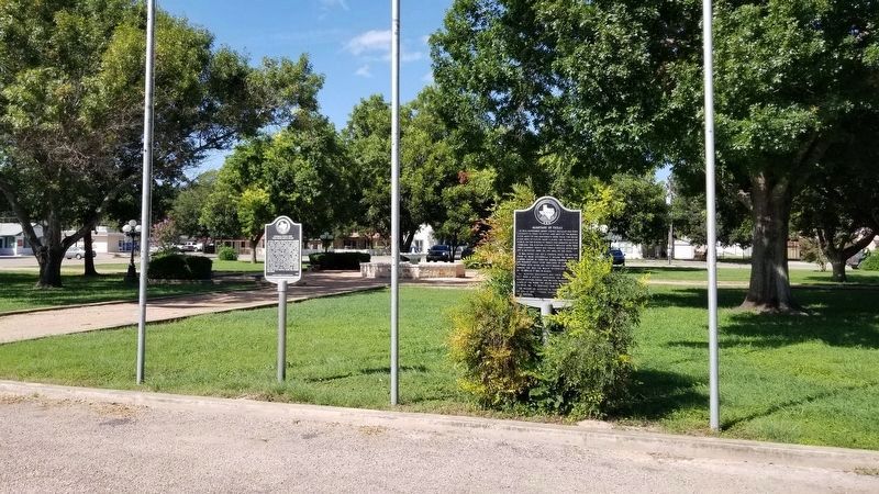
Born in Philadelphia in 1817, Thomas S. Parker came to Texas at the age of twenty. In 1839 he and his parents William W. and Hannah Parker were awarded large land grants in the vicinity of present-day Corpus Christi; they used the land to raise . . . — — Map (db m31944) HM
New York native Samuel Matthias Jarvis (1822-1893) received an engineering degree from Columbia University and joined General Zachary Taylor's army when the United States declared war against Mexico.
After the war Jarvis worked in Vallecillo, . . . — — Map (db m118787) HM
Absalom Bishop (1804-1883) began his military service as a Captain of Militia in the Seminole War in Florida. He later attained the rank of Colonel. Bishop lived in several states before arriving in Hopkins County, Texas, in 1852, and then in what . . . — — Map (db m108529) HM
Citizens of central and western Virginia have contributed significantly to national defense and to the U.S. Army throughout its 200-year history.
During the Revolutionary War, Virginians fought valiantly as members of the militia and the . . . — — Map (db m21890) HM
Culpeper County. Area 384 Square Miles. Formed in 1748 from Orange, and named for Lord Culpeper, Governor of Virginia, 1680-1683. The Battle of Cedar Mountain, 1862, was fought in this county.
Orange County. Area . . . — — Map (db m23774) HM
These trees were planted
in commemoration of the
eight Presidents of
the United States
who were sons of Virginia.
George Washington 1789-1797
Thomas Jefferson 1801-1809
James Madison 1809-1817
James Monroe 1817-1825 . . . — — Map (db m241179) HM
Orange County. Formed from Spotsylvania County in 1734, Orange County, a pastoral Piedmont county, was probably named in honor of William IV, the Dutch prince of Orange, who married Anne, the Princess Royal, daughter of George II of England, . . . — — Map (db m24228) HM
Orange County. Area 359 Square Miles. Formed in 1734 from Spotsylvania, and named for the Prince of Orange, who in that year married Princess Anne, daughter of King George II. President James Madison lived in this county and . . . — — Map (db m17747) HM
Orange County. Formed from Spotsylvania County in 1734, Orange County, a pastoral Piedmont county, was probably named in honor of William IV, the Dutch prince of Orange, who married Anne, the Princess Royal, daughter of George II of England, . . . — — Map (db m108411) HM
Orange County. Formed from Spotsylvania County in 1734, Orange County, a pastoral Piedmont county, was probably named in honor of William IV, the Dutch prince of Orange, who married Anne, the Princess Royal, daughter of George II of . . . — — Map (db m4758) HM
In Aug. 1863, Confederate Navy Lt. John Taylor Wood, moving overland with boarding cutters carried on modified wagons and a contingent of 82 men, embarked on an expedition to attack Union ships. At Wilton Creek, Wood and his men repulsed forces from . . . — — Map (db m74703) HM
This is Smithfield, the birthplace of William Ballard Preston (1805-1862). On April 16, 1861, in the Virginia Convention, he reluctantly introduced the formal resolution to secede from the Union.
Preston served in the Virginia House of . . . — — Map (db m84776) HM
Here was born Zachary Taylor, twelfth President of the United States, November 24, 1784. Taylor, commanding an American Army, won the notable Battle of Buena Vista in Mexico, 1847. — — Map (db m30181) HM
Culpeper County. Area 384 Square Miles. Formed in 1748 from Orange and named for Lord Culpeper, Governor of Virginia, 1680-1683. The Battle of Cedar Mountain, 1862, was fought in this county.
Orange County. Area 359 . . . — — Map (db m4322) HM
Orange County. Formed from Spotsylvania County in 1734, Orange County, a pastoral Piedmont county, was probably named in honor of William IV, the Dutch prince of Orange, who married Anne, the Princess Royal, daughter of George II of England, . . . — — Map (db m159382) HM
A mile north is Bloomsbury, estate of the pioneer, James Taylor, ancestor of Presidents James Madison and Zachary Taylor. He was a member of Spotswood's expedition over the mountains in 1716. — — Map (db m4699) HM
A valiant soldier General Zachary Taylor 1784-1850 Twelfth President of the United States Born in Orange County Virginia Erected by Orange County Post No. 156 The American Legion 1934 — — Map (db m83144) HM
The 12th U.S. President, Taylor earned his national reputation in the Mexican War. There he commanded the military in Texas after its annexation to the U.S. and successfully kept the territory in American possession. His nickname was "Old Rough and . . . — — Map (db m165940) HM
General Zachary Taylor, on his way to Washington to be inaugurated as the 12th President of the U.S., found his steamer blocked by ice here. He left his boat and completed his trip over the National Pike. — — Map (db m54810) HM
Major Zachary Taylor served as commandant of Fort Howard for nearly three years, arriving in the spring of 1817 with 500 men of the fifth United States Infantry.
He would become the twelfth president of the United States on the fifth of . . . — — Map (db m202937) HM
On August 2, 1832, the Black Hawk War effectively ended when the U.S. Military massacred many followers of Sauk Indian leader Black Hawk at the Battle of Bad Axe, located about 35 miles north of here. Black Hawk, known as Ma-ka-tai-me-she-kia-kiak, . . . — — Map (db m43531) HM
The Second Fort Crawford Military Hospital was built here in 1831. In 1934 this portion of it was restored with original stone as a memorial to William Beaumont, M.D. (1785-1853), pioneer military surgeon.
Among prominent military personnel . . . — — Map (db m43641) HM
The first Fort Crawford was built in 1816, and stood on the site now occupied by the "Villa Louis." After a decade of Mississippi River flooding, the U. S. Army relocated Fort Crawford to this site, constructing the new fort of locally quarried . . . — — Map (db m43532) HM
In late July, during the Black Hawk War of 1832, Sac Indian leader Black Hawk led his starving followers through this area in their escape from the General Henry Atkinson and his military forces. After Black Hawk's brilliant delaying tactics at the . . . — — Map (db m31659) HM
In July, 1833, Lt. Alexander Center blazed a nearby oak, marking the 100-mile point of a military road he and James Doty were surveying. The Old Military Road, built from 1835 to 1837, connected Ft. Crawford at Prairie du Chien, Ft. Winnebago at . . . — — Map (db m36907) HM
You are traveling the route of the Old Military Road, built in 1835-36, to connect Fort Crawford at Prairie du Chien and Fort Howard at Green Bay, via Fort Winnebago at "The Portage" between the Fox-Wisconsin rivers. The section from Prairie du . . . — — Map (db m36908) HM
A thriving and important town of the lead-mining days, here on July 28, 1832 troops crossed the Wisconsin River in pursuit of Indians under Black Hawk
Among officers of the Army here present these later became distinguished
Gen. Henry . . . — — Map (db m35333) HM
During the Black Hawk War of 1832, General Atkinson camped near this location on two occasions. On July 7th, Atkinson led his entire militia, including future President's Abraham Lincoln and Zachary Taylor here. On July 19th, Atkinson returned . . . — — Map (db m31762) HM
135 entries matched your criteria. Entries 101 through 135 are listed above. ⊲ Previous 100