William Bartram traveled the Southeast United States from 1773 through 1777. He published observations of plants, animals, geography and people in 1791. Bartram's Travels remains in print to the present.
On Alabama Route 59 at milepost 56, on the right when traveling north.
William Bartram, America’s first native born artist - naturalist, passed through Baldwin County during the Revolutionary era, making the first scientific notations of its flora, fauna and inhabitants. As the appointed botanist of Britain’s King . . . — — Map (db m81855) HM
On Alabama Route 225 just north of Lower Bryants Landing Road, on the left when traveling north.
Here on the banks of the Tensaw River -- named for the Tensa Indian tribe whose principal village was located at this place -- Major Robert Farmar developed a plantation c. 1772. Farmar was one of the most prominent and controversial Alabamians of . . . — — Map (db m66380) HM
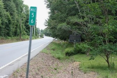
On Sherling Lake Road (County Road 44) 1 mile west of Braggs Road (State Route 263), on the right when traveling west.
Front
William Bartram, America's first great naturalist, passed through northwest Butler County in July 1775. He described the "limestone rocks" and "banks of various kinds of sea shells" left by oceans that covered this area millions of . . . — — Map (db m120937) HM
On Rockville Road (County Road 15) at Stimpson Sanctuary Road, on the right when traveling south on Rockville Road.
William Bartram, America’s first native born artist-naturalist, passed through Clarke County during the Revolutionary era, making the first scientific notations of its flora, fauna and inhabitants. As the appointed botanist of Britain’s King George . . . — — Map (db m101568) HM
On West Fort Toulouse Road, 0.1 miles west of U.S. 231, on the right when traveling west.
William Bartram, America’s first native born artist-naturalist, passed through Elmore County during the Revolutionary era, making the first scientific notations of its flora, fauna and inhabitants. In 1776 the appointed botanist of Britain’s King . . . — — Map (db m69431) HM
On Forest Road 949, 0.2 miles north of State Route 186, on the left when traveling north.
William Bartram, America's first native born artist - naturalist, passed through Macon County during the Revolutionary era, making the first scientific notations of its flora, fauna and inhabitants. As the appointed botanist of Britain's King George . . . — — Map (db m99676) HM
On Alabama Route 165 north of Creek Trail, on the right when traveling north.
William Bartram, American's first native born artist - naturalist, passed through Russell County during the Revolutionary era, making the first scientific notations of its flora, fauna and inhabitants. As the appointed botanist of Britain's King . . . — — Map (db m164144) HM
On 221st Street near 65th Avenue, on the right when traveling south.
In 1774, noted botanist William Bartram travelled across what is now the southeastern corner of Alachua County following an old Indian and trading trail. In Florida's territorial period, English-speaking settlers used the same route as a frontier . . . — — Map (db m41100) HM
On NE Cholokka Blvd (County Road 234), on the left.
The great Quaker naturalist of Philadelphia made a long journey through the southeastern states in the 1770's collecting botanical specimens. In May, 1774, he visited the Seminole Chief, Cowkeeper, at the Indian village of Cuscowilla located near . . . — — Map (db m146839) HM
On US Hwy 27 & 41 (U.S. 27) at Northwest 16th Avenue, on the right when traveling north on US Hwy 27 & 41.
Blue Sink
Visited by William Bartram, America's first naturalist, in 1774.
Erected by Newberry Garden Club in cooperation with Dist. V. FFGC National Council of State Garden Clubs, Inc.
Fla. Dept. of Transportation — — Map (db m119044) HM
Near Playalinda Road, 4 miles north of A. Max Brewer Memorial Parkway, on the left when traveling north.
William Bartram, while residing in Florida in 1776-77, explored Mosquito Lagoon by canoe seeing 11 bears in one day and many deer. — — Map (db m164644) HM
Near Playalinda Road, 2.2 miles north of A. Max Brewer Memorial Parkway.
William Bartram exploring here in the 1760s collected many new plants and discovered the tropical Zebra Butterfly: Heliconius Charitonius. — — Map (db m164647) HM
On East Main Street (County Road 196) at South Alcaniz Street, on the right when traveling east on East Main Street.
In 1775 William Bartram described Pensacola and the hospitality he received when even Gov. Chester urged him to be his houseguest. — — Map (db m91130) HM
Near South Pace Boulevard, 0.1 miles south of Cypress Street when traveling south.
Bartram wrote of the security and extent of intracoastal water ways from Virginia's Chesapeake Bay to the Mississippi, in 1774. — — Map (db m110475) HM
William Bartram, botanist, artist, naturalist, explored St. Johns River area while headquartered near this site in 1774.
Erected by Palatka Daily News in cooperation with Garden Club of Palatka, Tillandsia Wildflower Club and Florida Federation . . . — — Map (db m56639) HM
Near Memorial Parkway at Laurel Street, on the right when traveling north.
The Flower Hunter William Bartram, naturalist and author of Travels, sailed past Palatka in the spring of 1774. The Seminoles called him "Puc-Puggy," which means "Flower Hunter." The dried flower on this panel is one of the . . . — — Map (db m167990) HM
On Memorial Parkway just east of South Second Street, on the right when traveling north.
In 1774, while coasting past a Seminole settlement on the riverfront
of what is now Palatka, William Bartram wrote in his book, Travels:
"There were 8 to 10 habitations facing the river. Some of the youth were naked up to their hips in . . . — — Map (db m240766) HM
On County Road 309 at Fort Gates Ferry Road, on the right when traveling south on County Road 309.
Mount Royal has been a favored location for people to live for thousands of years. Archaeological sites include a Native American burial mound, earthworks, village area, and evidence of a British plantation, as well as the remains of a Spanish . . . — — Map (db m60469) HM
Near Spring Avenue, 0.1 miles south of Lake Street, on the left when traveling north.
North of this marker on Lake Jessup are warm sulphur springs, near which John and William Bartram camped during their excursion up the Saint Johns River in 1765-1766.
In the late 1870’s, W.G. White built a store here, bringing goods by . . . — — Map (db m156161) HM
On State Road 16, 0.8 miles west of State Road 13 (State Road 13), on the right when traveling east.
In 1766 on the banks of the St. Johns River at Little Florence Cove, William Bartram attempted to farm a 500-acre land grant. Bartram had spent much of the previous year exploring the new British Colony of East Florida with his father, John Bartram, . . . — — Map (db m48683) HM
On County Road 13, 0.5 miles north of County Road 208, on the right when traveling south. Reported missing.
At Fort Picolata, Nov. 18, 1765,
William Bartram and his father John
saw Creek Indian Treaty signed and
began their Florida plants survey.
Erected by
The Wildflower Garden Club of District IV
In loving memory of Lorraine Ridge . . . — — Map (db m42235) HM
Near Anastasia Boulevard (State Highway A1A) 0.1 miles south of Madeira Drive, on the left when traveling south.
In 1765, William Bartram, famed Colonial Naturalist visited the Coquina Quarry & recorded the flora & fauna of the area.
Erected by
The Presidents Council of Garden Clubs & St. Johns County Inc. &
Gaillardia, Dianthus, Cherokee, . . . — — Map (db m127360) HM
On State Road 13, on the left when traveling north.
Within a mile and a half of this marker are numerous prehistoric sites, several of which date from 2000 BC. Native Americans occupied the northern river section from about 4000 BC until the arrival of Europeans after 1500 AD. Riverbank . . . — — Map (db m236728) HM
Near Kalua Way just north of Alhambra Avenue, on the right when traveling north.
Bartram Gardens & Trail at the Stetson Aquatic Center The grounds of the Stetson Aquatic Center commemorate the work of William Bartram (1739-1823), America's first native born naturalist. The site is part of the Bartram Trail that . . . — — Map (db m184636) HM
Near Kalua Way just north of Alhambra Avenue, on the right when traveling north.
Sites Bartram Visited in Volusia County These sites are locations visited by John and William Bartram along the St. Johns River and included in William's book, Travels. A site listed below with a blue heading is accessible by . . . — — Map (db m184721) HM
Near Kalua Way just north of Alhambra Avenue, on the right when traveling north.
Bartram Noticed Migration William Bartram was among the first naturalists to describe, name, or illustrate Florida birds, and one of the first to explain how migration works. He saw birds in Florida during the winter that he knew to . . . — — Map (db m184679) HM
Near Kalua Way just north of Alhambra Avenue, on the right when traveling north.
Fly Fishing for "Trout" The St. Johns River has long been associated with fishing. Bartram was probably the first to describe fly-fishing with a treble hook, deer fur, and feathers that he called "a bob." As he travelled up the St. . . . — — Map (db m184692) HM
Near Kalua Way just north of Alhambra Avenue, on the right when traveling north.
A Connection with Wild Nature William Bartram's Quaker upbringing held a view of nature as a reflection of God. Scientists continue to examine his accounts for their accurate descriptions of the Florida environment before the impact . . . — — Map (db m184693) HM
Near Kalua Way just north of Alhambra Avenue, on the right when traveling north.
Bartram writes the following just prior to being hit by the "hurricane" on Lake Beresford: "SOON after ascending this branch of the river, on the right hand presents to view, a delightful little bluff, consisting chiefly of shells, and covered . . . — — Map (db m184754) HM
Near Kalua Way just north of Alhambra Avenue, on the right when traveling north.
"The Laurel Magnolia, which grows on this river are the most beautiful and tall… The flowers are… in the center of a coronet of dark green, shining, ovate pointed entire leaves: they are large, perfectly white, and expanded like a full blown Rose… . . . — — Map (db m184760) HM
Near Kalua Way just north of Alhambra Avenue, on the right when traveling north.
William Bartram's legacy to western literature, art, science, and American exploration is expansive and undeniable. His published work inspired English writers such as William Wordsworth, Samuel Coleridge, Percy Shelly, and Alfred Tennyson, and . . . — — Map (db m184749) HM
Near Magnolia Avenue (Becker Boulevard), 1 mile south of West French Avenue.
William Bartram's Travels Famed naturalist, artist and poetic writer William Bartram first visited Blue Spring in January 1766. His writing and artwork inspired many, from naturalist artist John James Audubon to Romantic poet Samuel . . . — — Map (db m184662) HM
On Colonial Station Drive, 0 miles south of Columbus Road, on the right when traveling south.
During his 1775 visit, Bartram noted this area “exhibited a delightful diversified rural scene and promises a happy, fruitful, and salubrious region.” — — Map (db m49588) HM
On North Liberty Street (U.S. 25) at East 7th Street, on the right when traveling north on North Liberty Street.
Shell Bluff on the Savannah River 15 miles northeast has been famous since Indian days because of its outcrops of fossil shells including those of giant
oysters. These lived in the Eocene sea that covered this part of Georgia some 50 million years . . . — — Map (db m13134) HM
On W. River Street near N. Barnard St., on the left.
In 1765 John and William Bartram, naturalists, began an extended trail from Savannah through Georgia and left a legacy of impressions. — — Map (db m5087) HM
On Carl Sutton Road, 0.4 miles north of Sandy Point Road, on the right when traveling north.
In July 1774 William Bartram entered Crawford County here, site of Marshall's Mill, going on to Knoxville, Roberta, and Cusetta. — — Map (db m59559) HM
On Coach Jimmy Smith Highway (U.S. 378) at Old Petersburg Road (Georgia Route 43 Conn), on the right when traveling east on Coach Jimmy Smith Highway.
In 1775 took William Bartram to Fort James on the "Petersburg Road" and passed through Lincoln County, parts now covered by Clark Hill Reservoir — — Map (db m11509) HM
On Wrightsboro/Stagecoach Road, 4 miles west of U.S. 78, on the left when traveling west.
1773 the Treaty of Augusta
Bartram visited Wrightsborough
He described the view of high hills
and rich vales. He took on supplies. — — Map (db m9810) HM
William Bartram Visits Augusta
1773 for Indian Ceded Lands Treaty.
1775 said . . . ."Augusta would become
the Metropolis of Georgia" — — Map (db m9762) HM
"The village of Augusta." wrote the celebrated American naturalist and botanist of his visits in 1765 and 1773, "is situated on a rich and fertile plain of the Savanna River; the buildings are near its banks and extend two miles. The site of Augusta . . . — — Map (db m9761) HM
On Broad Street (U.S. 278) at Monument street, on the right when traveling west on Broad Street.
The colonial road from Charleston to Vicksburg followed the highway at this point. The route, used by Col. Langdon Welch on his expedition to the Mississippi in 1698, was thereafter followed by British traders. Through Taliaferro Co., it followed . . . — — Map (db m15242) HM
On Georgia Route 137 at Fickling Mill Road, on the right when traveling west on State Route 137.
In 1775 during the travels of botanist William Bartram he first discovered golden St. John’s wort (his Hypericum aureum) near this site on Patsiliga Creek — — Map (db m28057) HM
Near Airline Highway (U.S. 61) 1 mile south of Highland Road (State Highway 42), on the right when traveling south.
In 1775, next to Bayou Manchac, Bartram Travelled a "road strait, spacious" and "under the shadow of a grand forest." In memory Of Fred G. Benton, Jr., Bartram Trail Supporter — — Map (db m107914) HM
Near Beach Boulevard (U.S. 90) at Main Street, on the right when traveling east.
William Bartram, noted naturalist and journalist, traveled down the Mississippi and along the Gulf Coast in 1777. His observations of plant life, geography and inhabitants were published in 1791. — — Map (db m79087) HM
On Phillips Street at West Main Street (Business U.S. 441), on the right when traveling north on Phillips Street.
The North Carolina Bartram Trail is a hiking trail to commemorate the 1775 visit of Philadelphia naturalist William Bartram to Western North Carolina. Begun in the 1970s, the trail parallels Bartram's actual route into Cherokee country. It begins at . . . — — Map (db m123224) HM
On West Main Street (Business U.S. 441) at Iotla St (Local Highway 1323), on the right when traveling west on West Main Street.
William Bartram Naturalist
Visited this area of the Cherokee Nation in May, 1775
while on his mission to record the natural
and cultural resources along the trading
route between the Low Country to the east
and the Overhill Country to . . . — — Map (db m123222) HM
Philadelphia naturalist, author, exploring this area, met a Cherokee band led by their chief, Atakullakulla, in May 1776, near this spot. — — Map (db m57728) HM
On Cherokee Foothills Scenic Highway (SC Highway 11).
[Front Side]:
The main trading path to the Cherokee Nation paralleled the route of Highway 11 for several miles at this point. This section of the path was used by travelers going from Keowee, the main Lower Town of the Cherokees, across . . . — — Map (db m14383) HM