601 entries match your criteria. The first 100 are listed. Next 100 ⊳
Lighthouses Historical Markers
Lighthouses mark dangerous coastlines, hazardous shoals, reefs, rocks, and safe entries to harbors. Once widely used, the number of operational lighthouses has declined due to the expense of maintenance and have become uneconomical since the advent of cheaper electronic navigational systems. Many remain standing due to historic preservation efforts.
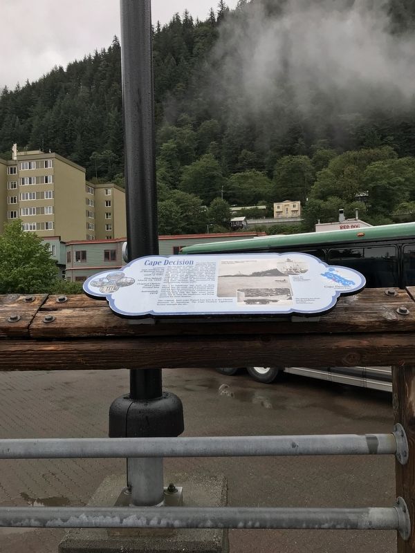
The Cape Decision lighthouse was the last one built in Alaska. Need for it grew as ship traffic and the size of the ships increased. Southeast Alaska was booming with many salmon canneries, herring salteries and whale oil reduction plants. Large . . . — — Map (db m181646) HM
Perched high on a cliff, Cape Hinchinbrook lighthouse marks the entrance to the sheltered waters of Prince William Sound. The wreck of the steamer Oregon on Hinchinbrook Island in 1906 prompted the light's installation. Foul weather during . . . — — Map (db m181634) HM
Facing the open Gulf of Alaska, Cape Saint Elias lighthouse stands on Kayak Island, where in 1741, Russian voyagers first set foot on North American soil. The Cape's bald pinnacle serves as a key landmark in daylight. The light provides guidance at . . . — — Map (db m181632) HM
Scotch Cap and Cape Sarichef lighthouses mark the north and south entrances to Unimak Pass in the Aleutian Islands. Both sites were declared to be too isolated for family life.
Scotch Cap was the first light on Alaska's outside coast and is the . . . — — Map (db m181636) HM
Cape Spencer lighthouse stands on a barren, isolated rock at the entrance to Cross Sound, where the sheltered Inside Passage meets the open Gulf of Alaska. The original lighthouse still stands. It is a single-story, reinforced concrete building that . . . — — Map (db m181631) HM
Eldred Rock is the oldest original lighthouse still standing in Alaska. It is a two-story building topped by a light tower. The ground floor was built of reinforced concrete, the first time that material was used for a lighthouse facing Alaska's . . . — — Map (db m181635) HM
Southeast Five Finger was the first name given this lighthouse site due to its location on the southeastern-most island of the Five Finger Islands group. The original, wood boathouse and carpenter shop remain.
A keeper thawing frozen water pipes . . . — — Map (db m181645) HM
A square, white wooden tower housed the Guard Islands light, with a separate keeper's house nearby. When a reinforced concrete building replaced the old light tower in 1922, a second house was built so two keepers could live there with their . . . — — Map (db m181640) HM
For more than 100 years, lighthouses have guided mariners through Alaskan waters.
Lighthouses capture our imagination as lonely sentinels of the sea. They played a vital role in Alaska's development because for more than 70 years, ships . . . — — Map (db m181647) HM
Widely spaced along Alaska's Inside Passage, these three lighthouses were among the first built, and the first discontinued.
The lighthouse on Lincoln Rock, near Ketchikan, was unusually difficult to build. The small, rocky pinnacle on which it . . . — — Map (db m181637) HM
The lighthouse on Mary Island is the second one seen by ships heading up Alaska's Inside Passage. The beacon guides mariners into Revillagigedo Channel leading to Ketchikan. Like most of Alaska's lighthouses, it was built soon after the Klondike . . . — — Map (db m181642) HM
The red-roofed, white buildings at Point Retreat are a familiar sight to local boaters and passengers on cruise ships sailing between Juneau and Glacier Bay. The original, wooden light tower at Point Retreat was only 6 feet tall, but it stood 19 . . . — — Map (db m181638) HM
Sentinel Island Lighthouse guards the entrance to Favorite Channel, linking Lynn Canal to Juneau's Auke Bay. The original, wood frame structures included a keeper's house with an attached light tower and out-buildings, including a wharf and . . . — — Map (db m181644) HM
Tree Point is Alaska's most southerly of the Southeast lighthouses. It marks the first landfall for northbound ships crossing Queen Charlotte Sound, 30 miles of coastal water open to the Pacific. Mariners used Tree Point Lighthouse to guide them . . . — — Map (db m181641) HM
Constructed in 1873-74, East Brothers Light Station is the older of only two remaining light stations of San Francisco Bay that have remained substantially unchanged. The original 5th order classical (Fresnel) lens was replaced with the present . . . — — Map (db m164491) HM
The Battery Point Lighthouse is one of the first lighthouses on the California Coast.
Rugged mountains and unbridged rivers meant coastal travel was essential for the economic survival of this region.
In 1855 Congress appropriated $15,000 for . . . — — Map (db m101692) HM
On 5th Street near Van Ness Avenue, on the left when traveling south.
The 780 prisms and fresnel lenses in this replica of the original Cape Mendocino Light House were hand ground in France, shipped around Cape Horn and originally placed in operation at Cape Mendocino in 1868. The entire mechanical gear and prisms . . . — — Map (db m189002) HM
On Mattole Road, on the right when traveling south. Reported missing.
Lit Dec. 1, 1868 to Mar. 3, 1951.
Built at 422 ft. elevation, the light swept 30 mi. to sea. The perilous waters here claimed nine ships. Mules took supplies to the site, 15 mi. north, the westernmost in the U.S.
Dedicated to the Keepers of . . . — — Map (db m51954) HM
On Lower Pacific Drive, on the left when traveling west.
The Mendocino presented a huge challenge to the designers of this lighthouse
The lighthouse’s assigned position was a storm-battered, 400-foot cliff prone to frequent earthquakes and landslides. The compact tower, with its lifesaving beacon, had to . . . — — Map (db m1108) HM
On Lower Pacific Drive, on the left when traveling west.
Lit Dec. 1, 1868, the light from its first order Fresnel lens swept 30 miles to sea. Decommissioned in 1951, the structure slowly began to inch toward the 422’ cliff. The light was dismantled in 1998 and moved to Point Delgada, Shelter Cove by . . . — — Map (db m1093) HM
On Lower Pacific Drive, on the left when traveling west.
A new home in Shelter Cove. Shelter Cove is not the original home of the Cape Mendocino lighthouse. The lighthouse operated at Cape Mendocino, 35 miles north of here.
The compact metal tower was installed on a cliff at the cape in 1868 . . . — — Map (db m1107) HM
The Trinidad Memorial Lighthouse is one of the most iconic landmarks on the North Coast and a beloved, historical symbol of the Trinidad community. The structure was built in 1949 as a replica of the original 1871 Trinidad Lighthouse, which . . . — — Map (db m139525) HM
Near Palos Verdes Drive West, 0.5 miles south of Hawthorne Boulevard.
The site was explored by Juan Rodriguez Cabrillo on Oct. 9, 1542, and named Pointe Vicente Bante Maria by Captain George Vancouver in 1793. Placed in service by the U.S. Lighthouse Service on May 1, 1926, it was renamed Point Vicente by the Pacific . . . — — Map (db m82001) HM
Point Reyes Light has guided and cautioned mariners along this hazardous coast for over 100 years. Built by the U.S. Lighthouse Service in 1870, it came under management of the U.S. Coast Guard in 1939. Resident personnel operated the station until . . . — — Map (db m63502) HM
Near Point Cabrillo Drive, on the left when traveling north.
The Point Cabrillo Light Station was built in 1908 by the US Lighthouse Service to protect the "Doghole Schooners" that plied the lumber trade between San Francisco and the Redwood Coast. These steam ships and sailing vessels were known for their . . . — — Map (db m543) HM
On Lighthouse Road, 2.5 miles north of California Route 1, on the right when traveling north.
This site and natural landmark has been a welcome guide to safe navigation for ships along the rugged Mendocino coast since 1870, destroyed by 1906 earthquake, two years later stately tower was erected. — — Map (db m64770) HM
Near Cabrillo Highway (California Route 1), on the right when traveling south.
Spanish explorers and later New England hide and tallow traders found the Big Sur coastline a great hazard. Heavy fogs and extreme winds caused the wreck of many vessels on this coast. The Gold Rush of 1849 dramatically increased coastal shipping. A . . . — — Map (db m68643) HM
Near Asilomar Boulevard at Lighthouse Avenue, on the right when traveling south.
“The Oil House”
*****************************
The structure you see before you is a fuel storage house commonly referred to as an ‘oil house’. This oil house was constructed in 1899.
In the 1880’s, before the conversion to . . . — — Map (db m63689) HM
No lighthouse kept vigil over the harbor four centuries ago when Cabrillo sailed into the bay. There were no channel buoys, fog horns, or local charts to guide mariners safely to anchor. Today, however, the Coast Guard and Port of San Diego provide . . . — — Map (db m84888) HM
On Congress Street, on the right when traveling east.
Established Aug. 1, 1890, Ballast Point Light Station was a fine example of “railroad Gothic” and lasted until 1866, when it was replaced by a light on top of a slender steel tower, and new quarters were built for the Coast Guard personnel who . . . — — Map (db m238819) HM
This lighthouse built in 1854, was one of the first eight lighthouses on the Pacific Coast. It continued in use until 1891, when the new Pelican Point Lighthouse began operating. The Point Loma Lighthouse became the site of the Cabrillo National . . . — — Map (db m36602) HM
Near Humphreys Road just south of Cabrillo Memorial Drive, on the left when traveling south.
The old lighthouse you are approaching protected sailors off the San Diego Coast for 36 years, from 1855 to 1891. It was a lonely outpost on a barren headland. In January 2004, the National Park Service completed restoration of the grounds of the . . . — — Map (db m157422) HM
Near Humphreys Road just south of Cabrillo Memorial Drive, on the left when traveling south.
San Diego's first lighthouse guided ships along the coast and marked the entrance to the harbor for over 30 years. A captain reported seeing the light from as far as 39 miles (63km). For many years it was the highest coastal light in the country — . . . — — Map (db m157361) HM
Near Humphreys Road south of Cabrillo Memorial Drive.
Since ancient times, lighthouses have been integral to the development of maritime commerce around the globe. With each voyage, mariners staked their cargoes and, indeed, their very lives on these lights. The story of lighthouses in the United . . . — — Map (db m157458) HM
Swift tides, treacherous rocks, dense fog, and a narrow harbor entrance have always made San Francisco’s coast and port difficult to navigate. Over 300 known vessels have failed to make the passage and sank in the cold, treacherous waters.
One . . . — — Map (db m48638) HM
On Lands End Trail west of El Camino del Mar. Reported permanently removed.
Deep channels make San Francisco’s remarkable harbor accessible to immense ships. On the other hand, a narrow entrance, swift currents, high winds, rocks, and fog make navigating the Golden Gate treacherous. Early mariners looked for on-shore . . . — — Map (db m48641) HM
On Treasure Island Road north of Macalla Road, on the right when traveling north.
With a strategic location in the center of the San Francisco Bay opposite the Golden Gate, Yerba Buena Island has been home to three branches of the U.S. Military – the Army, Navy and Coast Guard.
From 1867 to 1897 the Army used the island . . . — — Map (db m218468) HM
Built in 1890 as part of the original light station, this building combined the lighthouse (tower structure) and the residence/office of the head keeper and his family. — — Map (db m70052) HM
On Main Street near Cambria Road, on the left when traveling west.
This first order fresnel lens was manufactured in 1850 in France by Henry LaPaute. The clock mechanism was built in 1872 and the lens you see here was installed atop the lighthouse at Piedras Blancas in 1874.
In 1949 the lens was removed . . . — — Map (db m68626) HM
Near Pigeon Point Road, 0.2 miles west of Cabrillo Highway (State Route 1).
Pigeon Point Lighthouse's tall, double-walled tower supports a huge four-ton lens. The first-order, or largest, Fresnel lens has 1,008 glass elements mounted in a brass framework. This lens system was perfected by Augustin Fresnel, pronounced . . . — — Map (db m155249) HM
Near Año Nuevo State Park Road near Cabrillo Highway (State Route 1), on the left when traveling south. Reported missing.
Año Nuevo Island wasn't always an island! The first Spanish explorers to sail past this place named it Punto Año Nuevo or New Year's Point. The long jutting point has eroded since the 1600s. It is now an island separated from the mainland by a rough . . . — — Map (db m177849) HM
A Tower at Risk
Pigeon Point Lighthouse is one of one the oldest and most treasured landmarks on the California coast, a marvel of high-tech design when it was first lit in 1872. Its first-order Fresnel lens, the most powerful lens of the . . . — — Map (db m195605) HM
Near Pigeon Point Road near Cabrillo Highway (California Route 1).
A Landmark Worth Saving
For nearly a century and a half, Pigeon Point Lighthouse has stood as a symbol of California's spirit and a reminder of its past - a focal point for community amidst a stunning coastal landscape. but this icon is . . . — — Map (db m195606) HM
On Pigeon Point Road near Cabrillo Highway (California Route 1), on the right when traveling south.
Pre-1800s: Ohlone Indians inhabit the coast
Early 1800s: Spanish name Punta de las Balenas - Whale Point
1850s: Clipper ship Carrier Pigeon wrecks on the rocks that are thereafter called Pigeon Point
1860: Boom and . . . — — Map (db m93355) HM
This brick lighthouse was built to incorporate a French first order Fresnel lens. Although no longer used, the lens is still operable in the lantern room. Previously the lens had been installed at Cape Hatteras, North Carolina. It first flashed over . . . — — Map (db m2541) HM
Near Pidgeon Point Road west of Cabrillo Highway (California Route 1).
The Point Arena was built in 1887. This sturdy steam schooner carried large loads of cargo yet was nimble enough to navigate the tiny "dog hole" ports of California's central coast.
On August 9, 1913, the Point Arena was loading tanbark at Pigeon . . . — — Map (db m194662) HM
Near Surfside Drive, 0.6 miles west of Market Street, on the left when traveling west.
As early as 1857, the need for a lighthouse at Point Hueneme to mark the eastern Santa Barbara Channel entrance was recognized. In March 1873 Congress appropriated funds for a light station and a 60-acre lighthouse reservation at Point Hueneme. . . . — — Map (db m155775) HM
On East River Road, 1.7 miles south of Route 20, on the left when traveling south.
Who Lived Here ?
James Chaugham (a Native American who was, according to his granddaughter, a member of the Narragansett Tribe) and his wife, Molly (of European descent), lived in a village located here for fifty years,
in what became Peoples . . . — — Map (db m102323) HM
Near East River Road, 1.7 miles south of Connecticut Route 20.
About a dozen cellar holes dot the hillside of
Ragged Mountain.
Some, like the one before you, are clearly marked
with foundations made of stone quarried from
nearby bedrock, similar to the stone located directly
behind this . . . — — Map (db m112227) HM
You are now looking into the Lighthouse Village cemetery. The unmarked, upright field stones
designate the final resting places of many who lived in the community, including the founding couple,
James Chaugham, a Native American, and Molly . . . — — Map (db m102325) HM
Near East River Road, 1.7 miles south of Connecticut Route 20.
Charcoal production was an important industry in northwestern Connecticut in the nineteenth century.
Before Pennsylvania coal became readily available, the iron forges in Litchfield County were reliant upon locally produced charcoal as . . . — — Map (db m112226) HM
Near East River Road, 1.7 miles south of Connecticut Route 20.
The residents of the Lighthouse community were largely self-sufficient
when it came to their subsistence. Bone fragments found in their
fireplaces show that they ate deer and small wild game. Gun flints (used
in flint-lock rifles) and gun . . . — — Map (db m112198) HM
Near East River Road, 1.7 miles Connecticut Route 2.
The residents of the Lighthouse community were able to supply many of their needs here on Ragged Mountain. You saw how the foundations of some of their homes were constructed with stone; the people of the Lighthouse quarried some of that stone . . . — — Map (db m112229) HM
The butterfly garden was planted to attract butterflies and birds to the park, and to provide these animals with a reliable source of food. Spend some time here when the flowers are in bloom and see who stops by for a visit.
Monarch Migration . . . — — Map (db m107343) HM
A Birdwatcher’s Dream
You’re standing at one of the best hawk-watching sites in New England. Every autumn birds of prey from Northern New England and Canada migrate south in a broad band across New England. Because theses birds don’t like . . . — — Map (db m107347) HM
On State Street at Bank Street, on the right when traveling west on State Street.
In 1789, when the new federal government needed a national source of revenue, Congress turned to the sea. They placed a tax on imports, created the Customs Service to collect it and established federal oversight for lighthouses to ensure safer . . . — — Map (db m48329) HM
Near Greenmanville Avenue (Connecticut Route 27) at Bruggeman Place, on the right when traveling south. Reported permanently removed.
Mystic Seaport’s lighthouse is a reproduction of Nantucket Island’s Brant Point Lighthouse. Built in 1966, it is an exact replica in size and scale and uses a fourth order Fresnel lens.
Only the second lighthouse built in the English American . . . — — Map (db m68510) HM
Near Greenmanville Avenue (Route 27) south of Rossie Street, on the left when traveling north.
Mystic Seaport's lighthouse is a reproduction of Nantucket Island's Brant Point Lighthouse. Built in 1966, it is an exact replica in size and scale and uses a fourth-order Fresnel lens.
Only the second lighthouse built in the . . . — — Map (db m226983) HM
On Lighthouse Road (146th Street), on the right when traveling west. Reported permanently removed.
On December 29, 1858, the Lighthouse Board issued the following announcement:
“Notice to Mariners
New Light-House
at
Fenwicks Island, Delaware”
Notice is hereby given that the new tower at Fenwicks Island, Delaware, is finished, . . . — — Map (db m63345) HM
On 146th Street at Lighthouse Ave, on the left when traveling east on 146th Street.
The Fenwick Island Lighthouse
Erected 1858
In operation from 1859 to 1978
as an official aid to navigation
Transferred to Delaware, 1981
Restored, 1982 – 1983, by The Friends of
the Fenwick Island Lighthouse under the
leadership of . . . — — Map (db m3027) HM
On Lighthouse Road, on the right when traveling west. Reported permanently removed.
The Fenwick Island Lighthouse was listed in the National Register of Historic Places by the Department of Interior in 1979 in recognition of its significance of the rich maritime history of Delaware.
In 1852, responding to pressure to . . . — — Map (db m63347) HM
For more than 150 years, the Cape Henlopen Lighthouse guided ships into Delaware Bay on their way to the ports of Wilmington and Philadelphia.
The Cape Henlopen Lighthouse had its beginnings in 1761. Philadelphia merchants and ship owners . . . — — Map (db m79167) HM
Located on the eastern end of the Delaware Breakwater, this brown conical structure was built in 1885. The tower is composed of four tiers of cast iron plates lined with two feet of brick. It is twenty-two feet in diameter at the base and is set . . . — — Map (db m39378) HM
A temporary light was established on the south end of the recently completed National Harbor of Refuge Breakwater on January 1, 1902. It was replaced in 1908 by a three-story frame lighthouse. A series of storms damaged the structure, resulting in . . . — — Map (db m39374) HM
On Shipcarpenter Street near Pilottown Road, on the right when traveling north.
The Lightship Overfalls is one of the 179 ships that served as floating lighthouses on America's three coasts and the Great Lakes between 1820 and 1985. Lightships were used where it was not feasible to build a lighthouse, possibly because the . . . — — Map (db m38840) HM
Two of the many lighthouses that have guided mariners on Delaware Bay for nearly 250 years can be seen from Lewes beach.
The rust-colored Delaware Breakwater East End Lighthouse was built in 1885. It replaced an earlier lighthouse that was . . . — — Map (db m38524) HM
On Rehoboth Avenue (Delaware Route 1A) at Columbia Avenue, on the right when traveling west on Rehoboth Avenue.
The Cape Henlopen Lighthouse stood on the Great Dune near Lewes from 1765 through 1926. The lighthouse was a widely-recognized landmark in the region and in 1924, a realtor built a replica of it at his Rehoboth Beach office. The Village Improvement . . . — — Map (db m150120) HM
On Lighthouse Road near Control Tower Road, on the right when traveling north.
Originally constructed in 1868 overlooking the Cape Canaveral beach. Due to shoreline erosion, the lighthouse was dismantled and moved 1 ½ miles inland in the early 1890s. In July 1894, the light was relit at the new location. — — Map (db m23522) HM
On Lighthouse Road, on the left when traveling north.
On May 21, 1838, Florida territorial delegate Charles Downing requested a lighthouse be built on Cape Canaveral. The first lighthouse completed in Jan. 1848 stood 65-feet tall, had a 55-foot tower and a 10-foot lantern room equipped with 15 lamps on . . . — — Map (db m64798) HM
Near Hillsboro Mile (State Road A1A) 0.3 miles north of Bay Drive.
This lighthouse is one of five skeletal cast-iron towers built by the Russel Wheel and Foundry Co. in Detroit, Michigan. The optical system was built in 1906 by Barbier Benard et Turren in Paris, France. Following its construction, the lighthouse . . . — — Map (db m127765) HM
Construction began 1856, was lit 1859 and is still in use at the present time.
This lighthouse replaced the original lighthouse built 1824, the first lighthouse on the Gulf Coast. — — Map (db m50405) HM
Near Radford Blvd. at S. Blue Angels Pkwy., on the right when traveling east.
Site of
Pensacola’s First Lighthouse
and
First on Florida’s Gulf Coast
Lighted: December 20, 1824-December 31, 1858
Architect: Winslow Lewis
Tower: Conical 30-foot Brick
Light: 10 Whale Oil Lamps in 7-foot Lantern
Keepers: Jeremiah . . . — — Map (db m102635) HM
Near U.S. 98 at Cape Street, on the left when traveling east.
The Crooked River Lighthouse, built in 1895, replaced three lighthouses on Dog Island that over the years were destroyed by storms. The lightstation grounds originally included a house for both the Keeper and the Assistant Keeper, and several . . . — — Map (db m117427) HM
Near Periwinkle Way, 1.7 miles east of Causeway Boulevard.
The first permanent English-speaking settlers on Sanibel Island arrived from New York in 1833 as part of a colony planned by land investors. Although that settlement was short-lived, the initial colonists petitioned the U.S. government for the . . . — — Map (db m80475) HM
Near Cape Florida Park Boulevard when traveling south.
Dade Heritage Trust’s Cape Florida Lighthouse Brick Program Dade Heritage Trust is the leading voice for historic preservation in Miami-Dade County. Founded as a nonprofit in 1972, Dade Heritage Trust works to preserve the architectural, . . . — — Map (db m134814) HM
Near Cape Florida Park Boulevard at South Crandon Boulevard, on the left when traveling south.
The Cape Florida Lighthouse stands today as a reminder of perseverance in the face of hardship.
The Cape Florida Lighthouse was built to alert ships as they sailed near the dangerous reefs of the Florida Keys.
Constructed in December . . . — — Map (db m79720) HM
On Cape Florida Park Boulevard south of Crandon Boulevard.
The original brick dwelling was completed in July 1825: a two story cottage with two rooms on each floor. The lower floor was dirt and the upper floor had only one small window on each end. The kitchen was attached to the back. The first . . . — — Map (db m80255) HM
Near Cape Florida Park Boulevard when traveling south.
Have you ever wondered how people a hundred years from now will know how we lived? Preserving historical structures, such as the Cape Florida Lighthouse, is one way to connect the past with the present. In 1996, the Lighthouse was restored to its . . . — — Map (db m134825) HM
Near Cape Florida Park Boulevard when traveling south.
Road to Restoration Years of weather and wear left the Lighthouse in need of
tender love and care. The road to restoration for the Cape Florida Lighthouse was long, but exciting. First, craftsmen laid approximately 23,000 bricks to repair the . . . — — Map (db m134816) HM
Near Whitehead Street at Truman Avenue, on the left when traveling north.
The Key West Lighthouse Keeper and Assistant Keeper resided in this house along with each of their families. Being a lighthouse keeper was one of toughest jobs to have in the 1800s and the early 1900s. Keepers worked long grueling hours and had to . . . — — Map (db m232446) HM
Near Whitehead Street at Truman Avenue, on the left when traveling west.
In 1823, the U.S. Navy established a base in Key West and the need for a lighthouse became evident. Erecting a warning beacon was essential to reduce shipwrecks on the treacherous shoals surrounding the island. By the mid- 1800s there was an . . . — — Map (db m232342) HM
Near Whitehead Street at Truman Avenue, on the left when traveling north.
Following the destruction of the first Key Wet Lighthouse during the devastating Havana Hurricane of 1846, a new lighthouse was built farther inland at its present-day location. The tower and keeper’s quarters were completed in less than and the . . . — — Map (db m243914) HM
Near Whitehead Street at Truman Avenue, on the left when traveling north.
Working as a lighthouse keeper was a difficult task. While a might be considered a masculine job, the Key West Lighthouse actually employed three female principal keepers. Barbara Mabrity served for 30 years (1832 to 1862), Mary A. Carroll in 1889 . . . — — Map (db m243912) HM
Standing at the highest point on the island, the Amelia Island Lighthouse was built from bricks re-used from the Cumberland Island Lighthouse in 1839 on land purchased from Mary Fernandez. The 67 foot tall lighthouse has walls four feet thick at the . . . — — Map (db m33367) HM
On Old Dixie Highway (State Road 811) 0.2 miles south of Federal Highway (U.S. 1), on the right when traveling north.
Fort Jupiter was located three miles west on Loxahatchee River, erected January 1838 by troops commanded by Major General Thomas S. Jessup, establishing base for operations in the Seminole Indian Wars. Jupiter Lighthouse, approximately one mile . . . — — Map (db m96947) HM
Near Captain Armour's Way, 0.3 miles south of South Beach Road (Road 707), on the left when traveling south.
Designed by George G. Meade, later Federal commander at Gettysburg. First lighted July 10, 1860. Dark during the War Between the States and its mechanism hidden by Southern sympathizers. Relighted June 28, 1866, it has not missed a night in over . . . — — Map (db m96951) HM
Near Lighthouse Avenue south of Carver Street East when traveling south.
During World War II, German U-boats patrolled the shipping lanes off the coast of Florida attacking cargo ships carrying vital supplies across the Atlantic. For this reason, the Coast Guard maintained a strong presence at our lighthouse and used . . . — — Map (db m126900) HM WM
Near Lighthouse Avenue south of Carver Street East when traveling south.
This small brick structure was originally a privy (outhouse), likely built before the house sometime between 1872 and 1875 (there was also one in the south corner).
It was turned into a shed after indoor plumbing and bathrooms were added to the . . . — — Map (db m126898) HM
Near Lighthouse Avenue south of Carver Street East when traveling south.
These bricks are the remains of the south privy (outhouse), built for use primarily by tourists rather than the keepers’ families. At some point during its history this outhouse was converted into a toilet.
The smaller brick square just to the . . . — — Map (db m126954) HM
Near Lighthouse Avenue south of Carver Street East when traveling south.
Just to the east of this well stood the original wooden kitchens, used prior to adding the brick kitchens on either side of the keepers’ house.
The well had a pump handle, like the one you see between the two old kitchens in the picture to . . . — — Map (db m126897) HM
Near Lighthouse Avenue south of Carver Street East when traveling south.
This is one of two brick kitchens added in 1888, replacing former wooden kitchens that were located closer to the lighthouse tower. Before indoor air conditioning and safer cooking techniques, kitchens were detached from houses to protect them from . . . — — Map (db m126957) HM
Near Lighthouse Avenue near Carver Street East, on the left when traveling south.
The St. Augustine Lighthouse began as a Spanish watchtower and is St. Augustine’s oldest brick structure. Rare proof exists of African Americans on site during its construction. The 1876 house includes an uncommon coquina basement that stored . . . — — Map (db m126958) HM
On South Peninsula Drive south of Ocean Way Drive.
This bell, salvaged from a sunken sea buoy at the Charleston Harbor entrance channel, was minted in 1911 for the U.S. Lighthouse Service (USLHS). The 1000 Pounders were used as fog signals on harbor entrance buoys, on lightships, and at some . . . — — Map (db m35061) HM
Near South Peninsula Drive, 0.1 miles south of Ocean Way Drive.
Decorated as it might have been in 1890, this is the First Assistant Keepers dwelling. The building is named for Mrs. Davis, a life-long resident of Ponce Inlet who was born in this building and is the daughter of the last Principal Keeper of the . . . — — Map (db m234788) HM
Near South Peninsula Drive south of Ocean Way Drive,, on the left when traveling south.
Born in Savannah on August 7, 1872, Jesse Linzy came to Mosquito (now Ponce) Inlet possibly in the late 1890s. A skilled concrete worker, he built the sidewalk from the tower down to the river, replacing an old wooden boardwalk. The sidewalk . . . — — Map (db m35027) HM
Near South Peninsula Drive, 0.2 miles south of Ocean Way Drive, on the left when traveling south.
Tomatoes, carrots, beans, squash, and onions have all been grown here at various times during the Station's history. Residents struggled with the sandy, salty soil. Vegetables being grown here today are heirloom varieties whenever possible. Native . . . — — Map (db m114325) HM
601 entries matched your criteria. The first 100 are listed above. Next 100 ⊳