1391 entries match your criteria. The first 100 are listed. Next 100 ⊳
North Carolina Division of Archives and History Historical Markers
These markers can be found along the roadside in North Carolina and have been erected by the North Carolina Division of Archives and History and predecessor agencies.
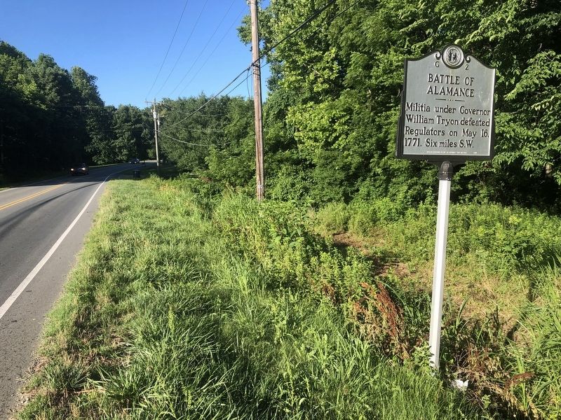
On NC Highway 62 at Clapp Mill Road, on the left when traveling south on NC Highway 62.
Here was fought (I) on May 16, 1771, the Battle of Alamance. Opposing forces were colonial militia, mainly from the eastern part of the province, commanded by Governor William Tryon, and a band of frontier dwellers known as Regulators, who had risen . . . — — Map (db m35055) HM
On North Carolina 62 (North Carolina Route 62) at Porter Sharpe Road, on the right when traveling south on North Carolina 62.
Troops led by Henry Lee ambushed British cavalry of Banastre Tarleton one mile north, Mar. 2, 1781. Americans retreated under heavy British fire. — — Map (db m222722) HM
On Maple Avenue near Anthony Road, on the right when traveling south. Reported permanently removed.
A body of Tories, going to join Cornwallis' Army at Hillsborough, was destroyed by a Whig force, Feb. 23, 1781. ¾ mile southwest. — — Map (db m28524) HM
On North Carolina 62, 0.1 miles south of Pond Road, on the right when traveling south.
Colonial trading route, dating from 17th century, from Petersburg, Virginia, to Catawba and Waxhaw Indians in Carolina, passed nearby. — — Map (db m222808) HM
On North Carolina Route 62 north of Pond Road (Route 0.2), on the right when traveling north.
Before and after the battle of Alamance, the militia of Governor William Tryon camped nearby, along Alamance Creek, May 13-19, 1771. — — Map (db m222809) HM
On State Highway 49 at 1300 Bellemont Lane on State Highway 49.
Before and after the Battle of Alamance, the Militia of the Governor William Tryon camped nearby, along Alamance Creek. May 13-19, 1771. — — Map (db m222810) HM
On State Highway 54 at State Highway 119, on the left when traveling east on State Highway 54.
Teacher in Piedmont area from 1819 to 1867; operated own school in Alamance County, 1851 - 67. Home is 1 mile, grave is 3½ miles northeast. — — Map (db m29244) HM
On Main Street, on the right when traveling north.
Racial violence in Caswell and Alamance counties in 1870 led to martial law, under Col. Geo. W. Kirk, impeachment & removal of Gov. W.W. Holden. — — Map (db m28308) HM
On North 5th Street (U.S. 70) at South 5th Street (North Carolina Route 119), on the right when traveling east on North 5th Street.
Brigadier general of North Carolina militia, member House of Commons, conventions 1788, 1789, and U.S. Congress. His home stood nearby. — — Map (db m223043) HM
On East Center Street at N. 7th Street, on the right when traveling east on East Center Street.
Colonial trading route, dating from 17th century, from Petersburg, Virginia, to the Catawba and Waxhaw Indians in Carolina, passed nearby. — — Map (db m223046) HM
On Snow Camp Road, 0.2 miles south of Greensboro-Chapel Hill Road.
Settled by Quakers in 1749. Cornwallis camped in area after Battle of Guilford Courthouse and used home of Simon Dixon as headquarters. — — Map (db m223102) HM
On State Highway 90, 0.2 miles west of Richard Lane (County Highway 1616), on the right when traveling west.
Noted educator and minister. Founded York Collegiate Institute & numerous academies. Professor at Rutherford College. Grave 5mi. N. — — Map (db m156756) HM
On State Highway 90, 0.6 miles east of Wayfound Church Road, on the right when traveling east.
A gem found only in N.C., named for W.E. Hidden, mineralogist of N.Y., who prospected
in this area about 1880. Mines were nearby. — — Map (db m156754) HM
On Main Street (U.S. 52) at Cemetery Street, on the right when traveling south on Main Street.
Free black served as a Baptist pastor at Rocky River Church until law in 1831 barred blacks from public preaching. Buried 500 yards west. — — Map (db m77358) HM
On Andrew Jackson Highway (U.S. 74) at Clark Mountain Road (County Route 1744), on the right when traveling west on Andrew Jackson Highway.
Jurist & Antifederalist leader. Member of court which in 1787 issued the first reported precedent for judicial review. His home stood 3 miles N.E. — — Map (db m77357) HM
On U.S. 52, 0.2 miles south of Old Sneedsboro Road (North Carolina Highway 1829), on the right when traveling south.
North Carolina. Colonized, 1585-87, by first English settlers in America; permanently settled c. 1650; first to vote readiness for independence, Apr. 12, 1776
South Carolina. Formed in 1712 from part of Carolina, which was . . . — — Map (db m42303) HM
On U.S. 52 at Old Sneedsboro Road (North Carolina Highway 1829), on the right when traveling south on U.S. 52.
Laid out 1795. Promoted as inland port town on Pee Dee River by Archibald D. Murphey. Only graveyard remains, five miles southeast. — — Map (db m42309) HM
On Andrew Jackson Highway (U.S. 74) 0.4 miles west of Boylin Road (North Carolina Highway 1420), on the right when traveling west.
Here was established the first district in America for a systematic program of land erosion control. Known as the Brown Creek District because it embraced the area of the Brown Creek Watershed, it heralded the beginning of a national program of soil . . . — — Map (db m42349) HM
On Andrew Jackson Highway (U.S. 74) at Horne-town Road (North Carolina Highway 1259), on the right when traveling east on Andrew Jackson Highway.
President of National Farmers' Alliance, 1889-1892; began Progressive Farmer, 1886; a founder of NCSU and Meredith College. Was born here. — — Map (db m42356) HM
On East Caswell Street (U.S. 74) at Greenwood Lane, on the right when traveling east on East Caswell Street.
Eighteenth-century house built by Patrick Boggan, Revolutionary soldier & a founder of Wadesboro. Now historical museum. Located 2 blocks south. — — Map (db m42321) HM
On Andrew Jackson Highway (U.S. 74) at Anson High School Road (North Carolina Highway 1259), on the right when traveling east on Andrew Jackson Highway.
“Father of soil conservation.” First chief of the Soil Conservation Service, U.S. Dept. of Agriculture, 1935-1952. Born 4 miles southwest. — — Map (db m42344) HM
On East Caswell Street (U.S. 74) at North Park Drive, on the right when traveling west on East Caswell Street.
Associate Justice, State Supreme Court, 1878-1887; Member of Congress, 1873-1877; Member of Confederate Congress; legislator. Home is one mile west. — — Map (db m42320) HM
On Rugby Road (State Highway 194) at Joe Thomas Road, on the left when traveling north on Rugby Road.
North Carolina. Colonized, 1585-87, by first English settlers in America; permanently settled c. 1650; first to vote readiness for independence, Apr. 12, 1776
Virginia. First permanent English colony in America, 1607, one of thirteen . . . — — Map (db m95737) HM
On East Main Street (State Highway 88) at Cherry Street, on the right when traveling west on East Main Street.
American botanist and Harvard professor. In July 1841, investigated the region's flora. Headquarters was in house that stood 50 yds. N. — — Map (db m95736) HM
On Main Street West (State Highway 184/194) at Maple Court, on the right when traveling west on Main Street West.
Presbyterian. Founded in 1900 by Edgar Tufts. Named for teacher Elizabeth McRae & benefactor Mrs. S. P. Lees. Senior college since 1988. — — Map (db m98511) HM
On Linville Falls Highway (U.S. 221) at Sloop Mill Dam Road, on the left when traveling west on Linville Falls Highway.
Founded by Mary Martin Sloop, physician, 1913, to serve region's youth. Weaving Room, est. 1920, boosted revival of handicrafts. Campus ½ mi. W. — — Map (db m77493) HM
On Craven Street near South Main Street, on the right when traveling east.
Anglican minister to N.C., 1753-71. Served parish of St. Thomas & as chaplain to Gov. Arthur Dobbs. Erected first glebe house on record in the colony. — — Map (db m65664) HM
Near Carteret Street (State Highway 92) at Harding Street.
Bath, oldest town in North Carolina, was established in 1705. The first settlers were French Huguenots from Virginia. Among the early English inhabitants were John Lawson, author of the first history of Carolina (1709) and Christopher Gale, Chief . . . — — Map (db m67574) HM
On South Main Street, on the left when traveling south.
The road from New England to Charleston, over which mail was first carried regularly in North Carolina, 1738-39, passed near this spot. — — Map (db m65358) HM
Near Carteret Street (State Highway 92) at Harding Street.
Bath, the oldest incorporated town in North Carolina, was established in 1705. By the 1708 the town consisted of twelve houses and a population of fifty people. Among the early inhabitants were John Lawson, Surveyor General of the colony and . . . — — Map (db m67575) HM
On South Main Street, 0.1 miles south of Craven Street, on the right when traveling north.
Agricultural reformer, a founder of the State Fair, published and edited the "Farmer's Journal", 1852-53, in Bath. This was his home. — — Map (db m67567) HM
On South Main Street near Carteret Street (County Road 99), on the left when traveling south.
Colonial home of Colonel Robert Palmer, Surveyor-General of North Carolina 1753-1771 and Collector of Customs for the Port of Bath. Built c. 1744, probably by Michael Coutanche, it is one of the oldest surviving dwelling-houses in the State. . . . — — Map (db m66701) HM
On State Highway 33 at Windmill Road (County Road 1124) on State Highway 33.
Site of Confederate batteries on Pamlico River which enabled General D. H. Hill's forces to besiege Washington in spring of 1863. Five miles east. — — Map (db m52837) HM
On State Highway 33 at Business U.S. 17, on the right when traveling east on State Highway 33.
Episcopal boys school founded in 1851 by The Rev. N.C. Hughes. Open off and on until 1908. Many students entered ministry. Stood here. — — Map (db m52835) HM
On West Main Street at Gladden Street, on the left when traveling east on West Main Street.
Prior to formation of 1st N.C. Colored Volunteers, about 100 black men were armed to aid Union forces during the siege of Washington in 1863. — — Map (db m114466) HM
On Bridge Street (U.S. 17), on the right when traveling north.
Congressman from New York, 1821-39; House leader for Jackson & Van Buren; minister to Russia; merchant. Was born in this town, 1786. — — Map (db m65820) HM
On West Main Street near South Respess Street, on the right when traveling south.
Governor, 1889-91, state Adjutant General, 1863, Confederate officer, superior court judge, state legislator. His home was here. — — Map (db m65862) HM
On East Main Street near Market Street, on the left when traveling east.
Native of Washington, Zurich graduate, head of a Boston hospital, 1st woman member N.C. Medical Society, 1872. Her girlhood home was here. — — Map (db m66169) HM
On U.S. 17 at North Carolina Highway 45, on the right when traveling west on U.S. 17.
Plantation setting for the novel "Bertie," by George R. Throop (1851), tutor in the family of Geo. W. Capehart. House built 1838 is 8 mi. S.E. — — Map (db m56987) HM
On Cypress Road at Governor Eden House Road, on the left when traveling east on Cypress Road.
Along the banks of the Chowan River and Salmon Creek, the seeds were planted for the colony and state of North Carolina. From these roots in the 1600s emerged the refined plantation life of the ruling colonial gentry in the 1700s, made possible by . . . — — Map (db m56927) HM
On Sterlingworth Street (State Highway 308) at West Watson Street, on the right when traveling north on Sterlingworth Street.
Built 1858 by Patrick H. Winston, Jr. Birthplace of sons George T., educator; Francis D., lt. gov., 1905-1909; & Robert W., writer. 100 yards east. — — Map (db m60651) HM
On State Highway 45 at Batchelor Bay Drive, on the left when traveling north on State Highway 45.
The Confederate ironclad ram Albemarle, led by Capt. J.W. Cooke, crossed Batchelor's Bay, May 5, 1864, and fought seven Union warships 15 mi. E. — — Map (db m56990) HM
On East Boulevard (U.S. 17/13) 0.8 miles north of East Main Street, on the right when traveling south.
Early channel of trade, its valley long an area of plantations. Frequent floods until 1952; since controlled by Kerr Dam. Old name was "Moratuck". — — Map (db m67521) HM
On South King Street (State Highway 308) at East Gray Street, on the right when traveling south on South King Street.
Member of Continental Congress, signer of the Federal Constitution, governor S.W. Territory, Senator from Tennessee. Birthplace ⅕ mi. S.W. — — Map (db m60649) HM