1391 entries match your criteria. Entries 101 through 200 are listed.⊲ Previous 100 — Next 100 ⊳
North Carolina Division of Archives and History Historical Markers
These markers can be found along the roadside in North Carolina and have been erected by the North Carolina Division of Archives and History and predecessor agencies.
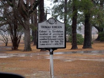
Colonel in Revolution, member of provincial congresses and state senator. Robeson County is named for him. His home stood ½ mile N.E. — — Map (db m222331) HM
Associate Justice United States Supreme Court, 1799–1804, officer in the Revolution, state Attorney General, Judge. Home was 18¾ mi. S. — — Map (db m215669) HM
Large Confederate fort stands 13 mi. S. After a strong Union attack it was evacuated Feb. 18, 1865, resulting in the fall of Wilmington. — — Map (db m6437) HM
Commissioners met here to run boundary in 1764. Popular stop for colonial travelers. Ruins used to establish present state line in 1928. Located 2¾ mi. S.E. — — Map (db m5375) HM
The road from New England to Charleston, over which mail was first carried regularly in North Carolina, 1738–39, passed near this spot. — — Map (db m6317) HM
South Carolina. Formed in 1712 from part of Carolina, which was chartered in 1663, it was first settled by the English in 1670. One of the 13 original states.
North Carolina. Colonized, 1585-87, b first English settlers in America; . . . — — Map (db m39649) HM
Seized by N.C. Militia three months before firing on Fort Sumter. Governor Ellis ordered its return to Federal Authority; three miles east. — — Map (db m5834) HM
Category 4 storm made landfall at Long Beach, October 15, 1954, with winds over 140 mph & 17-foot surge. Nineteen people killed in N.C. — — Map (db m5832) HM
Founded c. 1725, long a principal port of N.C., site of Spanish attack, 1748, and of Stamp Act resistance, 1766. Later abandoned. Was 2 mi. S.E. — — Map (db m6451) HM
A Spanish expedition captured the town of Brunswick, 1748, during King George’s War, but was soon driven away by the colonial militia. — — Map (db m6420) HM
Named for Gov. Caswell. Begun by U.S. in 1826; seized by N.C. troops, 1861; abandoned by Confederates, 1865. Stands five miles southeast. — — Map (db m16331) HM
Last royal governor of North Carolina, 1771–75. Fearing capture, in June 1775 he sought refuge here. Fled offshore to HMS Cruizer in July. — — Map (db m4790) HM
Barbadian planter turned pirate made North Carolina his base, 1718. Captured in naval battle few miles east. Hanged in Charleston. — — Map (db m101979) HM
Large Confederate fort stands 2 mi. E. After a strong Union attack it was evacuated Feb. 18, 1865, resulting in the fall of Wilmington. — — Map (db m6438) HM
Ordained 1707; came to America 1708. Served in many churches in area as missionary of Society for the Propagation of the Gospel, 1732–1755. — — Map (db m6483) HM
House built c. 1725, subsequent additions. Home first of Roger Moore, later of Gov. Benjamin Smith, still later of James Sprunt. ¾ mi. E. — — Map (db m167688) HM
Anglican, built under act of 1751. Graves of Governors Arthur Dobbs and Benjamin Smith and U.S. Justice Alfred Moore. Ruins 2 mi. S.E. — — Map (db m6467) HM
On April 3, 1865, Union Col. Isaac M. Kirby left East Tenn. with 1100 men on a raid against Asheville. On April 6, Kirby's force was defeated by local militia under Col. G. W. Clayton. Earthworks remain 100 yds. N. — — Map (db m55543) HM
Opened up western N.C. Built, 1824-28; the 75-mi. long route from S.C. line to Tenn. line, used by settlers & livestock drovers, passed nearby. — — Map (db m55544) HM
Devastated western N.C. and western Piedmont; destroyed homes, crops, mills, bridges. Four lives lost, July 16, near main gate of Biltmore Estate. — — Map (db m97531) HM
Bishop of the Methodist Episcopal Church,
1784-1816, often visited and preached at the
home of Daniel Killian which was one mile east. — — Map (db m31456) HM
United States Senator, 1895-1903. Republican leader, newspaperman, federal judge. His home is 3/10 mile east; grave is 1.3 mi. west. — — Map (db m12708) HM
Territorial Governor of Oregon, 1848-50,
Vice-Presidential candidate, 1860, U.S.
Senator, major general in Mexican War.
Born 3 miles east. — — Map (db m31534) HM
World War I soldier, aviator. First pilot
of Escadrille Lafayette to shoot down
enemy plane. Killed in action, Sept. 23, 1916.
Home 200 yds. W. — — Map (db m31325) HM
Established before 1793 as Union Hill Academy. Named for George Newton. Later site of a public school. Building stood 200 feet east. — — Map (db m2277) HM
Writer of fiction and poetry. "Fielding Burke," her pen name. Author of Call Home the Heart and Highland Annals. Home, 1925-68, was 1/4 mile N. — — Map (db m57222) HM
Congressman, 1895-1901; U.S. Minister to Persia, 1902-07, and to Greece and Montenegro, 1907-09. His home, “Richmond Hill,” was ½ mile N.W. — — Map (db m209952) HM
Graves of Thomas Wolfe & "O. Henry," authors; Zebulon B. Vance, governor; Thomas L. Clingman and Robert R. Reynolds, U.S. senators. One-half mile W. — — Map (db m97532) HM
The expedition led by Gen. Griffith Rutherford against the Cherokee, September, 1776, passed nearby on the banks of the Swannanoa River. — — Map (db m2279) HM
Established 1927; became Asheville-Biltmore College 1936. Moved here in 1961. A campus of The University of North Carolina, 1969. — — Map (db m55545) HM
Author of "Look Homeward Angel" (1929)."Of Time and the River", and other works. Home stands 200 yards N., birthplace 500 yds. N.E. — — Map (db m12706) HM
Est. 1892 as a center for social, moral, religious influence for blacks working at Biltmore. Businesses thrived in building 100 yards, S. — — Map (db m30151) HM
Leader in fight against tuberculosis in North Carolina, Superintendent of State Sanatorium
in Hoke County, 1914–24. His birthplace is 400 ft. W. — — Map (db m56701) HM
Captain of militia force which marched against the Cherokee in Nov., 1776. A fort which he built stood near here. His home was 200 yds. E. — — Map (db m57152) HM
Established in 1834 to serve travelers crossing Hickory Nut Gap. In continuous service until 1909. House stands 300 yards south. — — Map (db m209726) HM
Southern troops turned back Stoneman's U.S. cavalry, raiding through western North Carolina, at Swannanoa Gap, near here, April 20, 1865. — — Map (db m55830) HM
Used by Indians and pioneers in crossing Blue Ridge. General Rutherford's expedition against Cherokee passed here, September, 1776. — — Map (db m57036) HM
Longest (1,800 ft.) of 7 on railroad between Old Fort and Asheville. Constructed by convict labor, 1877-79. West entrance 300 yds. S.E. — — Map (db m56855) HM
Founded as Weaverville College, 1873; Methodist, coeducational. In 1934 merged with Rutherford to form Brevard College. Campus was one block W. — — Map (db m55842) HM
French botanist, pioneer in studying flora of western North Carolina. Spent nights of Sept. 8, 1794, and May 2, 1795, at "Swan Ponds," 3 mi. S.W. — — Map (db m99603) HM
Built of local cut stone, ca. 1835, by James Binnie. August terms of State Supreme Court held here, 1847-61. Raided by Union force 1865. Remodeled 1901. — — Map (db m99610) HM
Training camp for state troops, 1861-64, named for Col. Zebulon Vance, war governor, was here. The camp was raided by federal troops in 1864. — — Map (db m99612) HM
Rendezvous for "Over-Mountain Men" prior to Battle of Kings Mountain, 1780. Home of Joseph & Charles McDowell, military & political leaders. — — Map (db m99602) HM
On their raid through western North Carolina Gen. Stoneman's U.S. cavalry skirmished with Confederates near here on April 17, 1865. — — Map (db m20346) HM
First Attorney General of North Carolina, 1777-79, member provincial Congresses, colonel in Revolution. "Swan Ponds," his home, was 3 mi. S.W. — — Map (db m99607) HM
Evolved from private school opened c. 1853 by R.L. Abernethy. Operated 1900-1933 by Methodist Church. Closed 1935. The original site 1.3 mi N. — — Map (db m20391) HM
Evolved from private school opened c. 1853 by R.L. Adernethy. Operated 1900-1933 by Methodist Church. Closed 1935. The original site 8/10 mi N. — — Map (db m20393) HM
Presbyterian. Est. 1867 by Luke Dorland to educate Negro women, Scotia Seminary merged in 1930 with Barber Memorial Institute. Coed since 1954. — — Map (db m43383) HM
Cannon Mills president, 1921-1962; advanced the marketing of textiles. Civic leader and health care benefactor. Grave is one mile south. — — Map (db m42696) HM
Leader in founding of the Stonewall Jackson Training School, state senator, editor Concord “Standard” (1888-96) and “Uplift.” Home ½ block W. — — Map (db m43378) HM
Presbyterian. Founded in
early 1750s. Hugh McAden
preached here 1755. First
regular pastor, Alexander
Craighead, 1758. Present
church constructed 1860. — — Map (db m237991) HM
Lutheran. Began ca. 1745 as Dutch Buffalo Creek Church. Adolph Nussman was first regular pastor, 1773. Building erected 1845. 300 yards north. — — Map (db m77369) HM
Colonial trading route started in 17th century; extended from southern Va. to land of Catawba & Waxhaw Indians in N.C. Passed near this spot. — — Map (db m175745) HM
1391 entries matched your criteria. Entries 101 through 200 are listed above. ⊲ Previous 100 — Next 100 ⊳