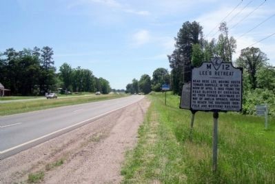
After evacuating Petersburg and Richmond on 2-3 Apr. 1865, Gen. Robert E. Lee's Army of Northern Virginia retreated west to Amelia Court House to obtain supplies and then turn south to North Carolina. On 6 Apr., however, when Maj. Gen. Philip H. . . . — — Map (db m155598) HM
Sheridan reached here on April 4, 1865 with cavalry and the Fifth Corps, and entrenched. He was thus squarely across Lee's line of retreat to Danville. On April 5, Grant and Meade arrived from the east with the Second Corps and the Sixth Corps. — — Map (db m10217) HM
From here Union cavalry moved north on April 5, 1865 to ascertain Lee's whereabouts. On the morning of April 6, the Second, Fifth and Sixth corps of Grant's army advanced from Jetersville toward Amelia Courthouse to attack Lee. — — Map (db m86139) HM
Three miles north is Amelia Springs, once a noted summer resort. There Lee, checked by Sheridan at Jetersville and forced to detour, spent the night of April 5-6, 1865. — — Map (db m10219) HM
Nottoway County. Area 310 Square Miles. Formed in 1788 from Amelia, and named for an Indian tribe. Tarleton passed through this county in 1781. Here lived William Hodges Mann, Governor of Virginia 1910-14. (Reverse) Formed in . . . — — Map (db m10220) HM
Nottoway County. Area 310 Square Miles. Formed in 1788 from Amelia, and named for an Indian tribe. Tarleton passed through this county in 1781. Here lived William Hodges Mann, Governor of Virginia 1910-14.
Amelia County. . . . — — Map (db m18925) HM
Here Custer, commanding advance guard of an Army of the Potomac, struck and drove back Fitz Lee, left flank guard of Army of Northern Virginia, April 3, 1865. — — Map (db m6156) HM
Amelia County. Area 371 Square Miles. Formed in 1734 from Prince George and Brunswick, and named for Princess Amelia, daughter of King George II. William B. Giles, Governor of Virginia 1827-30, lived in this county. . . . — — Map (db m18924) HM
On 11 June 1864, about 800 yards east, the Botetourt Battery prevented the destruction of the Orange and Alexandria Railroad bridge across the Tye River. This bridge was an important part of the Confederate railroad network for the movement of . . . — — Map (db m10227) HM
Bear Mountain is the spiritual center of the
Monacan community. The Bear Mountain Indian
Mission School, ca. 1868, was originally built for
church services and is listed on the National
Register of Historic Places. Virginia’s racial
segregation . . . — — Map (db m104369) HM
Amherst County opened Central High School here in 1956 to serve African American students. The school, established at the same time as the all-white Amherst County High School, was built in an effort to create "separate but equal" facilities despite . . . — — Map (db m179501) HM
Near here lived Anthony and Benjamin Rucker,
inventors of the James River batteau, which
superseded the double dugout canoe and rolling
road for transporting tobacco hogsheads. These
long (about 50 or 60 feet), double-ended vessels
dominated . . . — — Map (db m46342) HM
Nearby stood Rucker’s Chapel, one of the first Anglican (present-day Episcopal) churches in Amherst County. Also known as Harris Creek Church and later as St. Matthew’s, the church was founded by Col. Ambrose Rucker before 1751. It stood on part of . . . — — Map (db m46350) HM
Heavy rains early in 1854 left the James River and the treacherous Balcony Falls in full flood. On 21 January the towrope of the canal boat, Clinton, snapped. Washed over the Mountain Dam and through successive falls, its passengers became . . . — — Map (db m96744) HM
Amherst County. Area 470 Square Miles. Formed in 1781 from Albemarle, and named for Jeffrey, Lord Amherst, British commander in the French and Indian War. Balcony Falls are in this county.
Rockbridge County. Area . . . — — Map (db m49888) HM
In 1938, the celebration of the 150th anniversary of the United States Constitution, the Virginia Daughters of the American Revolution sponsored the planting of Constitution Forest in this area. With the help of the Civilian Conservation Corps and . . . — — Map (db m49885) HM
In the grove of trees some hundreds of yards to the west is the grave of Sarah Winston (Henry), mother of Patrick Henry, who died in November, 1784. — — Map (db m123090) HM
Nelson County. Area 473 Square Miles. Formed in 1807 from Amherst, and named for General Thomas Nelson, Governor of Virginia, 1781. Oak Ridge, an old home, is in this county.
Amherst County. Area 470 Square . . . — — Map (db m86235) HM
Amherst County. Area 470 Square Miles. Formed in 1781 from Albemarle, and named for Jeffrey, Lord Amherst, British commander in the French and Indian War. Balcony Falls are in this county.
Rockbridge County. Area . . . — — Map (db m65461) HM
Heavy rains early in 1854 left the James River and the treacherous Balcony Falls, south of this site, in full flood. On 21 January the towrope of the canal boat, Clinton, snapped. Washed over the Mountain Dam and through successive falls, its . . . — — Map (db m66946) HM
Amherst County. Area 470 Square Miles. Formed in 1761 from Albemarle, and named for Jeffrey, Lord Amherst, British commander in the French and Indian War. Balcony Falls are in this county.
Campbell County. Area 557 . . . — — Map (db m46431) HM
Patented in 1742 by John Bolling, Jr., the 2,735-acre Buffalo Lick Plantation tract along the James
River includes three notable historic sites. One
mile southeast stand the ruins of Mount Athos, the
home of William J. Lewis, an officer in . . . — — Map (db m46354) HM
Established in 1910 as the Virginia State
Epileptic Colony, the center admitted its first
patients in May 1911. The facility originally
served persons with epilepsy and began
accepting individuals with mental retardation
in 1913. Due to the new . . . — — Map (db m46394) HM
During the Civil War, a line of trenches and
fortified artillery positions extending past
here were built late in 1863 to defend Lynchburg against attack from the north. Brig.
Gen. Francis T. Nicholls was responsible for
ensuring that the local . . . — — Map (db m156359) HM
This liberal arts college for women, opened in 1906, granted its first Bachelor of Arts degrees in 1910. Established under the will of Indiana Fletcher Williams as a memorial to her only daughter, Daisy, the college is located on a 2800-acre . . . — — Map (db m86140) HM
West Africans developed the forerunners of the modern banjo. Free and enslaved Africans in the Americas later made similar stringed instruments, typically of animal hides, gourds, wood, and gut or horsehair. Black musicians who lived near here, . . . — — Map (db m172200) HM
This building, erected in 1892 when the county seat was moved to this location, should not be mistaken for the original, built in 1846 and destroyed by fire in 1892. Three miles northeast is old Appomattox Court House and the McLean House where Lee . . . — — Map (db m15514) HM
Here are buried eighteen Confederate soldiers who died April 8 and 9, 1865 in the closing days of the War Between the States. The remains of one unknown Union soldier found some years after the war are interred beside the Confederate dead. About 500 . . . — — Map (db m156470) HM
Near this building stood the station of the South Side Railroad where, on April 8, 1865, three trains unloading supplies for the Army of Northern Virginia were captured by units of Sheridan’s Union cavalry under Gen. Geo. Custer. Significant for its . . . — — Map (db m203259) HM
Three miles north is Eldon, birthplace and home of Henry D. "Hal" Flood (2 Sept.1865-8 Dec.1921). A member of the Virginia House of Delegates (1887-1891) and Senate (1891-1900), Flood also served in the U.S. Congress from 1901 to 1921. He served . . . — — Map (db m10225) HM
Nearby is buried Joel Walker Sweeney (ca. 1810-1860), the musician who redesigned this African instrument into the modern five-string banjo that is known today. Although slaves apparently added the fifth string to what had been a four-strong . . . — — Map (db m30076) HM
At the McLean house at Appomattox, two miles north, took place the meeting between Lee and Grant to arrange terms for the surrender of the Army of Northern Virginia. This was at 1:30 P.M. on Sunday, April 9, 1865. — — Map (db m34478) HM
Two miles north, at sunrise of April 9, 1865, Fitz Lee and Gordon, moving westward, attacked Sheridan's position. The attack was repulsed, but a part of the Confederate cavalry under Munford and Rosser broke through the Union line and escaped. This . . . — — Map (db m34477) HM
On 8 Apr. 1865, Gen. Robert E. Lee and his Army of Northern Virginia, retreating from Petersburg toward Pittsylvania County, reached the hills to the northeast. Gen. Ulysses S. Grant and his Federal army, pursuing Lee to the south, blocked him here. . . . — — Map (db m10224) HM
Appomattox County. Appomattox County was named for the Appomattox River, which runs through the county. The river is named for the Appamattuck tribe, which lived near the mouth of the river. The county was formed from parts of Buckingham, . . . — — Map (db m74018) HM
The South Side Railroad provided service
at Concord in 1854 when the track was
completed from Petersburg to Lynchburg.
During the Civil War, these rail lines were
important for transporting troops and supplies.
On 11 June, seven days before the . . . — — Map (db m64027) HM
Appomattox County. Area 342 Square Miles. Formed in 1845 from Buckingham, Prince Edward, Charlotte and Campbell, and named for an Indian tribe. This country was the scene of Lee's surrender, April 9, 1865.
Prince Edward . . . — — Map (db m30113) HM
According to local tradition, residents of this region were making clay smoking pipes here by the mid-eighteenth century. By 1879 the Pamplin Pipe Factory was in operation. Machines there were used to mold clay into pipes, which were then allowed to . . . — — Map (db m30109) HM
Thomas S. Bocock, lawyer and politician, was
born in present-day Appomattox Co. (then
part of Buckingham Co.) on 18 May 1815. In
1846, he was elected to the U. S. House of
Representatives and served there until 1861.
In 1859, Bocock was . . . — — Map (db m64026) HM
Orville Wright made his first heavier-than air
flight in Virginia at Fort Myer for the U.S.
Army on 3 Sept. 1908. He flew the plane
slightly more than a minute, reaching a
speed of 40 miles per hour. During the next
two weeks here, Wright broke . . . — — Map (db m108126) HM
On September 9, 1908, near this site,
Orville Wright carried aloft in
public his first passenger, Lt. Frank
P. Lahm, for a flight lasting 6
minutes and 24 seconds. Three days
later, he took Major George O. Squier
on a flight of 9 minutes and . . . — — Map (db m108151) HM
Although dueling was illegal in Virginia, Secretary of State Henry Clay challenged U.S. Senator John Randolph of Roanoke. Clay called Randolph out to defend his honor after Randolph insulted him in a speech on the Senate floor. Randolph confided to . . . — — Map (db m2315) HM
Margaret Elizabeth Pfohl Campbell was born to a Moravian family in North Carolina, where her upbringing and education led her to devote her life to seeking educational opportunities for others. She served as dean of Staunton's Mary Baldwin College . . . — — Map (db m55736) HM
George Moffett (1735–1811), a prominent regional military and civic leader, had joined the Augusta County militia by 1758. He participated in the French and Indian War (1756–1763), led a militia company at the Battle of Point Pleasant in . . . — — Map (db m30460) HM
Born near Churchville on 25 Feb. 1843, Hanger joined the Churchville Cavalry at Phillipi, W.Va., on 2 June 1861, where the next morning he was wounded. The resulting amputation of his leg was probably the first of the Civil War. He convalesced at . . . — — Map (db m15905) HM
Near this spot in 1764, Shawnee Indians killed John Tremble (Trimble) in the last such event in Augusta County. During the preceding decade, a series of conflicts between Native Americans and European settlers occurred along the western frontier of . . . — — Map (db m30461) HM
Mount Pleasant, a venerable stone dwelling exemplifying traditional Shenandoah Valley domestic architecture, was erected on the 1740 land grant to John Moffett from King George II. Originally known as Moffetts Bottom, early probate records reflect a . . . — — Map (db m30448) HM
Five miles east, formerly known as Woods’ Gap. Michael Woods, his three sons and three Wallace sons-in-law (Andrew, Peter, William), coming from Pennsylvania via Shenandoah Valley, crossed through this pass into Albemarle County in 1734 – . . . — — Map (db m16644) HM
This was first the Southern Branch of the “Triple Forks of Shenandoah” Congregation, which called John Craig as pastor in 1741. A church was completed here about 1748; two other buildings have succeeded it. Beginning with 1777, James Waddel, the . . . — — Map (db m122178) HM
The U.S. Army, needing stateside medical facilities during World War II, broke ground for Woodrow Wilson General Hospital here in June 1942. Named for the former U.S. president born in nearby Staunton, the hospital consisted of about 135 . . . — — Map (db m106826) HM
In 1947 the Woodrow Wilson Rehabilitation Center became the first
state comprehensive rehabilitation
center in the United States. Operated
by the Virginia Department of
Rehabilitative Services, this residential facility offers various . . . — — Map (db m50617) HM
Soon after the Civil War ended in 1865, Confederate veteran Charles S. Roller began teaching at the Old Stone Church nearby at Ft. Defiance. By 1874 he had founded Augusta Male Academy and incorporated military discipline into its classical . . . — — Map (db m11900) HM
The Augusta Stone Church, Virginia's oldest Presbyterian church in continuous use west of the Blue Ridge Mountains, opened on 22 Jan. 1749. It replaced a log meetinghouse built shortly after the congregation's founding in 1740. At the outbreak of . . . — — Map (db m155473) HM
John Craig, born in County Antrim, Ireland, and educated in Edinburgh, Scotland, immigrated to America in 1734. Ordained pastor in 1740 of the two churches known as Augusta Stone and Tinkling Spring, Craig was Virginia's first settled Presbyterian . . . — — Map (db m155472) HM
George Caleb Bingham, a renowned American genre painter of the 19th century, was born in a frame house just north of here on 20 March 1811. Bingham moved to Missouri in 1819, where he began painting portraits in the 1830s and later specialized in . . . — — Map (db m13620) HM
Nestled here in the countryside south of Staunton,
along historic Middlebrook Road, is one of the
oldest villages in the region. William and Nancy
Scott sold the first 27 lots in April 1799 to
Scots-Irish and German settlers. In 1851, . . . — — Map (db m50388) HM
Shenandoah Valley circuit-riding preacher Paul
Henkel formed Mount Tabor Lutheran Church
about 1785, several miles to the east. It shared a
log building with St. John’s, a Lutheran and
Reformed union congregation. Under the direction
of David . . . — — Map (db m50578) HM
Colonists first settled Mossy Creek in the 1740s. Mossy Creek Iron Works was founded by 1775, when partners Henry Miller and Mark Bird began operating an iron furnace, forge, and mills here. The ironworks became an important industrial enterprise . . . — — Map (db m1841) HM
The village of Stokesville, established by 1901,
became a boomtown after the Chesapeake Western
Railway was extended here in 1902. Tram lines
into the mountains brought timber to the rail
head. Lumber mills, bark tanneries, a stave and
heading . . . — — Map (db m98139) HM
Salem Evangelical Lutheran Church traces its existence to 1789 when Shenandoah Valley circuit preacher Paul Henkel held services for the German community in a schoolhouse nearby at Seawright Springs. By 1805, the congregation had built a frame . . . — — Map (db m30445) HM
On 5 June 1864, Confederate Brig. Gen. William E.
“Grumble” Jones deployed his 5,600-man force to
stop Union Maj. Gen. David Hunter’s advance on
Staunton. The main battle line formed just south of
here. Jones repulsed two assaults by . . . — — Map (db m155468) HM
The Rev. John Blair, a minister influenced by the Great Awakening, organized New Providence Presbyterian Church about 1746. The congregation moved to a site seven miles west of here about 1760, and the present Greek Revival-style sanctuary was . . . — — Map (db m172318) HM
A rural African-American school stood here by 1874. In 1927 a two-room elementary school serving Cedar Green and Smokey Row communities was built. The Augusta County Training School (Cedar Green School), the county’s first black consolidated school, . . . — — Map (db m59711) HM
Two miles west. The first church was built by Colonel Robert Doak in 1779. Captain James Tate, an elder, led in the battles of Cowpens and Guilford Courthouse (1781) a company drawn mainly from this church. In the churchyard 23 Revolutionary . . . — — Map (db m32104) HM
Five miles west is the birthplace of Virginia Institute, founded in 1842 by David F. Bittle, assisted by Christopher C. Baughman. Chartered on January 30, 1845, as Virginia Collegiate Institute, the school was moved to Salem, Virginia, in 1847, and . . . — — Map (db m32079) HM
Two and a half miles northwest. As early as 1748 a log meeting house stood there. In 1793 a stone church (still standing) was built. In 1859 it was succeeded by a brick church, which gave way to the present building in 1918. In the graveyard rest . . . — — Map (db m23759) HM
John Colter, born in Stuart's Draft about 1775, was a member of the northwest expedition led by Meriwether Lewis and William Clark (1804-1806). During his subsequent, solitary explorations of the West, Colter traversed the area now comprising . . . — — Map (db m46393) HM
The vestry of Augusta Parish purchased 200 acres here in 1749 to serve as a glebe, farmland set aside to support the minister. Just to the southwest, on a portion of this property, the parish established the first public cemetery in the vicinity. . . . — — Map (db m159738) HM
Newlyweds Anna Mary Robertson Moses (later
knows as Grandma Moses) and her husband
Thomas arrived in Augusta County from New
York in 1887. Renting several farms before purchasing Mt. Airy, a large brick Federal style
house built in 1880. The . . . — — Map (db m77511) HM
Here stood, from the early 19th century until the mid-1900s, the tavern and stagecoach stop first owned by Peter Hanger. In 1848 its second proprietor, Samuel Harnsbarger, planted a willow tree in a spring here, across the newly-constructed Valley . . . — — Map (db m11811) HM
This church, seven and a half miles west, was organized by John Blair in 1746. Five successive church buildings have been erected. The first pastor was John Brown. Samuel Brown, second pastor, had as wife Mary Moore, captured in youth by Indians . . . — — Map (db m122187) HM
Confederate troops, the remnant of the Army of the Northwest commanded by Brig. Gen. Edward “Allegheny” Johnson, constructed this fortification about 1 Apr. 1862 to protect the Shenandoah Valley, the “Breadbasket of the . . . — — Map (db m15791) HM
Highland County. Area 422 square miles. Formed in 1847 from Pendleton and Bath, and given its name because of its mountains. The Battle of McDowell, 1862, was fought in this county.
Augusta County. Area 1006 square . . . — — Map (db m30389) HM
Rockingham County. Area 876 square miles. Formed in 1778 from Augusta, and named for the Marquis of Rockingham, British statesman. John Seiver, of Tennessee, was born in this county. In it took place the battles of Cross Keys . . . — — Map (db m12369) HM
The Tidewater Hardwood Company built a lumber mill and company town here, 192–1922, naming it Bacova, a contraction for Bath Co., Va. Narrow-gauge railroads brought the logs to the mill. The company paid
workers in scrip redeemable for rent, . . . — — Map (db m70219) HM
Artist William Sergeant Kendall (1869–1938) and his wife Christine Herter Kendall (1890–1981) built this house soon after they arrived in Virginia in 1922. Garth Newel, Welsh for “New Home,” served as their residence and studio. A student of Thomas . . . — — Map (db m69747) HM
Born In Thaxton, Bedford County, Lettie Pate
Whitehead Evans played a major role in the early
distribution of bottled Coca-Cola. She was one
of the first women members of the board of
directors of a major American corporation,
serving on the . . . — — Map (db m69922) HM
Col. Charles Lewis, younger brother of Gen. Andrew Lewis, acquired 950 acres of land on the Cowpasture River in June 1750. Nearby, Fort Lewis, a small stockade, initially under the command of then Capt. Charles Lewis, was constructed by 1756 to . . . — — Map (db m30469) HM
Millboro began as a settlement around Cady’s
Tunnel, built by the Central Virginia Railroad.
By 1856 the tracks extended from Richmond
to Cabin Creek nearby. During the Civil War,
Confederate soldiers marched westward down
the old Crooked Spur . . . — — Map (db m69537) HM
T.C. Walker School, which opened in 1930, was named for Thomas Calhoun Walker a former slave from Gloucester County who became the first African American attorney in Virginia. It cost $4,600, and was underwritten with $500 from the Julius Rosenwald . . . — — Map (db m69471) HM
Bath County. Area 545 Square Miles. Formed in 1790 from Augusta, Greenbrier, and Botetourt, and probably named for the town of Bath in England. The warm springs and hot springs are in this county.
Rockbridge County. . . . — — Map (db m34304) HM
Nannie Crump West, Christian missionary and youth
advocate, founded Camp Mont Shenandoah in 1927 for
girls from Virginia’s elite families. This residential
summer camp, like others established along the
Cowpasture River early in the 20th . . . — — Map (db m107846) HM
The site was about one-half mile north of the river. This was one of a chain of frontier forts ordered erected by the Virginia legislature early in 1756. The chain extended from Hampshire County (now West Virginia) to Patrick County on the North . . . — — Map (db m77510) HM
Scotch-Irish Presbyterians, seeking freedom of worship and led by the Rev. Alexander Craighead, built a log meetinghouse a mile and a half down the Cowpasture River about 1749. Indians burned it during the French and Indian War. Moving to this site . . . — — Map (db m122193) HM
The Mountain Grove community grew up around William Gatewood’s plantation in the early 19th century. During the Civil War. Brig. Gen. William W. Averell’s Federal cavalry attacked from newly created West Virginia late in 1863 and fought with . . . — — Map (db m70233) HM
Union Hurst, a school for African Americans, was built near here on Pine Hurst Heights Road between 1924 and 1925. The school was built with the assistance of the Julius Rosenwald Fund, a program that helped build some 5,000 schools for African . . . — — Map (db m70245) HM
Bath County was formed in 1790 from parts of Augusta, Botetourt, and Greenbrier counties. The county court first met here on 10 May 1791 at the house of John Lewis's widow Margaret, who donated two acres opposite the mineral baths for public use. . . . — — Map (db m21754) HM
Mary Johnston, a novelist, historian, playwright, suffragist, and social advocate, lived here at Three Hills. Born in Botetourt County, Johnston published 23 novels between 1898 and 1936 and became the first woman to top best-seller lists in the . . . — — Map (db m69596) HM
Nearby is the site of Terrill Hill, home of the Terrill brothers of Bath County. Brig. Gen. William R. Terrill, a graduate of West Point commanded a Union brigade and was killed in the Battle of Perryville, Kentucky, on 8 Oct. 1862. His brother, . . . — — Map (db m21755) HM
After 112 years in buildings near the Warm
Springs mineral baths a mile northeast, the
Bath County Court moved to this site in 1908.
The architect, Frank P. Milburn, predicted the
new courthouse would be “an honor and ornament
to Bath . . . — — Map (db m30491) HM
Born in Waynesboro to former slaves, William H. Sheppard became a Presbyterian missionary to the Belgian colony of Congo Free State in 1890. He and others opposed King Leopold II of Belgium, who encouraged such atrocities as the amputation of . . . — — Map (db m5607) HM
This place became the county seat of Bedford when it was moved from New London in 1782. First called Liberty (incorporated in 1839), the town changed its name to Bedford City in 1890 and to Bedford in 1912. A third courthouse, built in 1834, was . . . — — Map (db m42879) HM
Here is the home of John Goode, political leader, born 1829, died, 1909. Goode was a member of the secession convention of 1861; of the Confederate Congress and of the United States Congress; Solicitor General of the United States; president of the . . . — — Map (db m42877) HM
Near here General Hunter, on his retreat from Lynchburg, halted for the night of June 18, 1864. He resumed his retreat early in the morning of June 19. — — Map (db m42875) HM
The Lynchburg and Salem Turnpike Co. was incorporated in 1818 to build a turnpike from Lynchburg west to Salem. The road reached Liberty (now Bedford) in 1828 and was completed to Salem in 1836. In Bedford County, covered bridges spanned the Big . . . — — Map (db m18830) HM
This road was followed by General Hunter when he crossed the Blue Ridge at the Peaks of Otter and came to Bedford en route to Lynchburg, June 16, 1864. — — Map (db m42893) HM
A Quaker Meeting was established on Goose Creek in 1757, and a meeting house built. Fear of Indians caused most of the Quakers to move elsewhere though some of them returned. Unsuccessful attempts were made to re-establish the Goose Creek Meeting. . . . — — Map (db m65610) HM
Randolph-Macon Academy, a Methodist preparatory school for boys, occupied a building on this site from 1890 until 1934 when the school was consolidated with the Randolph-Macon Academy at Front Royal. In 1936, the property was purchased by Bedford . . . — — Map (db m42878) HM
Chartered by the state in 1795, this is the oldest secondary school in Virginia in continuous operation under its own charter. Conducted for many years as a private school for boys, it began to receive public funds in 1884. It now operates as a . . . — — Map (db m55789) HM
2614 entries matched your criteria. Entries 101 through 200 are listed above. ⊲ Previous 100 — Next 100 ⊳