On Deer Hill Avenue at West Street, on the right on Deer Hill Avenue.
The potato famine of 1846-1851 brought large numbers of Irish immigrants to town. Many purchased homes in the Town Hill neighborhood and St. Peter Church became a focal point for the community.
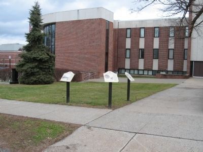
Germans immigrants were the first major group . . . — — Map (db m71353) HM
On Main Street at Library Place, on the right when traveling south on Main Street.
Charles Edward Ives, the ‘Father of Modern Music,’ was born in Danbury on October 20, 1874 to a prominent New England family who were leading citizens of he community. His grandfather, George White Ives, founder of The Savings Bank of Danbury, . . . — — Map (db m71183) HM
On Wooster Street at Deer Hill Avenue, on the right when traveling east on Wooster Street.
Many Danbury land records were destroyed during the British raid of 1777. Historic newspapers, old deeds and early maps help us piece together some of the earliest place names of our city.
Parts of Danbury were lost to Bethel when it broke . . . — — Map (db m71348) HM
On Main Street at West Street, on the right when traveling north on Main Street.
Although local folklore credits a man by the name of Zadoc Benedict with the start of hatting in Danbury after the Revolutionary War, hatters are thought to have been at work in the Danbury community before that time.
After the . . . — — Map (db m71237) HM
On Crosby Street near Main Street, on the left when traveling west.
When the Kohanza Reservoir Dam gave way on the night of February 20, 1869, sixty acres of water, ice, lumber and debris roared down north Main Street. It took shops, homes, bridges and factories with it and several lives were lost. A combination . . . — — Map (db m72857) HM
On Main Street, 0.1 miles north of South Street, on the right when traveling north.
On April 26, 1777, 2,000 British soldiers, under the command of General Tryon, marched into Danbury. The town was a supply depot for military stores.
A Corps of Artificers; skilled craftsmen, such as blacksmiths, were formed into special . . . — — Map (db m72558) HM
On Main Street (Connecticut Route 53) just south of West Street, on the right when traveling north.
Entertainment in Danbury has taken many forms. Buffalo Bill's Wild West Show and traveling circuses that passed through town competed with church-related activities and civic events.
The Taylor Opera House, built in 1870 provided first . . . — — Map (db m230137) HM
On Main Street at Library Place, on the right when traveling north on Main Street.
The origins of the Danbury Fair began in 1821 when the Fairfield Agricultural Society held gatherings in Elmwood Park on Main Street. The event gave farmers an opportunity to discuss farming methods and showcase the fruits of their labor. . . . — — Map (db m71186) HM
On West Street at Foster Street, on the right when traveling west on West Street.
• First recorded census taken in 1756, Danbury’s population: 1,527.
• Danbury’s first mayor, elected in 1888, was Lewis LeGrand Hopkins.
• The first train arrived on the tracks of the Danbury & Norwalk Railroad on March 1, 1851.
• . . . — — Map (db m152995) HM
On West Street at Foster Street, on the right when traveling west on West Street.
Throughout its history, countless women have contributed to Danbury and the lives of its citizens. Here are just a few that have left their mark on our community.
Mary Bull (1812-1882) dedicated her life to attending the poor and needy of . . . — — Map (db m71247) HM
On Deer Hill Avenue at West Street, on the right when traveling north on Deer Hill Avenue.
The start of the 20th century saw a continual influx of newcomers to Danbury. A religious census taken in 1916 showed that 27 nationalities and 20 creeds were represented among the 22,533 residents of the town.
The 1910 census shows that a . . . — — Map (db m71473) HM
On Deer Hill Avenue at West Street, on the right when traveling north on Deer Hill Avenue.
The first eight families arrived here in 1685; full of hope as they embarked on a new life filled with opportunity. Others soon joined them in this flourishing settlement in a newly born colony.
Most of Danbury’s inhabitants, prior to the . . . — — Map (db m71352) HM
On Main Street at Boughton Street, on the left when traveling south on Main Street.
In 1801, Mr. Major Starr donated the land necessary to take a large curve out of Main Street on condition that it serve as a permanent common. To this end, residents from the southern end of the street raised their own funds and created Elmwood . . . — — Map (db m71476) HM
On Deer Hill Avenue at George Street, on the right when traveling north on Deer Hill Avenue.
During the colonial period, agriculture was the principal occupation in Danbury. The daily tasks of our early settlers included clearing land, raising cattle, growing wheat, rye, corn, beans and squash.
Broad flat tracts of fertile ground . . . — — Map (db m71351) HM
On White Street at Main Street, on the right when traveling west on White Street.
Continuing educational opportunities have long been available in Danbury. In the late 1800s, the Stillman’s Business College, at the corner on Main and White Streets, offered classes in penmanship, commercial law and bookkeeping.
The . . . — — Map (db m71136) HM
On Wooster Street near Grand Street, on the right when traveling east.
The artificers, who produced and distributed goods for the army during the American Revolution, may have fueled the start of Danbury’s early manufacturing activities. During the years following the war, Danbury began its transition from a . . . — — Map (db m71474) HM
On Deer Hill Avenue near Wooster Street, on the right when traveling north.
Over 300 patents were issued to residents of Danbury between 1800 and 1890, one of the earliest was issued to D. Hoyt in 1838 for a door hinge.
Many inventions can be attributed to progress and practical conveniences including an oven, a . . . — — Map (db m71350) HM
On Main Street at West Street, on the right when traveling south on Main Street.
Lake Kenosia, said to originate from a Native American word meaning pike or pickerel, is part of the Still River waterway. This popular local park has always played an historic role as a recreational gathering place for Danbury residents.
In . . . — — Map (db m71239) HM
On Main Street at Library Place, on the right when traveling north on Main Street.
Marian Anderson was born in Philadelphia on February 27, 1897. Although her early musical training was sporadic, a scholarship enabled her to study abroad under distinguished teachers.
When Arturo Toscanini heard her perform at the Salzburg . . . — — Map (db m193431) HM
On West Street at Terrace Place, on the left when traveling west on West Street.
There are monuments located throughout our city that serve as a reminder of those who have served our country.
The dedication of the Civil War Soldier’s Monument took place on May 27, 1880 in City Hall Square. The 32-foot high granite . . . — — Map (db m71246) HM
On Main Street at West Street, on the right when traveling south on Main Street.
City Hall Square, the intersection of Main and White Streets has been a central focal point for public activities and structures since the late eighteenth century.
In the 1880s it became the center of Danbury public life. The old City Hall, . . . — — Map (db m71243) HM
On Main Street at Chapel Place, on the right when traveling south on Main Street.
An important aspect of Danbury’s growth as a regional center was the proliferation of banks.
The Savings Bank of Danbury began conducting business in 1849 when George W. Ives set up shop in the Ives homestead on Main Street. As noted by . . . — — Map (db m71138) HM
On Main Street at State Street, on the left when traveling north on Main Street.
Since its earliest days, the importance of education has been at the forefront of the development of the community. In 1763 the will of Comfort Starr left 800 pounds “for the support of a perpetual school in the centre of town.”
By 1769, a . . . — — Map (db m71477) HM
On Main Street at Wooster Street, on the right when traveling south on Main Street.
Danbury was home to several early pioneers of the American circus in the mid 1800s. In fact, Aaron Turner, proprietor of one of the earliest American traveling shows, was actually P.T. Barnum’s mentor. From 1836 to 1838, Barnum traveled with . . . — — Map (db m71475) HM
On Main Street at Wooster Street, on the left when traveling north on Main Street.
Danbury’s first courthouse was built in 1785; complete with old stocks and whipping posts near the front entrance. These were dispensed with when the city’s second courthouse was built in 1824.
Civic events and elections were held in the . . . — — Map (db m72557) HM
Near Ives Street at Railroad Place, on the right when traveling south.
The first reference to a fire department in Danbury can be found in The Republican Journal newspaper printed on November 11, 1793 announcing, “A subscription has been set forward in this town for the purpose of procuring a Fire Engine.” . . . — — Map (db m71137) HM
On Main Street at West Street, on the right when traveling south on Main Street.
In 1771, the Reverend Ebenezer Baldwin drew up terms for a subscription library that would be free to all denominations. Between 1793 and 1856, several other libraries were formed and disbanded.
In 1869 the present Danbury Library was . . . — — Map (db m71244) HM
On Main Street near Elm Street, on the right when traveling south.
The first newspaper printed in Danbury was called The Farmer’s Journal and the year was 1790.
By 1837, The Danbury Times was churning out a weekly paper on a small wooden press that printed one side of a page at a time. During the . . . — — Map (db m71135) HM
On Main Street at Library Place, on the right when traveling south on Main Street.
On April 19, 1889, Governor Morgan Bulkley signed a document granting Danbury official designation as a City within the State of Connecticut. Plans were immediately underway to create a city seal.
Committee member Henry Hoyt was assigned . . . — — Map (db m71181) HM
On Main Street at West Street, on the right when traveling south on Main Street.
In the spring of the year 1685, the first permanent settlement of Danbury was made. The eight determined families of Samuel Benedict, James Benedict, Thomas Barnum, Judah Gregory, Thomas Taylor, John Hoyt, Francis Bushnell and James Beebe settled . . . — — Map (db m71240) HM
On West Street at Foster Street, on the left when traveling west on West Street.
Historic newspapers reveal that sports have long been an outlet for both competitive and recreational gatherings in our city. Local coverage of amateur, club, factory, and school competitions were a regular feature.
Early baseball games . . . — — Map (db m71245) HM
On Main Street near Library Place, on the right when traveling south.
On March 1, 1852, the first train on the tracks of the Danbury & Norwalk Railroad pulled into the Main Street depot, located on the site of the present Post Office. The venture consisted of three locomotives, six passenger cars, twenty-four . . . — — Map (db m71184) HM
On Main Street (Connecticut Route 53) at Liberty Street, on the right when traveling north on Main Street.
Danbury citizens have actively participated in every war that has landed on our own shore as well as those of countries abroad. In each case, community debate has fueled our involvement each time.
Danbury citizens have honored and . . . — — Map (db m230138) HM WM
On Kennedy Avenue at Main Street, on the left when traveling east on Kennedy Avenue.
The intersection of Main Street with White and Elm Streets, known as Wooster Square became an increasingly important section of town with the completion of the Danbury and Norwalk Railroad depot on Main Street in 1851.
As the main route . . . — — Map (db m72855) HM