World War II Plaque
In Memory of
Students and
Faculty of NSC
Who Served in
WWII
NSC Vets Club
Sidney L. Smith
American Legion
Post #24
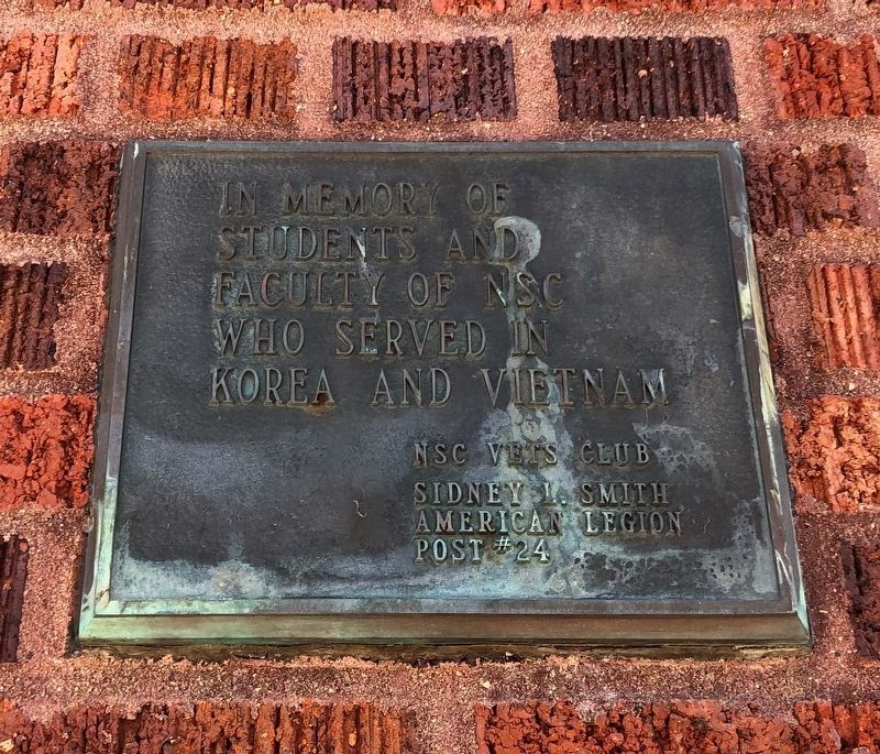
Korea and Vietnam Plaque
In Memory of
Students and . . . — — Map (db m150923) WM
World War I Plaque a.
This Archway
Erected By
The Classes of 1916, '17, '18, '19 and '20
Northern Normal and Industrial School
Dedicated to the
Four Hundred and Forty-Two
Students,
Alumni and . . . — — Map (db m150644) WM
Founded on N S T C Campus
1940
(American Legion Logo)
Charles Dalthorp Ivan Huntsinger
Dr. Harry R. Darling Judge Harry E. Mundt
N. Peter Wenge — — Map (db m114786) HM
Left Side
Clark Swisher's
Commitment to
N.S.U. and his
Efforts for the
Community,
Exemplify his
Love of athletics
And his desire
For students
To achieve
Educational
Excellence.
Right Side
Head . . . — — Map (db m112032) HM
At this site on June 22, 1989,
The State Centennial Wagon
Train with 44 wagons made
their noon stop. Over 700
people welcomed the wagon
train with an old fashioned
BBQ and entertainment. — — Map (db m90516) HM
Perhaps our best known group of birds, waterfowl species such as ducks, geese and swans have webbed feet and water repellent feathers that allow them to float and swim easily. Often striking in plumage, waterfowl are found in a variety of watery . . . — — Map (db m102937) HM
Located at the mouth of Elm River, Columbia has a notable history.
Here was the wintering place of Waneta "Cuthead Band"of Yanctonaise Sioux.
Here was the site of the scout's camp from which in 1866, Sam J. Brown
started his famous "ride in . . . — — Map (db m179946) HM
A Wetland Enhancement Project Developed by Ducks Unlimited, Inc. in cooperation with the U.S. Fish and Wildlife Service and the North American Wetlands Conservation Act Council on Sand Lake National Wildlife Refuge to improve North America's . . . — — Map (db m103078) HM
In 1880, John Daly and his four sons - George, John Charles ("JC"), Edward and Austin arrived at this location from Michigan.
It was here that "Daly Corners" started. On the northwest corner was J.C. Daly's tree claim and his homestead was on . . . — — Map (db m206716) HM
who rose to distinction in
American Letters
resided on this spot 1881-1884
Here stood the
Garland Homestead
where he began his first book
"Main Travelled Roads" — — Map (db m206717) HM
Sand Lake National Wildlife refuge, a 2,498 acre refuge, was established in 1935 to protect critical nesting and migrating habitat for our nation's waterfowl. The James River, which flows through the refuge, was dammed by the Civilian Conservation . . . — — Map (db m102938) HM
This 108-foot tower was built by the Civilian Conservation corps in 1936. The Sand Lake CCC camp ran from 1925 through 1939 and housed several hundred men. They built many of the dikes, fences, and facilities you see on the Refuge today. The . . . — — Map (db m103080) HM
"Over increasingly large areas of the United States, spring now comes unheralded by the return of the birds, and the early mornings are now strangely silent, where once they were filled with the beautiful bird song." Silent Spring, . . . — — Map (db m102940) HM
WEST
Looking to the west, the giant Canada goose pens and display pool are below you. In the spring and summer, you'll see the giant Canada geese raising their goslings in the area. Just beyond the goose area is the tree-lined Refuge . . . — — Map (db m103079) HM
(east side)
History
The united Norwegion Luthern church.
In memory of the pioneer members of the Aurland congregation, organized in 1885. Rev Rogne was the first Pastor. The services wer held in homes & school houses until when in . . . — — Map (db m206714) HM
In Honor
and Memory
of our Men and Women
Who have Served
Our Country in all
Branches of the Service.
This Tribute was Partially
Funded by the July 4, 2003
Celebration that Included
an Awards Ceremony, Parade,
and B-1 . . . — — Map (db m137487) WM
On June 22, 1883 Mrs. Matt (Valborg) Hanhela became the first Finnish settler here to die (in childbirth). She and her infant son were the first to be buried here. Their grave is unmarked and unknown.
Ten acres of land for this cemetery and for . . . — — Map (db m206651) HM
(south side)
Finnish Pioneer Settlers of Other Savo Area Twps. in Territory qf Dakota. 1882–1886
Names of Finnish pioneers. Ada Twp. 129 Range 61. Wm. Pöykkö N.W.14. Markku Rusko S.E.22. Michael . . . — — Map (db m206705) HM
This property
Old Finnish Apostolic
Lutheran Church
has been placed on the
National Register
of Historic Places
by the United States
Department of the Interior — — Map (db m206650) HM
A pioneer in Brown County, Philip Cain Gelling was born on the Isle of Man in 1849. He came to the Dakota Territory from Illinois in 1882 and homesteaded on this site. Philip married Elizabeth Johnson in 1887. From that union 8 children were . . . — — Map (db m169929) HM
Savo Hall
has been placed on the
National Register
of Historic Places
by the United States
Department of the Interior
Built 1899 — — Map (db m206662) HM
This monument was created to forever make available the story of those Finnish people who early came to Brown and Dickey Counties, and settled there.
Erected by the Savo Finnish Historical Society under the direction of John G. Peterson, the . . . — — Map (db m206703) HM
Created with its twin, North Dakota, 2 November 1889, its 77,047 square miles ranks 15th in size. Those square miles include; exceptional corn land in the SE, grass land in the W, wheat land in the N and Productive land all over. Its lowest point, . . . — — Map (db m177397) HM
The First Frederick school house was built in 1883.
Main-building was built in 1922 with four year curriculum.
The Original bell of Frederick school.
Purchased with money raised by student entertainment in April 1888.
Park . . . — — Map (db m137490) HM
Site of the
Tveit Homestead
Claimed in October 1882 by Iver Lars Tveit
Iver brought his bride Marta here in 1883, then his parents Lars & Ragnhilde in 1885
These Tveits were born and raised here: Lewis, Belle, Hilda, . . . — — Map (db m206665) HM
Camp BF-2 (Sand Lake): 2 1/2 miles W and 2 1/2 miles S at headquarters. Company: 2749--6/28/35 - 7/31/39.
The Civilian Conservation Corps was a federal work-relief program during the Great Depression. From 1933 to 1942, the CCC provided work . . . — — Map (db m100979) HM
Ralph Herseth, 1909 - 1969, was born on a ranch near Houghten and grew to manhood here. He graduated from Columbia High School and attended North Dakota State College. As a farmer - rancher, he raised wheat, corn, and Aberdeen Angus cattle and . . . — — Map (db m180972) HM
A Wetland of International Importance (Marker 1)
Wetlands are one of the most important ecosystems on the planet. They improve our quality of life by providing us with clean water, food, flood control, and many forms of recreation. . . . — — Map (db m100980) HM
Oakwood post, established in 1835 by Major Joseph R. Brown for the American Fur Company, was an early trading post in Brown County. French explorers called it “place of the scrub oaks,” a landmark used by Indians and Whites alike. Pierre Le . . . — — Map (db m187060) HM
"Lest We Forget"
Dedicated to all the Veterans of the United States of America and to those who will come after us for their Service to God and Country — — Map (db m90796) WM
Madison Gregory was born in Huron County, Ohio in 1848. He married Ester Randall on December 26, 1870 in Kankakee County, Illinois. Three daughters were born to them in Kankakee County-Lillie Gregory Martin, Jennie Gregory, and Ethel Gregory . . . — — Map (db m125356) HM
"Grant Tooker, one of the early settlers, told of the first burial at Westport. In the late fall of 1883 a man named Albright died of consumption. He lived west of town. No one would volunteer to dig the grave, but when Grant's father offered to . . . — — Map (db m125357) HM
Orrion & Edith Barger
Orrion Russell Barger was born August 23, 1913 at Paynesville, MN and Edith M. Meyer was born November 22, 1913 at Howard, SD. Orrion and Edith (Meyer) Barger were married on November 1, 1941. On June 2, . . . — — Map (db m242613) HM
Named for Selah Chamberlain, a Milwaukee RR official, the site was scene of an encounter between Jean Baptiste Trudeau and the Teton Sioux in 1794 and when Samuel H. Morrow surveyed the area, in November of 1868, he found a ranch on American Creek . . . — — Map (db m184645) HM
"Standing at a crossroads, Dignity echoes the interaction of earth, sky, and people. She brings to light the beauty and promise of the indigenous peoples and cultures that still thrive on this land. My intent is to have the sculpture stand as an . . . — — Map (db m124343) HM
In the 1930's St. Joseph's Indian School opened the Divine Infant Home on this site. The Divine Infant Home provided care for young infants and preschoolers when no other care was available.
The former Divine Infant Home was also a part of the . . . — — Map (db m242610) HM
The Fort Ridgely and South Pass Federal Wagon Road, surveyed and mounded in 1857 crossed here from NE to SW. First public road in the South Dakota area. — — Map (db m242461) HM
Dedicated July 7, 1974 by Governor Richard F. Kneip
Meriwether Lewis and William Clark with their party camped at several points
near this crossing. In September 1804, continuous rain had soaked their gear.
They stopped near Ocoma, above . . . — — Map (db m180987) HM
This Corps of Discovery II marker commemorates the bicentennial
of the Lewis and Clark expedition.
The geographic position of this marker has been established
using the satellite-based Global Positioning System.
This marker is part of the . . . — — Map (db m101382) HM
America's Shrine of Democracy, Mount Rushmore
National Memorial, is located near Keystone in
the Black Hills National Forest. The 60-foot
faces of four great American presidents
represent the birth, growth, development
and preservation of our . . . — — Map (db m161871) HM
On May 24, 2012, the South Dakota DOT Transportation Commission officially declared Interstate 90 from the Minnesota border to the Wyoming border as South Dakota's segment of the national Purple Heart Trail. The Purple Heart Trail was . . . — — Map (db m101380) WM
When the Corps of Discovery reached present-day Chamberlain on September 16, 1804, they were ready for a break. Since May, one member of the expedition, Sergeant Charles Floyd, had died, possibly of appendicitis. Another, Private George Shannon, . . . — — Map (db m98240) HM
Fr. Henry Hogebach – Founder
Fr. Henry Hogebach, SCJ, founded St. Joseph's Indian School in 1927. He devoted his life to the care and education of Native American children. His vision, patience and perseverance remains alive in our ongoing . . . — — Map (db m242611) HM
South Dakota's State Capitol is located in
Pierre, a city that sits along the banks of
the Missouri River near the Oahe Dam. The
building was completed in 1910 and restored
in 1989. The grounds feature Capitol Lake
surrounded by memorials to . . . — — Map (db m161873) HM
Norm and Eunabel McKie of Rapid City, South Dakota, announced their gift of Dignity to the State of South Dakota in 2014, in honor of the 125th anniversary of South Dakota statehood.
The statue was erected in September 2016 at this site, where it . . . — — Map (db m183903) HM
Mitchell is home to the World's Only Corn Palace.
It was originally constructed in 1892 to celebrate
the harvest and stimulate the economic growth
of the community. Today, visitors still enjoy
celebrations at the Corn Palace and continue to
see . . . — — Map (db m161874) HM
This spot offers a spectacular view of the Missouri River, but the river is much different today from when Lewis and Clark traveled up it. Several huge dams now control its flow.
When the expedition came through, the river could go from a mere . . . — — Map (db m242480) HM
Most of the native plants you see here are direct descendants of those found by Lewis and Clark when they arrived in the fall of 1804. As they traveled, the captains always noted stands of timber because they needed wood for kindling and because . . . — — Map (db m242479) HM
In memory of the Dakota whose lives were taken at Fort Thompson in 1863, these were the innocent exiled from Minnesota, who suffered hardship and sickness at this camp.
The stone that stands here, reminds us of the land from which you came. . . . — — Map (db m185463) HM WM
A Crow Creek Sioux dancer at a powwow.
Courtesy of South Dakota Public Broadcasting
The Crow Creek Reservation began in a tragic story of hardship. The Uprising, or the U.S. – Dakota War, started in 1862 when starving Dakota . . . — — Map (db m242476) HM
Dancers at a Lower Brule Sioux powwow.
Courtesy of Central Dakota Times, Debi Ruiz
For thousands of years, ancestors of the Kul Wicasa Oyate, members of the Lakota band known as the Sicangu (burnt or scorched thigh), . . . — — Map (db m242478) HM
Indigenous peoples throughout the West have used medicine wheels of many forms. For thousands of years, Native peoples have used this wheel pattern for health and healing.
The Spirit of the Circle Monument honors and remembers . . . — — Map (db m242477) HM
The statistical center of population for South Dakota in 2000,
according to the Census Bureau and the National Geodetic Survey,
lies at the point 3.2 miles northwesterly from this monument.
The center is at Latitude 44 degrees 02 . . . — — Map (db m125779) HM
[marker on south side of cabin] This cabin, built in 1876 of logs split & transported by Spaulding from the Black Hills, was the first home on the Redwater & what became Butte County. An experienced scout, familiar with the . . . — — Map (db m234772) HM
From this location you are able to view the “Beautiful Forks” of the Redwater River as it runs into the Belle Fourche River as named by French explorers as they passed through the area over 200 years ago. Of course, “Belle Fourche” (pronounced . . . — — Map (db m234799) HM
A.G. Challis built the 1st plank jail in 1896 (for under $400) where City Hall now stands. Unfortunately, an exuberant “one-legged” celebrant arrested at the Black Hills Soldiers & Sailors Reunion, built a fire on the unusually cool night & burned . . . — — Map (db m234740) HM
[west side]Dedicated to those who answered our Nations call in the pursuit of freedom. ”The Forgotten War” 25 June 1950 – 27 July 1953 [east side]Korea 1950 — 1953 Casualties Dead 54,246 . . . — — Map (db m234857) HM WM
Sheepherder's Monuments or stone Johnnies survive the day of the open range. These stone columns were probably built to indicate distance and direction to waterholes and provided the sheepherder with a pastime while tending his flock. — — Map (db m4564) HM
The Great Western Cattle Trail embodied the spirit, determination, and grit of the early cowboys and remains one of the most romantic and interesting times of our past. The entire trail extended from Matamoros, Mexico to Saskatchewan, Canada (Texas . . . — — Map (db m234800) HM
In 1959 following the admission of Alaska and Hawaii to the Union, the U.S. Coast and Geodetic survey officially designated a point 20 miles north of Belle Fourche, South Dakota as the Geographic Center of the Nation.
Entry of Alaska and Hawaii . . . — — Map (db m4867) HM
Hoffnungstal
EV. Lutheran Church
Eureka, South Dakota
Organized 1888
Disbanded December 31, 1968
Record Depository Zion Am. Lutheran Church
Eureka, South Dakota
Original Church Corner Stone
Ev. Luth. . . . — — Map (db m112049) HM
You are about to enter South Dakota Created with its twin, North Dakota, 2 November 1889, its 77,047 square miles ranks 15th in size. Those square miles include: exceptional corn land in the SE, grass land in the W, wheat land in the N. and . . . — — Map (db m44710) HM
The Town of Mound City was started by Edward C. McIntosh, and his father, E.H. McIntosh on June 10, 1884. It was named “Mound City” because of the small hills just north of town, which they called “bachelor mounds.” The . . . — — Map (db m154474) HM
Side A The Flint store and post office was built on this site in 1895. It was named after Moses E. Flint, and early homesteader. Mr. Flint served as a teamster with General Custer on the 1876 campaign against the Sioux which ended with the . . . — — Map (db m112082) HM
Lewis and Clark and the Legend of Stone Idol Creek
On their epic exploratory expedition Meriwether Lewis and William Clark stopped near here and noted two stones resembling human figures, and third like a dog. Capt. Clark writes on Oct. . . . — — Map (db m112085) HM
Lewis and Clark
The Lewis and Clark Expedition, officially the Corps of Discovery, was in what is now South Dakota from August 21 to October 14, 1804 and from August 21 to September 4, 1806.
While here they would make numerous . . . — — Map (db m187079) HM
Old Pollock
In 1901 Pollock was founded as the end point of the Soo Line rail service from Wishek, ND. Soo Line officials requested the town be named Pollock in honor of R.Y. Pollock, a pioneer lay minister and respected citizen of the . . . — — Map (db m112084) HM
Pollock, South Dakota Settlers The first settlers came to this area
about 1880. LaGrace, 9 miles
southwest, was the first town and
the County seat until 1888, when
It gradually disappeared.
The town of Pollock was founded
In 1901 at . . . — — Map (db m112086) HM
Camp BF-1 (DSE-204): located in edge of town of Lake Andes
Companies: Nebraskans?--July-October 1933; 2759V -- 7/31/34-11/1/34; 2743 (Nebraskans) -- 5/25/35-Fall 1935
The Civilian Conservation Corps was a federal relief program during . . . — — Map (db m187634) HM
Martin Marty
1834-1896
First Abbot of St. Meinrad Archabbey, First Bishop of the Dakota Territory, began to visit the Indians in this territory in 1877. He established the first Indian Mission called St. Ann’s Mission of Wheeler, . . . — — Map (db m177442) HM
This monument commemorates the Yankton Sioux Treaty of 1858.
As increasing numbers of settlers came upriver, the Yankton Sioux had to decide whether to join other Sioux tribes in armed resistance or to co-exist with the immigrants. They . . . — — Map (db m217461) HM
In memory of the Yankton Chiefs, who made the Treaty of 1858.
Struck by the Ree ·
Black Bear ·
Medicine Cow ·
White Swan ·
Pretty Boy ·
Feather in the Ear ·
Crazy Bull ·
Frank Deloria
Sioux
Delegates who signed the . . . — — Map (db m217464) HM
Making a hide tipi cover was a community project. The women would get together to make a cover, which was made by piecing together the hides of multiple animals, usually buffalo.
It required 18 tanned buffalo hides to make the average tipi. . . . — — Map (db m187547) HM
"You have noticed that everything an Indian does is in a circle, and that is because the power of the world always works in circles, and everything tries to be round. . . . The sky is round, and I have heard that the earth is round . . . — — Map (db m187544) HM
Fort Randall Dam
Construction Period: 1946-1956
Length: 10,700 ft
Width at Base: 4,300 ft
Max. Height: 165 ft
Type: Rolled Earth Fill
Earth Fill: 50 million cu yds
Concrete: 961,000 cu yds.
Record Discharge: 169,800 cfs (July . . . — — Map (db m187549) HM
To the Native American tribes of the Great Plains, the buffalo was sacred. They depended on the buffalo for their survival and used nearly every part of the animal. They felt a strong sense of kinship with the animal that kept them warm, . . . — — Map (db m187548) HM
Pickstown
Lewis and Clark passed this site on September 8, 1804. The next day they had their first encounter with prairie dogs, which they called barking squirrels. They killed one and caught one alive by pouring a great quantity of water . . . — — Map (db m187535) HM
Dedicated to all who served
in the defense of our country
South Dakota centennial year
1889 — 1989
Pickstown, S. D.
Unincorporated 1947–1986
Incorporated Aug. 10, 1986 — — Map (db m237280) WM
Living under a vast blanket of stars above the Great Plains, Native Americans had an interest in the stars. Stars are believed to be Woniya of Wakan Tanka, "the holy breath of the Great Spirit." Constellations in the night sky . . . — — Map (db m187545) HM
Few dwellings stir the imagination like the tipi. Used by nearly all Native American tribes of the Great Plains, this practical, moveable, one-room home was ideal for seminomadic tribes that followed buffalo herds across the prairie.
Inside . . . — — Map (db m187543) HM
Tipis were the exclusive responsibility of women among Great Plains tribes. They worked together to set them up and take them down, make hide covers, cut poles, and pack and transport the tipis and their contents.
After the arrival of the . . . — — Map (db m187546) HM
Our National Symbol
In 1782, over 200 years ago, the United States adopted the bald eagle as our national symbol. This majestic, white-headed bird, soaring freely throughout our continent, was a common sight to our ancestors.
Today, the . . . — — Map (db m234977) HM
The Omaha and Ponca
The Omaha and Ponca tribes were once a single people closely related to the Osage, Kansa and Quapaw tribes of the lower Missouri and Mississippi River valleys. The ancestoral Omaha-Ponca people migrated from that region . . . — — Map (db m234981) HM
has been designated a
Registered Natural Landmark
Under the provisions of the
Historic Sites Act of August 21, 1935
this site possesses exceptional value
in illustrating the natural
history of the United States
U.S. . . . — — Map (db m234940) HM
Basin
Many thousands of years ago a great continental ice sheet advancing from the northeast onto the northern plains blocked or reversed the flow of all rivers it came into contact with. The result of this titanic natural force was the . . . — — Map (db m234980) HM
Gone but not Forgotten
The Golden Years
Home of the Bears
This memorial to Ravinia Consolidated School is a tribute to all who attended and graduated from the humble institution, including dedicated educators and board members who . . . — — Map (db m187638) HM
This marker commemorates and gives directions to the Ravinia Consolidated School site and memorial ¼ mile south on County Highway 21 in Ravinia.
The school operated from 1917-1967 when reorganization dissolved the district. During this period . . . — — Map (db m187637) HM
Army Navy Air Force Marine Corps Coast Guard Merchant Marine
Duty · Honor · Country · Freedom
In honor of the brave men and women of the Armed Forces of the United States of America who served for our great country so each . . . — — Map (db m217530) WM
1590 entries matched your criteria. Entries 101 through 200 are listed above. ⊲ Previous 100 — Next 100 ⊳