The Delta represents a “melting pot” of diverse cultures. And most of them got here by canoe.
Canoeing is the oldest form of water transportation on the Mississippi River-at least 2,000 years old! In the Quapaw tribal history, they arrived from . . . — — Map (db m229322) HM
Late in the afternoon of January 17*, 1906, [see note below] a fire started in the Chronister Brothers grocery. Three hours later, twenty-two buildings, valued at two-hundred-fifty thousand dollars, were in ashes. Half of the central business . . . — — Map (db m225443) HM
A cyclone, carrying death and destruction in its wake, visited Fort Smith at 11:15 p.m. on Tuesday, January 11, 1898. Out of the western skies on an unusually balmy night came first an epic show of lightning followed by heavy winds. Then with the . . . — — Map (db m92364) HM
This marks the last encampment of the Cherokee Indians on "The Trail of Tears," from their ancestral homes in the South to the land allotted them in the Indian Territory. — — Map (db m92345) HM
On the morning of September 17, 1923, a grass fire spread from Wildcat Canyon over the hills into Berkeley. Driven by hot, dry winds, the fire spread rapidly across the northeast residential districts of the city, burning as far south and west as . . . — — Map (db m54213) HM
Panel One:
Fires and earthquakes are ever present dangers in the hills of the East Bay. This community exhibit provides a historical overview of major disasters in the area, and practical information on how local residents can prepare for . . . — — Map (db m222061) HM
15 Seconds
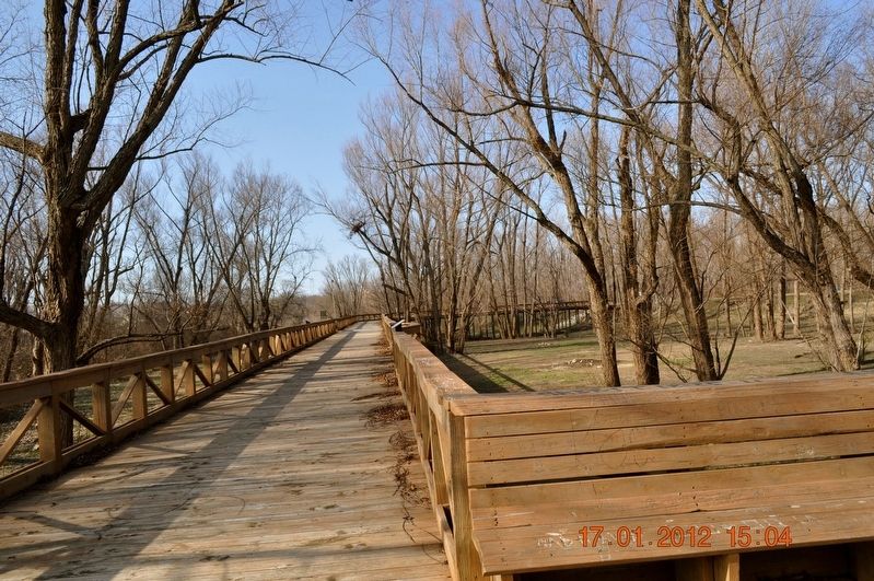
On October 17, 1989 at 5:04 pm the Loma
Prieta earthquake rocked the Bay Area.
Measuring 7.1 in magnitude, the earth
shook for 15 seconds. In those 15 seconds
a section of the Bay Bridge fell, a fire began
in the Marina and . . . — — Map (db m154538) HM
Designer: R. Vane Woods
Construction Date: 1922, remodeled 1992
Architectural Style: Early 20th century utilitarian
The Saroni family were San Francisco candy makers and sugar wholesalers who lost their home and business in the . . . — — Map (db m228119) HM
Argonaut Mine, discovered 1850, and Kennedy Mine, discovered 1856, played dramatic roles in the economic development of California. They produced $105,268,760 in gold. Kennedy Mine has a vertical shaft of 5,912 feet, the deepest in the United . . . — — Map (db m100586) HM
On the hill to your right stand the remains of the Argonaut Mine gallus (headframe), beneath which 47 miners were lost when a fire broke out deep in the main shaft on August 27, 1922. At that time the Argonaut was one of the deepest gold mines in . . . — — Map (db m94781) HM
In memory of Elmer Bacheller, James Clayton, Evan Ely, William Fessel, Charles Fitzgerald, Ernest Miller, Arthur and son Charles O'Berg, and Bert Seamans who died August 28, 1922 in the Argonaut Mine Fire — — Map (db m94757) HM
In memory of Peter Bagoye, Rafaelo Baldocchi, Domenico Boleri, Eugene Buscaglia, John Caminada, Peter Cavaglieri, Manuel Costa, Paul Delonga, A. Fazzini, V. Fideli, Simone Francisconi, Battista Gamboni, Timothy Garcia, Maurice Gianetti, Giuseppe . . . — — Map (db m94774) HM
- The Kennedy Mine -
You are standing on property that once belonged to the Kennedy Mine. The Kennedy Mine is named for Andrew Kennedy, who reportedly discovered a quartz ledge in the late 1850s. The Kennedy Mining Company was formed in 1860 . . . — — Map (db m72070) HM
Calaveritas, settled in 1849 by Mexicans, was a flourishing mining town complete with stores, saloons, gambling houses, and fandango halls. Joaquin Murieta is reported to have frequently visited its Fandango Halls and gambling houses. Destroyed by . . . — — Map (db m12992) HM
Here, at 10:08 p.m. on July 17, 1944 one of history's most powerful man-made, non-nuclear disasters obliterated two cargo ships, killed 320 men, and wounded hundreds. It was the worst stateside disaster of World War II. The cause of the explosion is . . . — — Map (db m136870) HM WM
July 17, 1944 was a typical day at Port Chicago Naval Magazine. Men of the Merchant Marine and the U.S. Navy Armed Guard prepared the empty, brand new SS Quinault Victory for loading on one side of the pier and prepared the nearly full SS . . . — — Map (db m136868) HM
Here, at 10:18 p.m. on July 17, 1944, one of history's most powerful manmade, non-nuclear explosions obliterated two ships, damaged structures in twelve nearby towns or cities, killed 320 men, and wounded 390. It was the worst stateside disaster of . . . — — Map (db m177667) HM
For more than a half-century, Port Chicago Naval Magazine has been a major port for the shipment of munitions to U.S. forces serving overseas. The Navy created the munitions-loading complex next to the town of Port Chicago as an annex to the Mare . . . — — Map (db m136861) HM WM
U.S. Naval Magazine and Naval Barracks
S2c James C. Akins • GM3c Clarence Allen, Jr. • Lt. (jg) Maxie L. Anderson • S2c Leslie K. Asare • S2c Isajah Ash. Jr. • S2c David Bacon, Sr. • S2c Henry W. Bailey • GM3c Leonard Baker • S2c Joseph . . . — — Map (db m136952) WM
In 1988, a massive oil spill from the nearby Shell Refinery
inundated the Carquinez Strait and downstream marshes
including McNabney Marsh. As a result of a settlement with
a number of agencies, Shell Oil paid over $12 million into a
Natural . . . — — Map (db m145095) HM
These young Welshmen died far from home in an 1876 mine accident. Despite hard times, these people of Nortonville pitched in to erect a white bronze monument on this site. This plaque keeps their memory alive. — — Map (db m199137) HM
During the evening of March 27, 1964 a massive earthquake shook Alaska’s Kenai Peninsula heavily damaging Anchorage, located more than 60 miles away, and sending a tsunami racing across the Pacific Ocean. About four hours later, on March 28, the . . . — — Map (db m114260) HM
The townspeople of Crescent City slumbered peacefully in the late-night hours
of March 28, 1964 - tragically unaware of a catastrophe at their doorstep.
Earlier whipped into fury by a devastating Alaskan earthquake, seismic waves
raced . . . — — Map (db m183645) HM
Thirty-seven tsunamis have been observed or recorded on the North Coast since
the first tide gauge was installed in Crescent City in 1933. All but five were tele-tsunamis (the source was far away). Crescent City, known as "Tsunami Central,” has . . . — — Map (db m183655) HM
The heroic voyage of this crossbreed steer; floating downriver from Klamath Glen and up the coast into Crescent City Harbor, was an inspiration to the flood victims of Klamath. He embodied their courage, stamina, and indomitable spirit. A living . . . — — Map (db m91941) HM
Built in 1850, the Sierra Nevada House was a two-story building with many windows and a broad balcony. Here guests could always expect superb food, excellent ballroom music, and comfortable beds. It was operated by Robert Chalmers from 1852 until . . . — — Map (db m215361) HM
The antique bricks that were used on the façade of this building were originally used to build the “Dougalss – Hines” Building.
The “Douglass – Hines” Building stood where the Fountain Plaza now stands at 312 . . . — — Map (db m13144) HM
In 1909 Dominique Bordagaray purchased six lots on 5th and “C” Streets and built row stores on them as Coalinga began to grow. The row stores included a French laundry, cigar shop, and liquor store, bicycle shop and confectionery shop.
The French . . . — — Map (db m63917) HM
On May 2nd, 1983 at 4:42 P.M. a major earthquake of 6.7 magnitude lasting 45 seconds destroyed 54 buildings in downtown Coalinga. Only 31 people were injured and miraculously there were no deaths.
The earthquake also destroyed over 300 homes and . . . — — Map (db m63914) HM
To the memory of the
38 pioneers who lost
their lives in the wreck
of the steamer "Northerner"
on January 6, 1860.
By Ferndale Parlor, NSGW, 1921.
Rebuilt because of
the earthquake of 1992.
Rededicated
February 11, 1995
by . . . — — Map (db m239831) HM
A World class Forest Preserve
Containing over 53,000-acres, Humboldt Redwoods State Park includes some of the world's most impressive redwood forests, many miles of river frontage, and nearly 100 miles of hiking, riding and mountain bike . . . — — Map (db m176731) HM
Periodic winter flooding is not uncommon along California's Northcoast, and several floods have been catastrophic!
Try to imagine standing at this exact spot while 33 feet of river water rages overhead. Such was the scene in 1964, when a . . . — — Map (db m176729) HM
Better Beginnings
You are standing on the site of the historic town of Dyerville.
In the late 19th century, timber gave rise to a booming community
that served outposts and lumber camps up and down the Eel River.
Dyerville boasted several . . . — — Map (db m121336) HM
During the first two decades of this century the Keane Wonder Mine was the scene of major investment and development. The products of this labor were the riches - gold and silver.
About 1903, Jack Keane, prospector, discovered gold in this . . . — — Map (db m159264) HM
Flash Flood Scours Grapevine Canyon
On the night of October 18, 2015, heavy rains pounded Grapevine Canyon. Floodwaters roared out of the canyon mouth — visible to the northeast — and down the valley behind the ranger station. After . . . — — Map (db m195573) HM
Named for the Diaz family who established a ranch
here when brothers Rafael and Eleuterio Diaz
emigrated from Chile in the 1860's. They owned and
operated a successful cattle ranch until the land
was sold to the City of Los Angeles Dept of . . . — — Map (db m221367) HM
On the date of March 26, 1872, an earthquake of major proportions shook Owens Valley and nearly destroyed the town of Lone Pine.
Twenty seven persons were killed.
In addition to single burials, 16 of the victims were interred in a . . . — — Map (db m34157) HM
On March 26, 1872 at 2:30AM, one of the largest earthquakes ever recorded destroyed 52 out of the 59 buildings in Lone Pine.
Because of the scarcity of building materials the largely immigrant population of Lone Pine, (estimated 250-300), . . . — — Map (db m52102) HM
In the 1930’s, more than half of a million Americans fled the Southwestern part of the United States due to the prolonged drought called the “Dust Bowl.”
Traveling in old cars with just basic necessities, the migrants came primarily from . . . — — Map (db m167100) HM
The first bank in Tehachapi was incorporated on October 11, 1892, in a dry goods store on "G" Street (now Tehachapi Boulevard). The founder and first President of the Bank of Tehachapi was Isadore Asher, who operated the bank in the rear of this . . . — — Map (db m52966) HM
On this site, the first frame building in Tehachapi was built by Mary and Bernard Kessing. They replaced the original wooden building in 1905 with a beautiful brick building named the Kessing Building, which was destroyed in the 1952 earthquake. A . . . — — Map (db m53123) HM
The Tehchapi Loop put Tehachapi on the map when it was completed in 1876. Before that time there was no rail access across the Tehachapi Mountains. The historic Loop is pictured here, circa 1952, with a trompe l'oeil effect showing damage to the . . . — — Map (db m53117) HM
In memory of conductor Everett S. Crown, brakeman Allan R. Riess, who lost their lives in a tragic train wreck in San Bernardino Calif. May 12, 1989.
Erected by employees and S.P.T.C.O. — — Map (db m141332) HM
On September 30th torrential rains flooded Tehachapi Creek, undermining the tracks under Santa Fe Engine No. 3834 which was waiting out the storm about ½ mile east of Woodford Station. The engine disappeared into the raging water below. It remained . . . — — Map (db m202039) HM
At 4:52 a.m. on July 21, 1952 Tehachapi residents were awaken by an earthquake lasting 45 seconds and registering 7.7 on the Richter Scale (lowered in recent years to 7.5). The quake claimed 11 lives, injured others and left 70% of the buildings in . . . — — Map (db m135037) HM
League's Store, destroyed in the fire of 1924, housed the beginnings of both the Odd Fellows Hall and the Harriet Lee Hammond Library. The post office moved here when the library opened in 1916. The Griner Brothers eventually built and relocated . . . — — Map (db m61079) HM
You've seen Western Town in hundreds of movies, TV shows and commercials. It all started back in 1927 when Paramount Pictures purchased 2,700 acres of the old Rancho Las Virgenes for use as a "movie ranch."
"Cisco Kid," "Dr. Quinn, Medicine . . . — — Map (db m150029) HM
On August 31, 1986 at 11:56 A.M., two planes collided above a Cerritos neighborhood in the vicinity of Carmenita Road and 183rd Street. The tragic accident claimed 82 lives, destroyed 11 homes and severely damaged seven others. The collision was . . . — — Map (db m73108) HM
In recognition of the leadership of Assistant City
Manager Bob McFall to preserve this heritage oak
during the 2009 Station Fire, the Community Services
& Parks Department has designated this stately tree as
"The McFall Oak." — — Map (db m239335) HM
On this site American Legion Post 288 once stood. The great flood swept through its walls shortly after midnight on New Year’s Day, taking with it 12 local residents. Most had taken refuge inside from the torrential rain and two were dedicated Red . . . — — Map (db m143027) HM
In remembrance of those who lost their lives in the St. Francis Dam disaster March 12-13, 1928. This was one of California’s greatest disasters with over 400 lives lost; five of whom were laid to rest at Lancaster Cemetery. — — Map (db m143730) HM
Colonel (USAF) Ellison Shoji Onizuka
Astronaut/National Aeronautics and Space Administration, June 24, 1946 — January 28, 1986.
Colonel Onizuka was the first Japanese American astronaut selected to
participate in America's Space . . . — — Map (db m183925) HM
On June 24, 1971, an explosion and fire took the lives of seventeen construction workers building a tunnel in Sylmar, California. The tunnel was being built for the Metropolitan Water District of Southern California by the Lockheed Shipbuilding . . . — — Map (db m126024) HM
In the early years of the Great Depression, Los Angeles battled joblessness by borrowing money through the Reconstruction Finance
Corporation. A local bond measure was passed to fund relief programs. Griffith Park, large and rustic, was made to . . . — — Map (db m222321) HM
May 19, 1995, 9:02 A.M.
In honor of Victims and Survivors
of the bombing of the Oklahoma City Federal Building,
April 19, 1995, 9:02 A.M. — — Map (db m163222) HM
Following Spanish and Mexican rule, Ex Rancho Mission de San Fernando, the land today known
as the San Fernando Valley, was sold by Governor Pio Pico to Don Eugolio de Celis for $14,000. After California
Statehood in 1849, the subdivision of . . . — — Map (db m202497) HM
On January 17, 1994, Los Angeles and the surrounding region experienced a 6.7 magnitude earthquake centered in Northridge. To commemorate the rebuilding of the region and CSUN, we created the sculpture garden incorporating remnants of the . . . — — Map (db m155780) HM
On Saturday night, October 29, 1960, a plane carrying the California State
Polytechnic College of San Luis Obispo 1960 football team, which was
returning from a football game with Bowling Green State University,
Bowling Green, Ohio, crashed at . . . — — Map (db m238461) HM
This tablet presented February 9, 1979, to the Veterans Memorial Park, in loving memory of the many veterans, nurses, and aides of the San Fernando Valley Veterans Hospital, whose lives were lost during the earthquake of February 9, 1971. — — Map (db m150941) HM
In dedication to the Firefighters who heroically defended Wildlife Waystation throughout the entire December 2017 Creek Fire. Our eternal gratitude for their selfless act of bravery - Cal Fire, Contra Costa County Fire, Los Angeles County Fire Dept, . . . — — Map (db m138093) HM
This park and memorial stand as a tribute to the young men who lost their lives on the Loop Fire, to those who survived, and to firefighters everywhere.
Forever Honored - Those Who Lost Their Lives
Raymond Chee - Age 23
• James . . . — — Map (db m79155) HM
On November 14, 2008, the Sayre (or Sylmar) Fire, a wind-driven fire, quickly moved through the hillside brush into residential areas above the 210 freeway and west of the 5 freeway. The fire was contained on November 20, 2008 after burning 11,262 . . . — — Map (db m128526) HM
The tiles surrounding the entry door and on the planters in the courtyard are examples produced by Malibu Potteries. The company had been established in 1926 by Mrs. Adamson's mother, May K. Rindge.
The 1920's was the golden age of tile making . . . — — Map (db m237683) HM
One of the most outstanding geological features in California, extending for over 650 miles from Point Arena, north of San Francisco, to south of San Gorgonio Pass, between twenty and thirty miles deep and more than a mile wide in some locations. . . . — — Map (db m149749) HM
The St. Francis Dam, part of the
Los Angeles Aqueduct system,
stood 1½ miles north of this site.
On March 12, 1928, the 185-foot high
concrete dam collapsed just
before midnight, sending 12⅓ billion
gallons of water roaring down . . . — — Map (db m146564) HM
On this site in August of 1924 construction started on the St. Francis Dam, a unit of the Los Angeles Aqueduct. When it was completed in May of 1926, this concrete dam stood 185 feet above the stream bed, impounding a 610 surface-acre lake.
. . . — — Map (db m143721) HM
The 185-foot concrete St. Francis Dam, part of the Los Angeles aqueduct system, stood 1½ miles north of this site. On March 12, 1928, the 185-foot high concrete dam collapsed just before midnight, sending 12½ billion gallons of water roaring down . . . — — Map (db m143722) HM
Dedicated to the victims of September 11, 2001, including those who lost their lives and those who lost their loved ones. This monument is a symbol of our nation’s renewed strength and unity, blending five operate metals (stainless steel, brass, . . . — — Map (db m100534) HM
High concentrations of natural gas posed a constant danger to oilmen developing the Signal Hill field in the form of “gassers,” “gushers,” gas flares and fires. When Shell Oil completed its second well in 1921. It was a “gasser” that blew out and . . . — — Map (db m100454) HM
Since 1889, United States Life-Saving Service and Coast Guard crews have risked their lives to save shipwreck victims at Point Reyes. Brave crews of highly trained men struggled in some of the worst conditions in North America, sacrificing comfort, . . . — — Map (db m102689) HM
The heyday of life-saving at Point Reyes is over, but this 1927 lifeboat station still stands alive with a history nearly lost along our coast. While the station preserves the last intact marine railway on the Pacific Coast, the history of ordinary . . . — — Map (db m102690) HM
No one knows how many cries for help went unanswered along this isolated coast. If shipwreck victims were not overcome by pounding surf, they would perish in a cold sea. But once the Life-Saving Station was established in 1889, victims of the coast . . . — — Map (db m102676) HM
San Anselmo has a long history of flooding.
This line is the high water mark from 2005.
For more information visit the Town of San
Anselmo website by scanning the QR code below. — — Map (db m189464) HM
San Anselmo has a long history of flooding. This line is the high water mark from 2005. For more information visit the Town of San Anselmo website by scanning the QR code below. — — Map (db m197253) HM
San Anselmo has a long history of flooding. This line is the high water mark from 2005. For more information visit the Town of San Anselmo website by scanning the QR code below. — — Map (db m197256) HM
San Anselmo has a long history of flooding. This line is the high water mark from 1982. For more information visit the Town of San Anselmo website by scanning the QR code below. — — Map (db m197259) HM
History
The Richmond-San Rafael Bridge opened to traffic in 1956, following 2 years of planning and design and 4 years of construction. At the time, its 4.5 mile-length and double-decker design made it one of the most complex bridges in the . . . — — Map (db m223322) HM
The Coulterville Main Street Historical District includes 25 structures, including this one story building built circa 1860. This building's stone and brick walls survived the 1879 and 1899 fires that destroyed Coulterville.
Using the walls, . . . — — Map (db m137795) HM
Rebuilt of brick in 1867, one year after the devastating Mariposa fire, Joseph H. Miller's Capital Saloon also saw duty as the Mariposa Post Office. Miller served as Postmaster until his death in 1887. Daughter-in-law Lucy Miller severed as . . . — — Map (db m192088) HM
The Tioga Road, one of the few roads that crosses the Sierra Nevada, reaches the highest point of any at Tioga Pass (9,945ft, 3km). It provides a gateway to the park, wilderness, and high country. The long winters and rigorous road-opening . . . — — Map (db m192086) HM
Our Captain's voice boomed above the roar of the surf. "Heave about! Turn the ship!"
With a mighty jolt a rock took our rudder and punched a hole in her hull. The Frolic was sinking and none of us knew how to swim! Captain Faucon, bless . . . — — Map (db m96476) HM
Ladd Construction Co. Plane Crash Site
9:03 AM November 6, 2007
In memory of our crew
Mark William Christopher
May 8, 1949
November 6, 2007
Tom Daniel Capener
September 17, 1965
November 6, 2007
Bruce George Mandville . . . — — Map (db m189614) HM
Not far from this site, in the early morning hours of March 7, 1911, a massive avalanche roared down the east slope of Copper Mountain and wiped out the town of Jordan. Eight people were killed including Robert Mason, the chief engineer of the power . . . — — Map (db m50074) HM
In Loving and Grateful Memory of
The C-130 Crew
Steve Wass, Craig Labare and Mike Davis
Who gave their lives to save
our community on June 17, 2002 — — Map (db m23036) HM
In 1904 the Coalinga Oil Transportation Company laid 168 miles of six-inch pipeline from the Belridge Field in San Joaquin Valley to the Tidewater-Associated Marine Terminal on Monterey Bay (top). Its purpose was to deliver heavy fuel oil for use in . . . — — Map (db m55215) HM
Recurring winter storms wreaked havoc on the Monterey fishing fleet every few years (top). On April 29, 1915, such a storm, with 60-mile-per-hour winds, destroyed or damaged nearly 50 boats. On Thanksgiving morning 1919, more than 93 vessels were . . . — — Map (db m55214) HM
Left Marker This rift extends from El Centro on the south, 650 miles northwesternly the length of California to Point Arenas, where it continues seaward. The most publicized of California's geologic faults, it is the source of dozens of . . . — — Map (db m111574) HM
The Donner family and their hired teamsters left Springfield, Illinois in April, 1846. At Independence, Missouri, their wagons joined hundreds of others traveling west on the Oregon-California Trail.
The New Captain Takes a Shortcut . . . — — Map (db m129925) HM
On October 28, 1846 the six covered wagons brought west by George and Jacob Donner and their families halted here for repairs. By March of 1847 one half of the party of 22 adults and children had died of starvation and cold. They came west seeking a . . . — — Map (db m60507) HM
Near this spot stood the tree which marked what was believed to be the campsite of the family of George Donner in the winter of 1846. The tree stood for 150 years (missing) the Donner families camped in Alder Creek before it succumbed to Mother . . . — — Map (db m129928) HM
History
The Donner Lake area is not only an exciting place to live and adventure, but also has lots of interesting history. The story of the Donner Party crossing over this amazing and majestic mountain range (1847) has spread through the . . . — — Map (db m129736) HM
Donner Party Camp at Alder Creek Valley
In the Fall of 1846, 25 Members of The Donner Party became Trapped by an Early Snowstorm here at Alder Creek Valley. The George and Jacob Donner Families, their Teamsters, and Fellow Travelers Suffered . . . — — Map (db m60303) HM
With threatening weather overhead, the Donners quickly set up camp. Crowded into inadequate shelters, these desperate people watched it snow.
As the snow got deeper, it wiped out all hope of leaving before spring.
People (age) at . . . — — Map (db m129927) HM
In February, 1847, the first relief party from Sutter's Fort arrived. Two more relief parties came in March. These relief parties took 14 people from here out across the frozen Sierra. Only 11 survived (8 were children). Five people remained at . . . — — Map (db m146235) HM
By December 20th, the outlook was grim. Jacob Donner and three of the teamsters had died. The cold and dampness were constant. As snow piled higher, dry fire wood was harder to find.
Tall tree stumps were once numerous throughout this area. They . . . — — Map (db m146234) HM
They were the first to take wagons through the new Hastings Cutoff. Although shorter, it was a difficult detour through rugged mountains and arid deserts. The emigrants lost valuable time, oxen, and supplies. One person was banished. Five people . . . — — Map (db m129926) HM
The pioneers began their trek across the continent with expectations of a new life. In sparsely populated California they could have land with fertile soil and a pleasant climate.
They heard about the wonders of California through letters sent . . . — — Map (db m129946) HM
3103 entries matched your criteria. Entries 101 through 200 are listed above. ⊲ Previous 100 — Next 100 ⊳