Gold discoveries brought Alaska and the Yukon to the attention of the world. A series of stampedes occurred over more than three decades. Drawn by dreams of gold, men and women from many places and all walks of life participated in an adventure that . . . — — Map (db m59836) HM
Captain E.T. Barnette, a passenger on the riverboat Lavelle Young, debarked near this site on August 26, 1901, and established a trading post which in 1902 became known as Fairbanks.
Alaska Centennial 1867-1967
State of Alaska
Governor Walter J. . . . — — Map (db m59831) HM
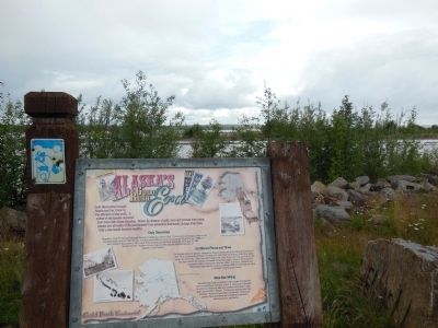
The gold deposit found in 1902 north of present-day Fairbanks proved to be the richest in Alaska. Prospector Felix Pedro and trader E.T. Barnette played key roles in the discovery and initial rush. A second strike made the following summer . . . — — Map (db m59826) HM
Captain E.T. Barnette, whose trading post on the Chena River became the city of Fairbanks, arrived here on the sternwheeler Lavelle Young with Captain Adams on August 26, 1901.
Felix Pedro and partners, mining for gold in the hills above town, saw . . . — — Map (db m47382) HM
This Sign Greeted New Arrivals As They Arrived At The Pipeline Construction Camp Located One Mile West Of Here. We Salvaged This Sign When The Camp Was Being Dismantled.
You are about 55 miles north of the Arctic Circle on the East Bank . . . — — Map (db m49597) HM
Fort Seward was the first permanent military base in Alaska. Completed in 1904 on 100 acres of land donated by the Presbyterian Church, it remained active until 1944. Named for William H. Seward, the U.S. Secretary of State who arranged the purchase . . . — — Map (db m70810) HM
Commemorating the Founders
of
Port Chilkoot
World War II Veterans
and their families
who bought Fort Wm. H. Seward in 1947
and pioneered their futures here.
Steve Homer • Ted and Mimi Gregg • Carl and Betty Heinmiller • Marty and . . . — — Map (db m70803) HM WM
Panel 1:
The City and Borough of Juneau Assembly Honors the Contributions of Filipinos in Juneau by naming this downtown location MANILA SQUARE
Juneau Assembly Members: Dale Anderson - Don Etheridge, Jr. - Jeannie Johnson - Ken . . . — — Map (db m68849) HM
At the turn of the century, Ketchikan's pioneer townsite sprouted up from the base of a rugged, uncleared rocky mountainside where it meets deep tidewater. The downtown business district was literally built upon pilings and planked decking, with . . . — — Map (db m181910) HM
“Thundering Wings” — the title of local master carver Nathan Jackson's magnificent cedar monument, depicts the Tlingit native origin of Ketchikan's name, as told by Chief Reynold Denny of the Beaver Clan:
“About three hundred years ago the . . . — — Map (db m181908) HM
In loving memory of
Dean H. Christopherson
1916-1992
Made possible by a generous
contribution from
Mrs. Elaine G. Christopherson
in memory of her husband
The cabin is similar to the cabin at Rohn
the eighth checkpoint on the . . . — — Map (db m80413) HM
Sharing Food, Sharing Life – Then and Now
Ukpiaġvik, which means ‘the place where we hunt snowy owls,’ was one of several ancient villages in the Barrow area. Our ancestors settled here primarily to hunt the great bowhead whales. But . . . — — Map (db m49595) HM
This place was central to Russia's hopes of establishing a lucrative colony in America.
Finding a Foothold
Starting in the 1740s, Russians were attracted to Alaska's coast by abundant, valuable sea otters. Russia claimed Alaska and . . . — — Map (db m181348) HM
The first American flag was raised by a colorguard from Company F, 9th Infantry, to signify the transfer of Alaska from czarist Russia.
The first 49 star American flag was raised on July 4, 1959, by a colorguard from the First Battle Group 9th . . . — — Map (db m133863) HM
The replica blockhouse before you, a symbol of Russia's role in Alaska's history, represents the walled fortifications that defined the limits of its control.
These blockhouses, or watchtowers, each housing cannons, protected the Russian . . . — — Map (db m133826) HM
This large frame house was constructed as a Russian residence about 1835. Although there has been some modification the building is thought to be the finest remaining example of Russian secular architecture in Alaska. — — Map (db m133829) HM
Captain William Moore first saw the Skagway River Valley and the White Pass in the spring of 1887 when he came with a Canadian survey team to determine the exact position of the 141st meridian separating Alaska and what is now Canada’s Yukon. He was . . . — — Map (db m72783) HM
Skagway had a deep-water harbor and was the starting point of the White Pass trail, which began in the river valley and let through the mountains. Skagway was the place where thousands of stampeders started their journey to the Klondike gold mines. . . . — — Map (db m72782) HM
The community of Big Delta began during the Gold Rush era as a trading post and roadhouse serving prospectors and travelers.
Known for many years as McCarty, Big Delta was a link in the paths of travel and trade. It was located at the . . . — — Map (db m49598) HM
This highway was constructed during World War II as a military supply route for interior Alaska Military and Airfields in 1942. 7 Army regiments and 42 Contractors and Public Roads Administrators working from Delta Junction South and Dawson Creek . . . — — Map (db m59840) HM