"… we found a gap in the bluffs of Boise valley, where we turned down and succeeded in reaching the valley in safety, although our road was very steep and stony, and long…" -- P.V. Crawford, 1851
President Abraham Lincoln created Idaho Territory, appointed its first officers and judges and addressed Congress about Idaho in 1863 and 1864. He considered Idaho issues in the White House on the afternoon that he was shot and invited the former . . . — — Map (db m126722) HM
The play was intense and furious: men smacking a leather-covered ball with their hands, or whipping their paddles, or palas, through the air. The sport, pelota, was brought to Idaho by early Basque immigrants. Juan and Juana Anduiza . . . — — Map (db m119131) HM
Idaho has a large Basque community that preserves it's ancient European traditions in a new land of opportunity. Coming here originally to herd sheep on mountain and desert ranges, they shifted into other occupations as quickly as possible, making . . . — — Map (db m31680) HM
In 1863 and 1864, overland packers hauling supplies from Salt Lake City to Idaho City crossed here and took a direct route northward to More's Creek.
They cut a steep grade from the Oregon Trail down to Beaver Dick's Ferry, which served a . . . — — Map (db m22641) HM
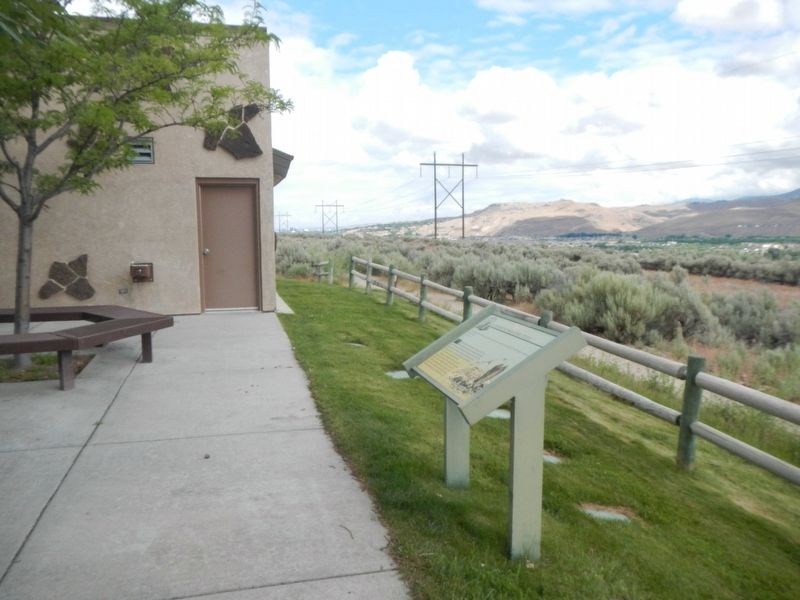
From the high ridge above the Boise River 5 miles southwest of here, westward-bound travelers got their first view of the Boise Valley. In 1811, Wilson Price Hunt and the Overland Astorians' party were the first white sojourners to enjoy the scene. . . . — — Map (db m119002) HM
The Cyrus Jacobs home, built in 1864, is the oldest surviving brick dwelling in Boise. Jacobs, a prominent merchant and mayor of Boise, lived here for almost 40 years. Beginning in 1910, it became the residence of Basque families - first, the . . . — — Map (db m119186) HM
In 1906, at the age of seventy-five, Ezra Meeker began a journey east from his home in Puyallup, Washington, to retrace the route of the Oregon Trail over which he originally traveled in 1852 with his wife and young son. He traveled the route with . . . — — Map (db m118993) HM
Westward-bound emigrants entered Idaho after crossing Thomas Fork Valley. They soon encountered the climb and descent of Big Hill, witnessed nature's curiosities at Soda Springs, and discovered willing traders at Fort Hall.
In 1843 wagons . . . — — Map (db m118992) HM
In 1850, at age seventeen, Jesus Urquides joined the California gold rush to Stockton and the Sierra Nevadas.
In 1860, striking out on his own, he followed the rush to Walla Walla, Lewiston, and The Dalles.
Boise Basin’s 1863 gold rush lured . . . — — Map (db m110696) HM
Legendary mule packer Jesus Urquides was a Boise pioneer and founder of a freighting business located on this site.
Born January 18, 1833 in Sonora, Mexico, Urquides migrated to the California gold fields in 1850 where he worked as a mule packer . . . — — Map (db m110694) HM
More's Creek is named for J. Marion More, leader of the party of miners who founded Idaho City, October 7, 1862.
Like most of Idaho's early miners, he came originally from the South. Unlike most of them, he struck it rich. During the Idaho gold . . . — — Map (db m22595) HM
Along this historic trail, from 1841 to 1861, traveled the greatest land migration in history. Nearly half a million pioneers came to settle America's Northwest. One out of every eight would perish along the way. — — Map (db m125859) HM
Between 1843 and 1869 over 300,000 emigrants fulfilled Americas's Manifest Destiny by voluntarily relocating to Oregon and California. Their nearly 2,000 mile journey along game trails long used by the early Native Americans would become known as . . . — — Map (db m119239) HM
Indians, trappers, and emigrants who came this way before 1900 used a more direct route to get between Boise and Glenns Ferry. Their road still can be seen at Bonneville Point 5 miles from here. Following close to a line of hills bordering a . . . — — Map (db m22181) HM
Placed here by Ezra Meeker on May 9, 1906
Pioneer • Preservationist • Visionary
Ezra Meeker was largely responsible for locating and preserving the Old Oregon Trail. To commemorate the centennial of this monument, a time capsule of . . . — — Map (db m128544) HM
Wednesday September 15th "Today we traveled up a long hill some 4 miles. Road good, ascent very gradual. When we arrived at the top we got a grand view of the Boise River Valley. It is all filled or covered with dry grass and a few trees . . . — — Map (db m125787) HM
The Canyon House was located across the Boise River from where you are standing. The house was designed and built by Arthur De Wint Foote in 1885, using funds from literary works by his wife, Mary Hallock Foote. As Chief Engineer for the Idaho . . . — — Map (db m119029) HM
Hunt’s party laid the groundwork for future trapping expeditions across the Snake River Plain. Donald Mackenzie, who accompanies Hunt and later joined the British North West Company, returned to establish trade relations with resident Indian bands. . . . — — Map (db m71834) HM
The Oregon Trail is still clearly visible coming off the rimrock across the river. Here the west bound emigrants after 1840 came gratefully down into this green valley.
The first cart passed here with Spalding and Whitman, pioneer missionaries, . . . — — Map (db m22639) HM
The landscape before you is part of the homeland of the Shoshone, Bannock, and Northern Paiute Indians. They occupied these lands for countless generations before the arrival of Euro-Americans. Living in small bands of several families, their lives . . . — — Map (db m71830) HM
Few things in Boise compare with the quiet charm of Julia Davis Park. Edging the north bank of the Boise River downstream from Broadway Ave. to just beyond Capitol Blvd., this emerald jewel is the setting for the city's major cultural institutions: . . . — — Map (db m125828) HM
On this very site stood the home of Boise pioneers Tom and Julia Davis.
In 1889, the Davis family built this fashionable Victorian home on a section of their homestead extending from Front Street to the Boise River. This handsome . . . — — Map (db m119190) HM
In 1879, with the death of his friend Antonio de Ocampo, the packer Urquides inherited Ocampo’s city lot at 115 Main Street.
Here along a canal he built a home for his wife, Adelaida, their sons, Arthur and Manuel and daughter, Maria . . . — — Map (db m110693) HM
The Warm Springs Avenue neighborhood began to emerge in the 1890’s, soon after Kelly Hot Springs, for which the street was named, was tapped to provide water for Boise’s fire hydrants.
The prominent owners of the water line built their mansions on . . . — — Map (db m109839) HM
"When we first came in sight of Boise City and valley we were upon a hill seven miles distant." -- Julius Caesar Merrill, 1864
Creaking, groaning wheels, the dust so thick that the hunch-back oxen ahead looked more like tawny . . . — — Map (db m125861) HM
(Three Panels are found at this overlook:)
"The River Boise..."
"Descending some steep hills we came down on the river 'Boisee,' which deserved its appellation from the dense fringes of cottonwood and willow trees that . . . — — Map (db m125862) HM
John Welch -- always known as Packer John -- hauled supplies from Lewiston to Idaho City during a major Boise Basin gold rush of 1863-1864.
He built a cabin (1/4 mile north of here) that immediately became an historic Idaho landmark. Territorial . . . — — Map (db m37957) HM
An act of Congress, approved April 1878, gave the Utah & Northern Railroad Co. permission to build a narrow gauge line through Marsh Valley. It reached Oneida by July of 1878, where the first station was built. The town attained a population of . . . — — Map (db m140074) HM
Charles Jefferson Hunt served in the Mormon Battalion as Captain of Company “A” and as assistant executive officer. In its historic march from Council Bluffs, Iowa to San Diego, California, 1846 - 47. His service won the commendation of . . . — — Map (db m48986) HM
This cabin, one of the first built on the Nine Mile Creek in Marsh Valley, was erected by William Jackson and Cyrus Coffin before 1866. Later it was purchased by Abigail Coffin who with her sons, Nathan, Cyrus, and William were among the first . . . — — Map (db m140126) HM
The development of McCammon was closely associated with the transportation industry. William Murphy, in early 1863, built the first toll bridge, and McCammon became the nucleus of the Overland Stage Lines. H.O. Harkness acquired the toll bridge . . . — — Map (db m108262) HM
A registered national historical landmark Indian and trapper trading post established by Nathaniel J. Wyeth in 1834 and sold to Hudson's Bay Company in 1837 It was the vital point on the Oregon and California immigration trails and in establishing . . . — — Map (db m108304) HM
Fort Hall, Keystone on the Oregon Trail, America's road to destiny, was located 14 miles north of this site. It was dedicated by Nathaniel J. Wyeth, Bostonian, on Aug. 5th 1834. Unable to compete with Hudson's Bay Co., Fort Boise; Wyeth sold the . . . — — Map (db m108305) HM
Pocatello's origin lies in the railroads an the role they played in westward expansion.
In the late-1800's, what would become Pocatello was a rest stop on the Utah and Northern Railroad, which went from Utah to Butte, Montana. In 1882, . . . — — Map (db m108325) HM
Most early Bear Lake settlers came from Britain. One was the first woman convert to the LDS church in Europe.
Born in Preston, England, Aug. 24, 1806. Ann Elizabeth Walmsley Palmer was baptized July 30, 1837. An invalid, she was carried into the . . . — — Map (db m99318) HM
The Bear Lake resort town of Fish Haven was founded in 1864. Most of the original settlers moved away, leaving Thomas and William Shirley, Henry Howell, John Stock and their families the first permanent settlers. Joseph C. Rich and John Bagley threw . . . — — Map (db m140164) HM
In 1870, Brigham Young appointed Ezra T. Clark, David Hess, and Nicholas Barkdull to colonize this area.
Originally known a Twin Creeks, Joseph C. Rich surveyed the site in 1871. In 1872, the new settlement was named Georgetown in honor . . . — — Map (db m140244) HM
In the spring of 1871, Joseph C. Rich surveyed the Twin Creeks area, later called Georgetown. In 1874, logs were hauled from the mountains for this cabin built originally on the corner of the block across the street and one block east and used for . . . — — Map (db m140243) HM
"Here we found pure water, sufficient for all of us and our cattle. Here we found oceans of grass and thousands of acres of rich, level land covered with wild flax." P.V. Crawford, July 8, 1851
In 1863 Charles C. Rich with others explored this valley. A group of settlers in eleven wagons traveled through Emigration Canyon in September and founded Paris. Log huts with dirt floors and roofs sheltered 48 men, 40 women, and 30 children during . . . — — Map (db m140162) HM
The pictures below reflect first views of the downtown entering Montpelier from the west in different times in history.
Brennan-Davis Building
The building was built for Edward Burgoyne by Jacob Tueller and Sons prior to 1899. The . . . — — Map (db m90920) HM
"... the greatest impediment on the whole route from the United States to Fort Hall." - Theodore Talbot, 1843
Near the Wyoming/Idaho border the pioneers face Big Hill, on of the most challenging obstacles of their journey. The dusty . . . — — Map (db m90854) HM
On their way west to Oregon and California, emigrant wagons often crossed high ridges in order to avoid gullies and canyons.
When he came here in 1843, Theodore Talbot noted that he "had to cross a very high hill, which is said to be the . . . — — Map (db m90807) HM
"the steepest and longest ascent we have made on the route..." - James Wilkins
Looking east across the fields is Big Hill, one of the most difficult obstacles along the 2,000-mile Oregon/California Trail. The trail crosses the Thomas . . . — — Map (db m90851) HM
Welcome to the Historic Downtown Montpelier Business District on Washington Street!
Take a few minutes to enjoy a walking tour filled with interesting information about this area and its place in history. Also, spend a few minutes visiting . . . — — Map (db m90878) HM
Beginning in Independence, Missouri, the Oregon/California Trail passes through present-day Missouri, Kansas, Wyoming, and Idaho. it ends in Oregon, California or Utah - depending on the destination of the pioneers.
While the . . . — — Map (db m90876) HM
Westward-bound emigrants entered Idaho after crossing Thomas Fork Valley. They soon encountered the climb and descent of Big Hill, witnessed nature's curiosities at Soda Springs, and discovered willing traders at Fort Hall.
In 1843 wagons first . . . — — Map (db m90852) HM
Coming west with Ezra Meeker in 1852, Thomas McAuley decided to build a road to let emigrants bypass Big Hill.
Worst of all Oregon Trail descents, Big Hill needed replacement. Eliza McAuley reported that her brother Tom "fished awhile, . . . — — Map (db m90808) HM
"One continual stream of honest looking open harted people going west" - James Cayman, mountain man, captured this sentiment in his diary as he watched pioneers heading west in 1846.
Between 1841 and 1869 nearly 300,000 farmers, . . . — — Map (db m90853) HM
In the spring of 1864, fifteen families of pioneers came from Paris, Idaho and settled Clover Creek, the name used until President Brigham Young changed it to Montpelier. After building crude homes the settlers erected a large building of logs, . . . — — Map (db m105874) HM
On April 7, 1852, seventeen-year-old Eliza Ann McAuley, with her older brother Thomas and sister Margaret, left Mount Pleasant, Iowa, to travel overland to California. For a time they were accompanied by the "Eddyville Company," led by William Buck . . . — — Map (db m90850) HM
A bad ford gave trouble to wagon trains crossing this stream on the trail to California and Oregon in 1849.
In that year, gold-seeking 49'ers developed a shortcut that crossed here. Then emigrants built two bridges here in 1850. But an . . . — — Map (db m90804) HM
The region comprising Bear Lake County has alway been an important juncture for overland travel. From the 1800s onward, migrants on the Oregon and California trails traversed the area, relying on knowledge garnered by Native Americans, early . . . — — Map (db m140213) HM
Settled in 1864, the community of Ovid was among the first permanent settlements in the Bear Lake Valley. Its first residents were predominantly Scandinavian immigrants, and the first home was a dugout cabin constructed by Thomas C. Peterson. Over . . . — — Map (db m140214) HM
In honor of
Charles Coulson Rich
1809-1893
Pioneer builder of the west.
Major-General of the Nauvoo Legion
Alderman of the City of Nauvoo, in the time of Joseph Smith.
Pioneer of Utah, 1847.
Chairman of the first committee . . . — — Map (db m105849) HM
Paris, Idaho was settled in the fall of 1863. Two years later a building used for church, school and recreation was erected by James Nye and others, of logs hauled from George Sirrine's sawmill It was 20' X 60' with two large rooms and a stage at . . . — — Map (db m105873) HM
This pioneer Idaho town was founded Sept. 26, 1863 when a wagon train brought more than 30 families of Mormon colonizers.
More pioneers soon followed, some living in huts of quaking aspen and others building log cabins for the mild first . . . — — Map (db m105836) HM
The Thomas Sleight Cabin was built in the fall of 1863 by Thomas Sleight and Charles Atkins, who with their wives, Marianne and Ann, occupied it together during the first winter of the settlement of Paris, Idaho.
It was first finished with . . . — — Map (db m105866) HM
Erected in Honor of
Gutzon Borglum
Born in the village of St. Charles
Idaho, March 25, 1867
He is internationally known for
his painting and sculptoring
and most famous for Mount
Rushmore National Monument
Gutzon . . . — — Map (db m105878) HM
In May, 1864 Brigham Young called Swan Arnell, Sr., Charles G. Keetch, Sr., Robert Pope, and Johh Windley with their families to settle here. Soon others followed. Charles Windley was the first child born in the village. The town site was surveyed . . . — — Map (db m105869) HM
The Coeur d’Alene people are the earliest inhabitants of this area.
The natural wealth of the forests, rivers, and lakes sustained their existence for countless generations on five million acres of ancestral land.
Their lifestyle was . . . — — Map (db m110383) HM
John Mullan was the Army officer who in 1859-1862 surveyed and built the Mullan Road
from Walla Walla, Washington to Fort Benton, Montana.
The road was to connect the Missouri and the Columbia, and Congress approved in 1855.
Indian . . . — — Map (db m110031) HM
Capt. John Mullan U.S. Army
Capt. John Mullan, US Army, Constructor and surveyor.
He was directed to mark a wagon and railroad route from Fort Benton, Montana to Walla Walla, Washington from 1853-1855.
He built the actual road . . . — — Map (db m110000) HM
The Saint Maries River Valley was said to have the largest single stand of white pine in the world. Homesteaders and lumberjacks flocked here by wagon road and boats to take advantage of vast stands of western white pine, fir, tamarack and cedar. . . . — — Map (db m122621) HM
In 1879 the U.&N. Railroad Co. named their water stop, Basalt. Henry R. Whitmill settled in Cedar Point in 1884. Andrew O. Inglestrom filed on land, 1885. Others followed, built canal, homes, L.D.S. church house, cheese factory, two stores, saloon, . . . — — Map (db m231263) HM
(Three panels are mounted in a kiosk located near the Fort Hall Indian Reservation Museum)Panel 1:
Shoshone and Bannock Tribes
Before settlers came to this region, Shoshone and Bannock tribal members moved with . . . — — Map (db m108545) HM
The south part of this area, known as Presto, was settled in 1870 by the Burrell, Just and Shoemaker families. In 1883 the Pritchett family came to Cedar Hollow. Later the Goshen, and the Christensen Monson, Hansen, Jensen, Teeples, Stoddard . . . — — Map (db m140400) HM
Moreland, Bingham County, Idaho, was carved out of flat, sagebrush-covered land inhabited by snakes and jackrabbits. It received its name from a remark made by an apostle of the Church of Jesus Christ of Latter-day Saints While visiting the area he . . . — — Map (db m140398) HM
Before the close of 1885 the families of James Mitchell, A.T. Lawrence, Darius Allen, Joshua Adams, Felix, Heber, Frank and Ann Husband, Albert Christiansen and N.G. Mickelson settled here. Soon other followed. These settlers were organized into a . . . — — Map (db m140402) HM
As the pioneers passed through this parched landscape they were happy to find any available water.
Most water is soaked up like a giant sponge when it reaches the lava fields, but here, small creeks to the north cover the porous lava rock with a . . . — — Map (db m109897) HM
After Warren P. Callahan located a rich lead-silver mine here, April 26, 1876, thousands of eager treasure-hunters joined in a rush to Wood River in 1880
Successful prosectors discovered valuable lodes from here to Bellevue. Galena has a . . . — — Map (db m110052) HM
Pioneering explorer Alexander Ross visited the valley in search of beaver in 1821. The Hudson's Bay Company reported the area as "promising." Ketchum's short mining era began in 1879, after the Sheepeater War and the relocation of the Native . . . — — Map (db m110105) HM
Gold discoveries on Beaver Creek in 1879 led to mining activity near here that summer, but major production was delayed until 1886.
By 1885, Sawtooth City had three saloons, two restaurants, a meat market, a store, a Chinese laundry, and . . . — — Map (db m110045) HM
Levi Smiley found gold on Smiley Creek in 1878, and E.M. Wilson discovered a still richer lode 8 miles above here near Vienna, on June 4, 1879.
Before shutting down in 1886, Vienna was a thriving mining camp with a $200,000 twenty-stamp . . . — — Map (db m110048) HM
An immigrant from Denmark where he had studied forestry, he came to this part of Idaho in 1883 to mine, hunt and trap.
Before Idaho became a state in 1890, he built a winter cabin below Grandjean Peak on a site later occupied by Grandjean Ranger . . . — — Map (db m22638) HM
Gold was struck in Boise Basin (over the ridge to the east) in 1862, and the rush to these new mines came through here.
Traffic came by steamer up the Columbia to Umatilla, and thence overland. At first there were only pack and saddle trains, but . . . — — Map (db m23235) HM
Named for George Grimes who, with Moses Splawn, led the party which on August 2, 1862 made the strike that started the Boise basin gold rush.
The party was searching for a rich basin described to Splawn a year earlier by an Indian. Farther up . . . — — Map (db m22600) HM
In 1907, Nathaniel W. Lowman settled here, and four years later, when he started a post office in his large log house, this community was named for him.
Only a few scattered settlers lived here then. Lowman got all its supplies once a year from a . . . — — Map (db m22616) HM
At Mamaloose Point, two miles
South, Kullyspell house,
first trading post in Idaho,
was built September, 1809 by
David Thompson
and
Finnan Macdonald — — Map (db m112928) HM
Henrietta
Tugboat for Hope Lumber
Original Thornton School
Spring Creek ca 1909
1894 Flood Changed Landscape
Destroyed buildings along the tracks
Floodwaters at level of present highway
. . . — — Map (db m73480) HM
Idaho’s fur trade began in the fall of 1809 when David Thompson built a trading post 2½ miles southwest of here. Kullyspell House (Thompson spelled “Kalispell” that way) was the earliest fur trade post in the American Pacific . . . — — Map (db m112927) HM
...the falls
As you look down at the Pend Oreille (Pond O'Ray) River and Albeni Falls Dam (Albany) you may be looking for the falls. In 1887 a 26 year-old French Canadian farmer living in Blanchard, Idaho, also wondered where the falls . . . — — Map (db m109902) HM
Canadian explorer David Thompson noted a point of sand in his diary in 1809 which he believed to be near where the city of Sandpoint is today.
Settlement began in Sandpoint in the 1880s, but it was the panhandle's timber wealth that brought . . . — — Map (db m122665) HM
This village, first called South Iona, was settled by Latter-day Saints. A branch of the Church was organized Nov. 26, 1889 with Arthur M. Rawson as presiding elder. He later became bishop. On Feb. 12, 1893, the ward name was changed to Ammon, . . . — — Map (db m140511) HM
Six men came to this area from Hooper, Utah, to homestead in the early spring of 1885: John, Edward and William Priest, Smith Johnson, and Edwin and Abiah Wadsworth Jr. They each built a log house on their claim before returning to Utah for their . . . — — Map (db m231554) HM
Marking the site of the first Latter-Day Saints meeting house, built in 1885.
This was the first building erected in this community for religious purposes. The building was 16 X 28 feet costing $450.00, money for which was obtained by donation.
. . . — — Map (db m109814) HM
Keefer’s Island occupies 1.85 acres and is located approximately ¼ mile south (downstream) from a cut in the Snake River known as John’s Hole.
Keefer’s Island was named for Fred. W. Keefer, a member of a prominent family in the early days of Eagle . . . — — Map (db m110484) HM
The earliest known human occupation of the Idaho Falls area reaches back about 1,200 years, according to archaeological evidence.
The bones of mammoths, ground sloths, camels, and other extinct mammals, discovered in association with Native . . . — — Map (db m110497) HM
The fertile soil and abundance of water in this
valley lured pioneer settlers. With small slip
scrapers, hand plows, picks and shovels, they
cleared sagebrush, built log homes, made canals,
ditches and dams to put water on the land. One of . . . — — Map (db m239843) HM
which means "The Beautiful" was named by apostle W. Taylor in honor of a town in Palestine. It was originally known as Sand Creek and embraces a tract of country lying east of Eagle Rock (now Idaho Falls). The first settlement was made in 1883 by . . . — — Map (db m140538) HM
The Willow Creek pioneers established farms in this area in 1874, a school and irrigation canal in 1879, and early branch of the Latter-day Saints church in 1885
This portion of the East Willow Creek country became Shelton Ward on Aug. 14, 1892. . . . — — Map (db m140539) HM
In 1888 the first settlers of the Coltman Ward cleared the sage brush, dug canals and ditches, and built humble homes. At first it was a part of what was called Poverty Flat, later named Grant Ward. In 1896 Grant was divided and this, the south . . . — — Map (db m140544) HM
The Lower Kootenai people, on their seasonal migrations, were the first to travel through this area. They walked time-worn forest trails and paddled their sturgeon-nosed canoes on the Kootenai River and through the valley marshlands.
In 1808 . . . — — Map (db m122713) HM
Gold miners rushing to Wild Horse in British Columbia in 1863 were paddled across this river by Indians; in 1864 E.L. Bonner established a proper ferry here.
This ferry and its trading store served the Wild Horse packtrains for many years. . . . — — Map (db m122203) HM
Big Southern Butte -- A Waypoint for Thousands of Years
“Just passing through, ma’ma”
The harsh conditions on the plain discouraged most long-term settlement, but Big Southern Butte was a clear waypoint. In the 1800s, travelers headed . . . — — Map (db m70573) HM
From this vantage point, you gaze across 25 miles of lava to Big Southern Butte. Early pioneers, following Goodale’s Cutoff from the Oregon Trail, used this land mark to navigate around the rugged lavas of the Snake River Plain. As a traveler today, . . . — — Map (db m70595) HM
In Memory of
Benjamin A. Pearson
Born-1848 Died-1934
Came to Idaho in 1869 with wife-Eliza Mary Curtis
Homesteaded in valley in 1884-Ranched 45 years
Ran freight & stage-Blackfoot to Challis-1896
Was first State Senator from . . . — — Map (db m140065) HM
After reaching Boise River, emigrant wagons had to travel 30 miles to find a good crossing about 1/4 mile north of here.
They had to avoid a wide zone of shifting channels, so they descended Canyon Hill where the route is still visible. In . . . — — Map (db m22326) HM
347 entries matched your criteria. The first 100 are listed above. Next 100 ⊳