In October 1861, a group of prospectors in search of the mythical Blue Bucket Mine, made camp on a creek six miles southwest of here. That evening, Henry Griffin discovered gold in the gulch which bears his name. That started a stampede which . . . — — Map (db m108152) HM
“McCord’s Corner” contributed much to Baker City history.
S. (Syrenus) B. McCord was the first mayor of Baker City. City residents elected him to four terms, and he also served several terms as county treasurer.
In 1873, McCord . . . — — Map (db m108209) HM
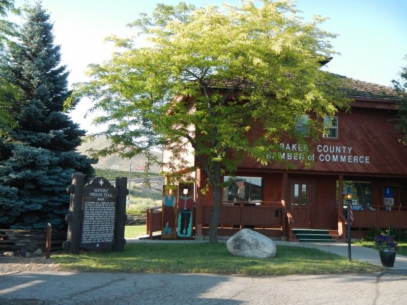
Wagons and cattle of the Great Migration, led by Marcus Whitman in 1843, descended Sept. 25 into Lone Pine valley.
After nearly a month of travel over the hot dry Snake river plains from Fort Hall near Pocatello, Idaho, the cool climate and lush . . . — — Map (db m108157) HM
A moveable community for four to six months along the trail… the wagon encampment typically grouped into a circle, forming a temporary corral. Around the circle, tents and bedrolls provided the shelter for exhausted pioneers. A few guards kept an . . . — — Map (db m199177) HM
Here cattlemen loaded herds into boxcars bound for Portland; while cowboys and rustlers haunted saloons.
Railhead warehouses of the 1880's were town down in the 1990's and with salvaged materials the park project began.
With foresight and . . . — — Map (db m111276) HM
(Six panels dealing with the Baker Valley portion of the Oregon Trail are found beneath this kiosk) Permanent Settlers
In 1861, Henry Griffin, a prospector from California discovered gold eight miles southwest of the present . . . — — Map (db m111284) HM
The first cabin known to have been built in Baker Co. in 1861. Moved from it's original site five miles south in 1993. Disassembled and reconstructed to depict the life of the Oregon Trail Pioneers upon settling in the valley.
Donated to the . . . — — Map (db m111278) HM
(The Farewell Bend Oregon Trail kiosk houses seven panels which deal with the trials and tribulations on this arid portion of the Oregon Trail.)
"Pathway to the "Garden of the World"
Excitement filled the air May 22, . . . — — Map (db m107276) HM
From Alkali Springs, called by many pioneers Sulphur Springs, the emigrants traveled on to Birch Creek, which offered much needed water and grass for their livestock. First named "Riviere aux Bouleaux" by French-Canadian fur trappers, here travelers . . . — — Map (db m107212) HM
In October 1860 the Van Ornum Party, survivors of the Utter Disaster, reached Farewell Bend. Here they again encountered Indians.
On September 9 & 10, in Idaho, the Elijah P. Utter wagon train suffered a two-day attack by Indians in . . . — — Map (db m107219) HM
By October 1860 the Van Ornum party reached Farewell Bend. They were survivors of the Elijah P. Utter wagon train that was attacked by Indians on September 9 and 10, just west of Castle Butte in Owyhee County, Idaho. The survivors had escaped the . . . — — Map (db m107220) HM
By October 1860 the Van Ornum party reached Farewell Bend. They were survivors of the Elijah P. Utter wagon train that was attacked by Indians on September 9 and 10, just west of Castle Butte in Owyhee County, Idaho. The survivors had escaped the . . . — — Map (db m107292) HM
The bustling boom town of Sumpter stretched from here westward to Powder River at the peak of the mining boom.
The mining camp was named for Fort Sumter, South Carolina, by five ex-Confederate soldiers who discovered gold near here in 1862. . . . — — Map (db m112914) HM
(Six panels dealing with the Burnt River portion of the Oregon Trail are found beneath this kiosk)
Dear Little Willie
Emigration on the Oregon Trail peaked in 1852 with 10,000 would-be Oregonians. Poor sanitation and . . . — — Map (db m108110) HM
(Seven panels dealing with topics related to the Applegate Trail are found at this kiosk.)
Applegate Trail
Southern Route to Oregon
In 1846, Jesse Applegate and fourteen others from near Dallas, Oregon, established a . . . — — Map (db m116846) HM
The banks of the Willamette River were the focus of early town development. The town plat for Marysville was files on February on February 25, 1851, by Joseph C. Avery, using a portion of his land claim of 1845. The town included property from the . . . — — Map (db m117488) HM
Fred J. Porter was the great-grandson of Benton County pioneer, Johnson Mulkey.
In the winter of 1845, Mulkey filed a land claim for 640 acres along Oak Creek, on the north side of Baldy Mountain. This was only a few months after Joseph Conant . . . — — Map (db m117266) HM
A Watershed
A watershed is an area of land from which water drains and flows into a river and its tributaries. Small watersheds, such as Oak Creek’s, become part of larger watersheds when their streams converge. Thus, Oak Creek‘s . . . — — Map (db m108389) HM
Site of the earliest boat landing Lower Town, Marysville, 1851 Presented to City of Corvallis, Oregon Centennial Celebration, June 1957 by the Winema Chapter Daughters of the American Revolution — — Map (db m107333) HM
In June 1846 Jesse Applegate, Levi Smith and 11 other men left their homes near Dallas Oregon to develop a southern route from Fort Hall (Idaho) to the Willamette Valley. Their route passed through the gap west of Pigeon Butte, then proceeded . . . — — Map (db m119068) HM
On this knoll stood Ebenezer School-
house, built in 1850. The first school
in the historic Belknap settlement, it was
also used for Methodist Sunday school
and class meetings.
In 1854, the second Methodist Conference
on the West . . . — — Map (db m119276) HM
(Two interpretive displays are located here next to the South Benton Community Museum):
(First Display)
In 1846, Jesse Applegate and fourteen others from near Dallas, Oregon, established a trail south from the Willamette Valley and . . . — — Map (db m116837) HM
United Methodist
Historic Site
No. 323
In Memory of the Pioneers of
The Belknap Settlement
Who Served God Faithfully
In An Untamed Land — — Map (db m122508) HM
During the first year of the Civil War, Reuben and Mary Jane Shipley donated land to establish this cemetery for the burial of both black and white people. The Shipleys were former enslaved laborers who arrived by wagon with their owners. Mary . . . — — Map (db m234519) HM
Mount Union Cemetery is situated on Reuben and Mary Jane Shipley, one of Oregon's earliest Black pioneer couples. Reuben was born into slavery in Kentucky and was brought to Oregon by his enslaver, Robert Shipley, in 1853. In return for driving . . . — — Map (db m234513) HM
This mountain pass in named for Samuel K. Barlow who opened the first wagon route over the Cascades in 1846 to complete the Oregon Trail. The route was far from easy. Emigrant Isom Cranfill (cabinet maker, farmer, and itinerant preacher) made the . . . — — Map (db m112383) HM
Imagine feeding your hungry children and skinny ox teams whottleberries here. Helping you spouse repair your tired wagon for tomorrow's dreaded drop down Laurel Hill. Rain clouds gather around Mount Hood's peak. More storms coming. And they say the . . . — — Map (db m112373) HM
Village of
Government Camp
formerly a camp on the old Barlow Road, the village was named in 1849 when US Cavalry troops were forced to abandon wagons and supplies here. — — Map (db m112337) HM
Village of
Government Camp
Formerly a camp on the old Barlow Road was named in the fall of 1849 when the first United States Mounted Rifles abandoned a large number of wagons here, while a detachment was traveling from The Dalles to . . . — — Map (db m112338) HM
Samuel Kimbrough Barlow
Oregon Pioneer from Kentucky
Built the first wagon road across
Cascade Mountains
passing this spot
1845 - 1846
The building of railways . . . — — Map (db m241048) HM
George M. Rogers purchased this lot in 1918 and lived in its existing small house until 1929, when he engaged Van Evera Bailey, a noted Portland architect, to design this unique Arts and Crafts/Mediterranean style residence. Exterior is . . . — — Map (db m119859) HM
Albert Alonzo Durham filed the first donation land claim here in 1850, naming the place Oswego after his New York home town. In 1864 John Corse Trullinger bought Durham's sawmill on Sucker Creek, and in 1866 this 87-acre portion of land, Trullinger . . . — — Map (db m117168) HM
In the early 19th century, the river landing at the mouth of Oswego Creek was a convenient camping place for explorers, fur traders, and pioneers. In the words of one old timer, it was "a stopping place, a sort of a relay station for boats both . . . — — Map (db m121328) HM
On this site Oswego's first industry, a saw mill, was established in 1850 by Albert Alonzo Durham on this portion of his 637 acre Donation Land Grant which included "Old Town" and much of East Oswego. He advertised his new mill in the . . . — — Map (db m117224) HM
"When woman's true history shall have been written, her part in the upbuilding of this nation will astound the world." -- Abigail Scott Duniway, Path Breaking (1914)
The third in a family of fourteen, Abigail "Jenny" Scott traveled west . . . — — Map (db m114173) HM
Commerce came quickly to the area as pioneers cleared land and became established. Pasture and grazing was common but presented transportation problems before refrigeration and good roads or bridges. The Clear Creek Creamery co-op was formed to . . . — — Map (db m114236) HM
Welcome to the Baker Cabin Historical Site. This is one panel of many that are spaced throughout the site. You are invited to see them all. The Baker Cabin Historical Society is the present day organization founded from the Old Timers Association of . . . — — Map (db m114257) HM
This marker is located on the grounds of Baker Cabin Historical Site.
Oregon Trail emigrants left established homes and farms in the East to start anew in the wilderness that was the Oregon Country. Emigrants packed simple farm wagons with enough . . . — — Map (db m114232) HM
The Baker's water supply consisted of a hand dug well located close to the cabin. Likely located by dowsing , there is a strong underground stream easily found even today with a 'water-witch.' The well extended down approximately 25 feet and often . . . — — Map (db m114256) HM
Before the coming of the white immigration, the flat area above the falls was a native encampment called "Kanim" or "Canoe Place". In 1844 Absolom Hedges staked out a donation land claim and platted it in 1849 naming the area Falls City. The first . . . — — Map (db m114029) HM
Dr. Forbes Barclay left Scotland in 1839 for Fort Vancouver (Washington) where he became chief physician for Hudson's Bay Company. He moved to Oregon City in 1850 where he practiced medicine for many years. He was one of Oregon City's early mayors, . . . — — Map (db m8692) HM
Born in Riviere du Loup, Canada, October 19, 1784.
1824 Came to the Oregon Country as Chief Factor of the Columbia Department of the Hudson's Bay Company.
1829 Located his claim to the present site of Oregon City.
1845 Resigned his . . . — — Map (db m8699) HM
Chief Factor, 1821-1845, and Superintendent of the Columbia Department, 1824-1821, of the Hudson's Bay Company, laid claim to and took possession of the Site of Oregon City in 1829.
In 1842 he had the site surveyed, and subsequently dedicated . . . — — Map (db m114027) HM
"He stood among his pioneer contemporaries like towering old (Mount) Hood ... a born leader of men." -- Willard H Res, description of John McLoughlin during speech, 1879
His personality was measured in patience, generosity, . . . — — Map (db m114065) HM
Here the Pioneers Ended Their
Journey West.
Abernethy Green is the Official
End of the Oregon Trail,
As Designated by the U.S. Congress
In 1978.
Placed in Honor
of the Pioneer Achievements of
Dan Fowler
Oregon . . . — — Map (db m114198) HM
Oregon City, Western Terminus of the Oregon Trail
(about 2200 miles from Independence, MO)
Here at Abernethy Green in the fall of 1845, members of the Barlow-Palmer-Rector Wagon Train entered Oregon City as best they could. Pioneering a . . . — — Map (db m114199) HM
"We pitched our tent... remaining at this camp for about one week, feasting on watermelons and good, fresh vegetables right from the garden, which are brought in by the Clackamas County farmers in great abundance." E.W. Conyers on arrival in . . . — — Map (db m114201) HM
Born in Washington Co. Va., Meek leaves home at age 18, arriving in St. Louis in the fall of 1828. Meek signs on as a trapper with the Rocky Mtn. Fur Co., remaining in the Rockies until 1839.
1839 - 1843: Meek travels to the Willamette Valley and . . . — — Map (db m8673) HM
Lot Whitcomb, proprietor of the town, gave two lots and an unfinished building that had cost him about $1,000 - the first Episcopal church building in Oregon.
His wife, Irene, suffered from asthma. Believing Oregon a healthy place, in . . . — — Map (db m114171) HM
In the city he founded, in this house he built, lived Dr. John McLoughlin, 1846-57.
He won enduring fame for his generous and humane aid to early American settlers in the Oregon Country, as Chief Factor and Superintendent of the Hudson’s Bay . . . — — Map (db m8693) HM
"A few of us (went) to the Falls of Willamut where we found many people & considerable of business." Medorem Crawford, Journal, October 3, 1842
An emigrant of 1842, Medorem Crawford worked for nearly a decade hauling freight around . . . — — Map (db m114760) HM
"We claim that country - for what? To make the wilderness blossom as the rose, to establish laws, to increase, multiply, and subdue the earth..." -- John Quincy Adams, Congressional Globe, February 9, 1846
Arguing that God had manifestly . . . — — Map (db m114064) HM
Oregon City - supply point for pioneer emigrants was first located as a claim by Dr. John McLoughlin in 1829. The first provisional legislature of the Oregon Country was held here in 1843 and land and tax laws formulated. Oregon City was the . . . — — Map (db m8700) HM
400 feet south
of this marker
stood the home of
Peter Skene Ogden
Chief Factor of
Hudson's Bay Co.
and rescuer of the
survivors of the
Whitman Massacre. — — Map (db m8714) HM
'It was two stories, 68 x 105, and was the first hotel west of the Rocky mountains." -- Harvey K. Hines, An Illustrated History... (1893)
In 1842 Dr. Elijah White recruited over one hundred people to emigrate across the Oregon Trail. . . . — — Map (db m114165) HM
Horace Baker emigrated from Illinois along the Oregon Traill in 1846 and married fellow emigrant Jane Hatten in 1852. The Bakers claimed 640 acres and built this cabin by 1856. The Baker Cabin is one of the oldest log structure in the state, and it . . . — — Map (db m114230) HM
Little is known about the first ten years after Horace and Jane Baker arrived in the 1846 Barlow Trail wagon train, and the construction of this cabin. Perhaps, like most pioneers they lived out of their wagon or tents the first winter. Most then . . . — — Map (db m114233) HM
The Barlow Trail branch of the Oregon Trail formally ended at the Phillip Foster Farm near Eagle Creek. From that point immigrants fanned out, taking several routes to Oregon City and beyond. One route passed this spot on the way up Gronlund Road to . . . — — Map (db m114235) HM
"Past on twelve miles or more, took the (w)rong road and arrived at the Willammette bottoms about dark a little below the City." -- Samuel Dexter Francis, October 14, 1852
In September and October, and early November the meadows at the . . . — — Map (db m114136) HM
Letters in newspapers, emigrant guide-books, and word of mouth gave counsel on overland travel. Emigrants commonly used farm wagons - simple, well-made, and utilitarian. Many were home-made or commission-built by local wagon makers. Some had custom . . . — — Map (db m114761) HM
When travelers arrived at the End of the Oregon Trail, they found Willamette Falls, a natural wonder that attracted both those early settlers and the Native Americans who settled here centuries earlier. For the traditional peoples, the main . . . — — Map (db m114034) HM
The pioneer road here detoured the Columbia River rapids and Mount Hood to the Willamette Valley. The road at first followed an old Indian trail. The later name was Barlow Road. Travel was difficult. Wagons were snubbed to trees by ropes on held . . . — — Map (db m112372) HM
In the shadow of the tall trees, a stream of travelers crossed ash flows, talus slopes and boggy wetlands along this last stretch of the trail. Some emigrants were forced to abandon their wagons with the death of livestock and walk, carrying their . . . — — Map (db m112341) HM
Chief factor of the Hudson’s Bay Company at Fort Vancouver, philanthropist, and founder of Oregon City. The land on the east bank of the Willamette River at the falls was claimed by Dr. McLoughlin and the Hudson’s Bay Co. in 1828-29. First called . . . — — Map (db m8669) HM
From 1845 to 1849, George Abernethy was the first Provisional Governor of the Oregon Country, which extended from the Pacific Ocean to the Rocky Mountains and from California to Northern British Columbia. After arriving in Oregon in 1840 as part of . . . — — Map (db m8670) HM
Many of Oregon’s early transportation routes resulted from the efforts of enterprising pioneers like the Boone family of Clackamas County. In 1846 Alphonso Boone, grandson of Daniel Boone, emigrated to Oregon via the Applegate Trail with his large . . . — — Map (db m127162) HM
Lt. Neil M. Howison, U.S.N., arrived in the Columbia River 1 July, 1846 on board the 300-ton United States Naval Survey Schooner "Shark" for the purpose of making an investigation of part of the Oregon Country. His report was instrumental in . . . — — Map (db m113513) HM
The oldest American settlement west of the Rocky Mountains, dating back to Lewis & Clark.
Explore our history, natural beauty and opportunities for adventure.
For free maps and visitor information, visit one of the Astoria-Warrenton . . . — — Map (db m113011) HM
On April 12, 1961, Lord Astor of Hever, England, direct descendant fo John Jacob Astor from whom this city of Astoria derived its name 150 years ago, dedicated this monument to transportation. From here members of the Astor Expedition blazed . . . — — Map (db m149475) HM
[panel 1] Great Chief of the Chinook Nation, known to Lewis and Clark, honored and respected by the founding Astorians, the Northwesters and the Hundson's Bay fur traders. [panel 2] Symbolic memorial dedicated by Comcomly's . . . — — Map (db m113009) HM
This area was once the crossroads of several cultures in Astoria.
Along the waterfront to the east and west were over 20 canneries with their hordes of workers, many of them Chinese.
After 12 to 16 hours of hard work, the Chinese went home to . . . — — Map (db m112997) HM
Well after the end of the American Revolution, this vast river we call the Columbia and the entire Northwest Coast were still only vague lines on even the best European maps. But the region was home to native peoples whose ancestors had lived . . . — — Map (db m113236) HM
Here you look out over Astoria's first neighborhood.
Platted in 1846 by prominent pioneers, Colonel John McClure and John Shively, this district was home to our most influential citizens; elected officials, leading businessmen, cannery . . . — — Map (db m113014) HM
Erection of a fort was begun
April 12, 1811
by the thirty-three members of the Astor party who sailed around Cape Horn in the ship Tonquin and established here the famous fur trading post which was the first American settlement west of the . . . — — Map (db m113562) HM
Alexandre Gilbert, one of the founding fathers of Seaside, was born in the coastal town of LaRochelle, France on April 16, 1845, the son of Frank and Mary Gilbert. At the age of twenty-four and just prior to the Franco-Prussian war (1870-71), . . . — — Map (db m113870) HM
"Captain" John West was a self-made man. A native of Scotland, he settled on the lower Columbia River near this spot in the early 1850s after trying his luck in the goldfields of California. West built and operated sawmills, ran a general store and . . . — — Map (db m113583) HM
Panel 1
Once covered by an Ice Age ocean, then home to the Diersinno (Keeassino) Indian Tribe led by Chief Cassino, this area then became the meeting grounds for all the Northwest Indians who gathered each year to hold their . . . — — Map (db m113156) HM
One of the Oregon Country’s most picturesque fur-traders, Thomas McKay is buried near Scappoose.
He was a daring leader, famous storyteller and could drive a nail with a rifle ball.
A Canadian, he arrived with the Astorians as a teen-age boy; . . . — — Map (db m114416) HM
The path before you represents the Corps of Discovery's journey on the Columbia River – from its confluence with the Snake to the Pacific Ocean.
Entering the Columbia in mid-October 1805, they travelled along the river from shore to shore . . . — — Map (db m113154) HM
In the year 1874 on this and adjoining
property Captain Judah Parker and
partners built and operated the first
steam sawmill and steam tug on the
Coquille River. A year later Captain
Parker, with the assistance of the
settlers and farmers . . . — — Map (db m73228) HM
On the beach west of here the U.S. Transport Captain Lincoln was beached at high tide during a storm. The soldiers and crew built a camp from the sails under the trees across the bay from this spot and made a flag pole from a mast from which Old . . . — — Map (db m241038) HM
(panel 1)
The Oregon Coast boasts forested headlands, towering dunes of sand, and sparkling lakes and rivers. From the Columbia River south to Bandon, the picturesque coastline is bordered to the east by the peaks of . . . — — Map (db m113658) HM
This Memorial
was dedicated August 7, 1938
by the
Crook County Pioneer Association
in grateful remembrance of
the heroic early settlers of
the Central Oregon Country
whose bravery, intelligence and industry
blazed the trail . . . — — Map (db m114268) HM
Gold discovered on the beaches at the mouth of Rogue River in the mid-1800s brought miners here; resulted in the Rogue River Indian Wars of 1855-56.
Prattsville, Ellensburg, officially becoming Gold Beach in 1890.
In the 60’s returns from . . . — — Map (db m113220) HM
"From the numerous miners and settlers that are pressing into their country they are suffering many grievous wrongs that call for the immediate interference of the Government. Within the last six months four of their villages have . . . — — Map (db m176836) HM
During the early 1850s hundreds of miners and settlers poured into southwest Oregon and onto Indian lands staking claims and establishing farms. The clash of cultural attitudes toward the ownership and use of natural resources led to the Rogue River . . . — — Map (db m113293) HM
The Tututní people lived along the Southern Oregon coast, including this site, and the lower Rogue River for thousands of years before first contact with explorers, miners, and settlers.
In 1792, George Vancouver was among the first outsiders to . . . — — Map (db m176841) HM
Battle Rock City Park has been dedicated in memory of the ancient people (Dene Tsut Dah) and the pioneer founders of this townsite. In 1850, the U.S. Congress passed the Oregon Donation Land Act. This act allowed white settlers to file claims on . . . — — Map (db m176821) HM
Patrick and Jane Hughes' strong support of education and religion helped their children and community flourish.
John Hughes
The third Hughes son, John, studied in the east for the priesthood and was ordained in . . . — — Map (db m113408) HM
Imagine starting a farm from scratch on isolated, raw land, with no running water, refrigeration or electricity. Everything was hard; everything was physical.
The family cleared great stands of spruce, rooting out the stumps with teams of horses, . . . — — Map (db m176853) HM
A.M. Drake and his wife Florence set camp at the bank of the Deschutes River in June 1900 enticed by the 1894 Federal Carey Act, which encouraged private enterprise to reclaim and develop desert land by building irrigation systems and infrastructure . . . — — Map (db m157945) HM
Covered wagons poured into the Willamette Valley for over a quarter of a century before Euro-American settlers arrived here in great numbers. Alexander M. Drake, who arrived at the spot in 1900, was one of the first to realize the high prospects of . . . — — Map (db m157706) HM
The bustling marketplace you see today, filled with shops, theaters, restaurants, entertainment and recreation was once the site of the largest pine sawmills in the country.
Back in the 1920s, they were busy, noisy and dusty mills, each . . . — — Map (db m113931) HM
Trees were felled in the woods and hauled to the Deschutes River where they floated downstream to the mills.
The final steps of this log-to-lumber journey occurred as the wet lumber, known as green wood, exited the mill on the green chain.
As . . . — — Map (db m113933) HM
Clyde McKay first came to Bend in 1900 and returned every year thereafter until he moved his family to Bend in 1911. That same year he formed the Bend Company, which purchased the Drake holdings, including the original townsite, a sawmill and power . . . — — Map (db m157655) HM
In the beginning...there were old growth trees.
The small community, first called Farewell Bend from the nearby big bend in the Deschutes River, could have been called “Pilot Butte” if the 1901 recommendation of Postmaster William . . . — — Map (db m63089) HM
(Seven panels dealing with topics related to the Applegate Trail are found at this kiosk.)
Applegate Trail
Southern Route to Oregon
In 1846, Jesse Applegate and fourteen others from near Dallas, Oregon, established . . . — — Map (db m112862) HM
321 entries matched your criteria. The first 100 are listed above. Next 100 ⊳